Chhera Island on:
[Wikipedia]
[Google]
[Amazon]
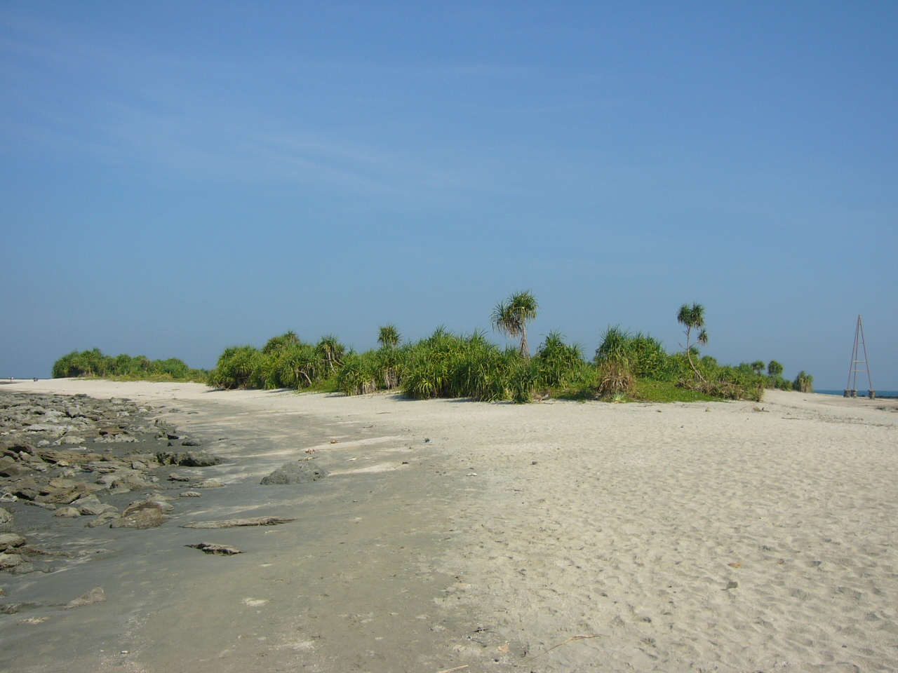
 Chhera Island, also called Chhera Dwip, Cheradia Island or Cheridia Island (Bengali : ছেঁড়া দ্বীপ) , is an uninhabited island and extension of
St. Martin's Island
Saint Martin's Island () is a small coral island in the north-eastern part of the Bay of Bengal, about 9 km south of the tip of the Cox's Bazar-Teknaf peninsula, and forms the southernmost part of Bangladesh. It has an area of only 3 ...
at the mouth of the Naf River
The Naf River ( ''Naf Nodi'' ; ; ) is an international river marking part of the Bangladesh–Myanmar border, border of southeastern Bangladesh and northwestern Myanmar.
Geography
The Naf's average depth is , and maximum depth is . Its width ...
in the Bay of Bengal
The Bay of Bengal is the northeastern part of the Indian Ocean. Geographically it is positioned between the Indian subcontinent and the Mainland Southeast Asia, Indochinese peninsula, located below the Bengal region.
Many South Asian and Southe ...
, within the Chittagong Division
Chittagong Division (), officially Chattogram Division, is geographically the largest of the eight administrative divisions of Bangladesh. It covers the southeasternmost areas of the country, with a total area of and a population according to th ...
of southeastern Bangladesh
Bangladesh, officially the People's Republic of Bangladesh, is a country in South Asia. It is the List of countries and dependencies by population, eighth-most populous country in the world and among the List of countries and dependencies by ...
. Chhera Island is the southernmost island of Bangladesh
Bangladesh, officially the People's Republic of Bangladesh, is a country in South Asia. It is the List of countries and dependencies by population, eighth-most populous country in the world and among the List of countries and dependencies by ...
Description
Duringhigh tide
Tides are the rise and fall of sea levels caused by the combined effects of the gravitational forces exerted by the Moon (and to a much lesser extent, the Sun) and are also caused by the Earth and Moon orbiting one another.
Tide tables ...
it is divided from St. Martin's Island by the sea. At low tide, the island can be reached by walking for about 2½ hours from St. Martin's Island.
The most popular travel mode to it is by local motorboat or tourist boat services.
Washed up coral
Corals are colonial marine invertebrates within the subphylum Anthozoa of the phylum Cnidaria. They typically form compact Colony (biology), colonies of many identical individual polyp (zoology), polyps. Coral species include the important Coral ...
s can be found on the island's beaches. It has an area of shrub
A shrub or bush is a small to medium-sized perennial woody plant. Unlike herbaceous plants, shrubs have persistent woody stems above the ground. Shrubs can be either deciduous or evergreen. They are distinguished from trees by their multiple ...
and palm tree
The Arecaceae () is a family of perennial, flowering plants in the monocot order Arecales. Their growth form can be climbers, shrubs, tree-like and stemless plants, all commonly known as palms. Those having a tree-like form are colloquially c ...
vegetation. No permanent settlement is established on the island.
See also
* *List of islands of Bangladesh
This is a list of Islands of Bangladesh.
The islands of Bangladesh are scattered along the Bay of Bengal and the river mouth of the Padma River, Padma.
The word "Char" is used in many of the names and refers to floodplain sediment islands in the ...
* ''Boli''
References
External links
Islands of the Bay of Bengal Uninhabited islands of Bangladesh Chittagong Division Cox's Bazar District Islands of Bangladesh {{island-stub