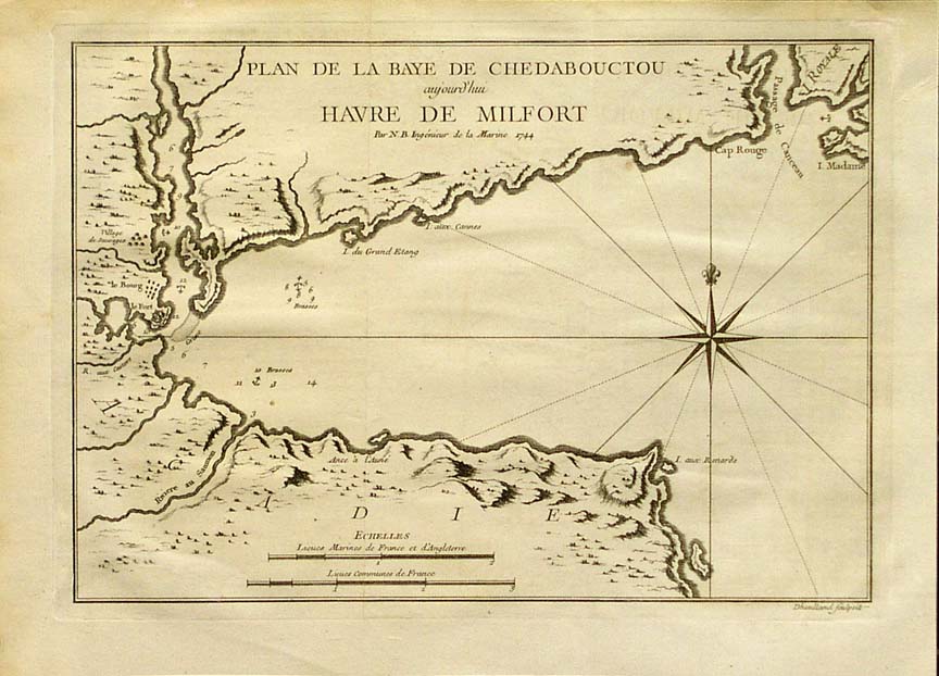
Chedabucto Bay on:
[Wikipedia]
[Google]
[Amazon]
Chedabucto Bay is a large bay on the eastern coast of mainland

Liberian Tanker Arrow
However, ever since the oil was largely cleaned up by both Human cleanup crews and natural processes, the sunk Tanker has proven to be largely positive for the local wildlife- providing sanctuary for many sea creatures and a home for a vast variety of aquatic plant life.
Nova Scotia
Nova Scotia is a Provinces and territories of Canada, province of Canada, located on its east coast. It is one of the three Maritime Canada, Maritime provinces and Population of Canada by province and territory, most populous province in Atlan ...
between the Atlantic Ocean
The Atlantic Ocean is the second largest of the world's five borders of the oceans, oceanic divisions, with an area of about . It covers approximately 17% of Earth#Surface, Earth's surface and about 24% of its water surface area. During the ...
and the Strait of Canso next to Guysborough County. At the entrance to Chedabucto Bay is the community of Canso at the head is the community of Guysborough and on the other end is the town of Mulgrave.
Geography
Chedabucto Bay was formed by the drowning of part of an ancient river system and owes its origin and shape to position of the Chedabucto Fault, which runs across central Nova Scotia from theBay of Fundy
The Bay of Fundy () is a bay between the Canadian provinces of New Brunswick and Nova Scotia, with a small portion touching the U.S. state of Maine. It is an arm of the Gulf of Maine. Its tidal range is the highest in the world.
The bay was ...
to the Canso peninsula.
History

Colonial
Merchants inLa Rochelle, France
La Rochelle (, , ; Poitevin-Saintongeais: ''La Rochéle'') is a city on the west coast of France and a seaport on the Bay of Biscay, a part of the Atlantic Ocean. It is the capital of the Charente-Maritime department. With 78,535 inhabitants ...
enjoyed a fishing monopoly in Acadia
Acadia (; ) was a colony of New France in northeastern North America which included parts of what are now the The Maritimes, Maritime provinces, the Gaspé Peninsula and Maine to the Kennebec River. The population of Acadia included the various ...
and formed the Company of Acadia which established a small fortification on Chedabucto Bay named Fort St. Louis. The principal ports were at Chedabucto, which accounted for fifty fishers in 1686. In 1690, Captain Cyprian Southack proceeded to Chedabucto to take Fort St. Louis at the present-day village of Guysborough which, unlike Port-Royal, put up a fight before surrendering.< The company encountered a variety of difficulties on the way to its final disappearance in 1702.
Modern
On Wednesday, February 4, 1970 theLiberia
Liberia, officially the Republic of Liberia, is a country on the West African coast. It is bordered by Sierra Leone to Liberia–Sierra Leone border, its northwest, Guinea to Guinea–Liberia border, its north, Ivory Coast to Ivory Coast–Lib ...
n-registered tanker ''Arrow'' ran aground on Cerberus Rock with a cargo of barrels of Bunker C
Fuel oil is any of various fractions obtained from the distillation of petroleum (crude oil). Such oils include distillates (the lighter fractions) and residues (the heavier fractions). Fuel oils include heavy fuel oil (bunker fuel), marine fue ...
fuel and split in two. A large oil spill contaminated the waters of the bay as well as of the shoreline.Environment CanadaLiberian Tanker Arrow
However, ever since the oil was largely cleaned up by both Human cleanup crews and natural processes, the sunk Tanker has proven to be largely positive for the local wildlife- providing sanctuary for many sea creatures and a home for a vast variety of aquatic plant life.
Notable people
* Pearleen Oliver was born near the bay, in 1917See also
* Cook's CoveReferences
{{Coord, 45, 23, 33.59, N, 61, 18, 13.36, W, region:CA-NS_scale:1000000, name=Chedabucto Bay, display=title Bays of Nova Scotia Landforms of Guysborough County, Nova Scotia Conflicts in Nova Scotia