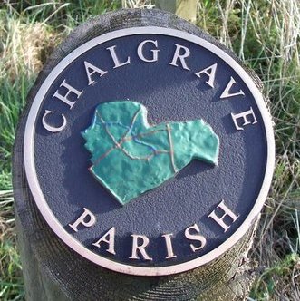
Chalgrave on:
[Wikipedia]
[Google]
[Amazon]
 Chalgrave is a
Icknield Way Trail
a multi-user route for walkers, horse riders and off-road cyclists also passes through the village.
Chalgrave Parish Council
Civil parishes in Bedfordshire Central Bedfordshire District {{Bedfordshire-geo-stub
 Chalgrave is a
 civil parish
In England, a civil parish is a type of Parish (administrative division), administrative parish used for Local government in England, local government. It is a territorial designation which is the lowest tier of local government below district ...
in the Central Bedfordshire
Central Bedfordshire is a unitary authority area in the ceremonial county of Bedfordshire, England. It was created in 2009.
Formation
Central Bedfordshire was created on 1 April 2009 as part of a structural reform of local government in Bedford ...
district of Bedfordshire
Bedfordshire (; abbreviated Beds) is a ceremonial county in the East of England. The county has been administered by three unitary authorities, Borough of Bedford, Central Bedfordshire and Borough of Luton, since Bedfordshire County Council ...
, England. The hamlets of Tebworth and Wingfield are in the west of the parish, with the church and manor in the east. Nearby places are Toddington (to the north), Chalton Chalton may refer to:
*Chalton, Bedfordshire, England
*Chalton, Hampshire, England
See also
*Charlton (disambiguation)
{{place name disambiguation ...
(to the east), Houghton Regis
Houghton Regis is a market town and civil parish in Bedfordshire, East of England.
The parish is located in Central Bedfordshire, which includes the hamlets of Bidwell, Thorn, and Sewell. Houghton Regis, along with its contiguous neighbo ...
(to the south), and Hockliffe
Hockliffe is a village and civil parish in Bedfordshire on the crossroads of the A5 road which lies upon the course of the Roman road known as Watling Street and the A4012 and B5704 roads.
It is about four miles east of Leighton Buzzard. Nearb ...
(to the west). Before 1929, the parish also included part of the village of Hockliffe.Stephen Coleman, ''Chalgrave'', Bedfordshire County Council (Bedfordshire Parish Surveys, Historic Landscape and Archaeology, 6), 1986, , pp. 7, 15, 17-22.
Chalgrave is part of the ward of 'Heath and Reach' which sends a Councillor to Central Bedfordshire Council. The ward includes the villages of Heath and Reach, Hockliffe, Eggington, Stanbridge, Tilsworth, Tebworth, and Wingrave. The ward was created in 2011 and has since been represented by Councillor Mark Versallion.
Chalgrave church and manor
The location now known as Chalgrave, just south of Toddington, was called East Coten (meaning "east cottages") in the year 926. Here a church andmanor house
A manor house was historically the main residence of the lord of the manor. The house formed the administrative centre of a manor in the European feudal system; within its great hall were held the lord's manorial courts, communal meals with ...
were established on well-drained soil at the top of the hill in the 11th or 12th century. At the beginning of the 13th century the church was rebuilt, and the manorial complex was moved east and then north to what is now Chalgrave Manor Farm.
The Icknield Way Path passes through the village past the church on its 110-mile journey from Ivinghoe Beacon
Ivinghoe Beacon is a prominent hill and landmark in Buckinghamshire, England, 233 m (757 ft) above sea level in the Chiltern Hills, close to Ivinghoe and Aldbury. Dunstable, Berkhamsted and Tring are nearby.
The Beacon lies within the ...
in Buckinghamshire to Knettishall Heath in Suffolk. ThIcknield Way Trail
a multi-user route for walkers, horse riders and off-road cyclists also passes through the village.
Tebworth
Tebworth is a small Hamlet 1 mile west of the church, about 4½ miles east ofLeighton Buzzard
Leighton Buzzard ( ) is a market town in Bedfordshire, England, in the southwest of the county and close to the Buckinghamshire border. It lies between Aylesbury, Tring, Luton/ Dunstable and Milton Keynes, near the Chiltern Hills. It is n ...
, about north of London
London is the capital and List of urban areas in the United Kingdom, largest city of England and the United Kingdom, with a population of just under 9 million. It stands on the River Thames in south-east England at the head of a estuary dow ...
, 1 mile east of Hockliffe, and south-west of Toddington.
Wingfield
Wingfield is a Hamlet almost 1 mile south-west of the church. Most of the houses are along Tebworth Road, which runs from Tebworth to the top of Lords Hill. Because of the location, there are a few well known people living in the Hamlet. Like Tebworth, it had developed as a settlement by the 13th century.References
External links
Chalgrave Parish Council
Civil parishes in Bedfordshire Central Bedfordshire District {{Bedfordshire-geo-stub