Cape Crillon on:
[Wikipedia]
[Google]
[Amazon]
Cape Crillon (, "Nishinotoro-misaki" (Cape Nishinotoro in Japanese), ) is the southernmost point of
 In 1808, Mamiya Rinzō was dispatched by the
Sakhalin
Sakhalin ( rus, Сахали́н, p=səxɐˈlʲin) is an island in Northeast Asia. Its north coast lies off the southeastern coast of Khabarovsk Krai in Russia, while its southern tip lies north of the Japanese island of Hokkaido. An islan ...
. The cape was named by Frenchman Jean-François de La Pérouse, who was the first European to discover it. Cape Sōya
is the northernmost point of the island of Hokkaidō, Japan. It is situated in Wakkanai, Hokkaido, Wakkanai, Sōya Subprefecture. The is at the cape, although the true List of extreme points of Japan, northernmost point under Japanese control ...
, in Japan, is located to the south, across La Pérouse Strait
La Pérouse Strait (), or , is a strait dividing the southern part of the Russian island of Sakhalin from the northern part of the Japanese island of Hokkaidō, and connecting the Sea of Japan on the west with the Sea of Okhotsk on the east.
...
.
A Russian weather station
A weather station is a facility, either on land or sea, with instruments and equipment for measuring atmosphere of Earth, atmospheric conditions to provide information for weather forecasting, weather forecasts and to study the weather and clima ...
, a lighthouse
A lighthouse is a tower, building, or other type of physical structure designed to emit light from a system of lamps and lens (optics), lenses and to serve as a beacon for navigational aid for maritime pilots at sea or on inland waterways.
Ligh ...
and a military base
A military base is a facility directly owned and operated by or for the military or one of its branches that shelters military equipment and personnel, and facilitates training and operations. A military base always provides accommodations for ...
are all situated at Cape Crillon today. Additionally, the cape is the Russian terminus of the proposed Sakhalin–Hokkaido Tunnel that would connect Japan and Russia by rail.
On the western coast of the cape is the rock formation formerly known in Japanese as ''Kinfugan'' (金敷岩, literally "Anvil Rock").
History
 In 1808, Mamiya Rinzō was dispatched by the
 Tokugawa shogunate
The Tokugawa shogunate, also known as the was the military government of Japan during the Edo period from 1603 to 1868.
The Tokugawa shogunate was established by Tokugawa Ieyasu after victory at the Battle of Sekigahara, ending the civil wars ...
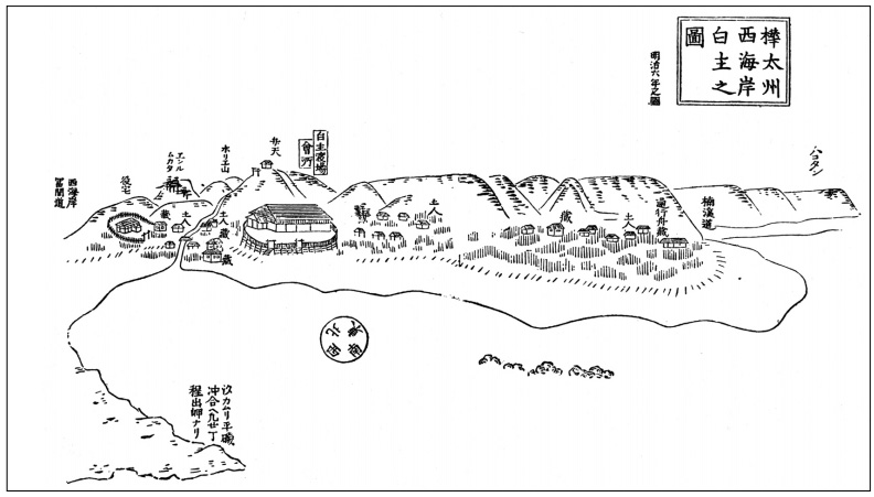
to survey Japanese territory on Sakhalin. Having arrived at the Matsumae domain outpost of Shiranushi on the southern tip of Cape Crillon, he was directed by local Ainu to a place called where the remains of rammed earth
Rammed earth is a technique for construction, constructing foundations, floors, and walls using compacted natural raw materials such as soil, earth, chalk, Lime (material), lime, or gravel. It is an ancient method that has been revived recently ...
walls were found.
By the early 20th century, the ruins had come to be known as the . In 1905, there were discovered Matsumae documents suggesting the castle had been built by Imai Kanehira.
Current archaeological evidence indicates the castle was a colonial product of the Yuan dynasty
The Yuan dynasty ( ; zh, c=元朝, p=Yuáncháo), officially the Great Yuan (; Mongolian language, Mongolian: , , literally 'Great Yuan State'), was a Mongol-led imperial dynasty of China and a successor state to the Mongol Empire after Div ...
. According to the Yuanshi, the general Yangwuludai (楊兀魯帶) crossed the sea and established frontier garrisons on Sakhalin.
See also
* Cape Elizabeth (Sakhalin) * Mongol invasions of SakhalinReferences
Crillon {{SakhalinOblast-geo-stub