Caloplaca Hills on:
[Wikipedia]
[Google]
[Amazon]
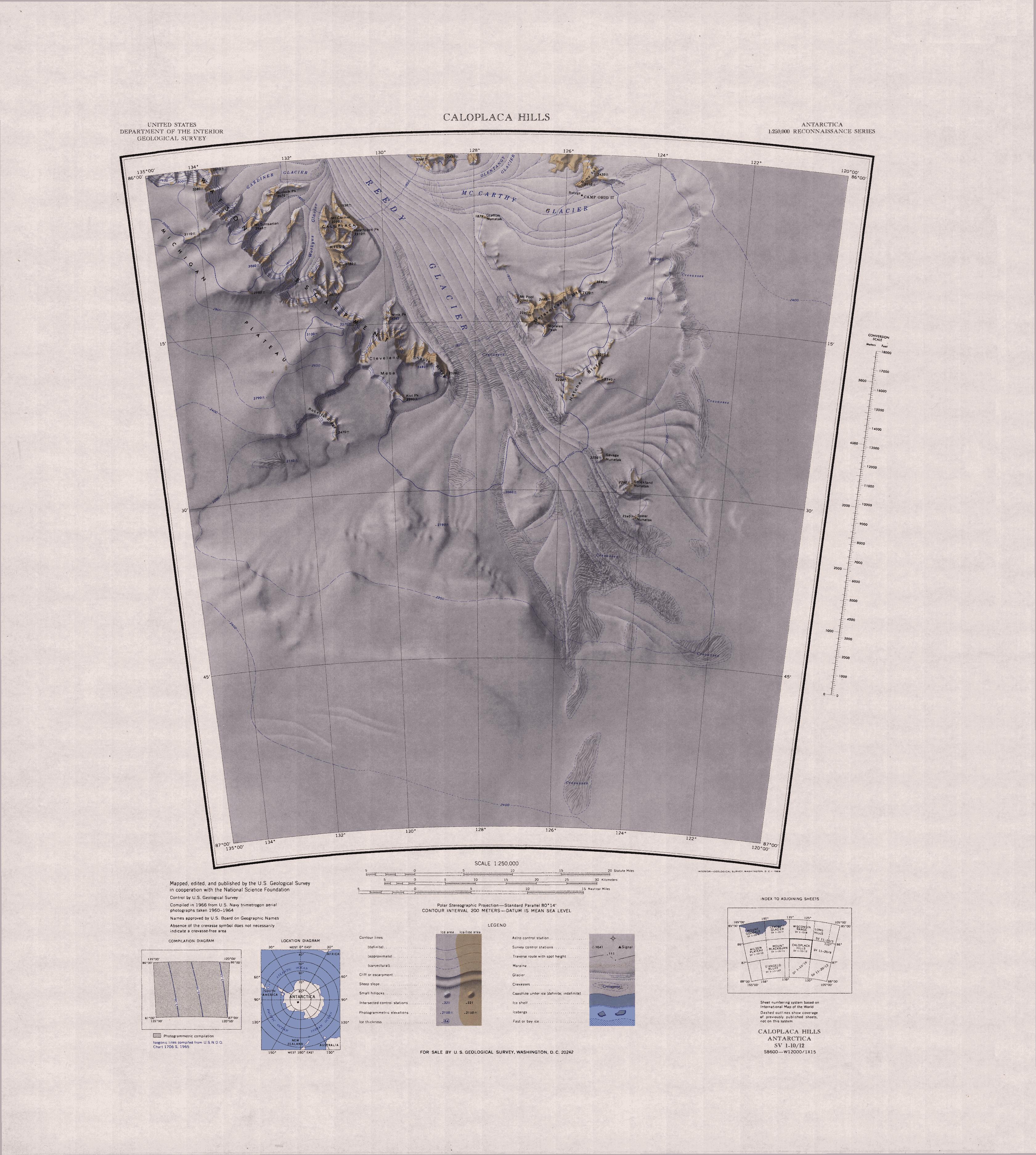
The Caloplaca Hills () are a distinctive group of rock hills including Mount Carmer and Heathcock Peak, lying east of the
 The Caloplaca Hills lie to the west of the Reedy Glacier, east of the Wotkyns Glacier, which flows north into the Reedy Glacier from the eastern part of the Watson Escarpment.
They include Mount Carmer and Heathcock Peak.
A 2005 map by Davis and Blankenship shows the Horlick Mountains including the eastern part of the
Watson Escarpment
Watson Escarpment () is a major escarpment in the Queen Maud Mountains, trending northward along the east margin of Scott Glacier (Transantarctic Mountains), Scott Glacier, then eastward to Reedy Glacier where it turns southward along the glacier' ...
on the west side of Reedy Glacier
The Reedy Glacier () is a major glacier in Antarctica, over long and wide, descending from the polar plateau to the Ross Ice Shelf between the Michigan Plateau and Wisconsin Range in the Transantarctic Mountains.
It marks the limits of the Qu ...
.
Exploration and naming
The Caloplaca Hills were mapped by theUnited States Geological Survey
The United States Geological Survey (USGS), founded as the Geological Survey, is an agency of the U.S. Department of the Interior whose work spans the disciplines of biology, geography, geology, and hydrology. The agency was founded on Mar ...
(USGS) from surveys and from United States Navy
The United States Navy (USN) is the naval warfare, maritime military branch, service branch of the United States Department of Defense. It is the world's most powerful navy with the largest Displacement (ship), displacement, at 4.5 millio ...
aerial photographs, 1960–64. The name was suggested by John H. Mercer of the Institute of Polar Studies, Ohio State University
The Ohio State University (Ohio State or OSU) is a public university, public Land-grant university, land-grant research university in Columbus, Ohio, United States. A member of the University System of Ohio, it was founded in 1870. It is one ...
, after ''Caloplaca
''Caloplaca'' is a lichen genus comprising a number of distinct species. Members of the genus are commonly called firedot lichen, jewel lichen.Field Guide to California Lichens, Stephen Sharnoff, Yale University Press, 2014, gold lichens, "ora ...
'', the type of lichen found here.
Location
 The Caloplaca Hills lie to the west of the Reedy Glacier, east of the Wotkyns Glacier, which flows north into the Reedy Glacier from the eastern part of the Watson Escarpment.
They include Mount Carmer and Heathcock Peak.
A 2005 map by Davis and Blankenship shows the Horlick Mountains including the eastern part of the
 Queen Maud Mountains
The Queen Maud Mountains () are a major group of mountains, ranges and subordinate features of the Transantarctic Mountains, lying between the Beardmore Glacier, Beardmore and Reedy Glaciers and including the area from the head of the Ross Ice Sh ...
and most of the Wisconsin Range.
The Wisconsin Range may be taken to include the Watson Escarpment
Watson Escarpment () is a major escarpment in the Queen Maud Mountains, trending northward along the east margin of Scott Glacier (Transantarctic Mountains), Scott Glacier, then eastward to Reedy Glacier where it turns southward along the glacier' ...
south of the Kansas Glacier, the Quartz Hills, the Caloplaca Hills and the Cleveland Mesa
Watson Escarpment () is a major escarpment in the Queen Maud Mountains, trending northward along the east margin of Scott Glacier, then eastward to Reedy Glacier where it turns southward along the glacier's west side. Somewhat arcuate, the escar ...
, all in the Queen Maud Mountains to the west of the Reedy Glacier.
Features
Mount Carmer
. A mountain on the east side of Wotkyns Glacier, standing west-northwest of Heathcock Peak. Mapped by USGS from surveys and USN air photos, 1960–64. Named by the United StatesAdvisory Committee on Antarctic Names
The Advisory Committee on Antarctic Names (ACAN or US-ACAN) is an advisory committee of the United States Board on Geographic Names responsible for recommending commemorative names for features in Antarctica.
History
The committee was established ...
(US-ACAN) for John L. Carmer, electronics technician at Byrd Station
The Byrd Station is a former research station established by the United States during the International Geophysical Year by U.S. Navy Seabees during Operation Deep Freeze II in West Antarctica. It was a year-round base until 1972, and then se ...
in 1962.
Heathcock Peak
. A peak, high, located in the east part of Caloplaca Hills and overlooking the west edge of Reedy Glacier. Mapped by USGS from surveys and United States Navy air photos, 1960-64. Named by US-ACAN for Joe D. Heathcock, builder at Byrd Station in 1962.References
Sources
* * * {{Include-USGov , agency=United States Geological Survey Hills of Marie Byrd Land