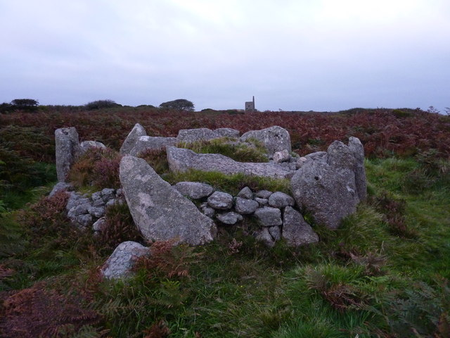
Bosiliack Barrow - Geograph on:
[Wikipedia]
[Google]
[Amazon]
 Bosiliack is a small farming hamlet in the civil parish of
 Bosiliack is a small farming hamlet in the civil parish of
 Madron
Madron ( (village) or (parish)) is a civil parishes in England, civil parish and village in west Cornwall, England, United Kingdom. Madron is named after Saint Madern's Church. Its annual Trafalgar Service commemorating the death of Horatio ...
, Cornwall
Cornwall (; or ) is a Ceremonial counties of England, ceremonial county in South West England. It is also one of the Celtic nations and the homeland of the Cornish people. The county is bordered by the Atlantic Ocean to the north and west, ...
, UK. The hamlet is located between Madron
Madron ( (village) or (parish)) is a civil parishes in England, civil parish and village in west Cornwall, England, United Kingdom. Madron is named after Saint Madern's Church. Its annual Trafalgar Service commemorating the death of Horatio ...
and Morvah
Morvah () is a civil parish and village on the Penwith peninsula in west Cornwall, England, United Kingdom. The parish has a population of 49.
Geography
The village is centred approximately west-southwest of St Ives and north-west of Penza ...
.
The hamlet contains several places of interest including Bosiliack Barrow
Bosiliack Barrow is a barrow on the Penwith Moors between Madron and Morvah near the hamlet of Bosiliack in Cornwall, UK.
The barrow is Neolithic and was excavated in 1984, causing little disturbance to the ancient site. The barrow is a uni ...
, a Neolithic burial chamber; Ding Dong Mine, one of the oldest mines in the UK; and Carfury Standing Stone.
References
External links
* http://www.megalithic.co.uk/article.php?sid=6922 * https://www.google.co.uk/maps/@50.1422394,-5.5865728,3a,16.6y,359.6h,84.64t/data=!3m6!1e1!3m4!1sepYGk9GnLSkU751VTxdlVA!2e0!7i13312!8i6656 * https://www.google.co.uk/maps/@50.1571509,-5.5885616,16.42z {{coord, 50.1500, -5.5915, type:landmark_region:GB, format=dms, display=title Hamlets in Cornwall