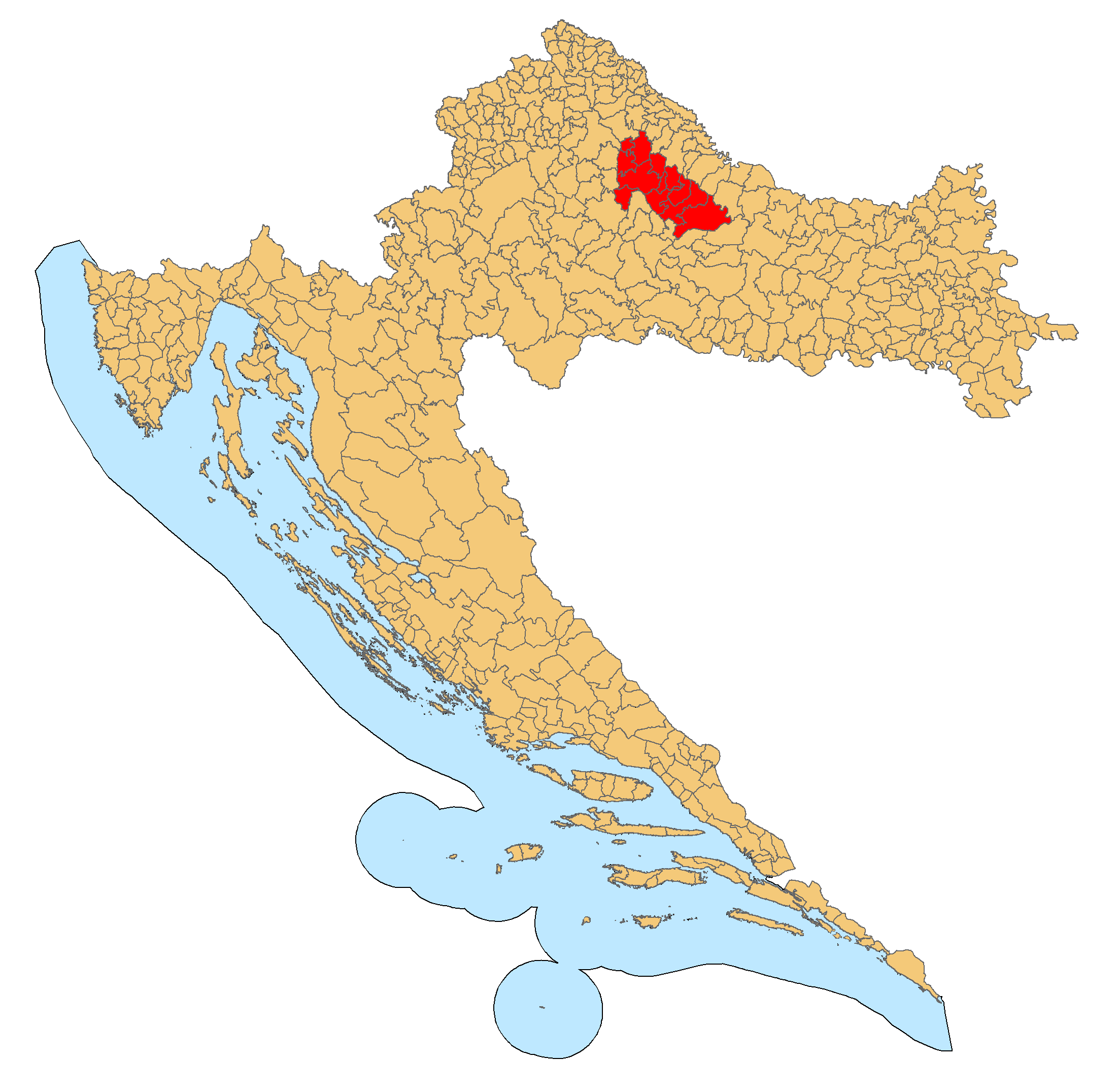
Bilogora on:
[Wikipedia]
[Google]
[Amazon]
Bilogora (English: ) is a low mountainous range and a microregion in
 The Croatian Meteorological and Hydrological Service has a measuring station on Bilogora.
Central Croatia
In contemporary geography, the terms Central Croatia () and Mountainous Croatia () are used to describe most of the area sometimes historically known as Croatia or Croatia proper (), one of the four historical regions of the Republic of Cro ...
. It consists of a series of hills and small plains some 80 kilometres in length stretching in the direction northwest–southeast, along the southwest part of the Podravina region. The highest peak is called Rajčevica (309 m), located in the north of the mountain.
The area lends its name to the Bjelovar-Bilogora County
Bjelovar-Bilogora County (; ) is a Counties of Croatia, county in central Croatia.
The central city of Bjelovar was first mentioned in 1413, and it only gained importance when a new fort was built in 1756 to defend against the Ottoman Empire, O ...
, one of the 21 counties of Croatia
The counties of Croatia () are the first-level administrative divisions of Croatia, administrative subdivisions of the Croatia, Republic of Croatia. Since they were re-established in 1992, Croatia has been divided into 20 county, counties an ...
with its seat in the nearby city of Bjelovar
Bjelovar (, , Czech language, Czech: ''Bělovar'' or ''Bělovár,'' Kajkavian dialect, Kajkavian: ''Belovar,'' Latin: ''Bellovarium'') is a city in central Croatia. In the Demographics of Croatia, 2021 census, its population was 36,316 .
It is ...
. The mountain is also shared with Koprivnica-Križevci County
Koprivnica-Križevci County ( ; ) is a county in Northern Croatia. Its hyphenated name comes from two entities: the two of its largest cities, Koprivnica and Križevci; Koprivnica is the official capital of the county.
The county also include ...
as well as Virovitica-Podravina County
Virovitica-Podravina County (; ; ) is a northern Slavonian county in Croatia. Its county seat is in Virovitica and it includes the area around the Drava river, Podravina being the Drava's drainage basin. Other notable towns are Slatina and ...
.
Bilogora is geographically located between the rivers of Drava
The Drava or Drave (, ; ; ; ; ), historically known as the Dravis or Dravus, is a river in southern Central Europe.
and Sava
The Sava, is a river in Central Europe, Central and Southeast Europe, a right-bank and the longest tributary of the Danube. From its source in Slovenia it flows through Croatia and along its border with Bosnia and Herzegovina, and finally reac ...
and is the source of the rivers Česma
The Česma is a river in central Croatia, a left tributary of the river Lonja-Trebež.
It is long, and its catchment area is .
It is created by merging streams ''Grđevica'' and ''Barna'' at near the village of Pavlovac in the municipality o ...
, Glogovnica
Glogovnica is a river in central Croatia, a right tributary of Česma. It is long.
Glogovnica rises in the southeastern part of Kalnik near the village of Apatovac, and flows towards the south, passing east of the eponymous
An eponym is a n ...
and Ilova. Bilogora is considered to be the lowest mountainous region in Croatia, but is also the largest in terms of area. It serves as a drainage divide
A drainage divide, water divide, ridgeline, watershed, water parting or height of land is elevated terrain that separates neighboring drainage basins. On rugged land, the divide lies along topographical ridges, and may be in the form of a single ...
separating the drainage basin
A drainage basin is an area of land in which all flowing surface water converges to a single point, such as a river mouth, or flows into another body of water, such as a lake or ocean. A basin is separated from adjacent basins by a perimeter, ...
s of the Sava and Drava rivers.
Name
In Hungarian the range is known as Bilo-hegység. The old name for today's Bilogora was Međurečka gora, meaning the mountain between rivers.The old name came from Bilogoras position dividing theSava
The Sava, is a river in Central Europe, Central and Southeast Europe, a right-bank and the longest tributary of the Danube. From its source in Slovenia it flows through Croatia and along its border with Bosnia and Herzegovina, and finally reac ...
and Drava
The Drava or Drave (, ; ; ; ; ), historically known as the Dravis or Dravus, is a river in southern Central Europe.
river basins. The actual origin of the modern name of Bilogora is disputed, however there are several assumptions and theories.
The mountain is interwoven with numerous mountain slopes, ridges and clearings which in Croatian are known as "bilo".
Hinko Hranilović also wrote that "the name of Bilogora could come from the white and gray soil, which is formed by marls and sands, giving it the name ''"Bijela gora"'' or ''"Bjelogora''" meaning white mountain, Which could indicate the origins of the name Bilogora could be extremely similar to the city of Bjelovar to its south. The Croatian Meteorological and Hydrological Service has a measuring station on Bilogora.
Climate
Since records began in 1981, the highest temperature recorded at the Bilogora station at an elevation of was , on 24 August 2012. The coldest temperature was , on 21 February 1978.Notes
References
Bibliography
Alpinism
*Geology
*Meteorology
* Mountain ranges of Croatia Landforms of Bjelovar-Bilogora County {{CentralCroatia-geo-stub