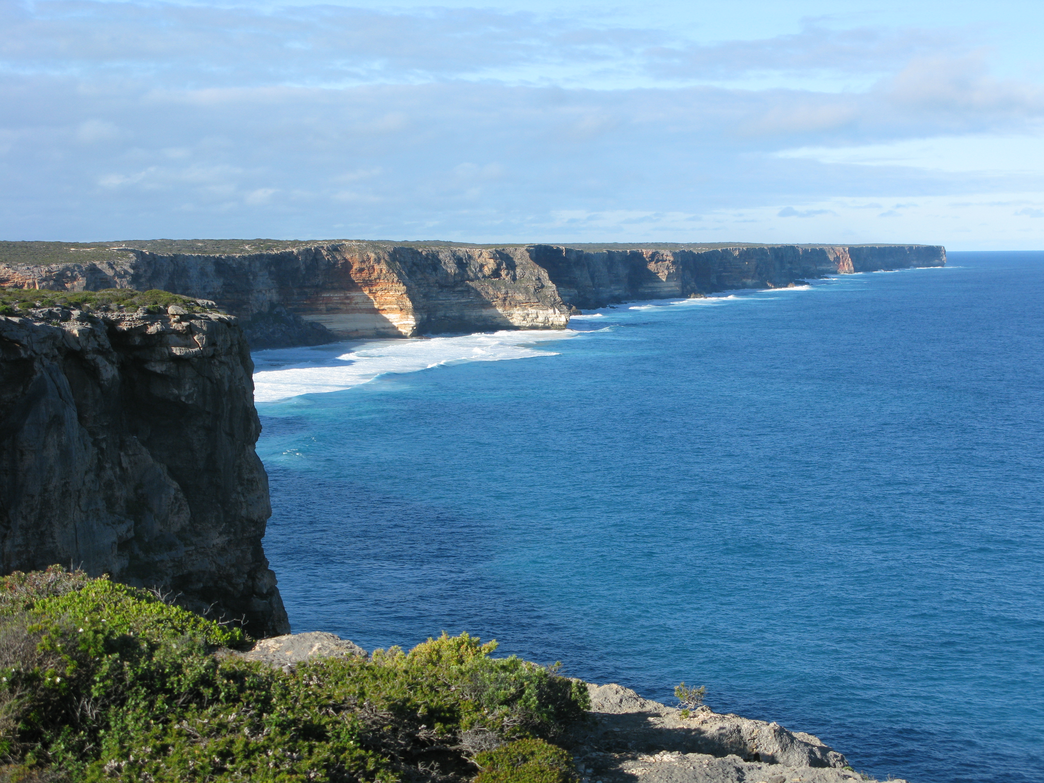
Baxter Cliffs on:
[Wikipedia]
[Google]
[Amazon]
 The Baxter Cliffs is a long stretch of coastal cliff on the
 The Baxter Cliffs is a long stretch of coastal cliff on the
 south coast South Coast is a name often given to coastal areas to the south of a geographical region or major metropolitan area.
Geographical
Australia
*South Coast (New South Wales), the coast of New South Wales, Australia, south of Sydney
* South Coast (Q ...
of Western Australia
Western Australia (commonly abbreviated as WA) is a state of Australia occupying the western percent of the land area of Australia excluding external territories. It is bounded by the Indian Ocean to the north and west, the Southern Ocean to ...
.
The Baxter Cliffs are up to 80 metres high and extend for almost 200 kilometres along the coast, from Point Culver in the west, which marks the northern end of the Israelite Plain, northeastwards to Twilight Cove
Twilight Cove is situated at the end of the Baxter Cliffs on the south coast of Western Australia on the Great Australian Bight coastline. It has had other names, including ''Malbinya''.
The local Aboriginal language for the area (known as Will ...
in the east, which is the transition from the cliffs to the coastal Roe Plains
The Roe Plains is a coastal plain in the southeastern corner of Western Australia.
The Roe Plains are predominantly marine dunes on a coastal plain. The plains are bounded on the south by the Great Australian Bight. They are bounded on the west ...
.N. P. James, Y. Bone, R. M. Carter & C. V. Murray-Wallace (2006) Origin of the Late Neogene Roe Plains and their calcarenite veneer: implications for sedimentology and tectonics in the Great Australian Bight, Australian Journal of Earth Sciences, 53:3, 407-419, DOI: 10.1080/08120090500499289 Toolinna Cove is the only place along the Baxter Cliffs where a boat can be landed.
The Baxter Cliffs are part of a long erosional escarpment which extends east and west across the Eucla Basin sedimentary formation. Other portions of the escarpment include the Hampton Tableland
Hampton Tableland is a feature that is found at the northern side of the current alignment of the Eyre Highway between Madura and Eucla in Western Australia, at the southern edge of the Nullarbor Plain.
Earlier trans-Nullarbor tracks were ...
north of the Roe Plains, and the Bunda Cliffs
The Bunda Cliffs, also known as the Nullarbor Cliffs, are a coastal scarp on the southern coast of Australia, extending from the western coast of South Australia to the south-eastern corner of Western Australia.
Geography
The Bunda Cliffs e ...
east of the Roe Plains in South Australia
South Australia (commonly abbreviated as SA) is a state in the southern central part of Australia. It covers some of the most arid parts of the country. With a total land area of , it is the fourth-largest of Australia's states and territories ...
.
The cliffs are named after John Baxter, a companion of the explorer Edward John Eyre
Edward John Eyre (5 August 181530 November 1901) was an English land explorer of the Australian continent, colonial administrator, and Governor of Jamaica.
Early life
Eyre was born in Whipsnade, Bedfordshire, shortly before his family moved t ...
, who was murdered there by two Aboriginals from Eyre's exploration party in April 1841. BAXTER CLIFFS -32 35 125 21
References
{{coord, 32, 50, 51, S, 124, 51, 49, E, type:landmark_region:AU-WA_dim:200000, display=title Great Australian Bight Goldfields-Esperance Nuytsland Nature Reserve South coast of Western Australia Cliffs of Australia