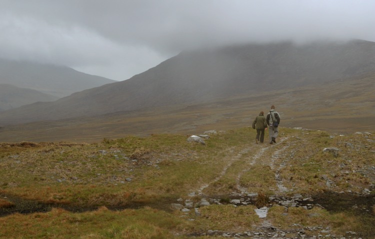
Bangor Trail on:
[Wikipedia]
[Google]
[Amazon]
 The Bangor Trail is a waymarked
 The Bangor Trail is a waymarked
 walking trail
A trail, also known as a path or track, is an unpaved lane or a small paved road (though it can also be a route along a navigable waterways) generally not intended for usage by motorized vehicles, usually passing through a natural area. How ...
in Erris
Erris is a barony in northwestern County Mayo in Ireland consisting of over , much of which is mountainous blanket bog. It has extensive sea coasts along its west and north boundaries. The main towns are Belmullet and Bangor Erris. The name E ...
, North Mayo, Ireland
Ireland (, ; ; Ulster Scots dialect, Ulster-Scots: ) is an island in the North Atlantic Ocean, in Northwestern Europe. Geopolitically, the island is divided between the Republic of Ireland (officially Names of the Irish state, named Irelan ...
. The trail, which is approximately in length, takes a route south from Bangor Erris
Bangor Erris () is a town in Kiltane parish in Erris, County Mayo, Ireland with a population of over 300. It is on the banks of the Owenmore River and is a "gateway" to the Erris Peninsula linking Belmullet with Ballina and Westport. It i ...
through the Nephin Beg Range
The Nephin Beg Range or Nephin MountainsO'Hara, Bernard. ''Mayo: Aspects of Its Heritage''. Archaeological, Historical & Folklore Society, 1982. p.207 is a mountain range in County Mayo, Ireland. The range contains the mountains of Slieve Car ...
to Newport
Newport most commonly refers to:
*Newport, Wales
*Newport, Rhode Island, US
Newport or New Port may also refer to:
Places Asia
*Newport City, Metro Manila, a Philippine district in Pasay
* Newport (Vietnam), a United States Army and Army of t ...
. Walking guides and maps of the Bangor Trail have been published by Mayo County Council
Mayo County Council () is the local government in the Republic of Ireland, local authority of County Mayo, Republic of Ireland, Ireland. As a county council, it is governed by the Local Government Act 2001. The council is responsible for housin ...
.
It is a fairly tough and remote hiking trail, in an area of largely blanket bog
Blanket bog or blanket mire, also known as featherbed bog, is an area of peatland, forming where there is a climate of high rainfall and a low level of evapotranspiration, allowing peat to develop not only in wet hollows but over large expanses ...
terrain. The Bangor Trail follows an old drover path which may date from the Iron Age
The Iron Age () is the final epoch of the three historical Metal Ages, after the Chalcolithic and Bronze Age. It has also been considered as the final age of the three-age division starting with prehistory (before recorded history) and progre ...
. There are, along the route, evidence of previous human habitation, particularly from the mid-19th century just prior to the Irish Famine
The Great Famine, also known as the Great Hunger ( ), the Famine and the Irish Potato Famine, was a period of mass starvation and disease in Ireland lasting from 1845 to 1852 that constituted a historical social crisis and had a major impact ...
.
The Western Way is another walking trail in the same area.
References
{{Coord, 54, 8, 24.6, N, 9, 44, 9.3, W, display=title Erris Long-distance trails in the Republic of Ireland Tourist attractions in County Mayo Protected areas of County Mayo