Balho on:
[Wikipedia]
[Google]
[Amazon]
Balho () is a town located in the Tadjourah

Satellite map at Maplandia.com
Populated places in Djibouti Tadjourah Region ---- {{Djibouti-geo-stub
region
In geography, regions, otherwise referred to as areas, zones, lands or territories, are portions of the Earth's surface that are broadly divided by physical characteristics (physical geography), human impact characteristics (human geography), and ...
of Djibouti
Djibouti, officially the Republic of Djibouti, is a country in the Horn of Africa, bordered by Somalia to the south, Ethiopia to the southwest, Eritrea in the north, and the Red Sea and the Gulf of Aden to the east. The country has an area ...
. It is situated on the RN-11 highway. It is situated about 32 kilometres (20 miles) west of Dorra and 6 km (4 mi) east of the Ethiopian
Ethiopians are the native inhabitants of Ethiopia, as well as the global diaspora of Ethiopia. Ethiopians constitute several component ethnic groups, many of which are closely related to ethnic groups in neighboring Eritrea and other parts of ...
border.
History
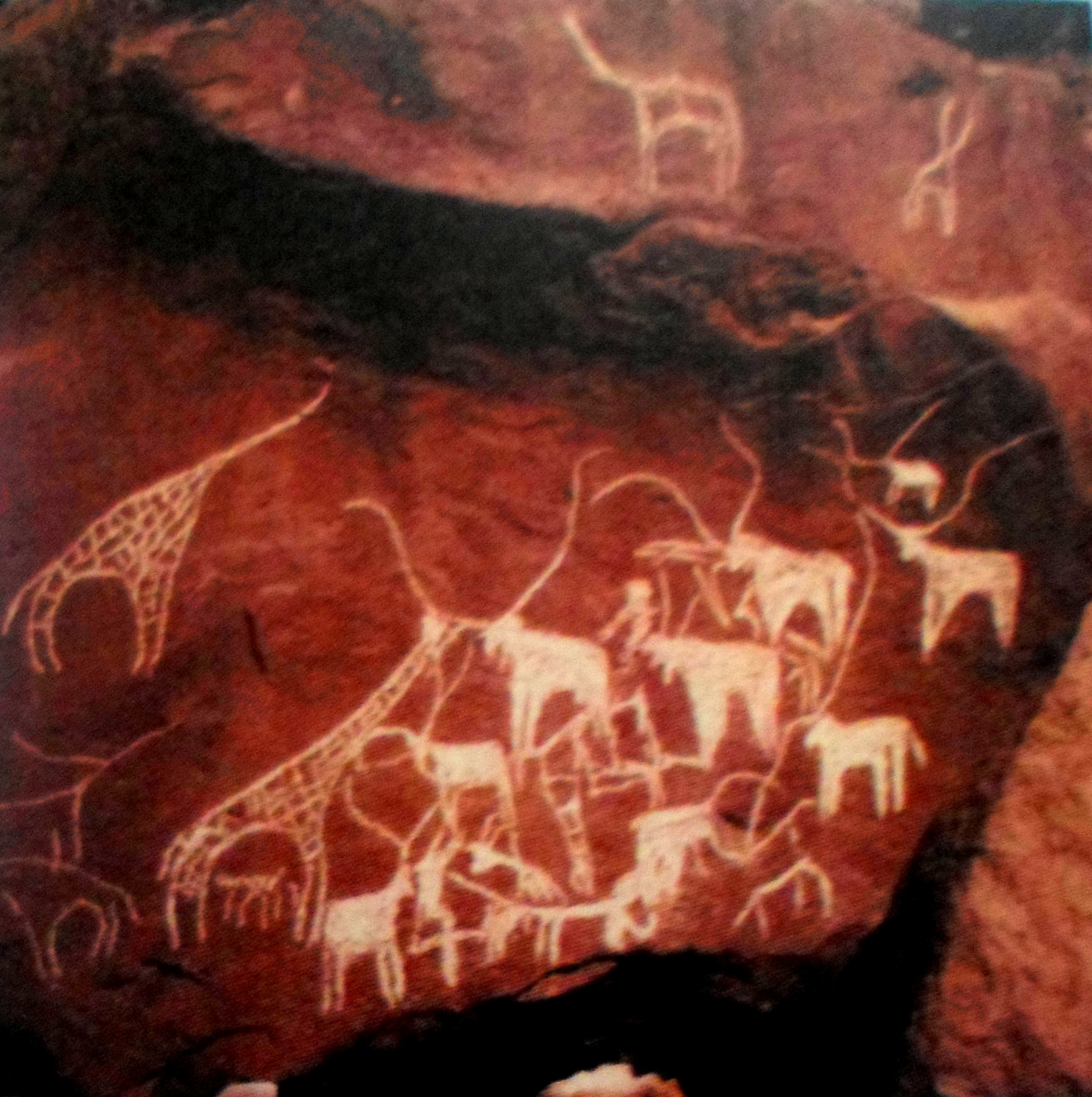
In Balho are found 10,000 years oldrock painting
In archaeology, rock arts are human-made markings placed on natural surfaces, typically vertical stone surfaces. A high proportion of surviving historic and prehistoric rock art is found in caves or partly enclosed rock shelters; this type al ...
s. These were in 1974 in the former French territory of Afars and Issas used as a stamp motifs. 1991 joined in Balho three Afar opposition groups to Front for the Restoration of Unity and Democracy
The Front for the Restoration of Unity and Democracy (, FRUD; ) is a political party in Djibouti. It is aligned with the interests of the Afar people who live in the country, although it has supporters residing outside of Djibouti.
History Upr ...
(FRUD) together, in the Djiboutian Civil War fought against the government. In 1993 the army Balho, Dorra and Randa recapture and FRUD relegate to the north.
Climate
References
External links
Satellite map at Maplandia.com
Populated places in Djibouti Tadjourah Region ---- {{Djibouti-geo-stub