Ayres Natural Bridge State Park on:
[Wikipedia]
[Google]
[Amazon]
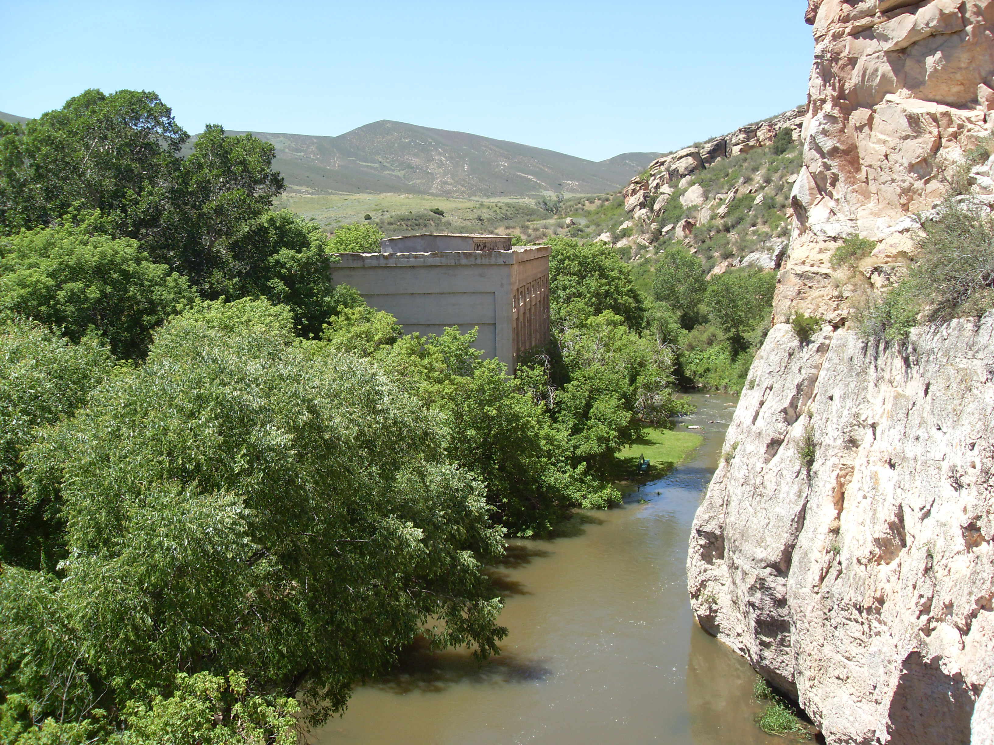
Ayres Natural Bridge Park is a county park in Converse County,  At the park entrance, the old power house, a gray concrete building from the early 1900s build by ''North Platte Irrigation Company'' to supply power to pump water from
Wyoming
Wyoming ( ) is a landlocked U.S. state, state in the Mountain states, Mountain West subregion of the Western United States, Western United States. It borders Montana to the north and northwest, South Dakota and Nebraska to the east, Idaho t ...
in the United States
The United States of America (USA), also known as the United States (U.S.) or America, is a country primarily located in North America. It is a federal republic of 50 U.S. state, states and a federal capital district, Washington, D.C. The 48 ...
. It occupies 150 acres (0.6 km²) between the towns Glenrock and Douglas
Douglas may refer to:
People
* Douglas (given name)
* Douglas (surname)
Animals
* Douglas (parrot), macaw that starred as the parrot ''Rosalinda'' in Pippi Longstocking
* Douglas the camel, a camel in the Confederate Army in the American Civil ...
about 6 kilometers south of Interstate 25
Interstate 25 (I-25), also known as the Pan-American Freeway, is a major Interstate Highway in the western United States. It is primarily a north–south highway, serving as the main route through New Mexico, Colorado, and Wyoming. I-25 st ...
exit 151. The park's name is derived from the rock formation of the same name. Ayres is the surname of the family who donated the land which had been part of their ranch.
Over the course of millions of years, a bend in LaPrele Creek (originally known as Bridge Creek) wore away at a wall of solid rock, creating a natural opening. The creek eventually shifted course through the opening, forming a 30-foot (10 m) high and 50-foot (15 m) wide arch
An arch is a curved vertical structure spanning an open space underneath it. Arches may support the load above them, or they may perform a purely decorative role. As a decorative element, the arch dates back to the 4th millennium BC, but stru ...
, today known as Ayres Natural Bridge, from sandstones of the Casper Formation.
Located about a mile (2 km) south of the Oregon Trail
The Oregon Trail was a east–west, large-wheeled wagon route and Westward Expansion Trails, emigrant trail in North America that connected the Missouri River to valleys in Oregon Territory. The eastern part of the Oregon Trail crossed what ...
, the Natural Bridge was often visited by emigrants traveling west. It is considered one of Wyoming's first tourist attractions. In 1843, a pioneer described it as "a natural bridge of solid rock, over a rapid torrent, the arch being regular as tho' shaped by art."
The park is free to visit. There is a small campground in the park, as well as open picnic areas and covered tables. It is opened from April 15 through October 15, from 8 a.m. to 8 p.m., with registered campers allowed to stay overnight. No pets are allowed in the park.
 At the park entrance, the old power house, a gray concrete building from the early 1900s build by ''North Platte Irrigation Company'' to supply power to pump water from
 North Platte River
The North Platte River is a major tributary of the Platte River and is approximately long, counting its many curves.U.S. Geological Survey. National Hydrography Dataset high-resolution flowline dataThe National Map accessed March 21, 2011 I ...
for irrigation is still preserved. The company went bankrupt before the project was completed.
External links
* * {{Protected Areas of Wyoming Parks in Wyoming Natural arches of Wyoming Oregon Trail Protected areas of Converse County, Wyoming Landforms of Converse County, Wyoming