Alligator Pond on:
[Wikipedia]
[Google]
[Amazon]
 Alligator Pond is a
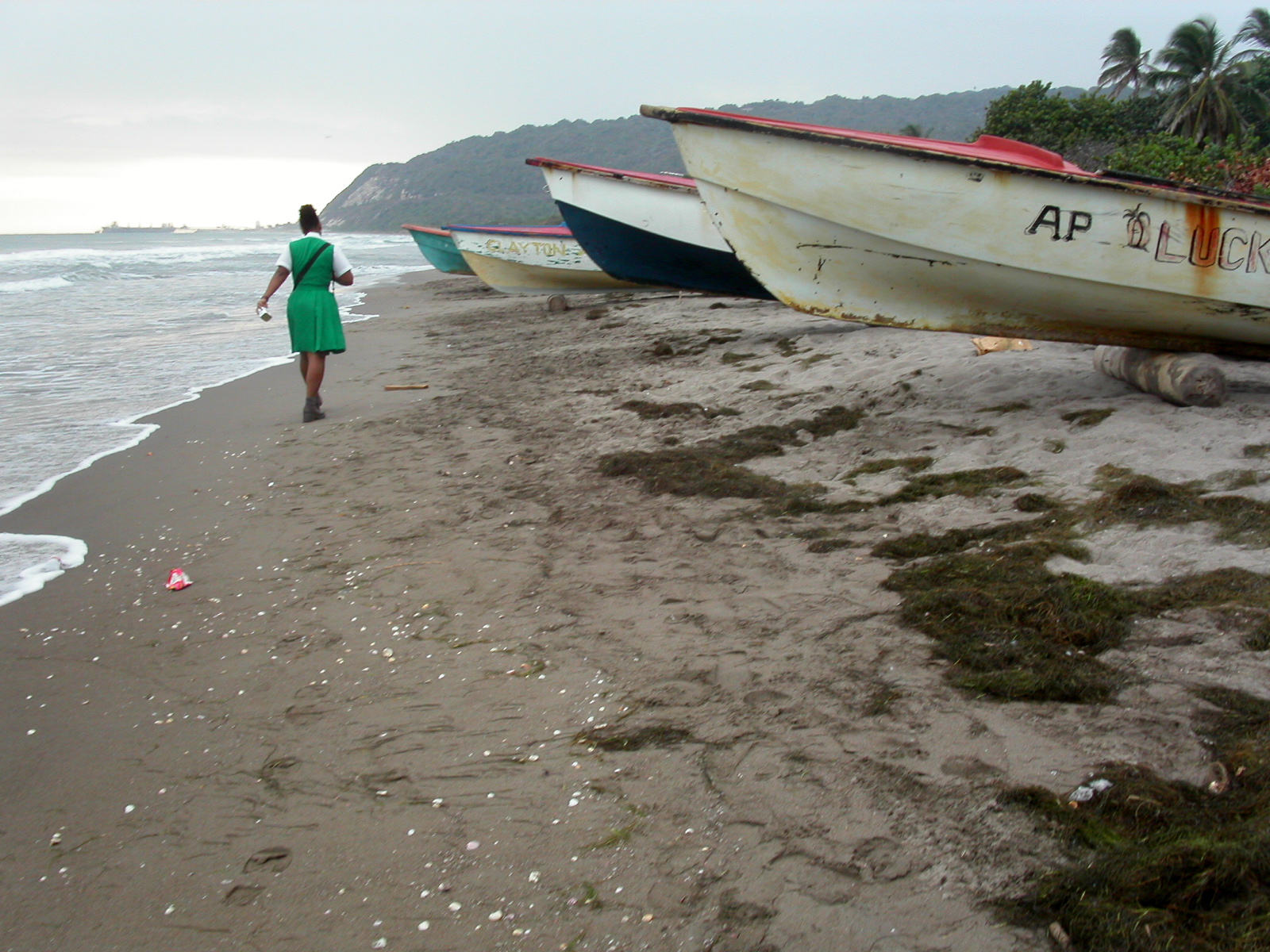
 Alligator Pond lies at the foot of the Don Figueroa Mountains to the north-east, some 35 km from Mandeville. The name is said by locals to derive from the shape of the mountain range, which viewed from the beach has bumps which suggest an alligator's back.
The Alligator Pond River is a bathing spot about 3.2 km (2 miles) west of the village off the road leading to
 ''The Little Ochie'', a fish restaurant, is located in several huts on the beach, some made from the hulls of fishing boats with thatched roofs. It has expanded to seat several hundred and attracts a clientele from far and wide, including some tourist tours.
Photo essay on life in Alligator Pond, Jamaica
{{Beaches of Jamaica Populated coastal places in Jamaica Beaches of Jamaica Populated places in Saint Elizabeth Parish Year of establishment missing
 Alligator Pond is a
 fishing village
A fishing village is a village, usually located near a fishing ground, with an economy based on catching fish and harvesting seafood. The continents and islands around the world have coastlines totalling around 356,000 kilometres (221,000 ...
on the southwestern coast of Jamaica
Jamaica (; ) is an island country situated in the Caribbean Sea. Spanning in area, it is the third-largest island of the Greater Antilles and the Caribbean (after Cuba and Hispaniola). Jamaica lies about south of Cuba, and west of Hispan ...
in the parish
A parish is a territorial entity in many Christian denominations, constituting a division within a diocese. A parish is under the pastoral care and clerical jurisdiction of a priest, often termed a parish priest, who might be assisted by one or ...
of Manchester
Manchester () is a city in Greater Manchester, England. It had a population of 552,000 in 2021. It is bordered by the Cheshire Plain to the south, the Pennines to the north and east, and the neighbouring city of City of Salford, Salford to ...
.
Unlike the tourist-oriented coasts in the northern part of the country, Alligator Pond's shoreline is as much about work as play; here fishermen
A fisher or fisherman is someone who captures fish and other animals from a body of water, or gathers shellfish.
Worldwide, there are about 38 million commercial and subsistence fishers and fish farmers. Fishers may be professional or recre ...
launch their boats to catch some of the island's best-regarded fish while women conduct the wholesale business of the catch. Weather-worn cookshops and bars line the sand's edge, supplying food staples such as curried goat and Red Stripe beer.
Geography
Port Kaiser
A port is a maritime facility comprising one or more wharves or loading areas, where ships load and discharge cargo and passengers. Although usually situated on a sea coast or estuary, ports can also be found far inland, such as Ham ...
.
The Little Ochie
See also
*List of cities and towns in Jamaica
The following is a list of the most populous settlements in Jamaica.
Definitions
The following definitions have been used:
*City: Official city status on a settlement is only conferred by Act of Parliament. Only three areas have the designati ...
* List of beaches in Jamaica
References
External links
Photo essay on life in Alligator Pond, Jamaica
{{Beaches of Jamaica Populated coastal places in Jamaica Beaches of Jamaica Populated places in Saint Elizabeth Parish Year of establishment missing