Adambakkam on:
[Wikipedia]
[Google]
[Amazon]
Adambakkam is a neighbourhood of 

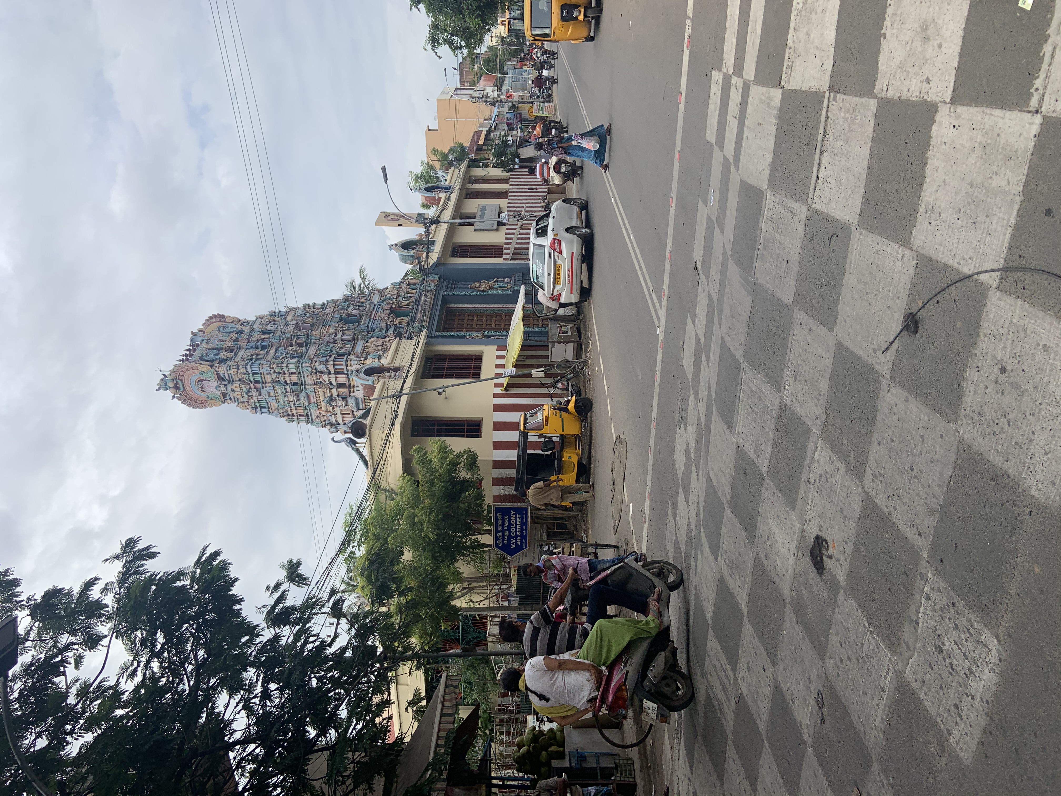
 Adambakkam has a population with diverse cultures and religions where Hindus, Muslims and Christians co-exist. Prominent Hindu temples are the famous Pazhandi Amman temple near St. Thomas Mount railway station, Sundara Vinayagar Temple in NGO COLONY, Devi Nagamuthu Mariamman temple in EB Colony, Lord Subramanya temple in Brindavan Nagar, Bhuvaneshwari Amman temple in Andal Nagar and Nandeeswarar temple near St. Thomas Mount railway station. Viswaroopa Sarvamangala Shaneeswara Bhagawan Sannidhi is located inside Devi Nagamuthu Mariamman temple. Prominent Mosque is the Masthan Gori Masjid in Masthan Ghori street. Prominent Church is St. Mark's Catholic Church in Brindavan Nagar. Adhinath Digambar Jain Temple at Indira Gandhi street, Vanuvampetttai near Adambakkam is a Jain place of worship.
 Adambakkam has a fully functional MTC Bus Terminus/Depot at NGO Colony in City Link Road. MTC uses this depot to park, maintain and refuel most of its buses serving nearby areas.
The St. Thomas Mount Railway Station between Alandur and Adambakkam, part of the
  Metro Rail from Central to St. Thomas Mount via Koyambedu running service via Alandur. Can also switch to Airport at Alandur.
Important Roads:
 * City link Road (Link Road) - Connects Race view Colony (
 * New Prince Matriculation Higher Secondary School
* D.A.V School
* G.K Shetty Hindu Vidyalaya Matriculation Higher Secondary School
* GKS Hindu Vidyalaya
* St. Mark's High School
* Indira Gandhi Matriculation School
* Beta Matriculation Higher Secondary School
* Saint Britto's College
Theatres
Mini Bus Services
Project Green Hands Nursery in EB Colony-Isha Foundation
Shri Narendra Modi (Gujarat CM)-DAV School Function
{{Geographic Location , Northwest = St. Thomas Mount / GST Road /
Chennai
Chennai (, ), formerly known as Madras ( the official name until 1996), is the capital city of Tamil Nadu, the southernmost Indian state. The largest city of the state in area and population, Chennai is located on the Coromandel Coast of ...
, India
India, officially the Republic of India ( Hindi: ), is a country in South Asia. It is the seventh-largest country by area, the second-most populous country, and the most populous democracy in the world. Bounded by the Indian Ocean on the ...
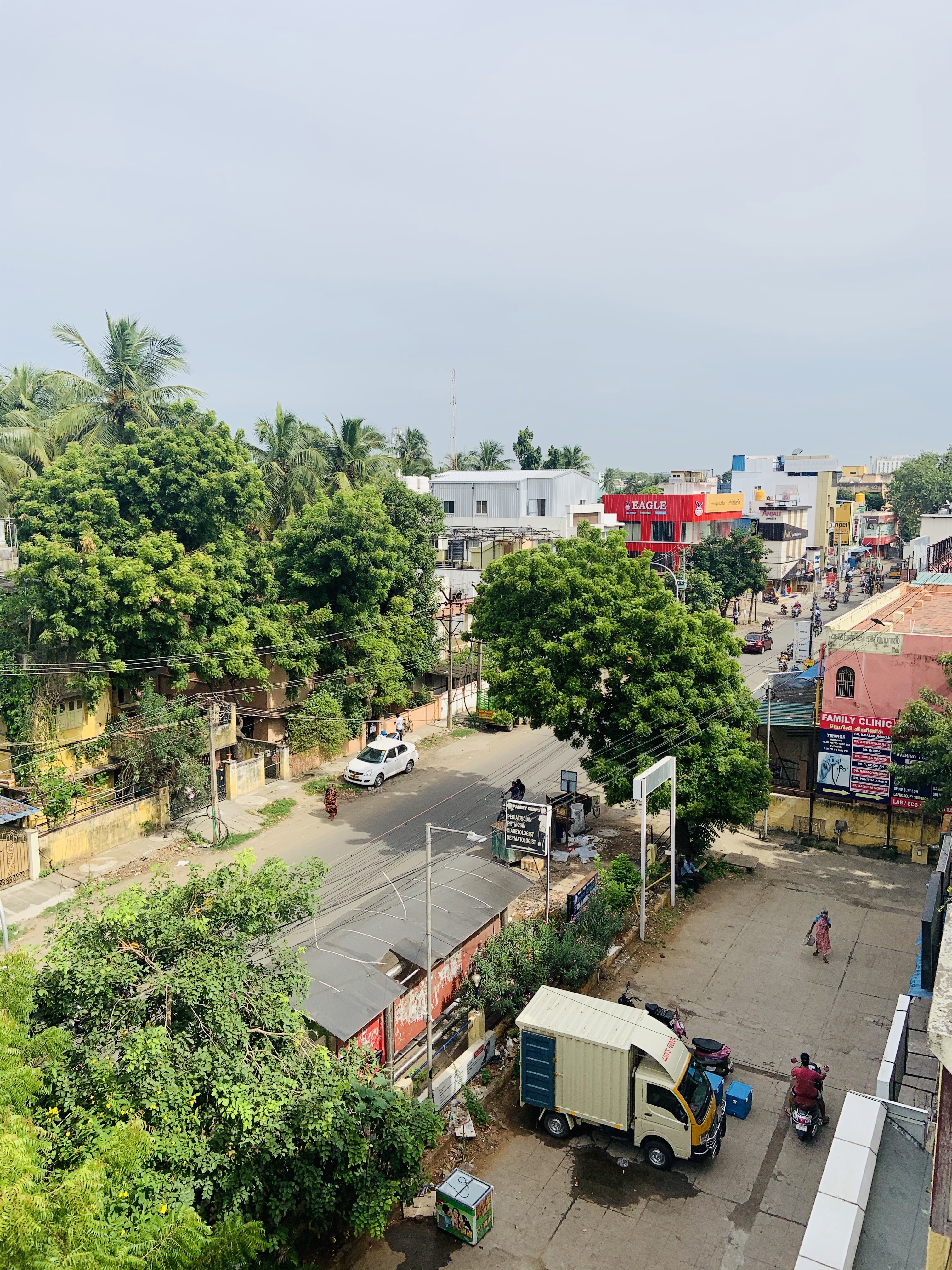
. It is primarily a residential locality situated in South Chennai . Adambakkam area comes under Velachery taluk
Velachery taluk is a taluk of the city district of Chennai in the Indian state of Tamil Nadu. It was formed in December 2013 from parts of the erstwhile Mambalam-Guindy and Mylapore-Triplicane taluks. It comprises the neighbourhoods of Besant Na ...
and Alandur taluk, Chennai District
Chennai district, formerly known as Madras district, is one of the 38 districts in the state of Tamil Nadu, India. It is the smallest and the most densely populated district in the state. The district is coterminous with the city of Chennai, w ...
of Chennai Corporation. Adambakkam is surrounded by areas namely, Alandur in the North-West, Nanganallur in the West, Madipakkam
Madipakkam is residential locality situated in south of Chennai, India. It has been recently placed under the Greater Chennai Corporation.
Demographics
India census, Madipakkam had a population of 14,940. Males constitute 51% of the popula ...
in the South, Velachery
Velachery (''pronounced as'' veh·luh·cheh·ree) is a commercial and residential area in south Chennai, and is the largest commercial centre in south Chennai. It is surrounded by Guindy in the north, IIT Madras in the north-east, Taramani in ...
in the East and Guindy
Guindy is one of the most important neighborhoods of Chennai, Tamil Nadu, and is nicknamed as ''The Gateway to Chennai''. The Kathipara junction where Anna Salai, Mount-Poonamallee Road, Inner Ring Road, 100 Feet Road or Jawaharlal Nehru ...
in the North. Earlier, one part of Adambakkam was under the direct governance of Chennai Corporation. From October 2011 onwards, the entire area was merged with the Chennai Corporation. Upon completion of the MRTS extension line, the neighbourhood will be served by Adambakkam railway station. Its Proximity to commercial localities like Velachery
Velachery (''pronounced as'' veh·luh·cheh·ree) is a commercial and residential area in south Chennai, and is the largest commercial centre in south Chennai. It is surrounded by Guindy in the north, IIT Madras in the north-east, Taramani in ...
, accessible railway stations, Metro Stations and road transport routes makes Adambakkam an ideal choice of location to live.

Geography
Adambakkam is located at . It has an average elevation of 7 metres (23 feet). The Adambakkam Lake situated in Jeevan Nagar and the Velachery Lake situated in Kakkan Nagar are the two lakes present in the locality.Culture

 Adambakkam has a population with diverse cultures and religions where Hindus, Muslims and Christians co-exist. Prominent Hindu temples are the famous Pazhandi Amman temple near St. Thomas Mount railway station, Sundara Vinayagar Temple in NGO COLONY, Devi Nagamuthu Mariamman temple in EB Colony, Lord Subramanya temple in Brindavan Nagar, Bhuvaneshwari Amman temple in Andal Nagar and Nandeeswarar temple near St. Thomas Mount railway station. Viswaroopa Sarvamangala Shaneeswara Bhagawan Sannidhi is located inside Devi Nagamuthu Mariamman temple. Prominent Mosque is the Masthan Gori Masjid in Masthan Ghori street. Prominent Church is St. Mark's Catholic Church in Brindavan Nagar. Adhinath Digambar Jain Temple at Indira Gandhi street, Vanuvampetttai near Adambakkam is a Jain place of worship.
Transport
 Adambakkam has a fully functional MTC Bus Terminus/Depot at NGO Colony in City Link Road. MTC uses this depot to park, maintain and refuel most of its buses serving nearby areas.
The St. Thomas Mount Railway Station between Alandur and Adambakkam, part of the
 Chennai suburban railway
The Chennai Suburban Railway is a commuter rail system in the city of Chennai, Tamil Nadu, India, operated by the Southern Railways branch of Indian Railways. It is the second largest suburban rail network in terms of route length and the third ...
serves this area. The phase II extension of the elevated Mass Rapid Transit System (MRTS) railway project is progressing at full pace and Adambakkam Station is expected to be built in Medavakkam main road junction near Vanuvampet ( Madippakam). ''St. Thomas Mount subway'' (underpass) and ''Thillai Ganga Nagar subway'' (underpass) connects Adambakkam with GST Road. The Kakkan Bridge connects Ramakrishnapuram and Brindavan Nagar. Another underpass exclusive for two wheeler traffic that connects the link road of Adambakkam and the Velachery road of Alandur is under construction.
Summary of Transport facilities in Adambakkam:
* MTC bus services via Medavakkam Main Road from all major areas to Nanganallur, Ullagaram
Puzhuthivakkam, commonly known as Ullagaram or Ullagaram–Puzhuthivakkam, is a southern neighbourhood of Chennai in Tamil Nadu, India. Puzhuthivakkam loosely translates to dust neighborhood. The neighbourhood is part of the Greater Chennai Corp ...
(Madipakkam
Madipakkam is residential locality situated in south of Chennai, India. It has been recently placed under the Greater Chennai Corporation.
Demographics
India census, Madipakkam had a population of 14,940. Males constitute 51% of the popula ...
), Keelkattalai, Nanmangalam, Kovilambakkam and Medavakkam Koot Road.
* MTC bus services via Brindavan Nagar from all major areas to Puzhuthivakkam and AG's Colony.
* Beach-Tambaram-Chengalpattu Suburban train service.
* MRTS extension from Velachery to Puzhuthivakkam, Adambakkam and St. Thomas Mount (Under construction).
*  Metro Rail from Central to St. Thomas Mount via Koyambedu running service via Alandur. Can also switch to Airport at Alandur.
Important Roads:
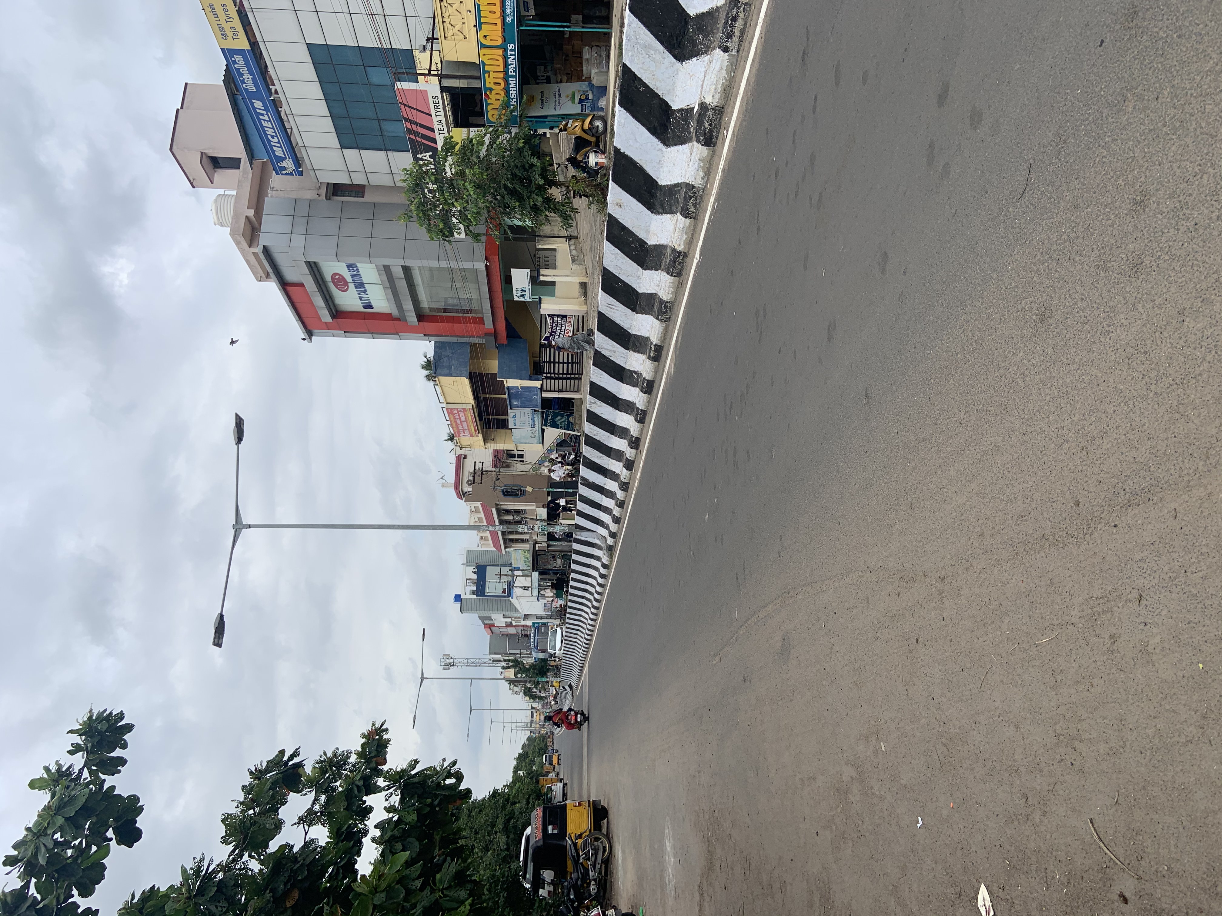
 * City link Road (Link Road) - Connects Race view Colony (
Guindy
Guindy is one of the most important neighborhoods of Chennai, Tamil Nadu, and is nicknamed as ''The Gateway to Chennai''. The Kathipara junction where Anna Salai, Mount-Poonamallee Road, Inner Ring Road, 100 Feet Road or Jawaharlal Nehru ...
) and Brindavan Nagar.
*Brindavan/Sakthi/Mahalakshmi/Balaji Nagar Main Road - Connects Kakkan Nagar and Jawaharlal Nehru road ( inner ring road).
*Medavakkam Main Road - Connects St Thomas Mount Railway Station and Jawaharlal Nehru road ( inner ring road) and further towards Medavakkam via Madipakkam
Madipakkam is residential locality situated in south of Chennai, India. It has been recently placed under the Greater Chennai Corporation.
Demographics
India census, Madipakkam had a population of 14,940. Males constitute 51% of the popula ...
, Keelkatalai and Kovilambakkam.
*Thiruvalluvar Main Road - Connects St Thomas Mount Railway Station and Adambakkam Depot (N.G.O Colony Bus Terminus).
*Karuneegar Street - Connects Parthasarathy Nagar and GST road via Alandur.
The Jawaharlal Nehru road ( inner ring road) that outlines Adambakkam in the southern side is becoming a hot spot for real estate and commercial establishments.
Educational Institutions
 * New Prince Matriculation Higher Secondary School
* D.A.V School
* G.K Shetty Hindu Vidyalaya Matriculation Higher Secondary School
* GKS Hindu Vidyalaya
* St. Mark's High School
* Indira Gandhi Matriculation School
* Beta Matriculation Higher Secondary School
* Saint Britto's College
Hospitals
* G.R. Hospital and Fertility Centre * Ponmalligai Multi Speciality Hospital * SP Hospital * Prime Care Hospital *Mount Multispeciality HospitalsSee also
* Nanganallur *Puzhuthivakkam
Puzhuthivakkam, commonly known as Ullagaram or Ullagaram–Puzhuthivakkam, is a southern neighbourhood of Chennai in Tamil Nadu, India. Puzhuthivakkam loosely translates to dust neighborhood. The neighbourhood is part of the Greater Chennai Corp ...
* Alandur
References
In the News
Theatres
Mini Bus Services
Project Green Hands Nursery in EB Colony-Isha Foundation
Shri Narendra Modi (Gujarat CM)-DAV School Function
{{Geographic Location , Northwest = St. Thomas Mount / GST Road /
Airport
An airport is an aerodrome with extended facilities, mostly for commercial air transport. Airports usually consists of a landing area, which comprises an aerially accessible open space including at least one operationally active surfa ...
, North = Alandur
, Northeast = Guindy
Guindy is one of the most important neighborhoods of Chennai, Tamil Nadu, and is nicknamed as ''The Gateway to Chennai''. The Kathipara junction where Anna Salai, Mount-Poonamallee Road, Inner Ring Road, 100 Feet Road or Jawaharlal Nehru ...
, West = Nanganallur / Thillai Ganga Nagar
, Centre = Adambakkam
, East = Velachery
Velachery (''pronounced as'' veh·luh·cheh·ree) is a commercial and residential area in south Chennai, and is the largest commercial centre in south Chennai. It is surrounded by Guindy in the north, IIT Madras in the north-east, Taramani in ...
, Southwest = Keelkattalai
, South = Vanuvampet / Ullagaram
Puzhuthivakkam, commonly known as Ullagaram or Ullagaram–Puzhuthivakkam, is a southern neighbourhood of Chennai in Tamil Nadu, India. Puzhuthivakkam loosely translates to dust neighborhood. The neighbourhood is part of the Greater Chennai Corp ...
/ Puzhuthivakkam
Puzhuthivakkam, commonly known as Ullagaram or Ullagaram–Puzhuthivakkam, is a southern neighbourhood of Chennai in Tamil Nadu, India. Puzhuthivakkam loosely translates to dust neighborhood. The neighbourhood is part of the Greater Chennai Corp ...
, Southeast = Madipakkam
Madipakkam is residential locality situated in south of Chennai, India. It has been recently placed under the Greater Chennai Corporation.
Demographics
India census, Madipakkam had a population of 14,940. Males constitute 51% of the popula ...
Neighbourhoods in Chennai
Cities and towns in Chennai district