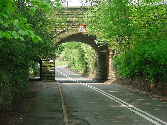
A448 Road on:
[Wikipedia]
[Google]
[Amazon]
The A448 is a main road in
 * Through Redditch the A448 used to follow now unclassified roads on the South Side of the new town, changes coming during the 1970s when new dual carriageways (or Highways) were built to deal with the rising volume of traffic following the town's growth.
* Between Redditch and Bromsgrove the villages of Tardebigge and Finstall have been bypassed
* The A448 used to be concurrent with the A38 along Bromsgrove High Street
SABRE: A448
{{DEFAULTSORT:4-0448 Roads in England Roads in Warwickshire Roads in Worcestershire
England
England is a Countries of the United Kingdom, country that is part of the United Kingdom. It is located on the island of Great Britain, of which it covers about 62%, and List of islands of England, more than 100 smaller adjacent islands. It ...
running between Studley in Warwickshire
Warwickshire (; abbreviated Warks) is a Ceremonial counties of England, ceremonial county in the West Midlands (region), West Midlands of England. It is bordered by Staffordshire and Leicestershire to the north, Northamptonshire to the east, Ox ...
and Kidderminster
Kidderminster is a market town and civil parish in Worcestershire, England, south-west of Birmingham and north of Worcester, England, Worcester. Located north of the River Stour, Worcestershire, River Stour and east of the River Severn, in th ...
in Worcestershire
Worcestershire ( , ; written abbreviation: Worcs) is a Ceremonial counties of England, ceremonial county in the West Midlands (region), West Midlands of England. It is bordered by Shropshire, Staffordshire, and the West Midlands (county), West ...
.
Route
The A448 starts at a fork junction on the A435 just to the South of Studley, heading North West into the new town ofRedditch
Redditch is a town and non-metropolitan district with borough status in Worcestershire, England. It is located south of Birmingham, east of Bromsgrove, north-west of Alcester and north-east of Worcester. In 2021, the town had a population of ...
, entering Worcestershire
Worcestershire ( , ; written abbreviation: Worcs) is a Ceremonial counties of England, ceremonial county in the West Midlands (region), West Midlands of England. It is bordered by Shropshire, Staffordshire, and the West Midlands (county), West ...
immediately before a roundabout where it meets the A441. For the next it is concurrent with the A441, before diverging at England's only Cloverleaf interchange
A cloverleaf interchange is a two-level interchange (road), interchange in which all turns are handled by slip roads. To go left (in right-hand traffic; reverse directions in left-driving regions), vehicles first continue as one road passe ...
. From this point the A448 heads West on a dual carriageway bypassing the villages of Tardebigge and Finstall. The dual carriageway ends on a roundabout with the A38 Bromsgrove
Bromsgrove is a town in Worcestershire, England, about north-east of Worcester and south-west of Birmingham city centre. It had a population of 34,755 in at the 2021 census. It gives its name to the wider Bromsgrove District, of which it is ...
Bypass. It continues through the congested town centre and out of the other side, passing under the M5. It is now a twisty single carriageway road passing through several villages before entering Kidderminster. It crosses the A449 at traffic lights, and descends past Kidderminster station and Severn Valley Railway
The Severn Valley Railway is a standard gauge, standard-gauge heritage railway in Shropshire and Worcestershire, England. The single-track line runs from Bridgnorth to Kidderminster, calling at four intermediate stations and three request stop ...
to meet the Ring Road.
Former routes
 * Through Redditch the A448 used to follow now unclassified roads on the South Side of the new town, changes coming during the 1970s when new dual carriageways (or Highways) were built to deal with the rising volume of traffic following the town's growth.
* Between Redditch and Bromsgrove the villages of Tardebigge and Finstall have been bypassed
* The A448 used to be concurrent with the A38 along Bromsgrove High Street
Places of interest
*Severn Valley Railway
The Severn Valley Railway is a standard gauge, standard-gauge heritage railway in Shropshire and Worcestershire, England. The single-track line runs from Bridgnorth to Kidderminster, calling at four intermediate stations and three request stop ...
* Tardebigge Locks
* Lickey Incline
See also
*Great Britain road numbering scheme
In Great Britain, there is a numbering scheme used to Categorization, classify and identify all roads. Each road is given a single letter (representing a category) and a subsequent number (between one and four digits). Though this scheme was in ...
References
External links
SABRE: A448
{{DEFAULTSORT:4-0448 Roads in England Roads in Warwickshire Roads in Worcestershire