|
Weathering Rind
A weathering rind is a discolored, chemically altered, outer zone or layer of a discrete rock fragment formed by the processes of weathering. The inner boundary of a weathering rind approximately parallels the outer surface of the rock fragment in which it has developed. Rock fragments with weathering rinds normally are discrete clasts, ranging in size from pebbles to cobbles or boulders. They typically occur either lying on the surface of the ground or buried within sediments such as alluvium, colluvium, or glacial till. A weathering rind represents the alteration of the outer portion of a rock by exposure to air or near surface groundwater over a period of time. Typically, a weathering rind may be enriched with either iron or manganese (or both), and silica, and oxidized to a yellowish red to reddish color. Often a weathering rind exhibits multiple bands of differing colors.Colman, SM, and KL Pierce (2001) ''Weathering rinds on andesitic and basaltic stones as a Quaternary age ... [...More Info...] [...Related Items...] OR: [Wikipedia] [Google] [Baidu] |
Spheroidal Weathering
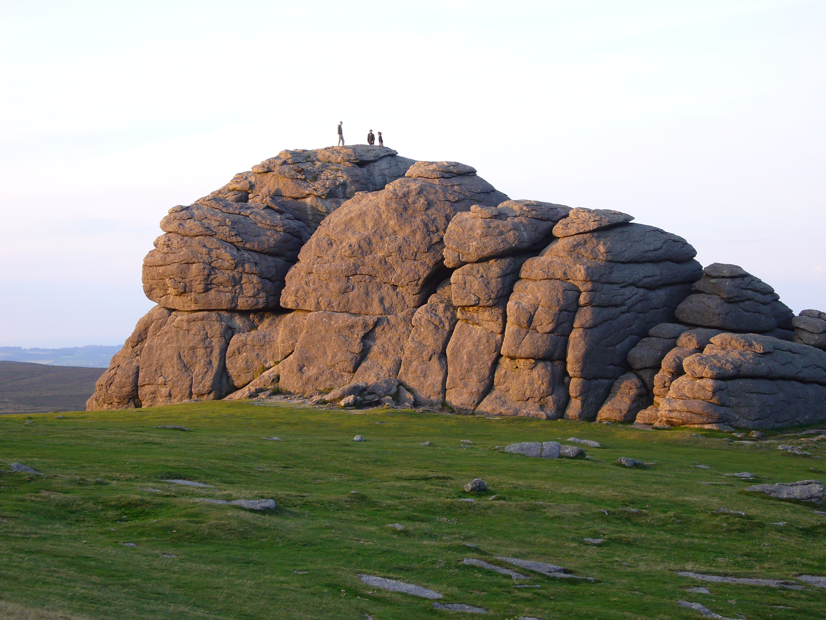
Spheroidal weathering is a form of chemical weathering that affects jointed bedrock and results in the formation of concentric or spherical layers of highly decayed rock within weathered bedrock that is known as ''saprolite.'' When saprolite is exposed by physical erosion, these concentric layers peel (spall) off as concentric shells much like the layers of a peeled onion. Within saprolite, spheroidal weathering often creates rounded boulders, known as ''corestones'' or ''woolsack'', of relatively unweathered rock. Spheroidal weathering is also called onion skin weathering, concentric weathering, spherical weathering, or woolsack weathering.Fairbridge, RW (1968) ''Spheroidal Weathering.'' in RW Fairbridge, ed., pp. 1041–1044, The Encyclopedia of Geomorphology, Encyclopedia of Earth Sciences, vol. III. Reinhold Book Corporation, New York, New York. Ollier, C.D. (1971). ''Causes of spheroidal weathering. ''Earth-Science Reviews 7:127–141.Neuendorf, KKE, JP Mehl Jr., and JA J ... [...More Info...] [...Related Items...] OR: [Wikipedia] [Google] [Baidu] |
Landform
A landform is a land feature on the solid surface of the Earth or other planetary body. They may be natural or may be anthropogenic (caused or influenced by human activity). Landforms together make up a given terrain, and their arrangement in the landscape is known as topography. Landforms include hills, mountains, canyons, and valleys, as well as shoreline features such as bays, peninsulas, and seas, including submerged features such as mid-ocean ridges, volcanoes, and the great oceanic basins. Physical characteristics Landforms are categorized by characteristic physical attributes such as elevation, slope, orientation, structure stratification, rock exposure, and soil type. Gross physical features or landforms include intuitive elements such as berms, cliffs, hills, mounds, peninsulas, ridges, rivers, valleys, volcanoes, and numerous other structural and size-scaled (e.g. ponds vs. lakes, hills vs. mountains) elements including various kinds of inland ... [...More Info...] [...Related Items...] OR: [Wikipedia] [Google] [Baidu] |
Debitage
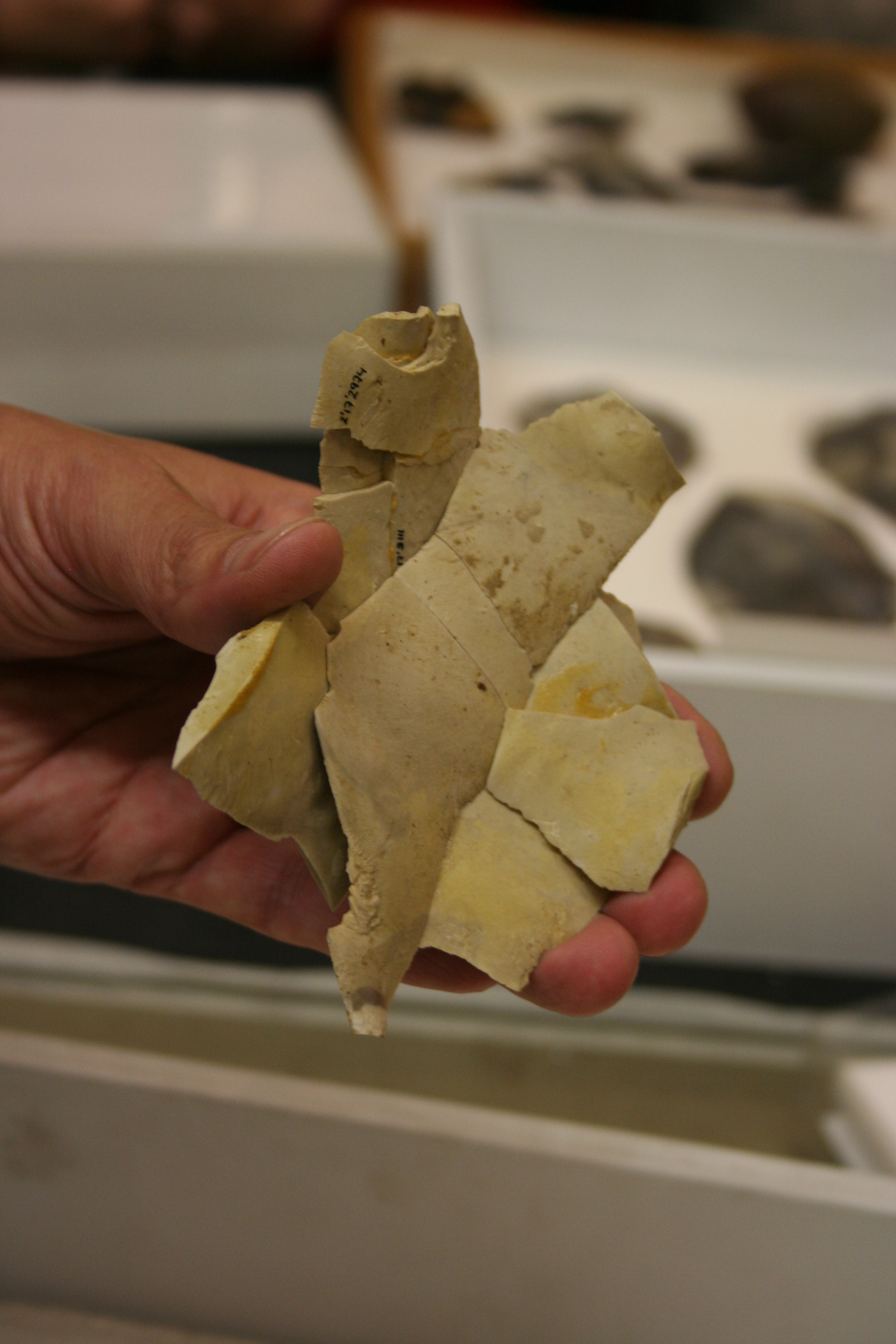
In archaeology, debitage is all the material produced during the process of lithic reduction – the production of stone tools and weapons by knapping stone. This Assemblage (archaeology), assemblage may include the different kinds of lithic flakes and lithic blades, but most often refers to the shatter and production debris, and production rejects. Debitage analysis Debitage analysis, a sub-field of lithic analysis, considers the entire lithic waste assemblage. The analysis is undertaken by investigating differing patterns of debris morphology, size, and shape, among other things. This allows researchers to make more accurate assumptions regarding the purpose of the lithic reduction. Quarrying activities, core reduction, biface creation, tool manufacture, and retooling are believed to leave significantly different debitage assemblages. Lithic manufacture from a quarried source, or from found cobbles also leave different signatures. Some claim that they can determine the so ... [...More Info...] [...Related Items...] OR: [Wikipedia] [Google] [Baidu] |
Secondary Ion Mass Spectrometry
Secondary-ion mass spectrometry (SIMS) is a technique used to analyze the composition of solid surfaces and thin films by sputtering the surface of the specimen with a focused primary ion beam and collecting and analyzing ejected secondary ions. The mass/charge ratios of these secondary ions are measured with a mass spectrometer to determine the elemental, isotopic, or molecular composition of the surface to a depth of 1 to 2 nm. Due to the large variation in ionization probabilities among elements sputtered from different materials, comparison against well-calibrated standards is necessary to achieve accurate quantitative results. SIMS is the most sensitive surface analysis technique, with elemental detection limits ranging from parts per million to parts per billion. History In 1910, British physicist J. J. Thomson observed a release of positive ions and neutral atoms from a solid surface induced by ion bombardment. Improved vacuum pump technology in the 1940s enabled th ... [...More Info...] [...Related Items...] OR: [Wikipedia] [Google] [Baidu] |
Magnification
Magnification is the process of enlarging the apparent size, not physical size, of something. This enlargement is quantified by a size ratio called optical magnification. When this number is less than one, it refers to a reduction in size, sometimes called ''de-magnification''. Typically, magnification is related to scaling up visuals or images to be able to see more detail, increasing resolution, using microscope, printing techniques, or digital processing. In all cases, the magnification of the image does not change the perspective of the image. Examples of magnification Some optical instruments provide visual aid by magnifying small or distant subjects. * A magnifying glass, which uses a positive (convex) lens to make things look bigger by allowing the user to hold them closer to their eye. * A telescope, which uses its large objective lens or primary mirror to create an image of a distant object and then allows the user to examine the image closely with a smaller ... [...More Info...] [...Related Items...] OR: [Wikipedia] [Google] [Baidu] |
Microscope
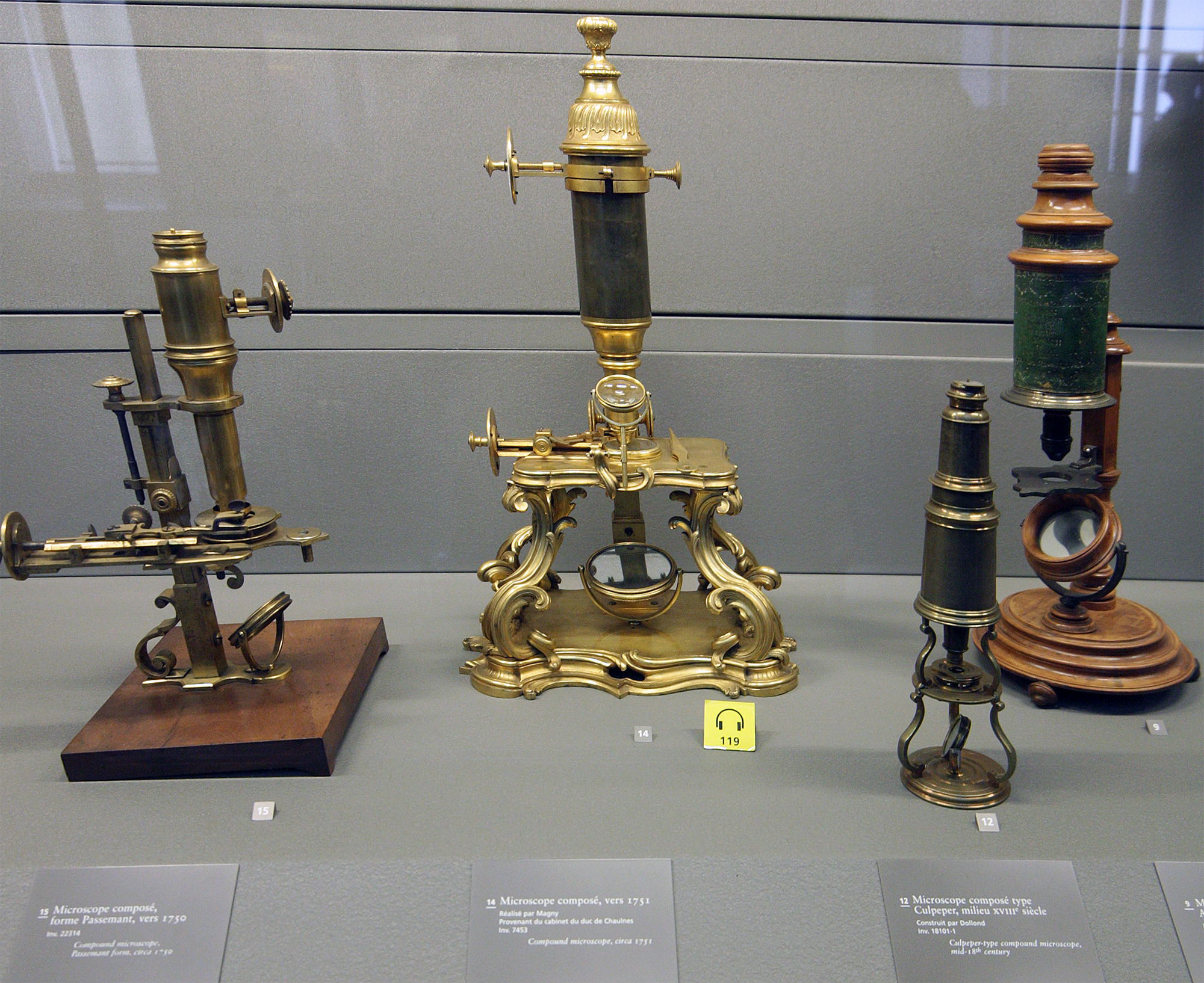
A microscope () is a laboratory equipment, laboratory instrument used to examine objects that are too small to be seen by the naked eye. Microscopy is the science of investigating small objects and structures using a microscope. Microscopic means being invisible to the eye unless aided by a microscope. There are many types of microscopes, and they may be grouped in different ways. One way is to describe the method an instrument uses to interact with a sample and produce images, either by sending a beam of light or electrons through a sample in its optical path, by detecting fluorescence, photon emissions from a sample, or by scanning across and a short distance from the surface of a sample using a probe. The most common microscope (and the first to be invented) is the optical microscope, which uses lenses to refract visible light that passed through a microtome, thinly sectioned sample to produce an observable image. Other major types of microscopes are the fluorescence micro ... [...More Info...] [...Related Items...] OR: [Wikipedia] [Google] [Baidu] |
Obsidian
Obsidian ( ) is a naturally occurring volcanic glass formed when lava extrusive rock, extruded from a volcano cools rapidly with minimal crystal growth. It is an igneous rock. Produced from felsic lava, obsidian is rich in the lighter elements such as silicon, oxygen, aluminium, sodium, and potassium. It is commonly found within the margins of rhyolite, rhyolitic lava flows known as obsidian flows. These flows have a high content of silicon dioxide, silica, giving them a high viscosity. The high viscosity inhibits the atomic diffusion, diffusion of atoms through the lava, which inhibits the first step (nucleation) in the formation of mineral crystals. Together with rapid cooling, this results in a natural glass forming from the lava. Obsidian is hard, Brittleness, brittle, and amorphous; it therefore Fracture (mineralogy)#Conchoidal fracture, fractures with sharp edges. In the past, it was used to manufacture cutting and piercing tools, and it has been used experimentally as s ... [...More Info...] [...Related Items...] OR: [Wikipedia] [Google] [Baidu] |
Fluvial Terrace
Fluvial terraces are elongated Terrace (geology), terraces that flank the sides of floodplains and fluvial valleys all over the world. They consist of a relatively level strip of land, called a "tread", separated from either an adjacent floodplain, other fluvial terraces, or uplands by distinctly steeper strips of land called "risers". These terraces lie parallel to and above the river channel and its floodplain. Because of the manner in which they form, fluvial terraces are underlain by fluvial sediments of highly variable thickness. River terraces are the remnants of earlier floodplains that existed at a time when either a stream or river was flowing at a higher elevation before its channel downcut to create a new floodplain at a lower elevation. Changes in elevation can be due to changes in the base level (elevation of the lowest point in the fluvial system, usually the drainage basin) of the fluvial system, which leads to headward erosion along the length of either a stream or ... [...More Info...] [...Related Items...] OR: [Wikipedia] [Google] [Baidu] |
Fluvial
A river is a natural stream of fresh water that flows on land or inside caves towards another body of water at a lower elevation, such as an ocean, lake, or another river. A river may run dry before reaching the end of its course if it runs out of water, or only flow during certain seasons. Rivers are regulated by the water cycle, the processes by which water moves around the Earth. Water first enters rivers through precipitation, whether from rainfall, the runoff of water down a slope, the melting of glaciers or snow, or seepage from aquifers beneath the surface of the Earth. Rivers flow in channeled watercourses and merge in confluences to form drainage basins, or catchments, areas where surface water eventually flows to a common outlet. Rivers have a great effect on the landscape around them. They may regularly overflow their banks and flood the surrounding area, spreading nutrients to the surrounding area. Sediment or alluvium carried by rivers shapes the landscape a ... [...More Info...] [...Related Items...] OR: [Wikipedia] [Google] [Baidu] |
Moraine
A moraine is any accumulation of unconsolidated debris (regolith and Rock (geology), rock), sometimes referred to as glacial till, that occurs in both currently and formerly glaciated regions, and that has been previously carried along by a glacier or ice sheet. It may consist of partly rounded particles ranging in size from boulders (in which case it is often referred to as boulder clay) down to gravel and sand, in a groundmass of finely-divided clayey material sometimes called glacial flour. Lateral moraines are those formed at the side of the ice flow, and terminal moraines are those formed at the foot, marking the maximum advance of the glacier. Other types of moraine include ground moraines (till-covered areas forming sheets on flat or irregular topography) and medial moraines (moraines formed where two glaciers meet). Etymology The word ''moraine'' is borrowed from French language, French , which in turn is derived from the Savoyard dialect, Savoyard Italian ('mound of e ... [...More Info...] [...Related Items...] OR: [Wikipedia] [Google] [Baidu] |
Glacial
A glacier (; or ) is a persistent body of dense ice, a form of rock, that is constantly moving downhill under its own weight. A glacier forms where the accumulation of snow exceeds its ablation over many years, often centuries. It acquires distinguishing features, such as crevasses and seracs, as it slowly flows and deforms under stresses induced by its weight. As it moves, it abrades rock and debris from its substrate to create landforms such as cirques, moraines, or fjords. Although a glacier may flow into a body of water, it forms only on land“Glacier, N., Pronunciation.” Oxford English Dictionary, Oxford UP, June 2024, https://doi.org/10.1093/OED/7553486115. Accessed 25 Jan. 2025. and is distinct from the much thinner sea ice and lake ice that form on the surface of bodies of water. On Earth, 99% of glacial ice is contained within vast ice sheets (also known as "continental glaciers") in the polar regions, but glaciers may be found in mountain ranges on every co ... [...More Info...] [...Related Items...] OR: [Wikipedia] [Google] [Baidu] |
Antarctic
The Antarctic (, ; commonly ) is the polar regions of Earth, polar region of Earth that surrounds the South Pole, lying within the Antarctic Circle. It is antipodes, diametrically opposite of the Arctic region around the North Pole. The Antarctic comprises the continent of Antarctica, the Kerguelen Plateau, and other list of Antarctic and Subantarctic islands, island territories located on the Antarctic Plate or south of the Antarctic Convergence. The Antarctic region includes the ice shelf, ice shelves, waters, and all the island territories in the Southern Ocean situated south of the Antarctic Convergence, a zone approximately wide and varying in latitude seasonally. The region covers some 20 percent of the Southern Hemisphere, of which 5.5 percent (14 million km2) is the surface area of the Antarctica continent itself. All of the land and ice shelf, ice shelves south of 60th parallel south, 60°S latitude are administered under the Antarctic Treaty System. Biogeograph ... [...More Info...] [...Related Items...] OR: [Wikipedia] [Google] [Baidu] |


