|
Truck Bypass
A truck bypass is a roadway that provides physical separation of trucks from passenger vehicles at a freeway interchange (road), interchange in order to eliminate weaving between passenger cars traveling at higher speeds and trucks traveling at lower speeds. Typically a truck bypass exits the main freeway some distance before the interchange it is intended to bypass; trucks are usually required to use the bypass, while passenger cars may choose between the bypass and the main traffic lanes. A truck bypass may take the form of a dedicated roadway or a collector/distributor road. The bypass allows vehicles traveling on it to exit the interchange in the same possible directions as the main line of traffic, and then merges with the respective freeway at some point past the interchange. ''Truck bypass'' should not be confused with ''truck lane''; a truck lane is a lane dedicated for trucks on steep inclines that is not physically separated from the main highway. Notable examples Unit ... [...More Info...] [...Related Items...] OR: [Wikipedia] [Google] [Baidu] |
Bypass Route
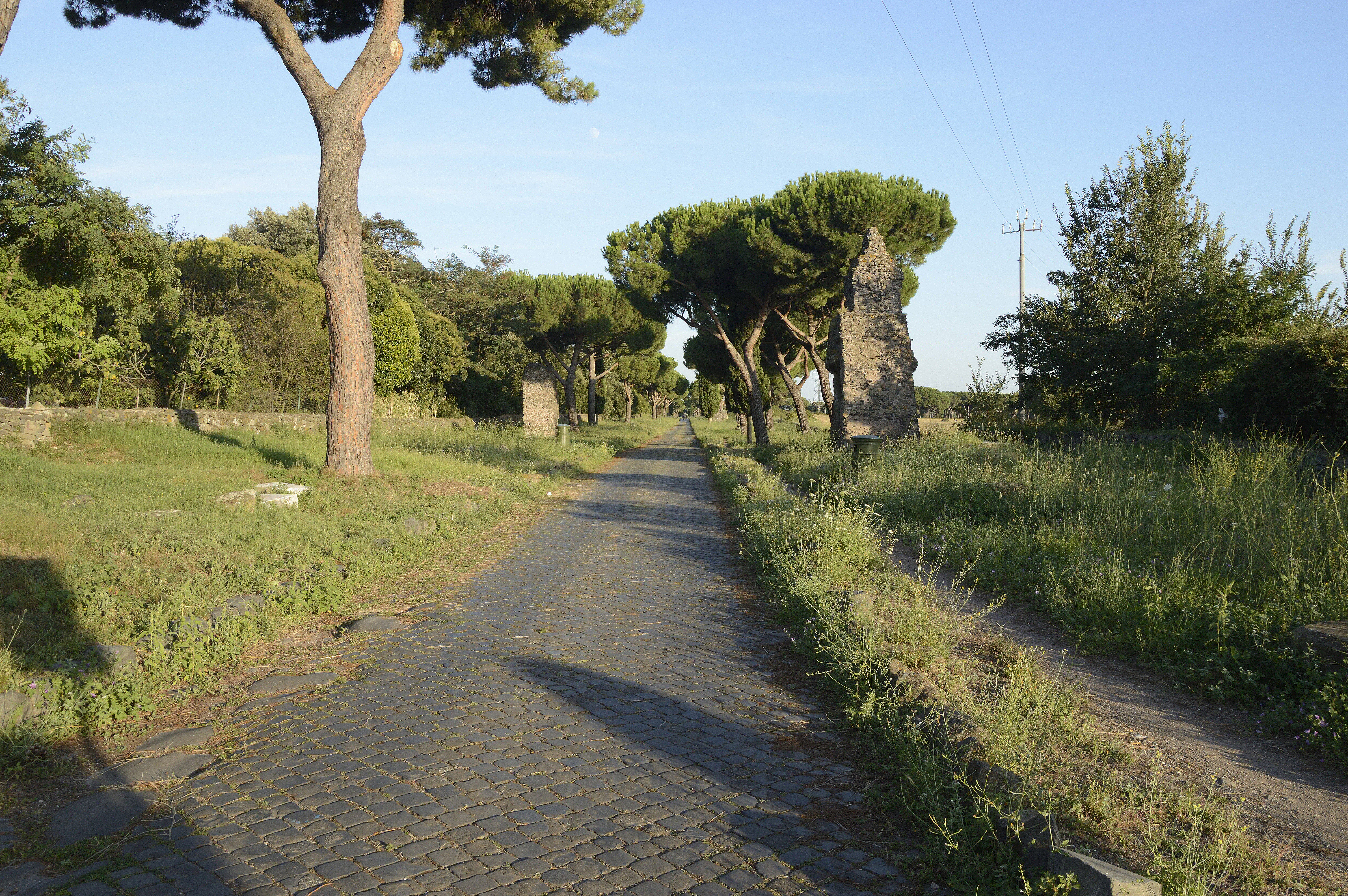
A bypass is a road or highway that avoids or "bypasses" a built-up area, town, or village, to let through traffic flow without interference from local traffic, to reduce congestion in the built-up area, to improve road safety and as replacement for obsolete roads that are no longer in use as a result of devastating natural disasters (earthquakes, tsunamis, landslides, volcanic eruptions). A bypass specifically designated for trucks may be called a truck route. If there are no strong land use controls, buildings are often built in town along a bypass, converting it into an ordinary town road, and the bypass may eventually become as congested as the local streets it was intended to avoid. Many businesses are often built there for ease of access, while homes are often avoided for noise and pollution reasons. Bypass routes are often on new land where no road originally existed. This creates a conflict between those who support a bypass to reduce congestion in a built-up area and/or ... [...More Info...] [...Related Items...] OR: [Wikipedia] [Google] [Baidu] |
California State Route 60
State Route 60 (SR 60) is an east–west state highway in the U.S. state of California. It serves the cities and communities on the eastern side of the Los Angeles metropolitan area and runs along the south side of the San Gabriel Valley. It functions as a bypass route of Interstate 10 (I-10) through the area between the East Los Angeles Interchange in Los Angeles and Beaumont. SR 60 provides a route across several spurs of the Peninsular Ranges, linking the Los Angeles Basin with the Pomona Valley and San Gabriel Valley. The highway also runs concurrently with SR 57 and I-215. Portions of SR 60 are designated as either the Pomona Freeway or the Moreno Valley Freeway. Route description SR 60 begins at the East Los Angeles Interchange near Downtown Los Angeles, designated as the Pomona Freeway. The freeway heads east from the junction after splitting off from I-10 (Santa Monica Freeway) and passes through East Los Angeles, where it has a four le ... [...More Info...] [...Related Items...] OR: [Wikipedia] [Google] [Baidu] |
Road Junction Types
A road is a thoroughfare used primarily for movement of traffic. Roads differ from streets, whose primary use is local access. They also differ from stroads, which combine the features of streets and roads. Most modern roads are paved. The words "road" and "street" are commonly considered to be interchangeable, but the distinction is important in urban design. There are many types of roads, including parkways, avenues, controlled-access highways (freeways, motorways, and expressways), tollways, interstates, highways, and local roads. The primary features of roads include lanes, sidewalks (pavement), roadways (carriageways), medians, shoulders, verges, bike paths (cycle paths), and shared-use paths. Definitions Historically, many roads were simply recognizable routes without any formal construction or some maintenance. The Organization for Economic Co-operation and Development (OECD) defines a road as "a line of communication (travelled way) using a stabilized base oth ... [...More Info...] [...Related Items...] OR: [Wikipedia] [Google] [Baidu] |
Road Infrastructure
A road is a thoroughfare used primarily for movement of traffic. Roads differ from streets, whose primary use is local access. They also differ from stroads, which combine the features of streets and roads. Most modern roads are paved. The words "road" and "street" are commonly considered to be interchangeable, but the distinction is important in urban design. There are many types of roads, including parkways, avenues, controlled-access highways (freeways, motorways, and expressways), tollways, interstates, highways, and local roads. The primary features of roads include lanes, sidewalks (pavement), roadways (carriageways), medians, shoulders, verges, bike paths (cycle paths), and shared-use paths. Definitions Historically, many roads were simply recognizable routes without any formal construction or some maintenance. The Organization for Economic Co-operation and Development (OECD) defines a road as "a line of communication (travelled way) using a stabilized base o ... [...More Info...] [...Related Items...] OR: [Wikipedia] [Google] [Baidu] |
Runaway Truck Ramp
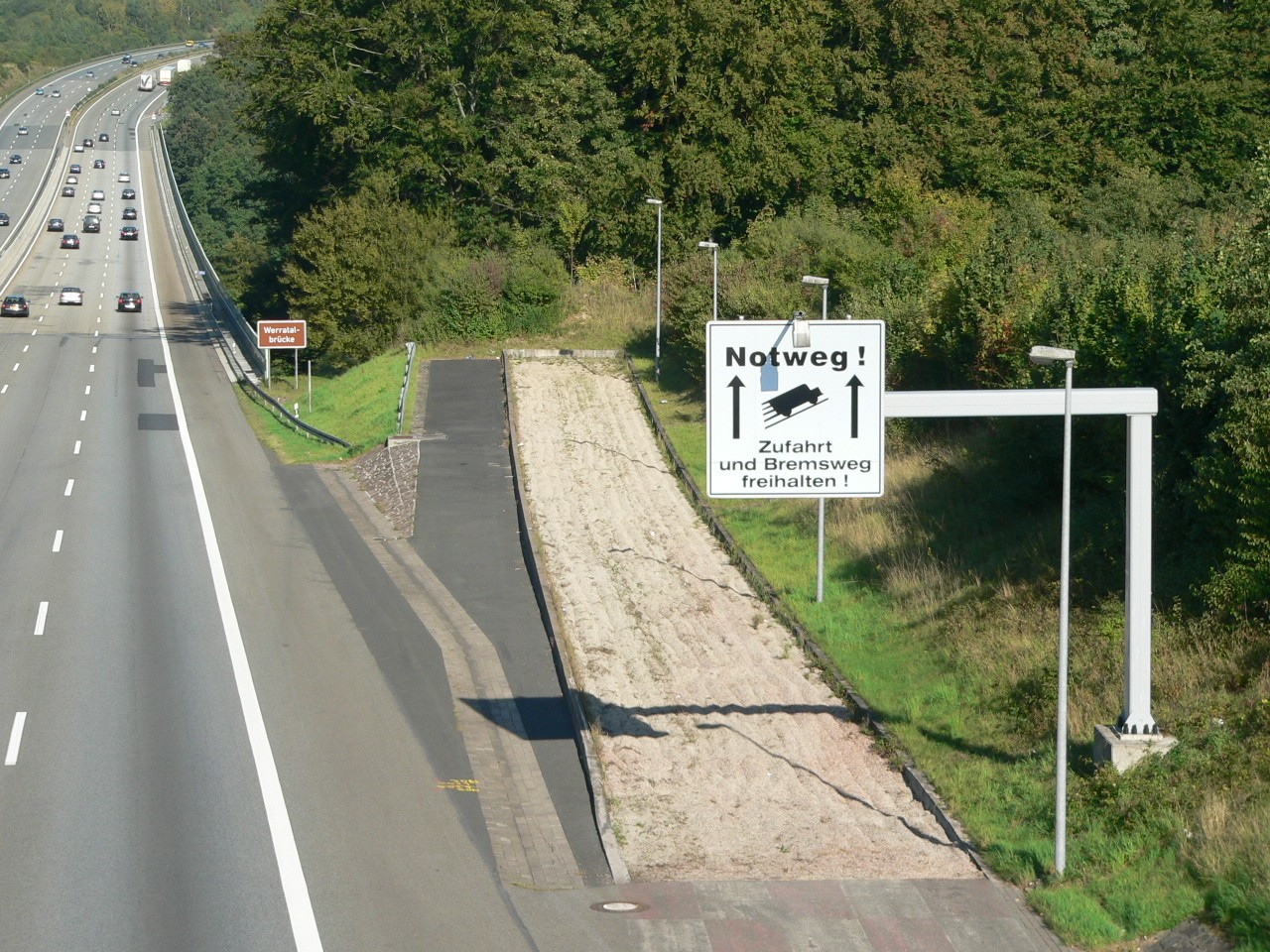
A runaway truck ramp, runaway truck lane, escape lane, safety ramp, emergency escape ramp, or truck arrester bed is a traffic device that enables vehicles which are having braking problems to stop safely. It is typically a long, sand- or gravel-filled lane connected to a steep downhill Grade (slope), grade section of a main road, and is designed to accommodate large trucks or buses. It allows a moving vehicle's kinetic energy to be dissipated gradually in a controlled and relatively harmless way, helping the operator stop it safely. Design Emergency escape ramps are usually located in mountainous areas which cause high construction costs and present difficult site selection. Designs include: *''Arrester bed'': a gravel-filled ramp adjacent to the road that uses rolling resistance to stop the vehicle. The required length of the bed depends on the mass and speed of the vehicle, the grade of the arrester bed, and the rolling resistance provided by the gravel. These are similar to ... [...More Info...] [...Related Items...] OR: [Wikipedia] [Google] [Baidu] |
Google Street View
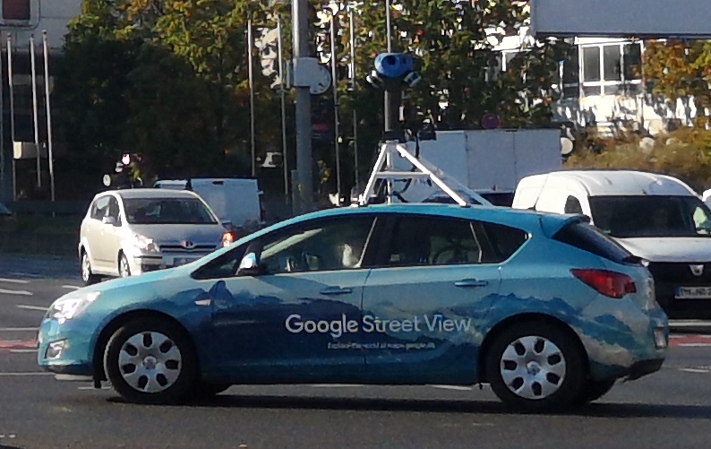
Google Street View is a technology featured in Google Maps and Google Earth that provides interactive panoramas from positions along many streets in the world. It was launched in 2007 in several cities in the United States, and has since expanded to include all of the country's major and minor cities, as well as the cities and rural areas of many other countries worldwide. Streets with Street View imagery available are shown as clickable blue lines on Google Maps. Google Street View displays interactive panoramas of stitched VR photographs. Most photography is done by car, but some is done by tricycle, camel, boat, snowmobile, underwater apparatus, and on foot. History Street View had its inception in 2001 with the Stanford CityBlock Project, a Google-sponsored Stanford University research project. The project ended in June 2006, and its technology was folded into Street View. The technology was launched on May 25, 2007, in the United States. In May 2008, Google announc ... [...More Info...] [...Related Items...] OR: [Wikipedia] [Google] [Baidu] |
Oregon Route 99W
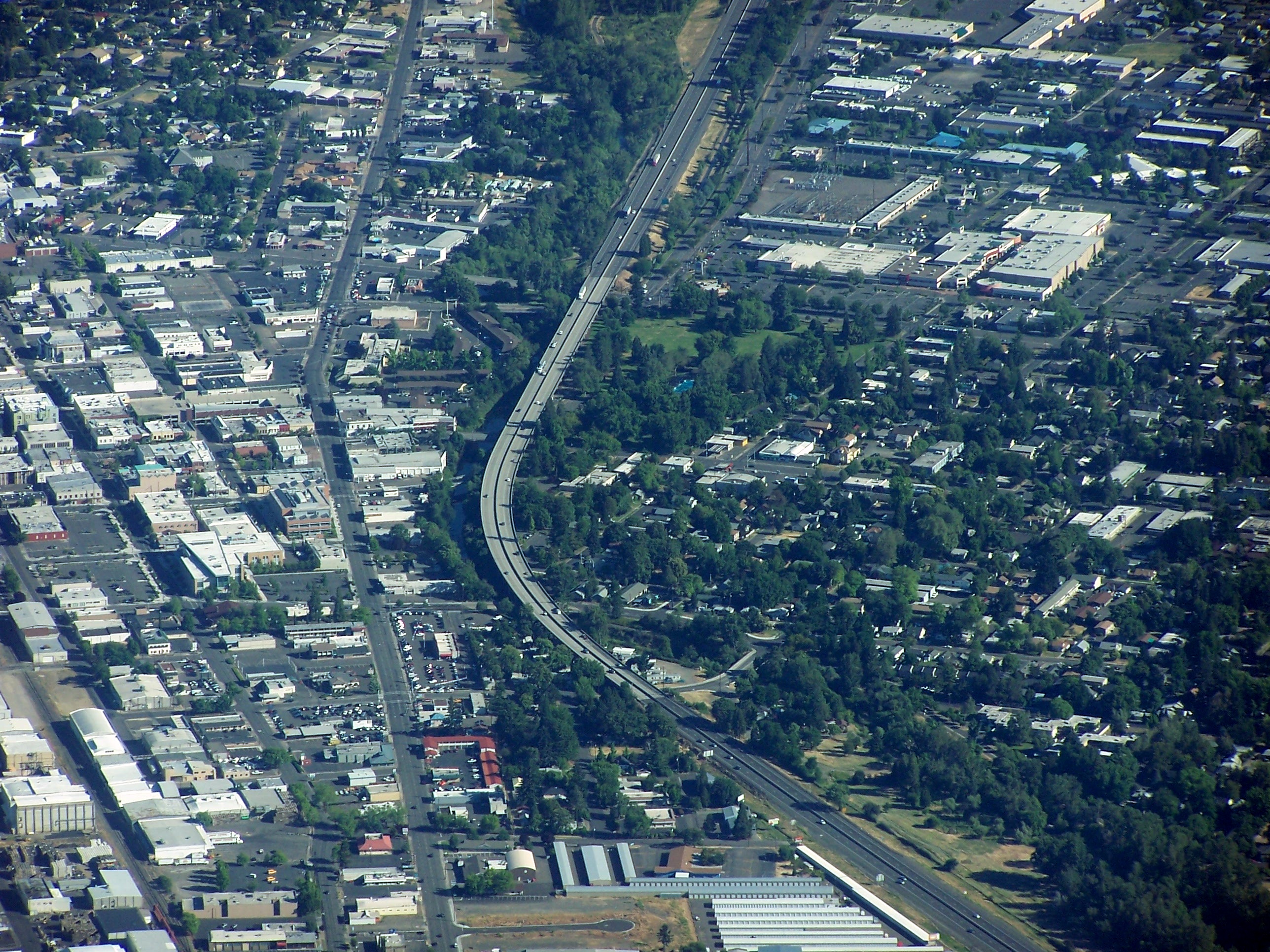
Oregon Route 99W is a state-numbered route in Oregon, United States, that runs from OR 99 and OR 99E in Junction City north to I-5 in southwestern Portland. Some signage continues it north to US 26 near downtown, but most signage agrees with the Oregon Department of Transportation's (ODOT) description, ending it at I-5. OR 99W is known by ODOT as the Pacific Highway West No. 1W (see Oregon highways and routes); that highway continues north through downtown (along a former extension of OR 99W) to the Pacific Highway No. 1 (I-5) in northern Portland, as well as south on OR 99 to the Pacific Highway (I-5) in Eugene. Until around 1972, OR 99W was U.S. Route 99W, rejoining OR 99E (formerly US 99E) in northern Portland. US 99 then continued north along present I-5 into Washington; the next segment still numbered 99 is WA 99 south of Seattle. Route description The Pacific Highway West begins at the interchange with I-5 (Pacific Highway) and OR 126 Business ( McKenzie High ... [...More Info...] [...Related Items...] OR: [Wikipedia] [Google] [Baidu] |
Interstate 5 In Oregon
Interstate 5 (I-5) in the U.S. state of Oregon is a major Interstate Highway that traverses the state from north to south. It travels to the west of the Cascade Mountains, connecting Portland to Salem, Eugene, Medford, and other major cities in the Willamette Valley and across the northern Siskiyou Mountains. The highway runs from the California state line near Ashland to the Washington state line in northern Portland, forming the central part of Interstate 5's route between Mexico and Canada. I-5 was designated in 1957 and replaced U.S. Route 99 (US 99) for most of its length, itself preceded by the Pacific Highway and various wagon roads. The freeway incorporated early bypasses and expressways built for US 99 in the 1950s, including a new freeway route from Portland to Salem, and additional bypasses were built using federal funds. The last segment of I-5, on the Marquam Bridge in Portland, was opened in October 1966 and the whole highway was dedicated la ... [...More Info...] [...Related Items...] OR: [Wikipedia] [Google] [Baidu] |
New Jersey Turnpike
The New Jersey Turnpike (NJTP) is a system of controlled-access highway, controlled-access toll roads in the U.S. state of New Jersey. The turnpike is maintained by the New Jersey Turnpike Authority (NJTA).The Garden State Parkway, although maintained by the New Jersey Turnpike Authority, is not considered part of the turnpike. The mainline's southern terminus is at the Delaware Memorial Bridge on Interstate 295 (Delaware–Pennsylvania), Interstate 295 (I-295) in Pennsville Township, New Jersey, Pennsville Township. Its northern terminus is at an interchange with U.S. Route 46 (US 46) in Ridgefield Park, New Jersey, Ridgefield Park. Construction of the mainline, from concept to completion, took a total of 22 months between 1950 and 1951. It was opened to traffic on November 5, 1951, between its southern terminus and exit 10. The turnpike is a major thoroughfare providing access to various localities in New Jersey, and the toll road provides a direct bypass ... [...More Info...] [...Related Items...] OR: [Wikipedia] [Google] [Baidu] |
WMAZ-TV
WMAZ-TV (channel 13) is a television station in Macon, Georgia, United States, affiliated with CBS and The CW Plus. The station is owned by Tegna Inc., and maintains studios on Gray Highway on the northeast side of Macon; its transmitter is located on GA 87/ US 23/ 129 ALT (Golden Isles Highway) along the Twiggs– Bibb county line. History The station first signed on the air on September 27, 1953. It was the second TV station in Macon. WETV, later WNEX-TV and WOKA (channel 47), had begun operation on August 25, 1953, co-owned by WBML (1240 AM) and WNEX (1400 AM). However, in the 1950s, few people had TVs that received UHF channels; after being sold while indebted, it ended operations in May 1955. WMAZ-TV was originally owned by the Southeastern Broadcasting Company and took its calls from co-owned WMAZ radio (940 AM, now WMAC, and 99.1 FM, now WLXF at 105.5). WMAZ-TV is the fourth-oldest television station in the state of Georgia and the oldest outside of Atlanta, ... [...More Info...] [...Related Items...] OR: [Wikipedia] [Google] [Baidu] |
Georgia State Route 20
State Route 20 (SR 20) is a state highway roughly in the shape of a capital J rotated ninety degrees to the left, which travels through portions of Floyd, Bartow, Cherokee, Forsyth, Gwinnett, Walton, Rockdale, Newton, and Henry counties in the northwestern and north-central parts of the U.S. state of Georgia. Its counterclockwise, or western terminus is at the Alabama state line in Floyd County, and its clockwise, or eastern terminus occurs at its interchange with Lower Woolsey Road southwest of Hampton in Henry County south-southeast of the Atlanta Motor Speedway. Route description From the Alabama state line, SR 20 proceeds east through central Floyd County into the city of Rome, and is concurrent with US 27, SR 1, and SR 53 through downtown Rome. The highway leaves Rome to the east, concurrent with US 411, bisecting Floyd County, and then enters and bisects Bartow County, still concurrent with US 411 until just nor ... [...More Info...] [...Related Items...] OR: [Wikipedia] [Google] [Baidu] |
Interstate 475 (Georgia)
Interstate 475 (I-475) is a auxiliary Interstate Highway in Georgia (U.S. state), Georgia, splitting off from Interstate 75 in Georgia, I-75/Georgia State Route 540, State Route 540 (SR 540) and bypass route, bypassing Macon, Georgia, Macon. It is also unsigned highway, unsigned State Route 408 (SR 408). This is the preferred route for through traffic, as I-75 enters Downtown Macon, Georgia, Downtown Macon and reduces to four lanes (two in either direction; undergoing widening), and has a speed limit, in addition to the highway interchange with Interstate 16, I-16. Route description I-475 carries six lanes (three in each direction) throughout its entire route (expanding to eight lanes at both junctions with I-75), except at its northernmost terminus with I-75, where it briefly reduces to four lanes. One rest area can be found along the northbound lanes south of Exit 9 at mile marker 7.7. The road has also been equipped with traffic cameras, which ... [...More Info...] [...Related Items...] OR: [Wikipedia] [Google] [Baidu] |


