|
Tourism In Slovenia
Slovenia offers tourists a wide variety of landscapes: Julian Alps, Alpine in the northwest, Mediterranean in the southwest, Pannonian Basin, Pannonian in the northeast, and Dinaric Alps, Dinaric in the southeast. They roughly correspond to the traditional regions of Slovenia, based on the former four House of Habsburg, Habsburg crown lands (Carniola, Duchy of Carinthia, Carinthia, Styria (duchy), Styria, and the Slovenian Littoral, Littoral). Each offers its own natural, geographic, architectural, and cultural features. Slovenia has mountains, meadows, lakes, caves, and the sea, making it an attractive destination in Europe. The nation's capital, Ljubljana, has many important Baroque and Art Nouveau buildings, with several important works of the native born architect Jože Plečnik. Other attractions include the Julian Alps with picturesque Lake Bled and the Soča Valley, as well as the nation's highest peak, Mount Triglav. Perhaps even better known is the Karst Plateau in the ... [...More Info...] [...Related Items...] OR: [Wikipedia] [Google] [Baidu] |
Ljubljana
{{Infobox settlement , name = Ljubljana , official_name = , settlement_type = Capital city , image_skyline = {{multiple image , border = infobox , perrow = 1/2/2/1 , total_width = 260 , align = center , caption_align = center , image1 = Ljubljana made by Janez Kotar.jpg , caption1 = Ljubljana old town , image2 = Ljubljana Robba fountain (23665322093).jpg , caption2 = Town Hall , image3 = LOpéra-Ballet (Ljubljana) (9408363203).jpg , caption3 = Opera House , image4 = Dragon on the Dragon Bridge in Ljubljana-3906673.jpg , caption4 = Dragon Bridge , image5 = Ljubljana (36048969485).jpg , caption5 = University of Ljubljana , image6 = Le Château de Ljubljana et la place du ... [...More Info...] [...Related Items...] OR: [Wikipedia] [Google] [Baidu] |
Piran
Piran (; ) is a town in southwestern Slovenia on the Gulf of Piran on the Adriatic Sea. It is one of the three major towns of Slovenian Istria. A bilingual city, with population speaking both Slovene and Italian, Piran is known for its medieval architecture, with narrow streets and compact houses. Piran is the administrative seat of the Municipality of Piran and one of Slovenia's major tourist attractions. History In the pre-Roman era, the hills in the Piran area were inhabited by Illyrian Histri tribes who were farmers, hunters and fishermen. They were also pirates who disrupted Roman trade in the northern Adriatic. The Piran peninsula was incorporated into the Roman Empire in 178 and 177 BC and settled in the following years with rural homes ('' villae rusticae''). The decline of the Roman Empire, from the 5th century AD onward, and incursions by the Avars and Slavs at the end of the 6th century, prompted the Roman population to withdraw into easily defensible locatio ... [...More Info...] [...Related Items...] OR: [Wikipedia] [Google] [Baidu] |
Venetian Gothic Architecture
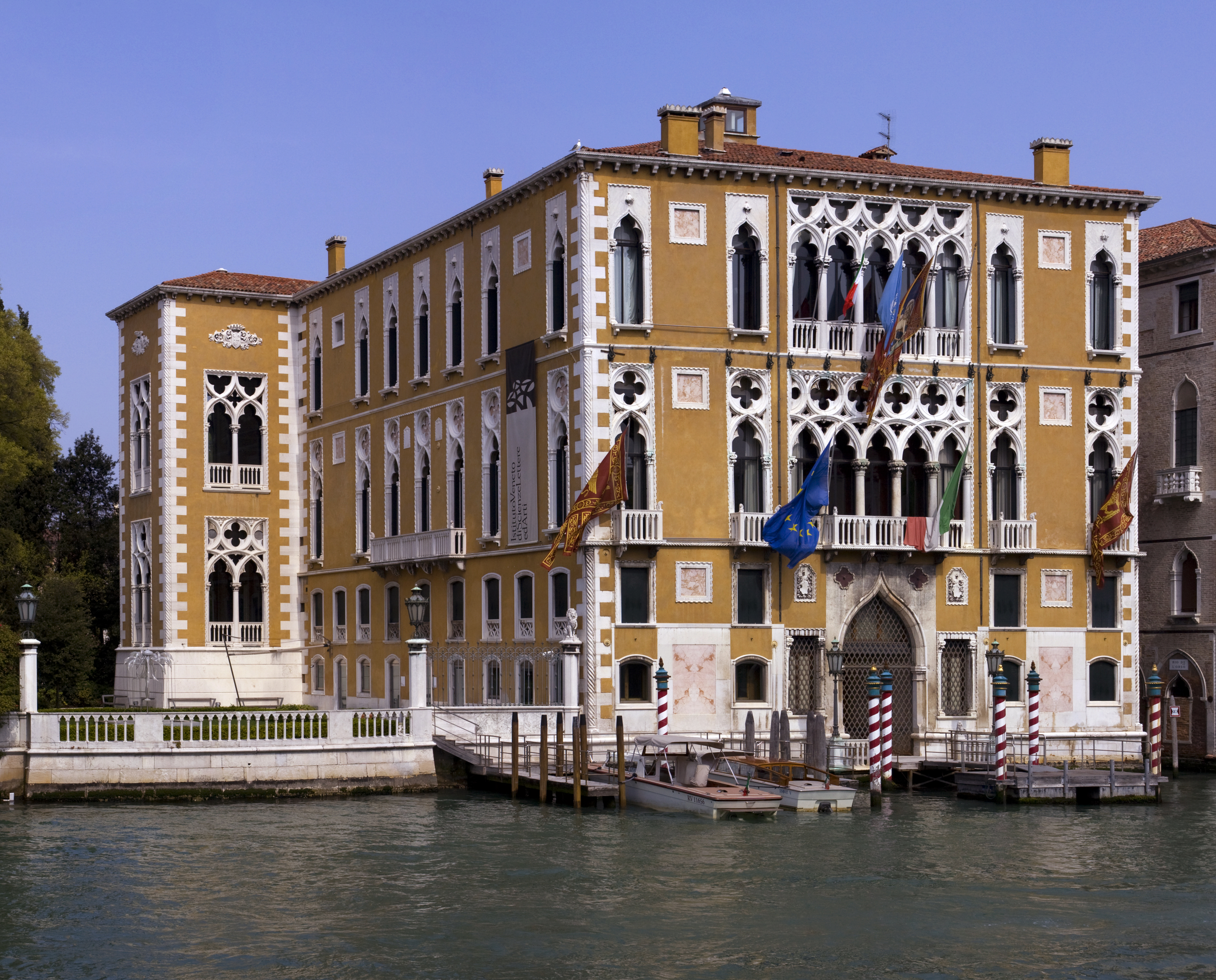
Venetian Gothic is the particular form of Italian Gothic architecture typical of Venice, originating in local building requirements, with some influence from Byzantine architecture, and some from Islamic architecture, reflecting Venice's trading network. Very unusually for medieval architecture, the style is at its most characteristic in secular buildings, with the great majority of surviving examples of the style being secular. The best-known examples are the Doge's Palace, Venice, Doge's Palace and the Ca' d'Oro. Both feature loggias of closely spaced small columns, with heavy tracery with quatrefoil openings above, decoration along the roofline, and some coloured patterning to plain wall surfaces. Together with the ogee arch, capped with a relief ornament, and ropework reliefs, these are the most iconic characteristics of the style. Ecclesiastical Gothic architecture tended to be less distinctively Venetian, and closer to that in the rest of Italy. The beginning of the st ... [...More Info...] [...Related Items...] OR: [Wikipedia] [Google] [Baidu] |
Vilenica
Vilenica Cave or Vilenica Cave at Lokev () is the oldest show cave in Europe. The first tourists to the cave were recorded in 1633. It is located next to the village of Lokev in the municipality of Sežana on the Karst Plateau in southwestern Slovenia. Natural environment Vilenica Cave is more than in length, with a depth of , but tourists are only allowed into the first of the cave. History Until the mid-19th century it was known as the biggest, most beautiful, and most frequently visited cave of the Classical Karst. It attracted artists such as Ferdinand Runk and Peter Fendi, who was awarded a gold medal in 1821 for his oil painting of the cave. Later it was surpassed by Postojna Cave. Since 1986, the annual Vilenica International Literary Festival has taken place in the cave and in the towns and villages of the Karst and elsewhere. The event most commonly happens in the beginning of September. The central part of the festival is the conferral of the Vilenica Prize for ... [...More Info...] [...Related Items...] OR: [Wikipedia] [Google] [Baidu] |
UNESCO World Heritage Site
World Heritage Sites are landmarks and areas with legal protection under an treaty, international treaty administered by UNESCO for having cultural, historical, or scientific significance. The sites are judged to contain "cultural and natural heritage around the world considered to be of outstanding value to humanity". To be selected, a World Heritage Site is nominated by its host country and determined by the UNESCO's World Heritage Committee to be a unique landmark which is geographically and historically identifiable, having a special cultural or physical significance, and to be under a sufficient system of legal protection. World Heritage Sites might be ancient ruins or historical structures, buildings, cities, deserts, forests, islands, lakes, monuments, mountains or wilderness areas, and others. A World Heritage Site may signify a remarkable accomplishment of humankind and serve as evidence of humanity's intellectual history on the planet, or it might be a place of grea ... [...More Info...] [...Related Items...] OR: [Wikipedia] [Google] [Baidu] |
Škocjan Caves
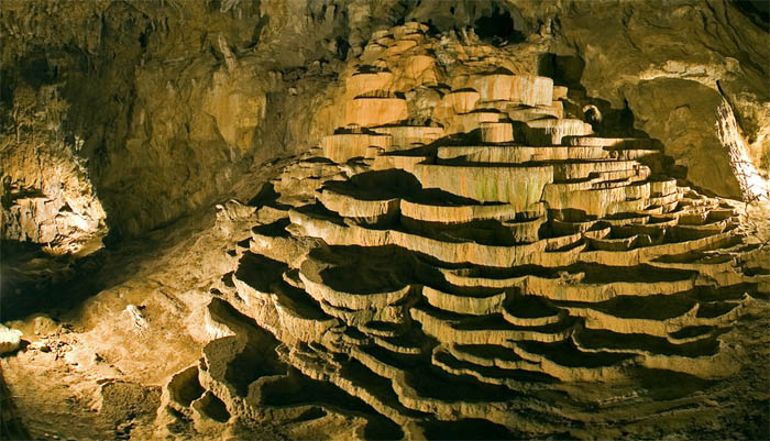
Škocjan Caves (; , ) is a cave system located in Slovenia. Škocjan Caves was included on UNESCO’s list of natural and cultural World Heritage Sites in 1986. Škocjan Caves is a significant underground phenomenon on the Karst Plateau and in Slovenia. After gaining independence from Yugoslavia in 1991, Slovenia made a commitment to actively protect the Škocjan Caves area. To fulfill this commitment, Škocjan Caves Regional Park was established, along with its managing authority, the Škocjan Caves Park Public Service Agency. Description Škocjan Caves is an underground phenomenon in the Karst region and Slovenia. It was designated as Ramsar wetlands of international importance on May 18, 1999. Along with the underground stream of the Reka River, it forms one of the longest karst underground wetlands in Europe. The explored length of the caves is . The caves have formed in a layer of Cretaceous and Paleocene limestone. At the Big Collapse Doline (), the Reka River dis ... [...More Info...] [...Related Items...] OR: [Wikipedia] [Google] [Baidu] |
Postojna Cave
Postojna Cave (; ; ) is a long karst cave system near Postojna, southwestern Slovenia. It is the second-longest cave system in the country (following the Migovec System) as well as one of its top tourism sites. The caves were created by the Pivka River. History The cave was first described in the 17th century by the pioneer of study of karst phenomena, Johann Weikhard von Valvasor, although graffiti inside dated to 1213 indicates a much longer history of use. In 1818, when the cave was being prepared for a visit by Francis I, the first Emperor of Austria-Hungary, a new area of the cave was discovered accidentally by Luka Čeč, a local man in charge of lighting lamps in the cave. In the 1850s, the Austrian-Czech geographer Adolf Schmidl published the first comprehensive scientific overview of the Postojna caves and the Pivka Basin, which became a standard reference point in the study of speleology. First tourist guide and electric lighting In 1819, Archduke Ferdinand vi ... [...More Info...] [...Related Items...] OR: [Wikipedia] [Google] [Baidu] |
Karst Plateau
The Karst Plateau or the Karst region (, ), also locally called Karst, is a karst plateau region extending across the border of southwestern Slovenia and northeastern Italy. It lies between the Vipava Valley, the low hills surrounding the valley, the westernmost part of the Brkini Hills, northern Istria, and the Gulf of Trieste. The western edge of the plateau also marks the traditional ethnic border between Italians and Slovenes. The region gave its name to karst topography. For this reason, it is also referred to as the ''Classical Karst''. Geographical position The plateau rises quite steeply above the neighboring landscape, except for its northeastern side, where the steepness is less pronounced. The plateau gradually descends from the southeast to the southwest. On average it lies 334 m above sea level. Its western edge, known as the Karst Rim (), is a continuation of the Učka mountain range in eastern Istria, and rises to the east and southeast of Trieste, endin ... [...More Info...] [...Related Items...] OR: [Wikipedia] [Google] [Baidu] |
Mount Triglav
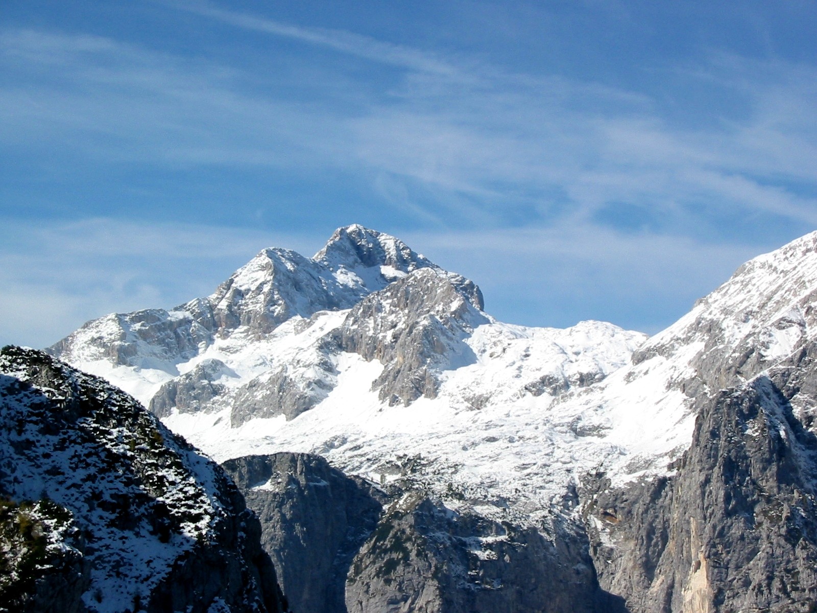
Triglav (; ; ), with an elevation of , is the highest mountain in Slovenia and the highest peak of the Julian Alps. The mountain is the pre-eminent symbol of the Slovene nation, appearing on the Coat of arms of Slovenia, coat of arms and Flag of Slovenia, flag of Slovenia. It is the centrepiece of Triglav National Park, Slovenia's only national park. Triglav was also the highest peak in Socialist Federal Republic of Yugoslavia, Yugoslavia before Slovenia's independence in 1991. Name Various names have been used for the mountain through history. An old map from 1567 used the Latin name ''Ocra mons'', whereas Johann Weikhard von Valvasor called it ''Krma'' (the modern name of an Alpine valley in the vicinity) in the second half of the 17th century. According to the German mountaineer and professor Adolf Gstirner, the name ''Triglav'' first appeared in written sources as ''Terglau'' in 1452, but the original source has been lost. The next known occurrence of ''Terglau'' is cited b ... [...More Info...] [...Related Items...] OR: [Wikipedia] [Google] [Baidu] |
Soča
Soča (, in Slovene) or Isonzo (, in Italian; other names: ; ; or ') is a long river that flows through western Slovenia () and northeastern Italy (). An Alpine river in character, its source lies in the Trenta Valley in the Julian Alps in northwestern Slovenia, at an elevation of . The river runs past the towns of Bovec, Kobarid, Tolmin, Kanal ob Soči, Nova Gorica (where it is crossed by the Solkan Bridge), and Gorizia, entering the Adriatic Sea close to the town of Monfalcone. It has a nival-pluvial regime in its upper course and pluvial-nival in its lower course. Prior to the First World War, the river ran parallel to the border between Kingdom of Italy and the Austro-Hungarian Empire. During World War I, it was the scene of bitter fighting between the two countries, culminating in the Battle of Caporetto in October and November 1917. Name The river was recorded in antiquity as ''Aesontius'', ''Sontius'', and ''Isontius''. Later attestations include ''supe ... [...More Info...] [...Related Items...] OR: [Wikipedia] [Google] [Baidu] |
Lake Bled
Lake Bled () is a lake in the Julian Alps of the Upper Carniolan region of northwestern Slovenia, where it adjoins the town of Bled. The area is a tourist destination. The lake is from Ljubljana International Airport and from the capital city, Ljubljana. Lake Bled is from the Lesce–Bled train station. Geography and history The lake is of mixed glacial and tectonic origin. It is long and wide, with a maximum depth of , and it has a small island. The lake lies in a picturesque environment, surrounded by mountains and forests. Lake Bled was an important cult centre during the Bronze Age. Gold appliqués dating from the 13th-12th century BC were found in a deposit by the lake shore. The embossed decorations on the appliqués are thought to represent the solar and lunar years. Similar appliqués have been discovered in Switzerland, Bavaria and Hungary, mainly in Bronze Age fortified settlements and in the graves of wealthy women. Medieval Bled Castle stands above the l ... [...More Info...] [...Related Items...] OR: [Wikipedia] [Google] [Baidu] |


