|
Thermokarst
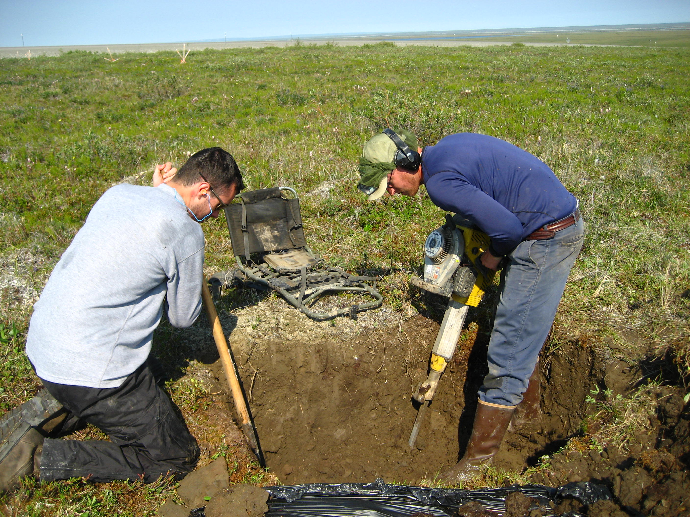
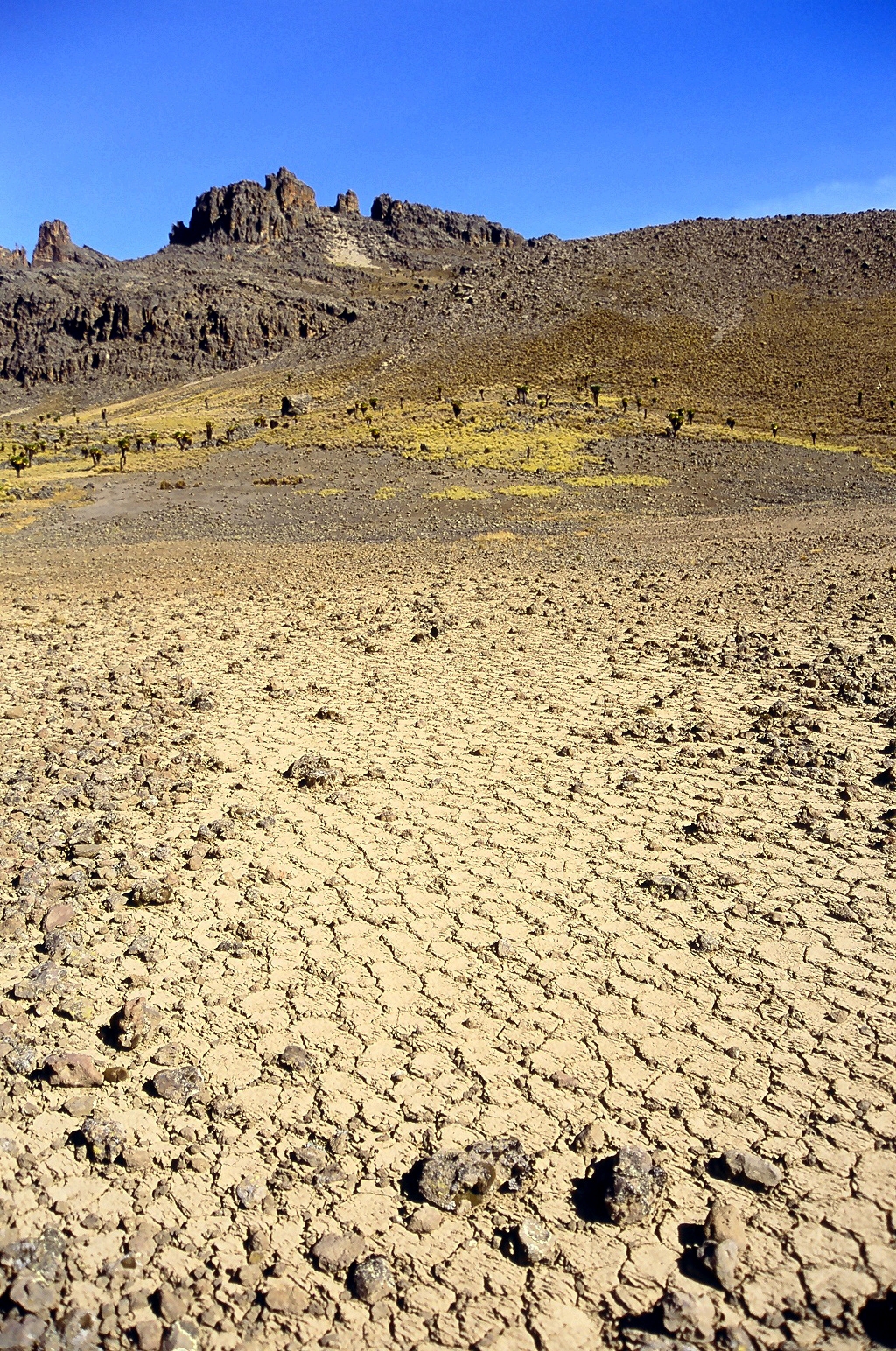
Thermokarst is a type of terrain characterised by very irregular surfaces of marshy hollows and small hummocks formed when ice-rich permafrost thaws. The land surface type occurs in Arctic areas, and on a smaller scale in mountainous areas such as the Himalayas and the Swiss Alps. These pitted surfaces resemble clusters of small lakes formed by dissolution of limestone in some karst areas, which is how they came to have "''karst''" attached to their name, even though no limestone is actually present. Small domes that form on the surface due to frost heaving with the onset of winter are only temporary features. They collapse during the following summer thaw, leaving a small surface depression. Some ice lenses grow and form larger surface hummocks (" pingos") which can last for many years, and sometimes become covered with grasses and sedges, until they begin to thaw. These domed surfaces eventually collapse – either annually or after longer periods – and form depressions wh ... [...More Info...] [...Related Items...] OR: [Wikipedia] [Google] [Baidu] |
Retrogressive Thaw Slumps
Retrogressive thaw slumps (RTS) are a type of landslide that occur in the terrestrial Arctic's permafrost region of the circumpolar Northern Hemisphere when an ice-rich section thaws. RTSs develop quickly and can extend across several hectares modifying Arctic coastlines and permafrost terrain. They are the most active and dynamic feature of thermokarstthe collapse of the land surface as ground ice melts. They are thermokarst slope failures due to abrupt thawing of ice-rich permafrost or glaciated terrains. These horseshoe-shaped landslides contribute to the thawing of hectares of permafrost annually and are considered to be one of the most active and dynamic features of thermokarst. They are found in permafrost or glaciated regions of the Northern Hemispherethe Tibetan Plateau, Siberia, from the Himalayas to northern Greenland, and in northern Canada's Northwest Territories (NWT), the Yukon Territories, Nunavut, and Nunavik and in the American state of Alaska. The largest RTS in t ... [...More Info...] [...Related Items...] OR: [Wikipedia] [Google] [Baidu] |
Permafrost Thaw Ponds In Hudson Bay Canada Near Greenland
Permafrost () is soil or underwater sediment which continuously remains below for two years or more; the oldest permafrost has been continuously frozen for around 700,000 years. Whilst the shallowest permafrost has a vertical extent of below a meter (3 ft), the deepest is greater than . Similarly, the area of individual permafrost zones may be limited to narrow mountain summits or extend across vast Arctic regions. The ground beneath glaciers and ice sheets is not usually defined as permafrost, so on land, permafrost is generally located beneath a so-called active layer of soil which freezes and thaws depending on the season. Around 15% of the Northern Hemisphere or 11% of the global surface is underlain by permafrost, covering a total area of around . This includes large areas of Alaska, Canada, Greenland, and Siberia. It is also located in high mountain regions, with the Tibetan Plateau being a prominent example. Only a minority of permafrost exists in the Southern Hemi ... [...More Info...] [...Related Items...] OR: [Wikipedia] [Google] [Baidu] |
Talik
A talik is a layer of year-round unfrozen ground that lies in permafrost areas. In regions of continuous permafrost, taliks often occur underneath shallow thermokarst lakes and rivers, where the deep water does not freeze in winter and thus the soil underneath does not freeze either. Sometimes closed, open, and through taliks are distinguished. These terms refer to whether the talik is surrounded by permafrost, open at the top (e.g. a thermokarst lake), or open both at the top and above an unfrozen layer beneath the permafrost. Supra-permafrost taliks Due to climate fluctuation or change, some permafrost regions may develop an unfrozen layer between the seasonally thawing and freezing top layer and the permafrost. The layer is called a supra-permafrost ("above the permafrost") talik; it is different from traditional taliks, which are usually associated with water bodies, in that a supra-permafrost talik occurs because the ground that thawed in the summer does not completely refre ... [...More Info...] [...Related Items...] OR: [Wikipedia] [Google] [Baidu] |
Pingo
Pingos are intrapermafrost ice-cored hills, high and in diameter. They are typically conical in shape and grow and persist only in permafrost environments, such as the Arctic and subarctic. A pingo is a Periglaciation, periglacial landform, which is defined as a non-glacial landform or process linked to colder climates. It is estimated that there are more than 11,000 pingos on Earth, with the Tuktoyaktuk peninsula area having the greatest concentration at a total of 1,350. History In 1825, John Franklin made the earliest description of a pingo when he climbed a small pingo on Ellice Island in the Mackenzie River, Mackenzie Delta. However, it was in 1938 that the term ''pingo'' was first borrowed from the Inuvialuit by the Arctic botanist Erling Porsild, Alf Erling Porsild in his paper on Earth mounds of the western Arctic coast of Canada and Alaska. Porsild Pingo in Tuktoyaktuk is named in his honour. The term pingo, which in Inuvialuktun means conical hill, has now been ... [...More Info...] [...Related Items...] OR: [Wikipedia] [Google] [Baidu] |
Teshekpuk Lake
Teshekpuk Lake ( Iñupiaq: ''Tasiqpak'') is the largest lake in Arctic Alaska, at width on the Alaska North Slope within the National Petroleum Reserve-Alaska, South of Pitt Point, east of Harrison Bay, east of Point Barrow. The Teshekpuk Lake region is considered one of the most productive, diverse, and sensitive wetland ecosystems in the entire Arctic, habitat to a variety of arctic wildlife, including the resident Teshekpuk Lake caribou herd of 64,000 animals, large numbers of shorebirds and migratory waterfowl, for whom it is an essential part of the East Asian–Australasian Flyway site network. The lake is threatened by salt water contamination from disappearing sea ice, as well as oil drilling in Alpine, Alaska, and by ConocoPhilipps Willow project. Etymology Its name comes from the Iñupiaq language , recorded by Rochfort Maguire as ''Tasok-poh'' in 1854, and reported to mean "big lagoon", "big enclosed coastal water" or "big coastal lake". It is also known as Lake ... [...More Info...] [...Related Items...] OR: [Wikipedia] [Google] [Baidu] |
Yedoma
Yedoma () is an organic-rich (about 2% carbon by mass) Pleistocene-age permafrost with ice content of 50–90% by volume. Yedoma are abundant in the cold regions of eastern Siberia, such as northern Sakha Republic, Yakutia, as well as in Alaska and the Yukon. Characteristics The landscape of yedoma areas is of glacier plains and hills with shallow depressions known as Alas (geography), alas. Yedoma usually form in lowlands or stretches of land with rolling hills where ice wedge polygonal networks are present, in stable relief features with accumulation zones of poor drainage, severe cold and arid continental climate zones resulting in scanty vegetation cover, intense periglacial weathering processes, as well as the proximity of sediment sources, such as low mountain ranges and foothills. The amount of carbon trapped in this type of permafrost is much more prevalent than originally thought and may be about 210 to 500 Gigatonne, Gt, that is a multiple of the amount of carbon relea ... [...More Info...] [...Related Items...] OR: [Wikipedia] [Google] [Baidu] |
Batagaika Crater
The Batagaika crater () is a thermokarst depression in the Chersky Range area. The largest known permafrost crater in the world, it is within the Sakha Republic, Russia, in its Verkhoyansky District. Description The depression is in the form of a one-kilometre-long gash up to 100 metres (328 feet) deep, and growing, in the East Siberian taiga, located southeast of Batagay and northeast of the settlement Ese-Khayya, about north-northeast of the capital Yakutsk. The structure is named after the near-flowing Batagayka, a right tributary of the river Yana. The land began to sink due to the thawing permafrost in the 1960s after the surrounding forest was cleared. Flooding also contributed to the enlargement of the crater. Paleontologists have found Ice Age fossils buried in the mud around the rim of the crater. The rim is extremely unstable as there are regular landslides into the crater and the permafrost is constantly thawing. The crater is currently growing in size.10 m and up to ... [...More Info...] [...Related Items...] OR: [Wikipedia] [Google] [Baidu] |
Periglacial Landforms
Periglaciation (adjective: "periglacial", referring to places at the edges of glacial areas) describes geomorphic processes that result from seasonal thawing and freezing, very often in areas of permafrost. The meltwater may refreeze in ice wedges and other structures. "Periglacial" originally suggested an environment located on the margin of past glaciers. However, freeze and thaw cycles influence landscapes also outside areas of past glaciation. Therefore, periglacial environments are anywhere when freezing and thawing modify the landscape in a significant manner. History Periglaciation became a distinct subject within the study of geology after Walery Łoziński, a Polish geologist, introduced the term in 1909. Łoziński drew upon the early work of Johan Gunnar Andersson. According to Alfred Jahn, his introduction of his work at the 1910 International Geological Congress held in Stockholm caused significant discussion. In the field trip to Svalbard that followed the congress ... [...More Info...] [...Related Items...] OR: [Wikipedia] [Google] [Baidu] |
Arctic Monitoring And Assessment Programme
The Arctic Monitoring and Assessment Programme was established as a working group of the Arctic Council in 1991. Its main function is to advise the governments of the eight Arctic member nationsCanada, Denmark, Finland, Iceland, Norway, Russia, Sweden and the United Stateson environment-related issues such as pollution. AMAP's work is a cooperative effort involving scientists and Arctic Indigenous peoples, as well as political representatives of the eight nations. Contributions and impact AMAP's monitoring and assessments have informed the United Nations Environment Programme (UNEP), Convention on Long-Range Transboundary Air Pollution (LRTAP), and the World Health Organization (WHO) on issues related to reduction of toxic and polluting chemical emissions. SWIPA The work of the Intergovernmental Panel on Climate Change (IPCC) was influenced significantly by AMAP's assessment reports on "Snow, Water, Ice and Permafrost in the Arctic" (SWIPA). The release of the first SWIPA repor ... [...More Info...] [...Related Items...] OR: [Wikipedia] [Google] [Baidu] |


