|
Terrain Cartography
Terrain cartography or relief mapping is the depiction of the shape of the surface of the Earth on a map, using one or more of several techniques that have been developed. Terrain or relief is an essential aspect of physical geography, and as such its portrayal presents a central problem in cartographic design, and more recently geographic information systems and geovisualization. Hill profiles The most ancient form of relief depiction in cartography, hill profiles are simply illustrations of mountains and hills in profile, placed as appropriate on generally small-scale (broad area of coverage) maps. They are seldom used today except as part of an "antique" styling. Physiographic illustration In 1921, A.K. Lobeck published ''A Physiographic Diagram of the United States'', using an advanced version of the hill profile technique to illustrate the distribution of landforms on a small-scale map.Lobeck, A.K. (1921''A Physiographic Diagram of the United States'' A.J. Nystrom & Co., ... [...More Info...] [...Related Items...] OR: [Wikipedia] [Google] [Baidu] |
Topographic Map Example
Topography is the study of the forms and features of land surfaces. The topography of an area may refer to the landforms and features themselves, or a description or depiction in maps. Topography is a field of geoscience and planetary science and is concerned with local detail in general, including not only Terrain#Relief, relief, but also natural environment, natural, artificial, and culture, cultural features such as roads, land boundaries, and buildings. In the United States, topography often means specifically relief, even though the United States Geological Survey, USGS Quadrangle (geography), topographic maps record not just elevation contours, but also roads, populated places, structures, land boundaries, and so on. Topography in a narrow sense involves the recording of relief or terrain, the three-dimensional quality of the surface, and the identification of specific landforms; this is also known as geomorphometry. In modern usage, this involves generation of elevatio ... [...More Info...] [...Related Items...] OR: [Wikipedia] [Google] [Baidu] |
United States
The United States of America (USA), also known as the United States (U.S.) or America, is a country primarily located in North America. It is a federal republic of 50 U.S. state, states and a federal capital district, Washington, D.C. The 48 contiguous states border Canada to the north and Mexico to the south, with the semi-exclave of Alaska in the northwest and the archipelago of Hawaii in the Pacific Ocean. The United States asserts sovereignty over five Territories of the United States, major island territories and United States Minor Outlying Islands, various uninhabited islands in Oceania and the Caribbean. It is a megadiverse country, with the world's List of countries and dependencies by area, third-largest land area and List of countries and dependencies by population, third-largest population, exceeding 340 million. Its three Metropolitan statistical areas by population, largest metropolitan areas are New York metropolitan area, New York, Greater Los Angeles, Los Angel ... [...More Info...] [...Related Items...] OR: [Wikipedia] [Google] [Baidu] |
Digital Elevation Model
A digital elevation model (DEM) or digital surface model (DSM) is a 3D computer graphics representation of elevation data to represent terrain or overlaying objects, commonly of a planet, Natural satellite, moon, or asteroid. A "global DEM" refers to a discrete global grid. DEMs are used often in geographic information systems (GIS), and are the most common basis for digitally produced Relief mapping (computer graphics), relief maps. A digital terrain model (DTM) represents specifically the ground surface while DEM and DSM may represent tree top Canopy (biology), canopy or building roofs. While a DSM may be useful for Landscape planning, landscape modeling, Urban planning, city modeling and visualization applications, a DTM is often required for flood or drainage modeling, Land-use planning, land-use studies, geological applications, and other applications, and in planetary science. Terminology There is no universal usage of the terms ''digital elevation model'' (DEM), ''di ... [...More Info...] [...Related Items...] OR: [Wikipedia] [Google] [Baidu] |
Eduard Imhof
Eduard Imhof (25 January 1895 – 27 April 1986) was a professor of cartography at the Swiss Federal Institute of Technology, Zürich, from 1925 to 1965. His fame, which extends far beyond the Institute of Technology, stems from his relief shading work on school maps and atlases. Between 1922 and 1973 Imhof worked on many school maps. He drew and shaded maps of Switzerland as well her various cantons and the Austrian province of Vorarlberg. Biography Eduard Imhof was born in Schiers, a town in eastern Switzerland. His father, also Eduard Imhof, was a geographer who taught at a local college. In 1902 the family moved to Zurich, were Imhof continued his schooling. In 1914 he began studying surveying at the Swiss Federal Institute of Technology, continuing until 1919. Whilst a student his studies where sometimes interrupted by military duty guarding the Swiss border as a lieutenant of artillery. During the Second World War he would return to military service in 1939 and serve oc ... [...More Info...] [...Related Items...] OR: [Wikipedia] [Google] [Baidu] |
Airbrush
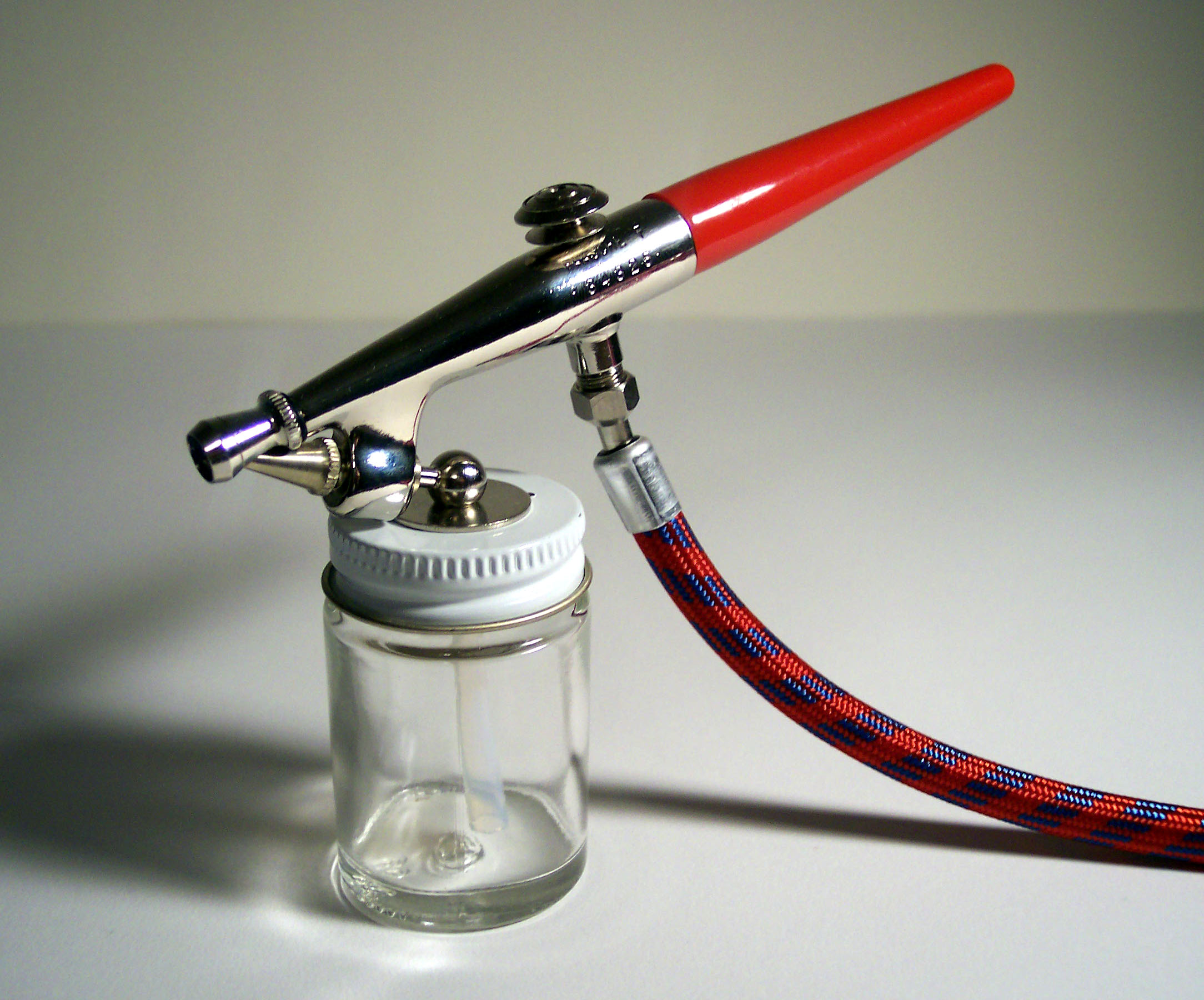
An airbrush is a small, air-operated tool that atomizes and sprays various media, most often paint, but also ink, dye, and make-up. Spray painting developed from the airbrush and is considered to employ a type of airbrush. History Up until the mid-2000s, it was widely published that the airbrush was invented in 1893, but following research undertaken in collaboration with New York University's Conservation Department, and personal support from Professor Margaret Holben Ellis, a more detailed history emerged, which required many authorities such as Oxford Art to update their dictionaries and references. Depending on the definition requiring compressed air or not, the first spray painting device that could be called an airbrush was patented in 1876 () by Francis Edgar Stanley of Newton, Massachusetts. This worked akin to a diffuser/atomizer and did not have a continuous air supply. Stanley and his twin brother later invented a process for continuously coating photographic ... [...More Info...] [...Related Items...] OR: [Wikipedia] [Google] [Baidu] |
Charcoal
Charcoal is a lightweight black carbon residue produced by strongly heating wood (or other animal and plant materials) in minimal oxygen to remove all water and volatile constituents. In the traditional version of this pyrolysis process, called charcoal burning, often by forming a charcoal kiln, the heat is supplied by burning part of the starting material itself, with a limited supply of oxygen. The material can also be heated in a closed retort. Modern charcoal briquettes used for outdoor cooking may contain many other additives, e.g. coal. The early history of wood charcoal production spans ancient times, rooted in the abundance of wood in various regions. The process typically involves stacking wood billets to form a conical pile, allowing air to enter through openings at the bottom, and igniting the pile gradually. Charcoal burners, skilled professionals tasked with managing the delicate operation, often lived in isolation to tend their wood piles . Throughout histo ... [...More Info...] [...Related Items...] OR: [Wikipedia] [Google] [Baidu] |
Multistable Perception
Multistable perception (or bistable perception) is a perceptual phenomenon in which an observer experiences an unpredictable sequence of spontaneous subjective changes. While usually associated with visual perception (a form of optical illusion), multistable perception can also be experienced with auditory and olfactory percepts. Classification Perceptual multistability can be evoked by visual patterns that are too ambiguous for the human visual system to definitively and uniquely interpret. Familiar examples include the Necker cube, Schroeder staircase, structure from motion, monocular rivalry, and binocular rivalry, but many more visually ambiguous patterns are known. Because most of these images lead to an alternation between two mutually exclusive perceptual states, they are sometimes also referred to as bistable perception. Auditory and olfactory examples can occur when there are conflicting, and so rival, inputs into the two ears or two nostrils. Characteri ... [...More Info...] [...Related Items...] OR: [Wikipedia] [Google] [Baidu] |
Top-left Lighting
Top-left lighting is an artistic convention in which illustrations are produced so that the light appears to come from the top left of the picture. The vertical element of the convention comes from the human intuition that sunlight comes from above. Most people prefer lighting from the left when resolving a convex–concave ambiguity, and this preference may be stronger for right-handed people. This is reflected in Roman mosaics and in Renaissance, baroque and impressionist art. In cartography, the predominant custom of placing the shadow on the right-hand side of hill profiles was established during the 15th century. Computer interfaces tend to use top left lighting as well (cf. Windows 9x and macOS screenshot), although this trend has gradually shifted more towards light coming straight from the top (cf. Android key light.) There are notable exceptions to this convention, such as Sandro Botticelli's ''The Birth of Venus'' due to the point of view which may represent geogr ... [...More Info...] [...Related Items...] OR: [Wikipedia] [Google] [Baidu] |
Shadow
A shadow is a dark area on a surface where light from a light source is blocked by an object. In contrast, shade occupies the three-dimensional volume behind an object with light in front of it. The cross-section of a shadow is a two-dimensional silhouette, or a reverse projection of the object blocking the light. Point and non-point light sources A point source of light casts only a simple shadow, called an "umbra". For a non-point or "extended" source of light, the shadow is divided into the umbra, penumbra, and antumbra. The wider the light source, the more blurred the shadow becomes. If two penumbras overlap, the shadows appear to attract and merge. This is known as the shadow blister effect. The outlines of the shadow zones can be found by tracing the rays of light emitted by the outermost regions of the extended light source. The umbra region does not receive any direct light from any part of the light source and is the darkest. A viewer located in the umbra regi ... [...More Info...] [...Related Items...] OR: [Wikipedia] [Google] [Baidu] |
Berthold K , a name
{{disambiguation, geo ...
Berthold may refer to: * Berthold (name), a Germanic given name and surname * Berthold Type Foundry, former German type foundry * Berthold, North Dakota, a place in the United States See also * Berthod, a surname * Berchtold Berchtold (also Berthold, Bertold, Bertolt) is a Germanic name from the Old High German ''beruht'' ('bright' or 'brightly') and ''waltan'' ('rule over'). The name came into fashion in the German High Middle Ages from about the 11th century. The cog ... [...More Info...] [...Related Items...] OR: [Wikipedia] [Google] [Baidu] |
Grayscale Image
In digital photography, computer-generated imagery, and colorimetry, a greyscale (more common in Commonwealth English) or grayscale (more common in American English) image is one in which the value of each pixel is a single sample (signal), sample representing only an ''amount'' of light; that is, it carries only luminous intensity, intensity information. Grayscale images, are black-and-white or gray monochrome, and composed exclusively of shades of gray. The contrast (vision), contrast ranges from black at the weakest intensity to white at the strongest. Grayscale images are distinct from one-bit bi-tonal black-and-white images, which, in the context of computer imaging, are images with only two colors: black and white (also called ''bilevel'' or ''binary images''). Grayscale images have many shades of gray in between. Grayscale images can be the result of measuring the intensity of light at each pixel according to a particular weighted combination of frequencies (or wavelen ... [...More Info...] [...Related Items...] OR: [Wikipedia] [Google] [Baidu] |


