|
Raised Beach
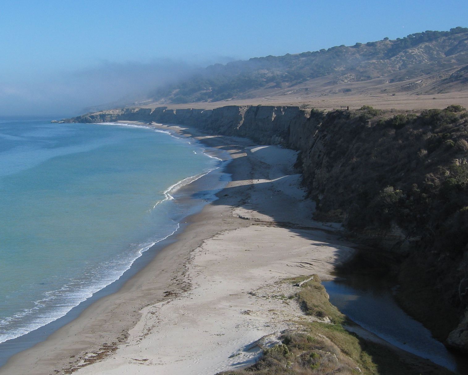
A raised beach, coastal terrace,Pinter, N (2010): 'Coastal Terraces, Sealevel, and Active Tectonics' (educational exercise), from 2/04/2011/ref> or perched coastline is a relatively flat, horizontal or gently inclined surface of marine origin,Pirazzoli, PA (2005a): 'Marine Terraces', in Schwartz, ML (ed) ''Encyclopedia of Coastal Science.'' Springer, Dordrecht, pp. 632–633 mostly an old abrasion platform which has been lifted out of the sphere of wave activity (sometimes called "tread"). Thus, it lies above or under the current sea level, depending on the time of its formation.Strahler AH; Strahler AN (2005): ''Physische Geographie.'' Ulmer, Stuttgart, 686 p.Leser, H (ed)(2005): ‚''Wörterbuch Allgemeine Geographie.'' Westermann&Deutscher Taschenbuch Verlag, Braunschweig, 1119 p. It is bounded by a steeper ascending slope on the landward side and a steeper descending slope on the seaward side (sometimes called "riser"). Due to its generally flat shape, it is often used for ... [...More Info...] [...Related Items...] OR: [Wikipedia] [Google] [Baidu] |
Tide
Tides are the rise and fall of sea levels caused by the combined effects of the gravitational forces exerted by the Moon (and to a much lesser extent, the Sun) and are also caused by the Earth and Moon orbiting one another. Tide tables can be used for any given locale to find the predicted times and amplitude (or " tidal range"). The predictions are influenced by many factors including the alignment of the Sun and Moon, the phase and amplitude of the tide (pattern of tides in the deep ocean), the amphidromic systems of the oceans, and the shape of the coastline and near-shore bathymetry (see '' Timing''). They are however only predictions, the actual time and height of the tide is affected by wind and atmospheric pressure. Many shorelines experience semi-diurnal tides—two nearly equal high and low tides each day. Other locations have a diurnal tide—one high and low tide each day. A "mixed tide"—two uneven magnitude tides a day—is a third regular category. ... [...More Info...] [...Related Items...] OR: [Wikipedia] [Google] [Baidu] |
Planosols
A Planosol in the World Reference Base for Soil Resources is a soil with a light-coloured, coarse-textured, surface horizon that shows signs of periodic water stagnation and abruptly overlies a dense, slowly permeable subsoil with significantly more clay than the surface horizon. In the US Soil Classification of 1938 used the name Planosols, whereas its successor, the USDA soil taxonomy, includes most Planosols in the ''Great Groups'' Albaqualfs, Albaquults and Argialbolls. Occurrence These soils are typically in seasonally waterlogged flat lands. They occur mainly in subtropical and temperate, semi-arid and subhumid regions. Planosols are formed mostly in clayey alluvial and colluvial deposits. Geological stratification and/or a pedogenetic process of destruction and removal of clay has resulted in the relatively coarse-textured, light-coloured surface soil abruptly overlying finer textured subsoil; impeded downward percolation of water causes temporarily reducing conditions ... [...More Info...] [...Related Items...] OR: [Wikipedia] [Google] [Baidu] |
Tsunami Deposit
A tsunami deposit (the term tsunamiite is also sometimes used) is a sedimentary unit deposited as the result of a tsunami. Such deposits may be left onshore during the inundation phase or offshore during the 'backwash' phase. Such deposits are used to identify past tsunami events and thereby better constrain estimates of both earthquake and tsunami hazards. There remain considerable problems, however, in distinguishing between deposits caused by tsunamis and those caused by storms or other sedimentary processes. Tsunamiite The term "tsunamiite" or "tsunamite" was introduced in the 1980s to describe deposits interpreted to have been formed by traction processes associated with tsunamis and is particularly used for marine deposits formed during the "backwash" phase. The term's application has broadened to encompass all tsunami-related deposits, but its use has been challenged. The main criticism of the term is that it describes deposits that have formed by many different processes th ... [...More Info...] [...Related Items...] OR: [Wikipedia] [Google] [Baidu] |
Allochthon
upright=1.6, Schematic overview of a thrust system. The hanging wall block is (when it has reasonable proportions) called a window. A klippe is a solitary outcrop of the nappe in the middle of autochthonous material. An allochthon, or an allochthonous block, is a large block of rock which has been moved from its original site of formation, usually by low angle thrust faulting. The term is derived from Greek: ''allo'', meaning other, and ''chthon'', meaning earth. For other possible mechanisms see obduction. An allochthon which is isolated from the rock that pushed it into position is called a klippe. If an allochthon has a "hole" in it so that one can view the autochthon beneath the allochthon, the hole is called a "window" (or fenster). In generalized terms, the term is applied to any geologic units that originated at a distance from their present location. In the United States there are three notable allochthons, all of which were displaced nearly 50 km (31 miles) along ... [...More Info...] [...Related Items...] OR: [Wikipedia] [Google] [Baidu] |
Soil
Soil, also commonly referred to as earth, is a mixture of organic matter, minerals, gases, water, and organisms that together support the life of plants and soil organisms. Some scientific definitions distinguish dirt from ''soil'' by restricting the former term specifically to displaced soil. Soil consists of a solid collection of minerals and organic matter (the soil matrix), as well as a porous phase that holds gases (the soil atmosphere) and water (the soil solution). Accordingly, soil is a three- state system of solids, liquids, and gases. Soil is a product of several factors: the influence of climate, relief (elevation, orientation, and slope of terrain), organisms, and the soil's parent materials (original minerals) interacting over time. It continually undergoes development by way of numerous physical, chemical and biological processes, which include weathering with associated erosion. Given its complexity and strong internal connectedness, soil ecologists ... [...More Info...] [...Related Items...] OR: [Wikipedia] [Google] [Baidu] |
Weathering
Weathering is the deterioration of rocks, soils and minerals (as well as wood and artificial materials) through contact with water, atmospheric gases, sunlight, and biological organisms. It occurs '' in situ'' (on-site, with little or no movement), and so is distinct from erosion, which involves the transport of rocks and minerals by agents such as water, ice, snow, wind, waves and gravity. Weathering processes are either physical or chemical. The former involves the breakdown of rocks and soils through such mechanical effects as heat, water, ice and wind. The latter covers reactions to water, atmospheric gases and biologically produced chemicals with rocks and soils. Water is the principal agent behind both kinds, though atmospheric oxygen and carbon dioxide and the activities of biological organisms are also important. Biological chemical weathering is also called biological weathering. The materials left after the rock breaks down combine with organic material to create so ... [...More Info...] [...Related Items...] OR: [Wikipedia] [Google] [Baidu] |
Colluvium
Colluvium (also colluvial material or colluvial soil) is a general name for loose, unconsolidated sediments that have been deposited at the base of hillslopes by either rainwash, Sheet erosion , sheetwash, slow continuous downslope creep, or a variable combination of these processes. Colluvium is typically composed of a heterogeneous range of rock types and sediments ranging from silt to Rock (geology), rock fragments of various sizes. This term is also used to specifically refer to sediment deposited at the base of a hillslope by unconcentrated surface runoff or sheet erosion. Location Colluviation refers to the buildup of colluvium at the base of a hillslope.Jackson, JA, J Mehl, and K. Neuendorf (2005) ''Glossary of Geology'' American Geological Institute, Alexandria, Virginia. 800 pp. Goodie, AS (2003) ''Colluvium'' in A. S. Goodie, ed., pp. 173, Encyclopedia of Geomorphology Volume 1, A–I. Routledge, New York, New York. 1200 pp. Colluvium is typically loosely consolidat ... [...More Info...] [...Related Items...] OR: [Wikipedia] [Google] [Baidu] |
Alluvium
Alluvium (, ) is loose clay, silt, sand, or gravel that has been deposited by running water in a stream bed, on a floodplain, in an alluvial fan or beach, or in similar settings. Alluvium is also sometimes called alluvial deposit. Alluvium is typically geologically young and is not Consolidation (geology), consolidated into solid rock. Sediments deposited underwater, in seas, estuaries, lakes, or ponds, are not described as alluvium. Floodplain alluvium can be highly fertile, and supported some of the earliest human civilizations. Definitions The present Scientific consensus, consensus is that "alluvium" refers to loose sediments of all types deposited by running water in floodplains or in alluvial fans or related landforms. However, the meaning of the term has varied considerably since it was first defined in the French dictionary of Antoine Furetière, posthumously published in 1690. Drawing upon concepts from Roman law, Furetière defined ''alluvion'' (the French term for al ... [...More Info...] [...Related Items...] OR: [Wikipedia] [Google] [Baidu] |
Coast
A coast (coastline, shoreline, seashore) is the land next to the sea or the line that forms the boundary between the land and the ocean or a lake. Coasts are influenced by the topography of the surrounding landscape and by aquatic erosion, such as that caused by wind wave, waves. The geology, geological composition of rock (geology), rock and soil dictates the type of shore that is created. Earth has about of coastline. Coasts are important zones in natural ecosystems, often home to a wide range of biodiversity. On land, they harbor ecosystems, such as freshwater marsh, freshwater or estuary, estuarine wetlands, that are important for birds and other terrestrial animals. In wave-protected areas, coasts harbor salt marshes, mangroves, and seagrass meadow, seagrasses, all of which can provide nursery habitat for finfish, shellfish, and other aquatic animals. Rocky shores are usually found along exposed coasts and provide habitat for a wide range of sessility (motility), sessile ... [...More Info...] [...Related Items...] OR: [Wikipedia] [Google] [Baidu] |
Wave-cut Platform
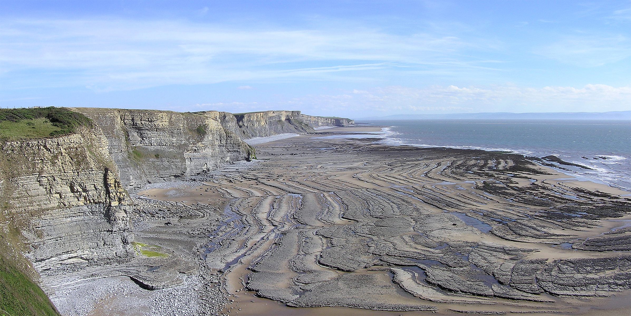
A wave-cut platform, shore platform, coastal bench, or wave-cut cliff is the narrow flat area often found at the base of a sea cliff or along the shoreline of a lake, bay, or sea that was created by erosion. Wave-cut platforms are often most obvious at low tide when they become visible as huge areas of flat rock. Sometimes the landward side of the platform is covered by sand, forming the beach, and then the platform can only be identified at low tides or when storms move the sand. __TOC__ Formation Wave-cut platforms form when destructive waves hit against the cliff face, causing an undercut between the high and low water marks, mainly as a result of abrasion, corrosion and hydraulic action, creating a wave-cut notch. This notch then enlarges into a cave. The waves undermine this portion until the roof of the cave cannot hold due to the pressure and freeze-thaw or biological weathering acting on it, and collapses, resulting in the cliff retreating landward. The base of the cave ... [...More Info...] [...Related Items...] OR: [Wikipedia] [Google] [Baidu] |
Subaerial
In natural science, subaerial (literally "under the air") has been used since 1833,Subaerial in the Merriam-Webster dictionary. notably in and , to describe features and events occurring or formed on or near the 's land surface. They are thus exposed to Earth's atmosphere. This may be contrasted with '' subaqueous'' events or features located below a water surface, '' |


