|
Physiographic Provinces
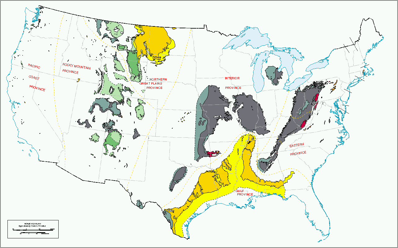
physiographic province is a geographic region with a characteristic geomorphology, and often specific subsurface rock type or structural elements. The continents are subdivided into various physiographic provinces, each having a specific character, relief, and environment which contributes to its distinctiveness. The physiographic provinces are then subdivided into smaller physiographic sections. Examples In eastern North America, the Atlantic Coastal Plain, Piedmont, Blue Ridge Mountains, Ridge-and-Valley Appalachians, and Appalachian Plateau are specific physiographic provinces. In the Western United States of western North America: the Basin and Range Province, Cascade Range, Colorado Plateau, Rio Grande rift, Great Basin, Central Valley (California), Peninsular Ranges, Los Angeles Basin, and Transverse Ranges The Transverse Ranges are a group of mountain ranges of Southern California, in the Pacific Coast Ranges physiographic region in North America. The Transverse Range ... [...More Info...] [...Related Items...] OR: [Wikipedia] [Google] [Baidu] |
Geomorphology
Geomorphology () is the scientific study of the origin and evolution of topographic and bathymetric features generated by physical, chemical or biological processes operating at or near Earth's surface. Geomorphologists seek to understand why landscapes look the way they do, to understand landform and terrain history and dynamics and to predict changes through a combination of field observations, physical experiments and numerical modeling. Geomorphologists work within disciplines such as physical geography, geology, geodesy, engineering geology, archaeology, climatology, and geotechnical engineering. This broad base of interests contributes to many research styles and interests within the field. Overview Earth's surface is modified by a combination of surface processes that shape landscapes, and geologic processes that cause tectonic uplift and subsidence, and shape the coastal geography. Surface processes comprise the action of water, wind, ice, wildfire, and lif ... [...More Info...] [...Related Items...] OR: [Wikipedia] [Google] [Baidu] |
Los Angeles Basin
The Los Angeles Basin is a sedimentary Structural basin, basin located in Southern California, in a region known as the Peninsular Ranges. The basin is also connected to an wikt:anomalous, anomalous group of east–west trending chains of mountains collectively known as the Transverse Ranges. The present basin is a coastal lowland area, whose floor is marked by elongate low ridges and groups of hills that is located on the edge of the Pacific plate. The Los Angeles Basin, along with the Santa Barbara Channel, the Oxnard Plain, Ventura Basin, the San Fernando Valley, and the San Gabriel Valley, San Gabriel Basin, lies within the greater Southern California region. The majority of the jurisdictional land area of the city of Los Angeles physically lies within this basin. On the north, northeast, and east, the lowland Drainage basin, basin is bound by the Santa Monica Mountains and Puente, Elysian, and Repetto hills. To the southeast, the basin is bordered by the Santa Ana Mountains a ... [...More Info...] [...Related Items...] OR: [Wikipedia] [Google] [Baidu] |
Geologic Provinces
A geologic province or geological province is a spatial entity with common geologic attributes. A province may include a single dominant structural element such as a basin or a fold belt, or a number of contiguous related elements. Adjoining provinces may be similar in structure but be considered separate due to differing histories. Geologic provinces by origin Geologic provinces by resources Some studies classify provinces based upon mineral resources, such as mineral deposits. There are a particularly large number of provinces identified worldwide for petroleum and other mineral fuels, such as the Niger Delta petroleum province. See also * Physiographic province * Geomorphology * United States Geological Survey The United States Geological Survey (USGS), founded as the Geological Survey, is an agency of the U.S. Department of the Interior whose work spans the disciplines of biology, geography, geology, and hydrology. The agency was founded on Mar ... Ref ... [...More Info...] [...Related Items...] OR: [Wikipedia] [Google] [Baidu] |
Geomorphology
Geomorphology () is the scientific study of the origin and evolution of topographic and bathymetric features generated by physical, chemical or biological processes operating at or near Earth's surface. Geomorphologists seek to understand why landscapes look the way they do, to understand landform and terrain history and dynamics and to predict changes through a combination of field observations, physical experiments and numerical modeling. Geomorphologists work within disciplines such as physical geography, geology, geodesy, engineering geology, archaeology, climatology, and geotechnical engineering. This broad base of interests contributes to many research styles and interests within the field. Overview Earth's surface is modified by a combination of surface processes that shape landscapes, and geologic processes that cause tectonic uplift and subsidence, and shape the coastal geography. Surface processes comprise the action of water, wind, ice, wildfire, and lif ... [...More Info...] [...Related Items...] OR: [Wikipedia] [Google] [Baidu] |
Geography Terminology
Geography (from Ancient Greek ; combining 'Earth' and 'write', literally 'Earth writing') is the study of the lands, features, inhabitants, and phenomena of Earth. Geography is an all-encompassing discipline that seeks an understanding of Earth and its human and natural complexities—not merely where objects are, but also how they have changed and come to be. While geography is specific to Earth, many concepts can be applied more broadly to other celestial bodies in the field of planetary science. Geography has been called "a bridge between natural science and social science disciplines." Origins of many of the concepts in geography can be traced to Greek Eratosthenes of Cyrene, who may have coined the term "geographia" (). The first recorded use of the word γεωγραφία was as the title of a book by Greek scholar Claudius Ptolemy (100 – 170 AD). This work created the so-called "Ptolemaic tradition" of geography, which included "Ptolemaic cartographic theory ... [...More Info...] [...Related Items...] OR: [Wikipedia] [Google] [Baidu] |
Physiographic Sections
Physical geography (also known as physiography) is one of the three main branches of geography. Physical geography is the branch of natural science which deals with the processes and patterns in the natural environment such as the atmosphere, hydrosphere, biosphere, and geosphere. This focus is in contrast with the branch of human geography, which focuses on the built environment, and technical geography, which focuses on using, studying, and creating tools to obtain, analyze, interpret, and understand spatial information. The three branches have significant overlap, however. Sub-branches Physical geography can be divided into several branches or related fields, as follows: * Geomorphology is concerned with understanding the lithosphere, surface of the Earth and the processes by which it is shaped, both at the present as well as in the past. Geomorphology as a field has several sub-fields that deal with the specific landforms of various environments, e.g. desert geomorpholog ... [...More Info...] [...Related Items...] OR: [Wikipedia] [Google] [Baidu] |
Physiographic Provinces
physiographic province is a geographic region with a characteristic geomorphology, and often specific subsurface rock type or structural elements. The continents are subdivided into various physiographic provinces, each having a specific character, relief, and environment which contributes to its distinctiveness. The physiographic provinces are then subdivided into smaller physiographic sections. Examples In eastern North America, the Atlantic Coastal Plain, Piedmont, Blue Ridge Mountains, Ridge-and-Valley Appalachians, and Appalachian Plateau are specific physiographic provinces. In the Western United States of western North America: the Basin and Range Province, Cascade Range, Colorado Plateau, Rio Grande rift, Great Basin, Central Valley (California), Peninsular Ranges, Los Angeles Basin, and Transverse Ranges The Transverse Ranges are a group of mountain ranges of Southern California, in the Pacific Coast Ranges physiographic region in North America. The Transverse Range ... [...More Info...] [...Related Items...] OR: [Wikipedia] [Google] [Baidu] |
:Category:Geologic Provinces Of The United States
United States The United States of America (USA), also known as the United States (U.S.) or America, is a country primarily located in North America. It is a federal republic of 50 U.S. state, states and a federal capital district, Washington, D.C. The 48 ... Geology of the United States ... [...More Info...] [...Related Items...] OR: [Wikipedia] [Google] [Baidu] |
Geologic Province
A geologic province or geological province is a spatial entity with common geologic attributes. A province may include a single dominant structural element such as a basin or a fold belt, or a number of contiguous related elements. Adjoining provinces may be similar in structure but be considered separate due to differing histories. Geologic provinces by origin Geologic provinces by resources Some studies classify provinces based upon mineral resources, such as mineral deposits. There are a particularly large number of provinces identified worldwide for petroleum and other mineral fuels, such as the Niger Delta petroleum province. See also * Physiographic province * Geomorphology * United States Geological Survey The United States Geological Survey (USGS), founded as the Geological Survey, is an agency of the U.S. Department of the Interior whose work spans the disciplines of biology, geography, geology, and hydrology. The agency was founded on Mar ... R ... [...More Info...] [...Related Items...] OR: [Wikipedia] [Google] [Baidu] |
:Category:Physiographic Regions Of The United States
*The Physiographic Regions—Physiographic divisions of the United States, within the North American U.S. states. {{Seealso, Physiographic regions of the world United States The United States of America (USA), also known as the United States (U.S.) or America, is a country primarily located in North America. It is a federal republic of 50 U.S. state, states and a federal capital district, Washington, D.C. The 48 ... +Physiographic ... [...More Info...] [...Related Items...] OR: [Wikipedia] [Google] [Baidu] |
:Category:Physiographic Regions Of Mexico ...
*The Physiographic regions—Physiographic divisions — of Mexico. :{{Seealso, Physiographic regions of the world Mexico Mexico, officially the United Mexican States, is a country in North America. It is the northernmost country in Latin America, and borders the United States to the north, and Guatemala and Belize to the southeast; while having maritime boundar ... [...More Info...] [...Related Items...] OR: [Wikipedia] [Google] [Baidu] |
Physiographic Regions Of The World
Physiographic regions are a means of defining Earth's landforms into independently distinct, mutually exclusive areas, independent of political boundaries. It is based upon the classic three-tiered approach by Nevin M. Fenneman in 1916, that separates landforms into physiographic divisions, physiographic provinces, and physiographic sections. The classification mechanism has become a popular geographical tool in the United States, indicated by the publication of a USGS shapefile that maps the regions of the original work and the National Park Services's use of the terminology to describe the regions in which its parks are located. Originally used in North America, the model became the basis for similar classifications of other continents. Physiography During the early 1900s, the study of regional-scale geomorphology was termed "physiography". Physiography later was considered to be a portmanteau of "''physi''cal" and "ge''ography''", and therefore synonymous with physica ... [...More Info...] [...Related Items...] OR: [Wikipedia] [Google] [Baidu] |


