|
Normalized Difference Vegetation Index
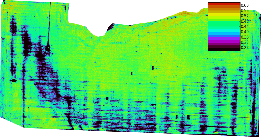
The normalized difference vegetation index (NDVI) is a widely-used metric for quantifying the health and density of vegetation using sensor data. It is calculated from spectrometric data at two specific bands: red and near-infrared. The spectrometric data is usually sourced from remote sensors, such as satellites. The metric is popular in industry because of its accuracy. It has a high correlation with the true state of vegetation on the ground. The index is easy to interpret: NDVI will be a value between -1 and 1. An area with nothing growing in it will have an NDVI of zero. NDVI will increase in proportion to vegetation growth. An area with dense, healthy vegetation will have an NDVI of one. NDVI values less than 0 suggest a lack of dry land. An ocean will yield an NDVI of -1 Brief history The exploration of outer space started in earnest with the launch of Sputnik 1 by the Soviet Union on 4 October 1957. This was the first man-made satellite orbiting the Earth. Subseq ... [...More Info...] [...Related Items...] OR: [Wikipedia] [Google] [Baidu] |
Landsat Program
The Landsat program is the longest-running enterprise for acquisition of satellite imagery of Earth. It is a joint National Aeronautics and Space Administration, NASA / United States Geological Survey, USGS program. On 23 July 1972, the Landsat 1, Earth Resources Technology Satellite was launched. This was eventually renamed to Landsat 1 in 1975. The most recent, Landsat 9, was launched on 27 September 2021. The instruments on the Landsat satellites have acquired millions of images. The images, archived in the United States and at Landsat receiving stations around the world, are a unique resource for global change research and applications in agriculture, cartography, geology, forestry, regional planning, surveillance and education, and can be viewed through the U.S. Geological Survey (USGS) "EarthExplorer" website. Landsat 7 data has eight spectral bands with Image resolution#Spatial resolution, spatial resolutions ranging from ; the temporal resolution is 16 days. Landsat ima ... [...More Info...] [...Related Items...] OR: [Wikipedia] [Google] [Baidu] |
NOAA
The National Oceanic and Atmospheric Administration (NOAA ) is an American scientific and regulatory agency charged with forecasting weather, monitoring oceanic and atmospheric conditions, charting the seas, conducting deep-sea exploration, and managing fishing and protection of marine mammals and endangered species in the US exclusive economic zone. The agency is part of the United States Department of Commerce and is headquartered in Silver Spring, Maryland. History NOAA traces its history back to multiple agencies, some of which are among the earliest in the federal government: * United States Coast and Geodetic Survey, formed in 1807 * Weather Bureau of the United States, formed in 1870 * Bureau of Commercial Fisheries, formed in 1871 (research fleet only) * Coast and Geodetic Survey Corps, formed in 1917 The most direct predecessor of NOAA was the Environmental Science Services Administration (ESSA), into which several existing scientific agencies such as the ... [...More Info...] [...Related Items...] OR: [Wikipedia] [Google] [Baidu] |
NASA
The National Aeronautics and Space Administration (NASA ) is an independent agencies of the United States government, independent agency of the federal government of the United States, US federal government responsible for the United States's civil list of government space agencies, space program, aeronautics research and outer space, space research. National Aeronautics and Space Act, Established in 1958, it succeeded the National Advisory Committee for Aeronautics (NACA) to give the American space development effort a distinct civilian orientation, emphasizing peaceful applications in space science. It has since led most of America's space exploration programs, including Project Mercury, Project Gemini, the 1968–1972 Apollo program missions, the Skylab space station, and the Space Shuttle. Currently, NASA supports the International Space Station (ISS) along with the Commercial Crew Program and oversees the development of the Orion (spacecraft), Orion spacecraft and the Sp ... [...More Info...] [...Related Items...] OR: [Wikipedia] [Google] [Baidu] |
Photosynthesis
Photosynthesis ( ) is a system of biological processes by which photosynthetic organisms, such as most plants, algae, and cyanobacteria, convert light energy, typically from sunlight, into the chemical energy necessary to fuel their metabolism. ''Photosynthesis'' usually refers to oxygenic photosynthesis, a process that produces oxygen. Photosynthetic organisms store the chemical energy so produced within intracellular organic compounds (compounds containing carbon) like sugars, glycogen, cellulose and starches. To use this stored chemical energy, an organism's cells metabolize the organic compounds through cellular respiration. Photosynthesis plays a critical role in producing and maintaining the oxygen content of the Earth's atmosphere, and it supplies most of the biological energy necessary for complex life on Earth. Some bacteria also perform anoxygenic photosynthesis, which uses bacteriochlorophyll to split hydrogen sulfide as a reductant instead of water, p ... [...More Info...] [...Related Items...] OR: [Wikipedia] [Google] [Baidu] |
Photosynthetically Active Radiation
Photosynthetically active radiation (PAR) designates the spectral range (wave band) of solar radiation from 400 to 700 nanometers that photosynthetic organisms are able to use in the process of photosynthesis. This spectral region corresponds more or less with the range of light visible to the human eye. Photons at shorter wavelengths tend to be so energetic that they can be damaging to cells and tissues, but are mostly filtered out by the ozone layer in the stratosphere. Photons at longer wavelengths do not carry enough energy to allow photosynthesis to take place. Other living organisms, such as cyanobacteria, purple bacteria, and heliobacteria, can exploit solar light in slightly extended spectral regions, such as the near-infrared. These bacteria live in environments such as the bottom of stagnant ponds, sediment and ocean depths. Because of their pigments, they form colorful mats of green, red and purple. Chlorophyll, the most abundant plant pigment, is most efficient in ca ... [...More Info...] [...Related Items...] OR: [Wikipedia] [Google] [Baidu] |
Par Action Spectrum
Par may refer to: Finance * Par value, stated value or face value in finance and accounting * Par yield or par rate, in finance Games * Par (score), the number of strokes a proficient golfer should require to complete a hole, round or tournament. * Par (golf scoring format), an alternative to Stableford and normal stroke play * Par contract, in contract bridge Organizations Businesses * Pan Am Railways, an American holding company * Par Pharmaceutical, now part of Endo International * PaR Systems, an American automation company Political parties * Aragonese Party (''Partido Aragonés'', PAR), Spain * Movement For! (''Kustība Par!''), Latvia * Party for the Restructured Antilles (''Partido Antiá Restrukturá'', PAR), Curaçao * Revolutionary Action Party ('Partido Acción Revolucionaria', PAR), Guatemala * People's Alliance for Reform, Singapore Other organizations * Parkinson Association of the Rockies, a not-for-profit organization * Pretoria Armoured Regiment, an armour r ... [...More Info...] [...Related Items...] OR: [Wikipedia] [Google] [Baidu] |
Goddard Space Flight Center
The Goddard Space Flight Center (GSFC) is a major NASA space research laboratory located approximately northeast of Washington, D.C., in Greenbelt, Maryland, United States. Established on May 1, 1959, as NASA's first space flight center, GSFC employs about 10,000 civil servants and contractors. Named for American rocket propulsion pioneer Robert H. Goddard, it is one of ten major NASA field centers. GSFC is partially within the former Goddard, Maryland, Goddard census-designated place; it has a Greenbelt, Maryland, Greenbelt mailing address.CENSUS 2000 BLOCK MAP: GODDARD CDP (PDF). U.S. Census Bureau. Retrieved September 1, 2018. 1990 Census map of Prince George's County [...More Info...] [...Related Items...] OR: [Wikipedia] [Google] [Baidu] |
Compton Tucker
Compton Tucker is an Earth scientist and academic. He is a Senior Earth Scientist in the Laboratory for Hydrospheric and Biospheric Sciences at NASA Goddard Space Flight Center in the Earth Science Division in Greenbelt, Maryland, USA. Tucker is most known for his work on satellite-based time-series monitoring of vegetation for global studies including photosynthesis, land cover, droughts, food security, weather-linked disease outbreaks, forest conditions, deforestation, land degradation, and carbon in semi-arid trees. He was elected a Member of the National Academy of Sciences in 2025. Education Tucker earned a B.S. in Biology in 1969 from Colorado State University. He later received an M.S. in 1973 and a Ph.D. in 1975, both in Systems Ecology, from the Natural Resource Ecology Laboratory in the Department of Forestry at Colorado State University. Career Tucker began his professional career as a National Academy of Sciences Postdoctoral Fellow at the NASA Goddard Space Flight C ... [...More Info...] [...Related Items...] OR: [Wikipedia] [Google] [Baidu] |
Texas A&M University
Texas A&M University (Texas A&M, A&M, TA&M, or TAMU) is a public university, public, Land-grant university, land-grant, research university in College Station, Texas, United States. It was founded in 1876 and became the flagship institution of the Texas A&M University System in 1948. Since 2021, Texas A&M has enrolled the List of United States university campuses by enrollment, largest student body in the United States. It is Carnegie Classification of Institutions of Higher Education, classified among "R1: Doctoral Universities – Very high research activity" and since 2001 a member of the Association of American Universities. The university was the first public higher education institution in Texas; it opened for classes on October 4, 1876, as the History of Texas A&M University, Agricultural and Mechanical College of Texas (A.M.C.) under the provisions of the 1862 Morrill Land-Grant Acts, Morrill Land-Grant Act. In the following decades, the college grew in size and scope, ... [...More Info...] [...Related Items...] OR: [Wikipedia] [Google] [Baidu] |
Solar Zenith Angle
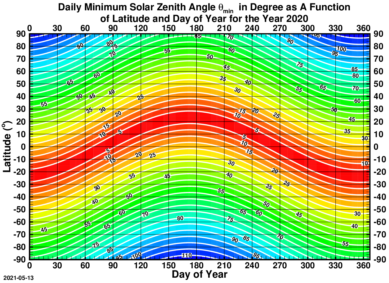
The solar zenith angle is the zenith angle of the sun, i.e., the angle between the sun’s rays and the vertical direction. It is the complement to the solar altitude or solar elevation, which is the altitude angle or elevation angle between the sun’s rays and a horizontal plane. At solar noon, the altitude angle (complement of the solar angle) is at a minimum and is equal to latitude minus solar declination angle. This is the basis by which ancient mariners navigated the oceans. Solar zenith angle is normally used in combination with the solar azimuth angle to determine the position of the Sun as observed from a given location on the surface of the Earth. Formula \cos \theta_s = \sin \alpha_s = \sin \Phi \sin \delta + \cos \Phi \cos \delta \cos h where * \theta_s is the ''solar zenith angle'' * \alpha_s is the ''solar altitude angle'', \alpha_s = 90^\circ - \theta_s * h is the hour angle, in the local solar time. * \delta is the current declination of the Sun * \Phi is the ... [...More Info...] [...Related Items...] OR: [Wikipedia] [Google] [Baidu] |
Texas
Texas ( , ; or ) is the most populous U.S. state, state in the South Central United States, South Central region of the United States. It borders Louisiana to the east, Arkansas to the northeast, Oklahoma to the north, New Mexico to the west, and has Mexico-United States border, an international border with the Mexican states of Chihuahua (state), Chihuahua, Coahuila, Nuevo León, and Tamaulipas to the south and southwest. Texas has Texas Gulf Coast, a coastline on the Gulf of Mexico to the southeast. Covering and with over 31 million residents as of 2024, it is the second-largest state List of U.S. states and territories by area, by area and List of U.S. states and territories by population, population. Texas is nicknamed the ''Lone Star State'' for its former status as the independent Republic of Texas. Spain was the first European country to Spanish Texas, claim and control Texas. Following French colonization of Texas, a short-lived colony controlled by France, Mexico ... [...More Info...] [...Related Items...] OR: [Wikipedia] [Google] [Baidu] |


