|
National Parks Of Wales
The national parks of Wales () are managed areas of outstanding landscape in Wales, United Kingdom where some forms of development are restricted to preserve the landscape and natural environment. Together, they cover 20% of the land surface of Wales and have a resident population of over 80,000 people. Each National Park Authority is a free-standing body within the local government framework. At present, Wales has three national parks: Snowdonia (Eryri), created in 1951, Pembrokeshire Coast, created in 1952, and the Brecon Beacons National Park, Brecon Beacons (Bannau Brycheiniog), created in 1957, as well as Areas of Outstanding Natural Beauty in Wales, five areas of outstanding natural beauty (AONB), which form some of the protected areas of Wales. One of the AONBs, the Clwydian Range and Dee Valley has been proposed to be replaced by North East Wales National Park, a new national park, which would become Wales' fourth national park. The three national park authorities work i ... [...More Info...] [...Related Items...] OR: [Wikipedia] [Google] [Baidu] |
Snowdonia
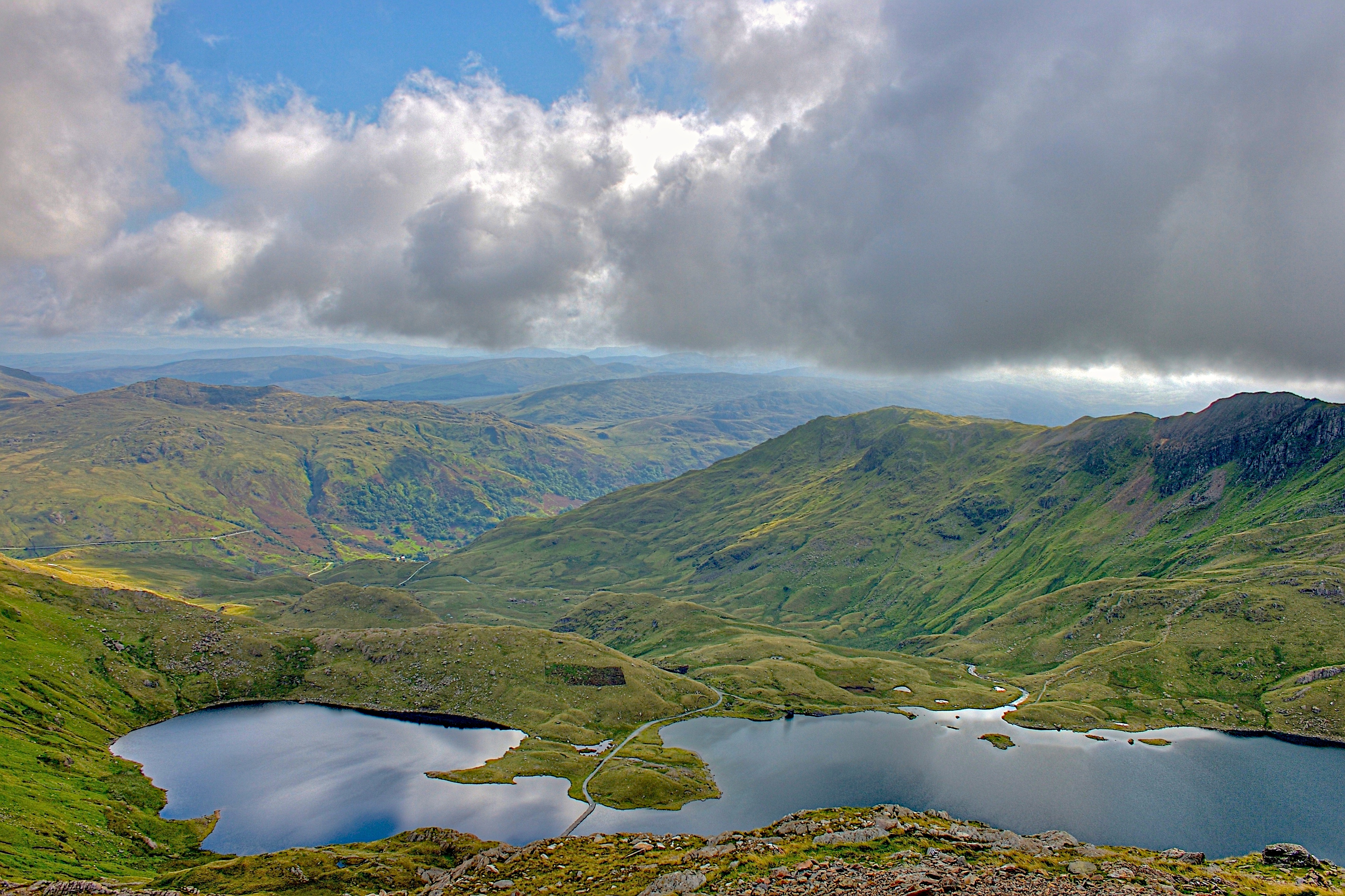
Snowdonia, or Eryri (), is a mountainous region and National parks of the United Kingdom, national park in North Wales. It contains all 15 mountains in Wales Welsh 3000s, over 3000 feet high, including the country's highest, Snowdon (), which is tall. These peaks are all part of the Snowdon Massif, Snowdon, Glyderau, and Carneddau ranges in the north of the region. The shorter Moelwynion and Moel Hebog ranges lie immediately to the south. The national park has an area of (the fourth-largest in the UK), and covers most of central and southern Gwynedd and the western part of Conwy County Borough. This is much larger than the area traditionally considered Snowdonia, and in addition to the five ranges above includes the Rhinogydd, Cadair Idris, and Aran Fawddwy, Aran ranges and the Dyfi hills, Dyfi Hills. It also includes most of the coast between Porthmadog and Aberdyfi. The park was the first of the three national parks of Wales to be designated, in October 1951, and the third i ... [...More Info...] [...Related Items...] OR: [Wikipedia] [Google] [Baidu] |
Senedd Cymru – Welsh Parliament
The Senedd ( ; ), officially known as the Welsh Parliament in English and () in Welsh, is the devolved, unicameral legislature of Wales. A democratically elected body, Its role is to scrutinise the Welsh Government and legislate on devolved matters that are not reserved to the Parliament of the United Kingdom. It is a bilingual institution, with both Welsh and English being the official languages of its business. From its creation in May 1999 until May 2020, the Senedd was officially known as the National Assembly for Wales () and was often simply called the Welsh Assembly. The Senedd comprises 60 members who are known as members of the Senedd (), abbreviated as "MS" (). Since 2011, members are elected for a five-year term of office under an Additional-member system, in which 40 MSs represent smaller geographical divisions known as "constituencies" and are elected by first-past-the-post voting, and 20 MSs represent five "electoral regions" using the D'Hondt method of prop ... [...More Info...] [...Related Items...] OR: [Wikipedia] [Google] [Baidu] |
Gwaun Valley
is a community and valley in north Pembrokeshire, Wales. The community is centred around Pontfaen, a parish and hamlet southeast of Fishguard, and includes the ancient parish of Llanychaer. In 2011, the population was 313. The valley is known for its unspoilt nature and old-world pub, and there are numerous other listed buildings. Geography The community's area is . ''The Companion Guide to Wales'' describes Cwm Gwaun as "one of the most important meltwater channels from the last ice age to be found in the British Isles." The River Gwaun rises in the Preseli Mountains near the village and its tributaries have carved heavily wooded steep, narrow side-valleys. To the northwest are hills such as Mynydd Dinas and Mynydd Melyn and the valley forms a notable wetland. Trees found in the valley include sessile oak, beech, alder, rowan, ash and willow. The valley is a nature walk of in the Pembrokeshire Coast National Park. The ''Rough Guide to Wales (Cwm Gwaun and the inland hill ... [...More Info...] [...Related Items...] OR: [Wikipedia] [Google] [Baidu] |
Preseli Hills
The Preseli Mountains (, ; or ), also known as the Preseli Hills, or just the Preselis, are a range of hills in western Wales, mostly within the Pembrokeshire Coast National Park and entirely within the county of Pembrokeshire. The range stretches from the proximity of Newport in the west to Crymych in the east, some in extent. The highest point at above sea level is Foel Cwmcerwyn. The ancient of track along the top of the range is known as the Golden Road. The Preselis have a diverse ecosystem, many prehistoric sites, and are a popular tourist destination. There are scattered settlements and small villages; the uplands provide extensive unenclosed grazing, and the lower slopes are mainly enclosed pasture. Slate quarrying was once an important industry. More recently, igneous rock is being extracted. The Preselis have Special Area of Conservation status, and there are three sites of special scientific interest ( SSSIs). Name variations A peak is spelt ''Percelye'' o ... [...More Info...] [...Related Items...] OR: [Wikipedia] [Google] [Baidu] |
Daugleddau Estuary
The River Cleddau () consists of the Eastern and Western Cleddau rivers in Pembrokeshire, west Wales. They unite to form the Daugleddau estuary and the harbour of Milford Haven Waterway. The name of the combined estuary – the Daugleddau – means “the two Cleddaus”. The name Cleddau, whilst seeming to be a plural ('-au' generally denotes plurality in Welsh) comes from the Welsh word ''cleddyf'' meaning 'sword' and refers perhaps to the manner in which both rivers are incised into the landscape of Pembrokeshire. A number of former Anglican parishes in the area have been combined to form the modern Church in Wales parish of Daugleddau in the Diocese of St Davids. Eastern Cleddau The Eastern Cleddau (Welsh: ''Cleddau Ddu'' meaning 'black') rises in the foothills of Mynydd Preseli at Blaencleddau in the parish of Mynachlog-ddu. It flows southwest through a broad moorland valley to Gelli Hill, where the River Syfynwy joins it. It then flows south through a deep valley pas ... [...More Info...] [...Related Items...] OR: [Wikipedia] [Google] [Baidu] |
Pembrokeshire Cast Path Near Pwllgwaelod
Pembrokeshire ( ; ) is a county in the south-west of Wales. It is bordered by Carmarthenshire to the east, Ceredigion to the northeast, and otherwise by the sea. Haverfordwest is the largest town and administrative headquarters of Pembrokeshire County Council. The county is generally sparsely populated and rural, with an area of and a population of 123,400. After Haverfordwest, the largest settlements are Milford Haven (13,907), Pembroke Dock (9,753), and Pembroke (7,552). St Davids (1,841) is a city, the smallest by population in the UK. Welsh is spoken by 17.2 percent of the population, and for historic reasons is more widely spoken in the north of the county than in the south. Pembrokeshire's coast is its most dramatic geographic feature, created by the complex geology of the area. It is a varied landscape which includes high sea cliffs, wide sandy beaches, the large natural harbour of Milford Haven, and several offshore islands which are home to seabird colonies. Most ... [...More Info...] [...Related Items...] OR: [Wikipedia] [Google] [Baidu] |
Penrhyndeudraeth
Penrhyndeudraeth (; ) is a small town and community in the Welsh county of Gwynedd. The town is close to the mouth of the River Dwyryd on the A487 nearly east of Porthmadog, and had a population of 2,150 at the 2011 census, increased from 2,031 in 2001. The community includes the villages of Minffordd and Portmeirion. History An older settlement of a few cottages at Upper Penrhyn was originally called ''Cefn Coch'' ('Red Ridge') and that name is perpetuated by the Penrhyndeudraeth primary school, which is known as Ysgol Cefn Coch; but the town proper is comparatively modern. The ground on which it stands was a malarial swamp encircling a huge stagnant pool. The present town owes its existence as a commercial centre to a local landowner, David Williams of Castell Deudraeth near Minffordd, who in the mid-19th century drained the swamp and dried the pool and constructed many streets. Adopting a scheme of town planning evolved by the builder of Tremadog and his Italian cr ... [...More Info...] [...Related Items...] OR: [Wikipedia] [Google] [Baidu] |
Eryri National Park Authority
Snowdonia, or Eryri (), is a mountainous region and national park in North Wales. It contains all 15 mountains in Wales over 3000 feet high, including the country's highest, Snowdon (), which is tall. These peaks are all part of the Snowdon, Glyderau, and Carneddau ranges in the north of the region. The shorter Moelwynion and Moel Hebog ranges lie immediately to the south. The national park has an area of (the fourth-largest in the UK), and covers most of central and southern Gwynedd and the western part of Conwy County Borough. This is much larger than the area traditionally considered Snowdonia, and in addition to the five ranges above includes the Rhinogydd, Cadair Idris, and Aran ranges and the Dyfi Hills. It also includes most of the coast between Porthmadog and Aberdyfi. The park was the first of the three national parks of Wales to be designated, in October 1951, and the third in the UK after the Peak District and Lake District, which were established in April and May ... [...More Info...] [...Related Items...] OR: [Wikipedia] [Google] [Baidu] |
Tal-y-llyn Lake
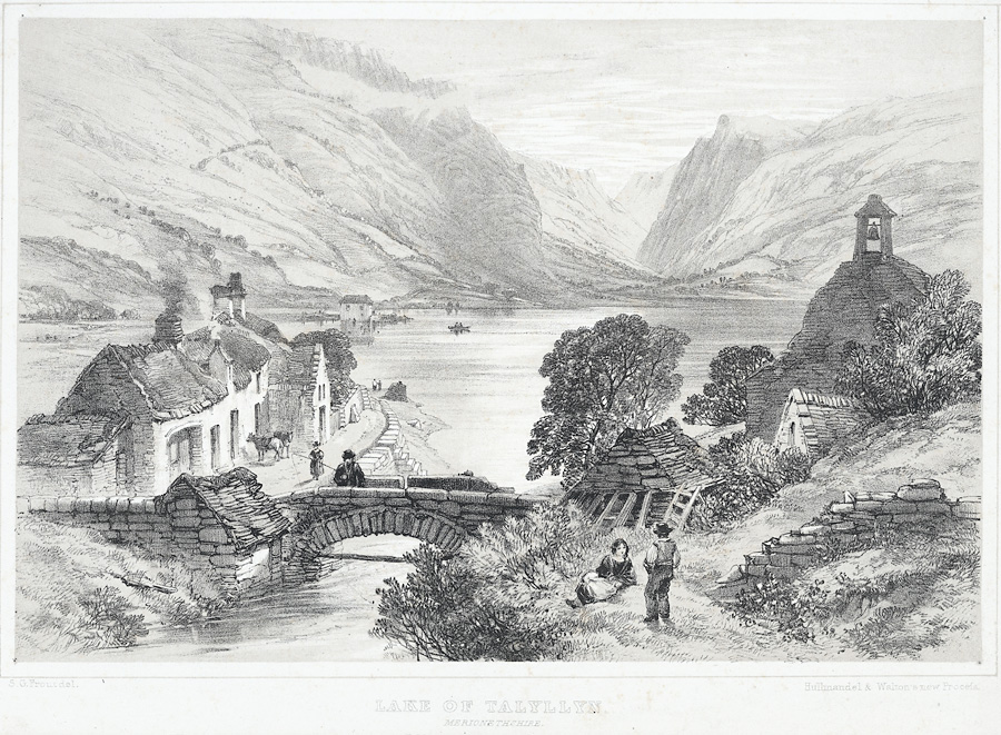
Tal-y-llyn Lake, (), also known as Talyllyn Lake and Llyn Myngul, is a large glacial ribbon lake in Gwynedd, North Wales. It is formed by a post-glacial massive landslip damming up the lake within the glaciated valley. The hamlet of Talyllyn lies at the west end of the lake. Name Tal-y-llyn Lake is named after the hamlet and historic parish of Tal-y-llyn. Tal-y-llyn itself is named after the lake and means 'the end of the lake' in Welsh. Literally, therefore, ''Tal-y-llyn Lake'' has the circular meaning of 'the lake at the end of the lake'. The Welsh name ''Llyn Myngul'' or ''Llyn Mwyngil'' probably derives from ''mŵn'' ('neck') and ''cul'' ('narrow'). Geography Tal-y-llyn Lake is situated to the north of Machynlleth, at the foot of Cadair Idris, in the Snowdonia mountain range of Gwynedd, Wales. The River Dysynni flows from the lake, through the village of Abergynolwyn, and discharges into the sea north of Tywyn. There is a route leading to the summit of Cadair Idris ... [...More Info...] [...Related Items...] OR: [Wikipedia] [Google] [Baidu] |
Nant Gwynant
Nant Gwynant (also spelt Nantgwynant) is a valley in northern Wales. The A498 road descends into the valley in about two miles (3 km) from Pen-y-Gwryd; it follows the Nant Cynnyd, the Afon Glaslyn and alongside Llyn Gwynant, then beside the Nant Gwynant river to Llyn Dinas and passing below Dinas Emrys to Beddgelert. The road continues through the Aberglaslyn Pass to Porthmadog. History and geography Early references The earliest contemporary reference to a route down the valley comes from John Leland, antiquarian to King Henry VIII, who travelled to Wales in 1538. In describing Nant Gwynant, he wrote: "The trees were so thick that a man on a white horse could not be seen from Llyn y Dinas to Pen y Gwryd." In 1802 Williams Williams described it as “a road, or rather a mere right of passage”. He continued: "Through this charming valley, like all other mountainous unimproved roads, the road is very bad, circuitous, and winding, and absolutely impassable when the ... [...More Info...] [...Related Items...] OR: [Wikipedia] [Google] [Baidu] |
Llanberis
Llanberis () is a village, community (Wales), community and electoral ward in Gwynedd, northwest Wales, on the southern bank of the lake and at the foot of Snowdon, the highest mountain in Wales. It is a centre for outdoor activity, outdoor activities in Snowdonia, including walking, mountaineering, climbing, mountain biking and pony trekking, as well as water sports such as scuba diving. The community includes Nant Peris. Llanberis takes its name from , an early Wales, Welsh saint. It is town twinning, twinned with the Italy, Italian town of in Lombardy. History The ruins of Dolbadarn Castle, Castle, which were painted by Richard Wilson (painter), Richard Wilson and J. M. W. Turner, stand above the village. The 13th century fortress was built by Llywelyn the Great, the Great and is a grade I listed building. The church of St is grade II* listed, as is the chapel of . In the 18th century was the home of the legendary strong woman Marged ferch Ifan. Demographics The po ... [...More Info...] [...Related Items...] OR: [Wikipedia] [Google] [Baidu] |
Cadair Idris
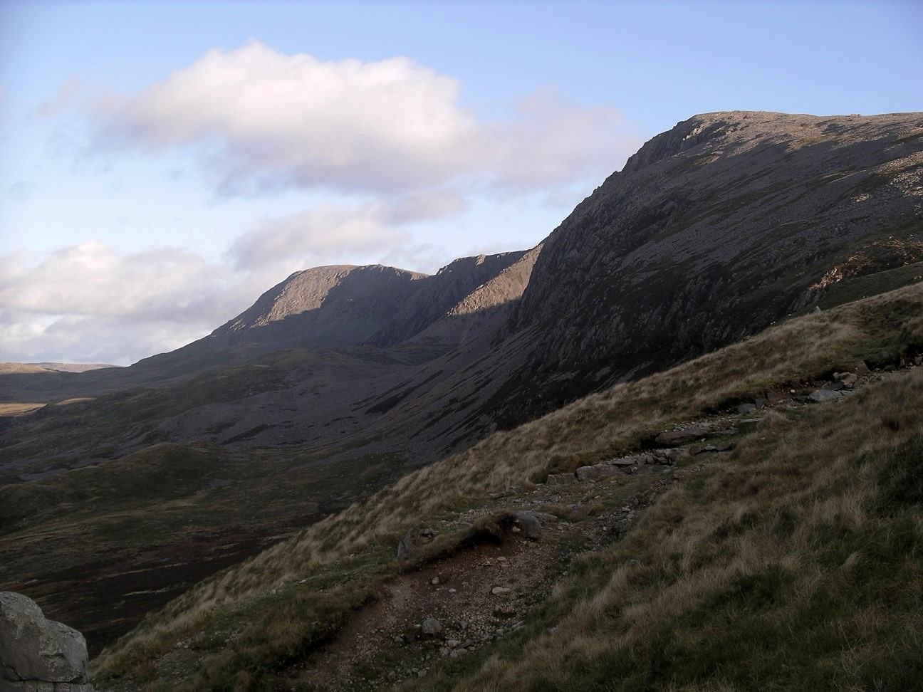
Cadair Idris or Cader Idris is a mountain in the Meirionnydd area of Gwynedd, Wales. It lies at the southern end of the Snowdonia National Park near the town of Dolgellau. The peak, which is one of the most popular in Wales for walkers and hiking, hikers, is composed largely of Ordovician igneous rocks, with classic glaciation, glacial erosion features such as Cirque, cwms, moraines, Glacial striations, striated rocks, and roche moutonnée, roches moutonnées. Etymology means 'Idris's Chair'. Idris (giant), Idris is usually taken to be the name of a giant or, alternatively, it may refer to (or ), a 7th-century prince of Meirionnydd who won a battle against the Irish on the mountain. was in fact referred to as ('Idris the Giant') in some mediaeval genealogies of Meirionydd. The basic meaning of the word (Middle Welsh/Early Modern Welsh or ) is 'seat, chair' (borrowed from the Greek language, Greek , , 'chair'). In place names can mean 'stronghold, fort, fortress' or 'mount ... [...More Info...] [...Related Items...] OR: [Wikipedia] [Google] [Baidu] |


