|
Municipalities Of The Canton Of Fribourg
There are 121 municipalities in the canton of Fribourg, Switzerland (). List *Attalens *Autigny, Switzerland, Autigny *Avry *Bas-Intyamon *Belfaux *Belmont-Broye *Billens-Hennens *Bois-d'Amont, Switzerland, Bois-d'Amont *Bösingen, Switzerland, Bösingen *Bossonnens *Botterens *Broc *Brünisried *Bulle *Châtel-Saint-Denis *Châtel-sur-Montsalvens *Châtillon (FR) *Châtonnaye *Chénens *Cheyres-Châbles *Corbières, Gruyère, Corbières *Corminboeuf *Cottens (FR) *Courgevaux *Courlevon *Courtepin *Cressier (FR) *Crésuz *Cugy (FR) *Delley-Portalban *Düdingen *Echarlens *Estavayer *Ferpicloz *Fétigny, Switzerland, Fétigny *Fräschels *Fribourg *Gibloux FR, Gibloux (FR) *Giffers *Givisiez *Gletterens *Grandvillard *Granges (Veveyse) *Granges-Paccot *Grangettes *Greng *Grolley-Ponthaux *Gruyères *Gurmels *Haut-Intyamon *Hauterive (FR) *Hauteville, Switzerland, Hauteville *Heitenried *Jaun *Kerzers *Kleinbösingen *La Brillaz *La Roche, Fribourg, La Roche *La Sonnaz *La Verreri ... [...More Info...] [...Related Items...] OR: [Wikipedia] [Google] [Baidu] [Amazon] |
Châtel-Saint-Denis
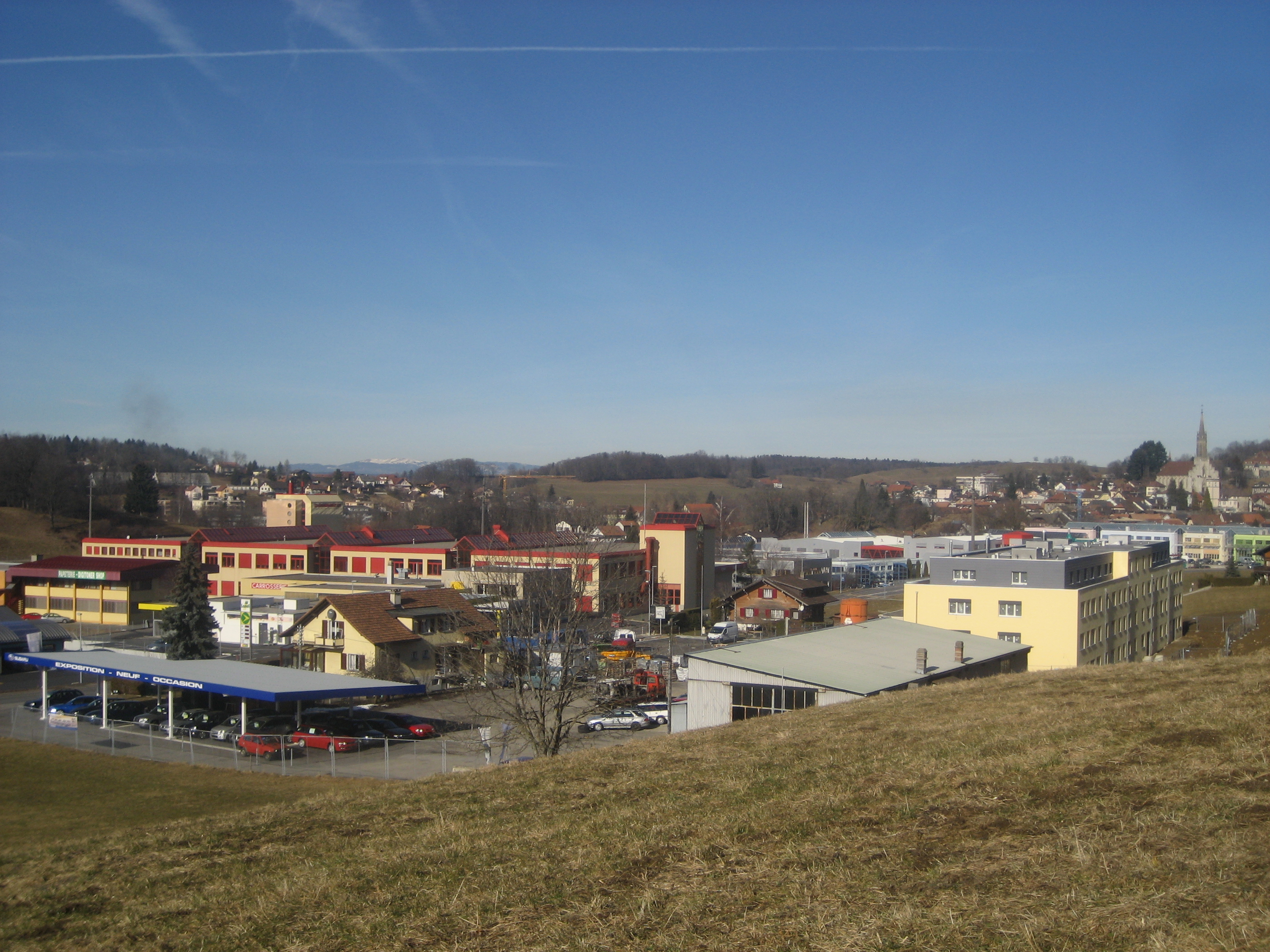
Châtel-Saint-Denis (; , locally ''Tsathi'' , or ''Châtél-Sent-Denis'', locally ''Tsathi-Chin-Dèni'') is a Municipalities of Switzerland, municipality and district capital of the district of Veveyse (district), Veveyse in the Cantons of Switzerland, canton of Fribourg (canton), Fribourg in Switzerland. Geography Châtel-Saint-Denis has an area of . Of this area, or 46.7% is used for agricultural purposes, while or 42.3% is forested. Of the rest of the land, or 7.0% is settled (buildings or roads), or 0.6% is either rivers or lakes and or 3.4% is unproductive land.Swiss Federal Statistical Office-Land Use Statistics 2009 data accessed 25 March 2010 Of the built up area, housing and buildings made up 3.3% and transportation infrastructure made u ... [...More Info...] [...Related Items...] OR: [Wikipedia] [Google] [Baidu] [Amazon] |
Crésuz
Crésuz (; , locally ) is a municipality in the district of Gruyère in the canton of Fribourg in Switzerland. History Crésuz is first mentioned in 1301 as ''Cresu''. Geography Crésuz has an area, , of . Of this area, or 34.3% is used for agricultural purposes, while or 35.4% is forested. Of the rest of the land, or 23.6% is settled (buildings or roads), or 7.3% is either rivers or lakes and or 0.6% is unproductive land.Swiss Federal Statistical Office-Land Use Statistics 2009 data accessed 25 March 2010 Of the built up area, housing and buildings made up 16.9% and transportation infrastructure made up 6.2%. Out of the forested land, 34.3% of the total land area is heavily forested and 1.1% is covered with orchards or small clusters of tree ... [...More Info...] [...Related Items...] OR: [Wikipedia] [Google] [Baidu] [Amazon] |
Cressier (FR)
Cressier (; , or ) is a municipality in the district of See or du Lac in the canton of Fribourg in Switzerland. History Cressier is first mentioned in 1080 as ''Crisei''. The municipality was formerly known by its German name ''Grissach'', however, that name is no longer used. Geography Cressier has an area, , of . Of this area, or 69.1% is used for agricultural purposes, while or 19.4% is forested. Of the rest of the land, or 10.8% is settled (buildings or roads), or 0.2% is either rivers or lakes.Swiss Federal Statistical Office-Land Use Statistics 2009 data accessed 25 March 2010 Of the built up area, industrial buildings made up 1.4% of the total area while housing and buildings made up 4.8% and transportation infrastructure made up 4.3%. Out ... [...More Info...] [...Related Items...] OR: [Wikipedia] [Google] [Baidu] [Amazon] |
Courtepin
Courtepin (; ) is a Municipalities of Switzerland, municipality in the district of See (district of Fribourg), See in the Cantons of Switzerland, canton of Fribourg (canton), Fribourg in Switzerland. On 1 January 2017 Barberêche, Villarepos and Wallenried merged into the extant municipality of Courtepin. History Courtepin is first mentioned in 1259 as ''Courtipin''. The municipality was formerly known by its German name ''Curtepy'', however, that name is no longer used. Geography After the 2017 merger Courtepin had an area of . Before the merger Courtepin had an area, (as of the 2004/09 survey) of . Of this area, about 46.3% is used for agricultural purposes, while 27.7% is forested. Of the rest of the land, 25.5% is settled (buildings or roads) and 0.5% is unproductive land. In the 2013/18 survey a total of or about 21.3% of the total area was covered with buildings, an increase of over the 1981 amount. Over the same time period, the amount of recreational space in the munici ... [...More Info...] [...Related Items...] OR: [Wikipedia] [Google] [Baidu] [Amazon] |
Courlevon
Courlevon is a former municipality in the district of See or du Lac in the canton of Fribourg in Switzerland. On 1 January 2016, the former municipalities of Courlevon, Jeuss, Lurtigen, and Salvenach merged into Murten/Morat. History Courlevon is first mentioned in 1214 as ''Curlivin''. Geography Courlevon had an area, , of . Of this area, or 57.4% is used for agricultural purposes, while or 37.7% is forested. Of the rest of the land, or 5.2% is settled (buildings or roads).Swiss Federal Statistical Office-Land Use Statistics 2009 data accessed 25 March 2010 Of the built up area, housing and buildings made up 4.3% and transportation infrastructure made up 0.6%. Out of the forested land, 35.6% of the total land area is heavily forested and 2.1% i ... [...More Info...] [...Related Items...] OR: [Wikipedia] [Google] [Baidu] [Amazon] |
Courgevaux
Courgevaux (; ; ) is a municipality in the district of See or district du Lac in the canton of Fribourg in Switzerland. History Courgevaux is first mentioned in 1055 as ''Corgivul''. Geography Courgevaux has an area, , of . Of this area, or 58.3% is used for agricultural purposes, while or 26.5% is forested. Of the rest of the land, or 16.1% is settled (buildings or roads), or 0.6% is either rivers or lakes.Swiss Federal Statistical Office-Land Use Statistics 2009 data accessed 25 March 2010 Of the built up area, industrial buildings made up 2.1% of the total area while housing and buildings made up 6.5% and transportation infrastructure made up 6.0%. Out of the forested land, 23.5% of the total land area is heavily forested and 3.0% is covered wit ... [...More Info...] [...Related Items...] OR: [Wikipedia] [Google] [Baidu] [Amazon] |
Cottens (FR)
Cottens (; , locally ) is a municipality in the district of Sarine in the canton of Fribourg in Switzerland. Its German name of ''Cottingen'' has now largely fallen out of use. History Cottens is first mentioned in 1138 as ''Cotens''. Geography Cottens has an area, , of . Of this area, or 69.8% is used for agricultural purposes, while or 17.3% is forested. Of the rest of the land, or 12.1% is settled (buildings or roads), or 0.2% is either rivers or lakes and or 0.6% is unproductive land.Swiss Federal Statistical Office-Land Use Statistics 2009 data . Retrieved 25 March 2010 Of the built up area, housing and buildings made up 7.0% and transportation infrastructure made up 4.2%. Out of the forested land, all of the forested land area is covere ... [...More Info...] [...Related Items...] OR: [Wikipedia] [Google] [Baidu] [Amazon] |
Corminboeuf
Corminboeuf (; , locally ) is a Municipalities of Switzerland, municipality in the district of Sarine (district), Sarine in the Cantons of Switzerland, canton of Fribourg (canton), Fribourg in Switzerland. In 2017 the former municipality of Chésopelloz merged into the municipality of Corminboeuf. History Corminboeuf is first mentioned in 1142 as ''Cormenbo''. In the 15th and 16th centuries it was known as ''Sankt Görg'' or ''St Georg''. Geography After the 2017 merger Corminboeuf had an area of . Before the merger Corminboeuf had an area, (as of the 2004/09 survey) of . Of this area, about 51.8% is used for agricultural purposes, while 33.3% is forested and 14.9% is settled (buildings or roads). In the 2013/18 survey a total of or about 12.9% of the total area was covered with buildings, an increase of over the 1981 amount. Over the same time period, the amount of recreational space in the municipality increased by and is now about 0.89% of the total area. Of the agr ... [...More Info...] [...Related Items...] OR: [Wikipedia] [Google] [Baidu] [Amazon] |
Corbières, Gruyère
Corbières (; ) is a Municipalities of Switzerland, municipality in the district of Gruyère (district), Gruyère in the Cantons of Switzerland, canton of Fribourg (canton), Fribourg in Switzerland. On 1 January 2011 the former municipality of Villarvolard merged into the municipality of Corbières.Nomenklaturen – Amtliches Gemeindeverzeichnis der Schweiz accessed 4 April 2011 History Corbières is first mentioned around 1115 as ''Corbere''. The municipality was formerly known by its German name ''Korbers'', however, that name is no longer used.Geography Corbières has an area, , of . Of this area, or 53.0% is used for agricultural purposes, while or 39.5% is forested. Of the ...[...More Info...] [...Related Items...] OR: [Wikipedia] [Google] [Baidu] [Amazon] |
Cheyres-Châbles
Cheyres-Châbles () is a Municipalities of Switzerland, municipality in the district of Broye (district), Broye in the Cantons of Switzerland, canton of Fribourg (canton), Fribourg in Switzerland. On 1 January 2017 the former municipalities of Châbles and Cheyres merged into the new municipality of Cheyres-Châbles. History Cheyres Cheyres is first mentioned in 1230 as ''Cheres''. Geography Cheyres-Châbles has an area, , of . Demographics The new municipality has a population () of . Historic Population The historical population is given in the following chart: Colors= id:lightgrey value:gray(0.9) id:darkgrey value:gray(0.8) ImageSize = width:1100 height:500 PlotArea = height:350 left:100 bottom:90 right:100 Legend = columns:3 left:220 top:70 columnwidth:160 AlignBars = justify DateFormat = x.y Period = from:0 till:1200 TimeAxis = orientation:vertical AlignBars = justify ScaleMajor = gridcolor:darkgrey increment:200 start:0 ScaleMinor = gridcolor:lightgrey ... [...More Info...] [...Related Items...] OR: [Wikipedia] [Google] [Baidu] [Amazon] |
Chénens
Chénens (; local , otherwise spelled as in French) is a Municipalities of Switzerland, municipality in the district of Sarine (district), Sarine in the Cantons of Switzerland, canton of Fribourg (canton), Fribourg in Switzerland. A French language, French-speaking community, its earlier German language, German name of ''Geiningen'' is no longer in common use. History Chénens is first mentioned in 1138 as ''Cheineis''. Geography Chénens has an area of . or 67.8% is used for agricultural purposes, while or 22.5% is forested. The rest of the region or 10.1% is settled (buildings or roads).Swiss Federal Statistical Office-Land Use Statistics 2009 data . Retrieved 25 March 2010 Housing and buildings made up 4.8% and transportation infrastructure made u ... [...More Info...] [...Related Items...] OR: [Wikipedia] [Google] [Baidu] [Amazon] |


