|
Janmi
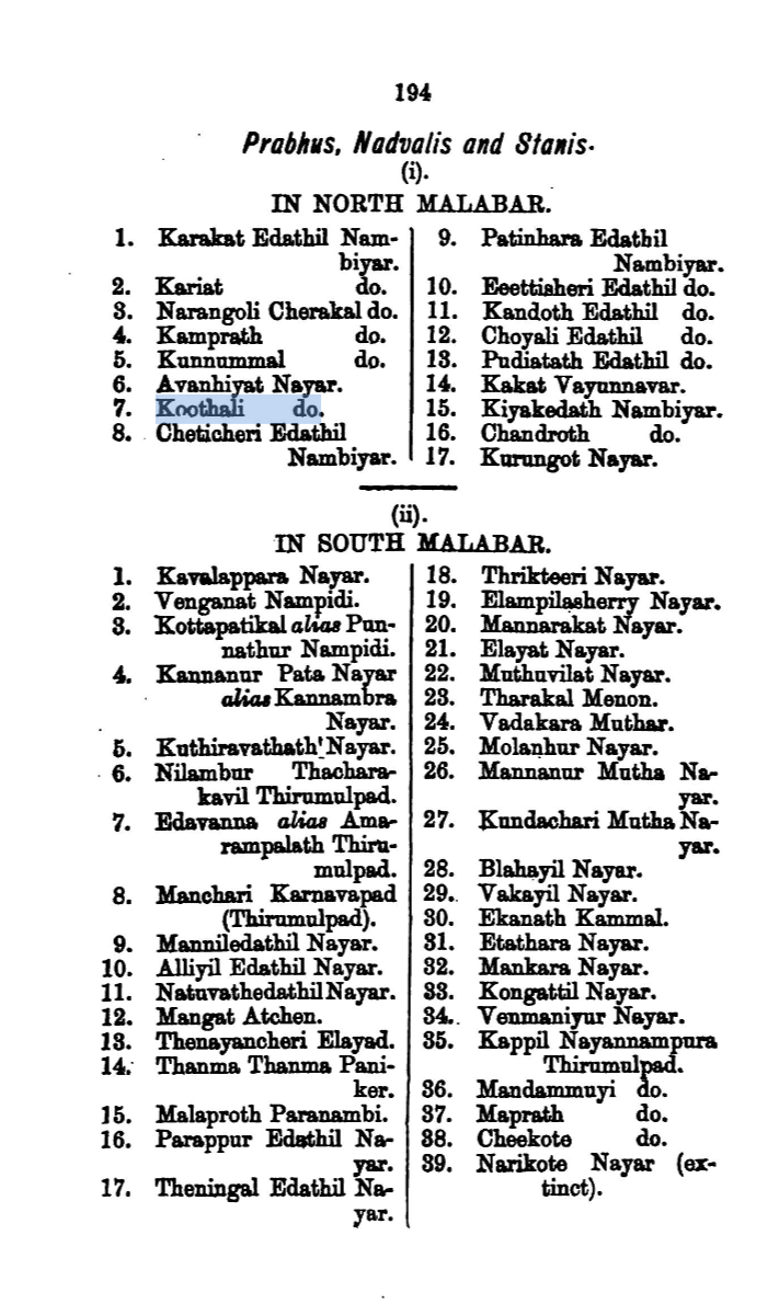
Jenmi or Janmi (), plural Jenmimar, is the Malayalam term used to refer to the landed aristocracy of Kerala who traditionally held their lands as absolute and allodial owners, with such lands known as Jenmom or Janmam. They formed the landowning nobility as well as the landed gentry of the region in colonial times, and the majority of the estates and feudal properties were owned by this community. They predominantly belonged to the Nair (Warrior caste) and Nambudiri (Brahmin priest) castes. History The twenty-two families paying 3,000 rupees or more in land revenue to the Crown held 620,012 acres among them; the Vengayil dynasty alone accounted for 200,000 acres, followed immediately by the Mannarghat and Kavalappara Moopil Nairs, whose respective swaroopams governed 180,000 acres and 155,358 acres. The Zamorins of Calicut owned between 60,000 and 90,000 acres of Jenmom estate lands, followed by the Raja of Kollengode with 82,000 acres of forest and 18,000 acres of farmland. ... [...More Info...] [...Related Items...] OR: [Wikipedia] [Google] [Baidu] |
Kavalappara
The Kavalappara is an princely Indian people, Indian Nair tharavad or swaroopam, whose estates and powers vested in the matrilineally-mediated succession to and from each Kavalappara Nair, who headed the family and held the rank of Moopil Nair. In medieval period, medieval Kerala, they served as part of the jenmi, or allodially landed nobility, and were sworn to the service of the rajas of the area, first that of Palghat and then later that of Cochin. Based at Kavalappara Desam in Karakkat, Valluvanada, their holdings extended to areas such as Kailiad and Panayur, ultimately compassing some 155,358 acres of jenmom estates, and ranking preeminent among the jenmimars of Malabar. Early history The Kavalappara Moopil Nayar, also known as the ''Karakkattu Kumaran Raman'', were one of the four chiefly dynasties or ''perumpata nayar'' of ancient :ml:നെടുങ്ങനാട്, Nedunganad. They became independent from the chieftainship of Nedungethiri in the 15th century, soon ... [...More Info...] [...Related Items...] OR: [Wikipedia] [Google] [Baidu] |
Nambudiri
The Nambudiri (), also transliterated as Nampoothiri, Nambūdiri, Namboodiri, Namboothiri, Namboodri, Namboori, and Nampūtiri, are a Malayali Brahmin caste, native to what is now the state of Kerala, India, where they constituted part of the traditional feudal elite. Headed by the Azhvanchery Thamprakkal , Azhvanchery Thamprakkal Samrāṭ, the Nambudiris were the highest ranking caste in Kerala. They owned a large portion of the land in the region of Malabar District, and together with the Nair monarchs of Kerala, the Nambudiris formed the landed aristocracy known as the Jenmimar, until the Land reform in Kerala, Kerala Land Reforms starting in 1957. The Nambudiris have traditionally lived in Tharavad, ancestral homes known as Illams and have been described by anthropologist Joan Mencher as, "A wealthy, aristocratic landed caste of the highest ritual and secular rank." Venerated as the carriers of the Sanskrit language and ancient Vedas, Vedic culture, the Nambudiris held m ... [...More Info...] [...Related Items...] OR: [Wikipedia] [Google] [Baidu] |
Malayalam
Malayalam (; , ) is a Dravidian languages, Dravidian language spoken in the Indian state of Kerala and the union territories of Lakshadweep and Puducherry (union territory), Puducherry (Mahé district) by the Malayali people. It is one of 22 Languages with official status in India, scheduled languages of India. Malayalam was designated a "Classical Languages of India, Classical Language of India" in 2013. Malayalam has official language status in Kerala, Lakshadweep and Puducherry (Mahé, Puducherry, Mahé), and is also the primary spoken language of Lakshadweep. Malayalam is spoken by 35.6 million people in India. Malayalam is also spoken by linguistic minorities in the neighbouring states; with a significant number of speakers in the Kodagu and Dakshina Kannada districts of Karnataka, and Kanyakumari district, Kanyakumari, Coimbatore district, Coimbatore and Nilgiris district, Nilgiris district of Tamil Nadu. It is also spoken by the Malayali diaspora, Malayali Diaspora wo ... [...More Info...] [...Related Items...] OR: [Wikipedia] [Google] [Baidu] |
Guruvayoor Temple
Guruvayur Temple is a Hindu temple dedicated to Guruvayurappan (four-armed form of the Vishnu), located in the town of Guruvayur in Kerala, India. Administrated by the Guruvayur Devaswom Board, it is one of the most important places of worship for Hindus across the world and is often referred to as ''Bhuloka Vaikunta'' (Holy Abode of Vishnu on Earth). The temple is classified among the 108 Abhimana Kshethram of Vaishnavate tradition. The central icon is a four-armed standing Vishnu carrying the conch Panchajanya, the discus Sudarshana, the mace Kaumodaki, and a lotus with a tulasi garland. This image represents the form of Vishnu as revealed to Krishna's parents Vasudeva and Devaki around the time of his birth. Worship proceeds according to routines laid down by Adi Shankara and later written formally in the Tantric way, the inter-religious spiritual movement that arose in medieval India, by Chennas Ravinarayanan Nambudiri (1427-1527), whose descendants are the heredit ... [...More Info...] [...Related Items...] OR: [Wikipedia] [Google] [Baidu] |
British Raj
The British Raj ( ; from Hindustani language, Hindustani , 'reign', 'rule' or 'government') was the colonial rule of the British The Crown, Crown on the Indian subcontinent, * * lasting from 1858 to 1947. * * It is also called Crown rule in India, * * * * or direct rule in India. * Quote: "Mill, who was himself employed by the British East India company from the age of seventeen until the British government assumed direct rule over India in 1858." * * The region under British control was commonly called India in contemporaneous usage and included areas directly administered by the United Kingdom of Great Britain and Ireland, United Kingdom, which were collectively called ''Presidencies and provinces of British India, British India'', and areas ruled by indigenous rulers, but under British British paramountcy, paramountcy, called the princely states. The region was sometimes called the Indian Empire, though not officially. As ''India'', it was a founding member of th ... [...More Info...] [...Related Items...] OR: [Wikipedia] [Google] [Baidu] |
Malabar District
Malabar District, also known as British Malabar or simply Malabar was an administrative district on the southwestern Malabar Coast of Bombay Presidency (1792–1800), Madras Presidency (1800–1950) and finally, Madras State (1950–1956) in India. It was the most populous and the third-largest district in the erstwhile Madras State. The historic town of Kozhikode was the administrative headquarters of this district. The district included the present-day districts of Kannur district, Kannur, Kozhikode district, Kozhikode, Wayanad, Malappuram district, Malappuram, Palakkad district, Palakkad (excluding Chittur-Thathamangalam, Chittur taluk), Chavakad, Chavakad Taluk and parts of Kodungallur, Kodungallur Taluk of Thrissur district (former part of Ponnani Taluk), and Fort Kochi area of Ernakulam district in the northern and central parts of present Kerala state, the Lakshadweep, Lakshadweep Islands, and a major portion of the Nilgiris district in modern-day Tamil Nadu. The detach ... [...More Info...] [...Related Items...] OR: [Wikipedia] [Google] [Baidu] |
Mysorean Invasion Of Malabar
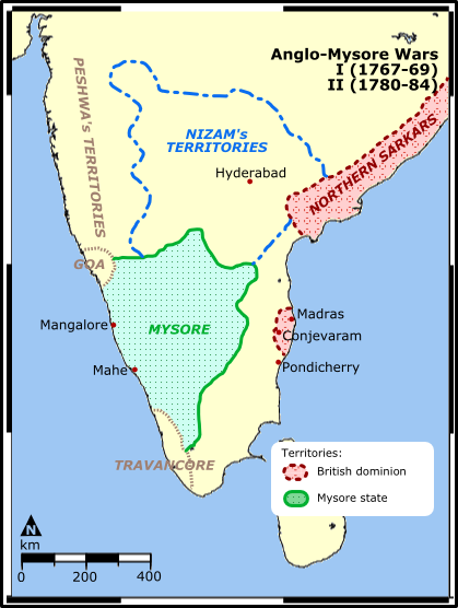
The Mysorean invasion of Malabar (1766–1792) was the military invasion of the Malabar region of Kerala, including the territories of the Zamorin of Calicut, by the then-''de facto'' ruler of the Kingdom of Mysore, Hyder Ali. After the invasion, the Kingdom of Cochin to the south of Malabar became a tributary state of Mysore. The invasion of Malabar was motivated by a desire for access to the ports bordering the Indian Ocean. The Mysore invasion gave the East India Company the opportunity to tighten their grip on the ancient feudal principalities of Malabar and convert Travancore into only a protected ally. www.kerala.gov.in History By the late 18th century, the small kingdoms had been absorbed or subordinated by three large states: Travancore, Calicut (ruled by Zamorins), and the Kingdom of Cochin. The Kingdom of Mysore, ruled nominally by the Wodeyar family, rose to prominence in India after the decline of the Vijayanagara Empire and again after the Mughal Empire. In 17 ... [...More Info...] [...Related Items...] OR: [Wikipedia] [Google] [Baidu] |
Kingdom Of Cochin
The kingdom of Cochin or the Cochin State, named after its capital in the city of Kochi (Cochin), was a kingdom in the central part of present-day Kerala state. It originated in the early part of the 12th century and continued to rule until its accession to the Dominion of India in 1949. The kingdom of Cochin, originally known as Perumpadappu Swarupam, was under the rule of the Kulasekhara dynasty (Second Cheras), Later Cheras in the Medieval India, Middle Ages. After the fall of the Kulasekhara dynasty (Second Cheras), Mahodayapuram Cheras in the 12th century, along with numerous other provinces Perumpadappu Swarupam became a free political entity. However, it was only after the arrival of Portuguese on the Malabar Coast that the Perumpadappu Swarupam acquires any political importance. Perumpadappu rulers had family relationships with the Nambudiri rulers of Edappally. After the transfer of Kochi and Vypin from the Edappally rulers to the Perumpadappu rulers, the latter came ... [...More Info...] [...Related Items...] OR: [Wikipedia] [Google] [Baidu] |
Europe
Europe is a continent located entirely in the Northern Hemisphere and mostly in the Eastern Hemisphere. It is bordered by the Arctic Ocean to the north, the Atlantic Ocean to the west, the Mediterranean Sea to the south, and Asia to the east. Europe shares the landmass of Eurasia with Asia, and of Afro-Eurasia with both Africa and Asia. Europe is commonly considered to be Boundaries between the continents#Asia and Europe, separated from Asia by the Drainage divide, watershed of the Ural Mountains, the Ural (river), Ural River, the Caspian Sea, the Greater Caucasus, the Black Sea, and the waterway of the Bosporus, Bosporus Strait. "Europe" (pp. 68–69); "Asia" (pp. 90–91): "A commonly accepted division between Asia and Europe ... is formed by the Ural Mountains, Ural River, Caspian Sea, Caucasus Mountains, and the Black Sea with its outlets, the Bosporus and Dardanelles." Europe covers approx. , or 2% of Earth#Surface, Earth's surface (6.8% of Earth's land area), making it ... [...More Info...] [...Related Items...] OR: [Wikipedia] [Google] [Baidu] |
Madampi (Nair Title)
Madampi or Madambi ''(equivalent to Lord in English),'' plural Madampimār, is the Malayalam term used to refer to the landed aristocracy of Kerala, used by the uppermost subdivisions of Nairs in Kerala. Pillai is the main title used by a Madampi. They were mostly found in the kingdoms of Jaisimhanadu and Venad ( Travancore Kingdom). Madampis served as '' Jenmis'' or landlords and had their own Nair armies during the pre-independence era. The Madambis held authority within their respective regions and had the right to adjudicate provincial disputes, often exercising greater judicial power than the kings themselves. Their power was severely reduced after the Communist government passed the Land Reforms Ordinance. The title Madampi was also used in Cochin, to denote the Nair and Nambudiri chiefs who ruled under the Maharajah of Cochin. A few Nambuthiri landlord families, most notable of whom being those in Vanjipuzha and Makilanjeri, were also given the Madampi title. In Cochin ... [...More Info...] [...Related Items...] OR: [Wikipedia] [Google] [Baidu] |
Venad Kingdom
Venad was a medieval kingdom between the Western Ghat mountains of India with its capital at city of Quilon.Noburu Karashmia (ed.), A Concise History of South India: Issues and Interpretations. New Delhi: Oxford University Press, 2014. 143-44.Narayanan, M. G. S. 2002. ‘The State in the Era of the Ceraman Perumals of Kerala’, in ''State and Society in Premodern South India'', eds R. Champakalakshmi, Kesavan Veluthat, and T. R. Venugopalan, pp.111–19. Thrissur, CosmoBooks. It was one of the major principalities of Kerala, along with kingdoms of Kolathunadu, Zamorin, and Kochi in medieval and early modern period.Menon, T. Madhava. ''A Handbook of Kerala.'' Vol 1. Trivandrum: Dravidian Linguistics Association, 2002/ref> Venad outlasted the Chera Perumals of Makotai, Chera Perumal kingdom, gradually developed as an independent principality, known as the Chera kingdomThapar, Romila'', The Penguin History of Early India: From the Origins to AD 1300.'' Penguin Books, 2002. ... [...More Info...] [...Related Items...] OR: [Wikipedia] [Google] [Baidu] |
Travancore
The kingdom of Travancore (), also known as the kingdom of Thiruvithamkoor () or later as Travancore State, was a kingdom that lasted from until 1949. It was ruled by the Travancore Royal Family from Padmanabhapuram, and later Thiruvananthapuram. At its zenith, the kingdom covered most of the south of modern-day Kerala ( Idukki, Kottayam, Alappuzha, Pathanamthitta, Kollam, and Thiruvananthapuram districts, major portions of Ernakulam district, Puthenchira village of Thrissur district) and the southernmost part of modern-day Tamil Nadu ( Kanyakumari district and some parts of Tenkasi district) with the Thachudaya Kaimal's enclave of Irinjalakuda Koodalmanikyam temple in the neighbouring kingdom of Cochin. However Tangasseri area of Kollam city and Anchuthengu near Attingal in Thiruvananthapuram were parts of British India. Malabar District of Madras Presidency was to the north, the Madurai and Tirunelveli districts of Pandya Nadu region in Madras Presidency ... [...More Info...] [...Related Items...] OR: [Wikipedia] [Google] [Baidu] |


