|
Glacial River Warren
Glacial River Warren, also known as River Warren, was a prehistoric river that drained Lake Agassiz in central North America between about 13,500 and 10,650 BP calibrated (11,700 and 9,400 14C uncalibrated) years ago. A part of the uppermost portion of the former river channel was designated a National Natural Landmark in 1966. Geological history Lake Agassiz was formed from the meltwaters of the Laurentide Ice Sheet during the Wisconsin glaciation of the last ice age. Agassiz was an enormous body of water, up to deep, and at various times covering areas totaling over . Blocked by an ice sheet to the north, the lake water rose until about 13,500 BP calibrated (11,700 14C uncalibrated) years ago when it overtopped the ''Big Stone Moraine'', a ridge of glacial drift left by the receding glacier, at the location of Browns Valley, Minnesota. The lake's outflow was catastrophic, and carved a gorge through the moraine wide and deep, which is now known as the Traverse Gap. Th ... [...More Info...] [...Related Items...] OR: [Wikipedia] [Google] [Baidu] |
Lake Agassiz
Lake Agassiz ( ) was a large proglacial lake that existed in central North America during the late Pleistocene, fed by meltwater from the retreating Laurentide Ice Sheet at the end of the last glacial period. At its peak, the lake's area was larger than all of the modern Great Lakes combined. It eventually drained into what is now Hudson Bay, leaving behind Lake Winnipeg, Lake Winnipegosis, Lake Manitoba, and Lake of the Woods. First postulated in 1823 by William H. Keating, it was named by Warren Upham in 1879 after Louis Agassiz, the then recently deceased (1873) founder of glaciology, when Upham recognized that the lake was formed by glacial action. Geological progression During the last glacial maximum, northern North America was covered by an ice sheet, which alternately advanced and retreated with variations in the climate. This continental ice sheet formed during the period now known as the Wisconsin glaciation, and covered much of central North America betw ... [...More Info...] [...Related Items...] OR: [Wikipedia] [Google] [Baidu] |
Hudson Bay
Hudson Bay, sometimes called Hudson's Bay (usually historically), is a large body of Saline water, saltwater in northeastern Canada with a surface area of . It is located north of Ontario, west of Quebec, northeast of Manitoba, and southeast of Nunavut, but politically entirely part of Nunavut. It is an inland sea, inland List of seas on Earth#Marginal seas by ocean, marginal sea of the Arctic Ocean. The Hudson Strait provides a connection between the Labrador Sea and the Atlantic Ocean in the northeast, while the Foxe Channel connects Hudson Bay with the Arctic Ocean in the north. The Hudson Bay drainage basin drains a very large area, about , that includes parts of southeastern Nunavut, Alberta, Saskatchewan, Ontario, Quebec, all of Manitoba, and parts of the U.S. states of North Dakota, South Dakota, Minnesota, and Montana. Hudson Bay's southern arm is called James Bay. The East Cree, Eastern Cree name for Hudson and James Bay is (southern dialect) or (northern dialect), m ... [...More Info...] [...Related Items...] OR: [Wikipedia] [Google] [Baidu] |
Proglacial Lake
In geology, a proglacial lake is a lake formed either by the damming action of a moraine during the retreat of a melting glacier, a glacial ice dam, or by meltwater trapped against an ice sheet due to isostatic depression of the crust around the ice. At the end of the last ice age about 10,000 years ago, large proglacial lakes were a widespread feature in the northern hemisphere. Moraine-dammed The receding glaciers of the tropical Andes have formed a number of proglacial lakes, especially in the Cordillera Blanca of Peru, where 70% of all tropical glaciers are. Several such lakes have formed rapidly during the 20th century. These lakes may burst, creating a hazard for zones below. Many natural dams (usually moraines) containing the lake water have been reinforced with safety dams. Some 34 such dams have been built in the Cordillera Blanca to contain proglacial lakes. Several proglacial lakes have also formed in recent decades at the end of glaciers on the eastern side ... [...More Info...] [...Related Items...] OR: [Wikipedia] [Google] [Baidu] |
Prescott, Wisconsin
Prescott is a city in Pierce County, Wisconsin, United States, at the confluence of the St. Croix River (Wisconsin-Minnesota), St. Croix River and Mississippi River. Prescott is at the edge of the Minneapolis–St. Paul metropolitan area. The population was 4,333 at the 2020 United States census, 2020 census, making it the county's second-largest city after River Falls, Wisconsin, River Falls and the largest entirely within Pierce County. Prescott was home to the mother house of the Franciscan Servants of Jesus. The town was first settled by (and named for) Philander Prescott, who opened a trading post there in 1839. Geography According to the United States Census Bureau, the city has an area of , of which is land and is water. Prescott is Wisconsin's westernmost incorporated community, although rural portions of Burnett County, WI, Burnett and Polk County, WI, Polk Counties are farther west. Along with the rest of Pierce County, Prescott is officially part of the Minneapolis- ... [...More Info...] [...Related Items...] OR: [Wikipedia] [Google] [Baidu] |
Minneapolis
Minneapolis is a city in Hennepin County, Minnesota, United States, and its county seat. With a population of 429,954 as of the 2020 United States census, 2020 census, it is the state's List of cities in Minnesota, most populous city. Located in the state's center near the eastern border, it occupies both banks of the Upper Mississippi River and adjoins Saint Paul, Minnesota, Saint Paul, the state capital of Minnesota. Minneapolis, Saint Paul, and the surrounding area are collectively known as the Minneapolis–Saint Paul, Twin Cities, a metropolitan area with 3.69 million residents. Minneapolis is built on an artesian aquifer on flat terrain and is known for cold, snowy winters and hot, humid summers. Nicknamed the "City of Lakes", Minneapolis is abundant in water, with list of lakes in Minneapolis, thirteen lakes, wetlands, the Mississippi River, creeks, and waterfalls. The city's public park system is connected by the Grand Rounds National Scenic Byway. Dakota people orig ... [...More Info...] [...Related Items...] OR: [Wikipedia] [Google] [Baidu] |
Minnehaha Falls
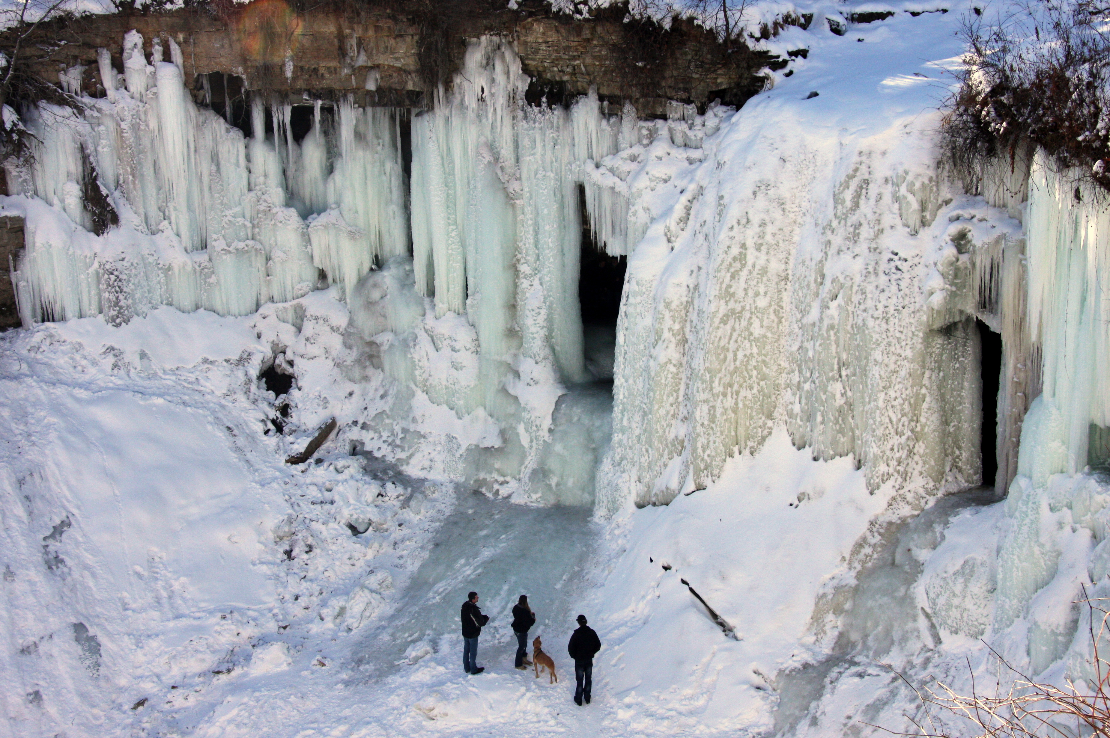
Minnehaha Park is a city park in Minneapolis, Minnesota, United States, and home to Minnehaha Falls and the lower reaches of Minnehaha Creek. Officially named Minnehaha Regional Park, it is part of the Minneapolis Park and Recreation Board system and lies within the Mississippi National River and Recreation Area, a unit of the National Park Service. The park was designed by landscape architect Horace W.S. Cleveland in 1883 as part of the Grand Rounds Scenic Byway system, and was part of the popular steamboat Upper Mississippi River "Fashionable Tour" in the 1800s. The park preserves historic sites that illustrate transportation, pioneering, and architectural themes. Preserved structures include the Minnehaha Princess Station, a Victorian train depot built in the 1870s; the John H. Stevens House, built in 1849 and moved to the park from its original location in 1896, utilizing horses and 10,000 school children; and the Longfellow House, a house built to resemble the Longfellow ... [...More Info...] [...Related Items...] OR: [Wikipedia] [Google] [Baidu] |
Saint Anthony Falls
Saint Anthony Falls, or the Falls of Saint Anthony (), located at the northeastern edge of downtown Minneapolis, Minnesota, was the only natural major waterfall on the Mississippi River. Throughout the mid-to-late 1800s, various dams were built atop the east and west faces of the falls to support the milling industry that spurred the growth of the city of Minneapolis. In 1880, the central face of the falls was reinforced with a sloping timber apron to stop the upstream erosion of the falls. In the 1950s, the apron was rebuilt with concrete, which makes up the most visible portion of the falls today. A series of lock (water transport), locks were constructed in the 1950s and 1960s to extend navigation to points upstream. The falls were renamed from their Dakota title in 1680 by Louis Hennepin, Father Louis Hennepin after his patron saint, Anthony of Padua, St. Anthony of Padua. The towns of St. Anthony and Minneapolis, which had developed on the east and west sides of the falls, r ... [...More Info...] [...Related Items...] OR: [Wikipedia] [Google] [Baidu] |
River Warren Falls
The River Warren Falls was a massive waterfall on the glacial River Warren initially located in present-day Saint Paul, Minnesota, United States. The waterfall was across and high. Geologic history The area now occupied by the Twin Cities of St. Paul and Minneapolis generally consisted of a thick layer of St. Peter Sandstone, under a thick layer of shale, under a thick layer of Platteville limestone. These layers were the result of an Ordovician Period sea which covered east-central Minnesota 500 million years ago. The hard limestone cap was formed from fossilized shell fish. About 20,000 years ago, the area was covered by the Superior Lobe of the Laurentide Ice Sheet, which left the St. Croix moraine on the Twin Cities as it receded. Later the Grantsburg Sublobe of the Des Moines Lobe also covered the area. Under these vast layers of ice, tunnel valleys were formed, cutting through the limestone layer with tremendous force, to release ice meltwater and glacier effl ... [...More Info...] [...Related Items...] OR: [Wikipedia] [Google] [Baidu] |
Saint Paul, Minnesota
Saint Paul (often abbreviated St. Paul) is the List of capitals in the United States, capital city of the U.S. state of Minnesota and the county seat of Ramsey County, Minnesota, Ramsey County. As of the 2020 United States census, 2020 census, the city had a population of 311,527, making it Minnesota's List of cities in Minnesota, second-most populous city and the List of United States cities by population, 63rd-most populous in the United States. Saint Paul and neighboring Minneapolis form the core of the Minneapolis–Saint Paul, Twin Cities metropolitan area, the third most populous in the Midwestern United States, Midwest with around 3.7 million residents. The Minnesota State Capitol and the state government offices sit on a hill next to downtown Saint Paul overlooking a bend in the Mississippi River. Local cultural offerings include the Science Museum of Minnesota, the Ordway Center for the Performing Arts, and the Minnesota History Center. Three of the region's profession ... [...More Info...] [...Related Items...] OR: [Wikipedia] [Google] [Baidu] |
Fort Snelling
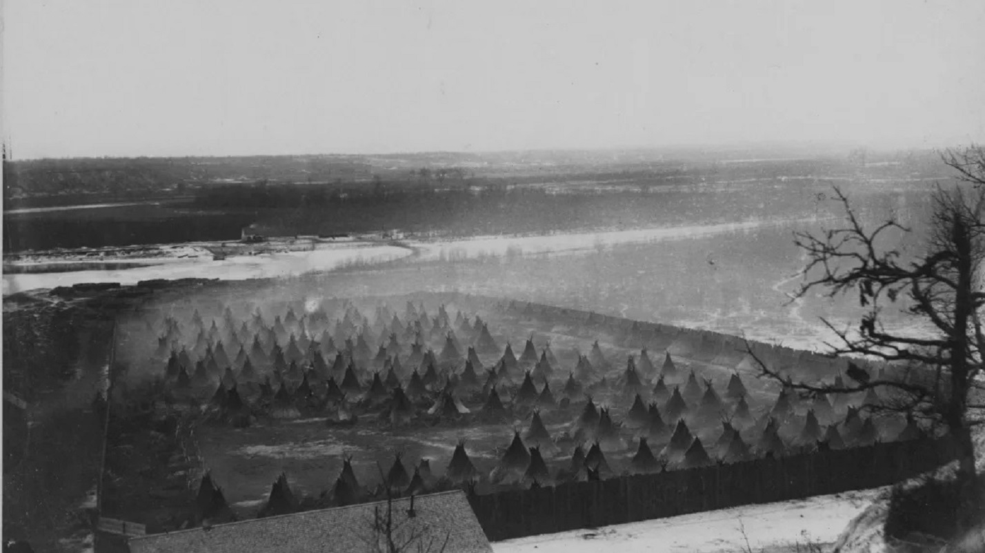
Fort Snelling is a former military fortification and National Historic Landmark in the U.S. state of Minnesota on the bluffs overlooking the confluence of the Minnesota and Mississippi Rivers. The military site was initially named Fort Saint Anthony, but it was renamed Fort Snelling once its construction was completed in 1825. Before the American Civil War, the U.S. Army supported slavery at the fort by allowing its soldiers to bring their personal enslaved people. These included African Americans Dred Scott and Harriet Robinson Scott, who lived at the fort in the 1830s. In the 1840s, the Scotts sued for their freedom, arguing that having lived in "free territory" made them free, leading to the landmark United States Supreme Court case '' Dred Scott v. Sandford''. Slavery ended at the fort just before Minnesota statehood in 1858. The fort served as the primary center for U.S. government forces during the Dakota War of 1862. It also was the site of the concentration camp where ... [...More Info...] [...Related Items...] OR: [Wikipedia] [Google] [Baidu] |
Mississippi River
The Mississippi River is the main stem, primary river of the largest drainage basin in the United States. It is the second-longest river in the United States, behind only the Missouri River, Missouri. From its traditional source of Lake Itasca in northern Minnesota, it flows generally south for to the Mississippi River Delta in the Gulf of Mexico. With its many tributaries, the Mississippi's Drainage basin, watershed drains all or parts of 32 U.S. states and two Canadian provinces between the Rocky Mountains, Rocky and Appalachian Mountains, Appalachian mountains. The river either borders or passes through the states of Minnesota, Wisconsin, Iowa, Illinois, Missouri, Kentucky, Tennessee, Arkansas, Mississippi, and Louisiana. The main stem is entirely within the United States; the total drainage basin is , of which only about one percent is in Canada. The Mississippi ranks as the world's List of rivers by discharge, tenth-largest river by discharge flow, and the largest ... [...More Info...] [...Related Items...] OR: [Wikipedia] [Google] [Baidu] |


