|
European Route E77
European route E 77 is a part of the International E-road network, inter-European road system. This Class A intermediate north–south route is long and it connects the Baltic Sea with the central part of the continent. History In the version of the E-road network established in 1975, E77 was a much shorter road in Hungary from Püspökladány, European route E60, E60 to Nyíregyháza, which is now part of European route E573, E573. The section of current E77 between Gdańsk and Budapest was part of E75. When the E77 was first defined in this area, its north end was in Gdańsk. Route The E 77 routes through several European countries. The north end of the road system is in Pskov Oblast in Russia, it passes through Estonia, Latvia, Lithuania, Poland, Slovakia, to the south end in Budapest, Hungary: (Pskov Oblast) *: Pskov - Neyolovo - Izborsk - Shumilkino - / border checkpoint *: / border - Määsi - Misso - Käbli - / border *: / border - Grundzāle - Si ... [...More Info...] [...Related Items...] OR: [Wikipedia] [Google] [Baidu] |
Pskov, Russia
Pskov Oblast () is a federal subject of Russia (an oblast), located in the west of the country. Its administrative center is the city of Pskov. As of the 2021 Census, its population was 599,084. Geography Pskov Oblast is the westernmost federal subject of contiguous Russia (Kaliningrad Oblast, while located further to the west, is an exclave).1september.ru. Д. В. Заяц (D. V. Zayats).Псковская область (''Pskov Oblast''). It borders with Leningrad Oblast in the north, Novgorod Oblast in the east, Tver and Smolensk Oblasts in the southeast, Vitebsk Oblast of Belarus in the south, and with the counties of Latvia (Alūksne Municipality, Balvi Municipality, and Ludza Municipality) and Estonia (Võru County) in the west. In the northwest, Pskov Oblast is limited by Lake Peipus, which makes up most of the state border with Estonia. The oblast is located in the Baltic Sea drainage basin, mostly in the basin of the Narva River. The biggest river of this basin i ... [...More Info...] [...Related Items...] OR: [Wikipedia] [Google] [Baidu] |
Tauragė
Tauragė (; see #Names and etymology, other names) is an industrial city in Lithuania, and the capital of Tauragė County. In 2020, its population was 20,956. Tauragė is situated on the Jūra, Jūra River, close to the border with the Kaliningrad Oblast, and not far from the Baltic Sea coast. Although first mentioned in 1507, Tauragė did not receive its town privileges, city charter until 1924, and its coat of arms (a silver hunting horn in a red field) until 1997. The previously small town was significantly developed in the 19th century and early 20th century, however its architecture suffered devastating damages during World War I and World War II. Notable surviving buildings in the city include the Tauragė castle, castle (19th century Russian Empire customs), 19th century Post office, buildings from the 20th century inter-war period, several churches: the Lutheran (built in 1843), the Catholic (1904) and Orthodox (1933). Lithuanian, Swedish and Danish factories operate in ... [...More Info...] [...Related Items...] OR: [Wikipedia] [Google] [Baidu] |
Kelmė
Kelmė (; ; Yiddish: קעלם) is a city in northwestern Lithuania, a historical region of Samogitia. It has a population of 8,206 and is the administrative center of the Kelmė District Municipality. Name Kelmė's name is likely derived from the Lithuanian language, Lithuanian word ''kelmynės'', literally: ''the stubby place'', because of the forests that were there at the time of its founding. The Yiddish name is Kelm, as in Kelm Talmud Torah. History Kelmė was first mentioned in 1416, the year that Kelmė's first church was built. It was located in the Duchy of Samogitia in the Grand Duchy of Lithuania within the Polish–Lithuanian Commonwealth. Prior to World War II, Kelmė () was home to a famous Rabbinical College, the Kelm Talmud Torah. According to an 1897 census, 2,710 of Kelme's 3,914 inhabitants were members of the town's Jewish population, the vast majority of whom were merchants and traders and lived in the town. Most of the Jews in Kelmė rural district were mu ... [...More Info...] [...Related Items...] OR: [Wikipedia] [Google] [Baidu] |
Šiauliai
Šiauliai ( ; ) is a city in northern Lithuania, the List of cities in Lithuania, country's fourth largest city and the List of cities in the Baltic states by population, sixth largest city in the Baltic States, with a population of 112 581 in 2024. From 1994 to 2010 it was the capital of Šiauliai County. Names Šiauliai is referred to by various names in different languages: Samogitian language, Samogitian ; Latvian language, Latvian (historic) and (modern); Polish language, Polish ; German language, German ; Belarusian language, Belarusian ; Russian language, Russian (historic) and (modern); Yiddish language, Yiddish . History The city was first mentioned in written sources as ''Soule'' in Livonian Order chronicles describing the Battle of Saule. Thus the city's founding date is now considered to be 22 September 1236, the same date when the battle took place, not far from Šiauliai. At first, it developed as a defence post against the raids by the Teutonic Knight ... [...More Info...] [...Related Items...] OR: [Wikipedia] [Google] [Baidu] |
Joniškis
Joniškis (; Samogitian language, Samogitian: ''Juonėškis''; ) is a city in northern Lithuania with a population of about 9,900. It is located 39 kilometers north of Šiauliai and 14 kilometers south of the Lithuania–Latvia border. Joniškis is the municipal and administrative centre of Joniškis district municipality. Name Joniškis is the Lithuanian language, Lithuanian name of the town. Historical versions of the name in other languages include Polish language, Polish: ''Janiszki'', Russian language, Russian: Янишки ''Yanishki'', Yiddish: יאַנישאָק ''Yanishok'', Latvian language, Latvian: ''Jānišķe'', and German: ''Jonischken''. History Joniškis was established in the beginning of the 16th century. It was mentioned in written sources on 23 February 1536 when Bishops of Vilnius and Bishop of Samogitia, Samogitia visited the area and found that people still practiced the Lithuanian mythology, old pagan faith. People were worshiping the God of Thunder (Perk ... [...More Info...] [...Related Items...] OR: [Wikipedia] [Google] [Baidu] |
Plikiškiai
Plikiškiai is a village in Lithuania Lithuania, officially the Republic of Lithuania, is a country in the Baltic region of Europe. It is one of three Baltic states and lies on the eastern shore of the Baltic Sea, bordered by Latvia to the north, Belarus to the east and south, P .... Villages in Šiauliai County {{ŠiauliaiCounty-geo-stub ... [...More Info...] [...Related Items...] OR: [Wikipedia] [Google] [Baidu] |
Eleja
Eleja is a village in the Eleja Parish of Jelgava Municipality in the Semigallia region of Latvia. Located 27 km south from Jelgava it spreads along the A8 highway crossroads with the regional P103 road. Meitene railroad station, located in the village, is no longer used for passenger service. The actual village of Meitene is a couple of kilometers south, right on the Latvia-Lithuania border. History During the 16th century the Eleja manor was established by the Eleja river. Owned first by Georg von Tiesenhausen from the Tyzenhaus family and later by Ulrich von Baehr (''Bähr'') in 1753 it was purchased by Count Johann Friedrich von Medem. Medem family owned it until the land reform of 1920. Between the 1806 and 1810 a grand new Eleja manor house was built here, which was burned down by the retreating Russian army in July 1915 and further demolished during the 1920-30s. Some efforts at renovating the manor house building complex and the arched stone fence started i ... [...More Info...] [...Related Items...] OR: [Wikipedia] [Google] [Baidu] |
Jelgava
Jelgava () is a state city in central Latvia. It is located about southwest of Riga. It is the largest town in the Semigallia region of Latvia. Jelgava was the capital of the united Duchy of Courland and Semigallia (1578–1795) and was the administrative center of the Courland Governorate (1795–1918). Jelgava is situated on a fertile plain rising only above mean sea level on the right bank of the river Lielupe. At high water, the plain and sometimes the town as well can be flooded. It is a railway center, and is also a host to the Jelgava Air Base. Its importance as a railway centre can be seen by the fact that it lies at the junction of over 6 railway lines connecting Riga to Lithuania, eastern and western Latvia, and Lithuania to the Baltic Sea. Name Until 1917, the city was officially referred to as Mitau. The name of Jelgava is believed to be derived from the Livonian word ''jālgab'', meaning "town on the river." The origin of the German name ''Mitau'' is unclea ... [...More Info...] [...Related Items...] OR: [Wikipedia] [Google] [Baidu] |
Riga
Riga ( ) is the capital, Primate city, primate, and List of cities and towns in Latvia, largest city of Latvia. Home to 591,882 inhabitants (as of 2025), the city accounts for a third of Latvia's total population. The population of Riga Planning Region, Riga metropolitan area, which stretches beyond the city limits, is estimated at 847,162 (as of 2025). The city lies on the Gulf of Riga at the mouth of the Daugava (river), Daugava river where it meets the Baltic Sea. Riga's territory covers and lies above sea level on a flat and sandy plain. Riga was founded in 1201, and is a former Hanseatic League member. Riga's historical centre is a UNESCO World Heritage Site, noted for its Art Nouveau/Jugendstil architecture and 19th century wooden architecture. Riga was the European Capital of Culture in 2014, along with Umeå in Sweden. Riga hosted the 2006 Riga summit, 2006 NATO Summit, the Eurovision Song Contest 2003, the 2013 World Women's Curling Championship, and the 2006 IIHF Wo ... [...More Info...] [...Related Items...] OR: [Wikipedia] [Google] [Baidu] |
Sigulda
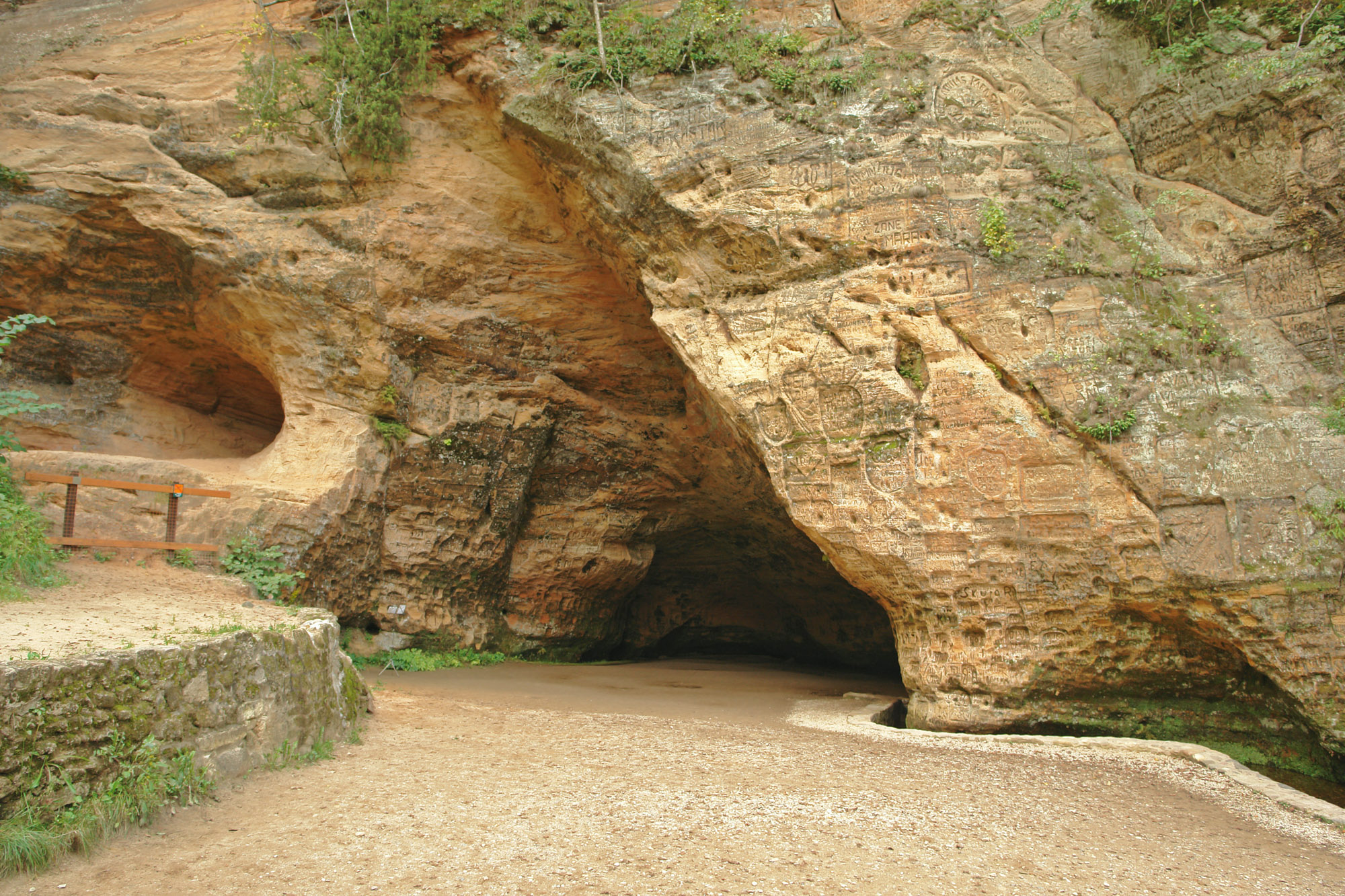
Sigulda (; ; Polish Zygwold) is a town in the Vidzeme region of Latvia, from the capital city Riga. Overview Sigulda is on a picturesque stretch of the primeval Gauja river valley. Because of the reddish Devonian sandstone which forms steep rocks and caves on both banks of the river, Sigulda has been called the "Switzerland of Vidzeme". After the restoration of Latvian independence in 1991, an emphasis was placed on conserving Sigulda's public monuments and parks as well as improving the town's tourist sector. Supported by the town council, a traditional Opera Festival takes place in an open-air music hall in the castle ruins each summer. A Town Festival is celebrated in May when cherry trees blossom, while Sigulda is known for the colors of its trees in autumn. Sports such as skiing, bobsledding, and the luge are popular in wintertime and bungee jumping is practiced during the rest of the year. Gutman's Cave lies halfway between Sigulda Castle and Turaida Castle and h ... [...More Info...] [...Related Items...] OR: [Wikipedia] [Google] [Baidu] |


