|
Electoral District Of Albert
Albert was a Legislative Assembly electorate in the state of Queensland which existed from 1887 to 1949 and 1959 to 2017. Albert was named for the Albert River, which runs through the electorate and separates Logan City from City of Gold Coast. It was first created in a redistribution in 1887 ahead of the 1888 colonial election and continued to exist (with various boundary alterations) until 1949, when the Darlington and Southport electorates were created. In 1959, the electorate was established again. The 1971 and 1977 redistributions greatly reduced the area of the electorate and minor changes were made in 1991, including the loss of Carbrook in the north and coastal areas below Paradise Point in the south. Its consistently changing boundaries together with its existence in a high-growth area do not provide consistent political leanings over time, although it showed more inclination towards the Labor Party over time than any other Gold Coast seat. The last Member for ... [...More Info...] [...Related Items...] OR: [Wikipedia] [Google] [Baidu] |
Albert River (Queensland)
The Albert River is a perennial river in the South East region of Queensland, Australia. Its catchment lies within the Gold Coast and Scenic Rim Region local government areas and covers an area of . The river provides potable water for the town of Beaudesert. Course and features Formed by the confluence of the Right and Left Branches of the river that begin in the Lamington National Park and drain the northern slopes of the Border Ranges within the Great Dividing Range, the Albert River rises below Neglected Mountain and east of the settlement of . The river flows generally north, joined by six minor tributaries before reaching its confluence with the Logan River between and . From there the Logan flows a further before entering Moreton Bay. The Albert River catchment is bounded by the McPherson Range to the south, the Beechmont Range in the east and the Jinbroken Range and Birnam Range to the west. The river's upper catchment is heavily influenced by the national par ... [...More Info...] [...Related Items...] OR: [Wikipedia] [Google] [Baidu] |
Electoral District Of Coomera
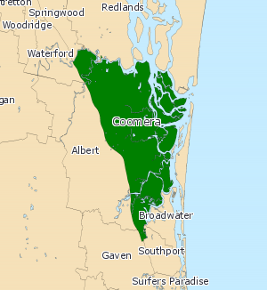
Coomera is an electoral district of the Legislative Assembly in the Australian state of Queensland, based at the northern end of the Gold Coast. The seat has been held by the Liberal National Party since its establishment in 2009. Geography A coastal suburban electorate, Coomera lies entirely east of the Pacific Motorway. It includes the City of Gold Coast suburbs of Hope Island, Jacobs Well, Steiglitz and parts of Coomera, Ormeau and Pimpama. It also includes the Logan City suburb of Eagleby. History A new district created for the 2009 state election to accommodate the Gold Coast's urban growth, Coomera was in large part drawn from the eastern half of the district of Albert, which was significantly reduced in size. The southern end of Coomera also includes parts previously belonging to the districts of Broadwater and Gaven. Its inaugural member is Michael Crandon of the Liberal National Party. Members for Coomera Election results References Externa ... [...More Info...] [...Related Items...] OR: [Wikipedia] [Google] [Baidu] |
North Stradbroke Island
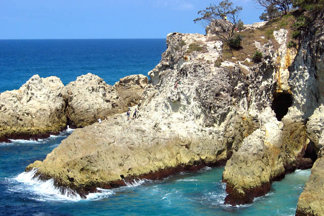
North Stradbroke Island (Janday language, Jandai: ''Minjerribah''), colloquially ''Straddie'' or ''North Straddie'', is an island that lies within Moreton Bay in the Australian state of Queensland, southeast of the centre of Brisbane. Originally there was only one Stradbroke Island but in 1896 it split into North Stradbroke Island and South Stradbroke Island separated by the Jumpinpin Channel. The Quandamooka people are the traditional owners of North Stradbroke island. The island is divided into four Suburbs and localities (Australia), localities: Dunwich, Queensland, Dunwich, Amity, Queensland, Amity and Point Lookout, Queensland, Point Lookout are small localities centred on the towns of the same name, while the remainder of the island is in the locality of North Stradbroke Island, Queensland, North Stradbroke Island. All the localities are within the City of Redland. At , it is the second largest sand island in the world. On the island there are three small towns, a number ... [...More Info...] [...Related Items...] OR: [Wikipedia] [Google] [Baidu] |
Redland City
Redland City, also known as the Redlands and formerly known as Redland Shire, is a Local government in Australia, local government area (LGA) and a part of Brisbane, Greater Brisbane in South East Queensland, Australia. With a population of 159,222 as of June 2021, Redland City is spread along the southern coast of Moreton Bay, covering . The city borders the City of Brisbane to the west and north-west and Logan City to the south-west and south, while its islands are situated north of the City of Gold Coast. The Redlands first attained city status on March 15th, 2008, having been a shire since 1949, when it was created by a merger of the Shire of Tingalpa, Tingalpa and Shire of Cleveland, Cleveland Shires.Queensland State Archives, ... [...More Info...] [...Related Items...] OR: [Wikipedia] [Google] [Baidu] |
Electoral District Of Fassifern
Fassifern was an electoral district of the Legislative Assembly in the Australian state of Queensland from 1873 to 1992. It was based on the area south of Ipswich and stretched toward the New South Wales border, although in subsequent redistributions was reduced in size away from the growing Brisbane area. It was named after the Fassifern Valley. Fassifern was a safe Country/National district for most of its existence. It was abolished in the 1991 redistribution under the Goss government, and was largely replaced by the new district of Beaudesert. Members for Fassifern Election results See also * Electoral districts of Queensland * Members of the Queensland Legislative Assembly This is a list of members of the Legislative Assembly of Queensland, the state parliament of Queensland, sorted by parliament. See also * Queensland Legislative Assembly electoral districts This is a list of current and former Electoral di ... by year * :Members of the Queensland Le ... [...More Info...] [...Related Items...] OR: [Wikipedia] [Google] [Baidu] |
Jimboomba, Queensland
Jimboomba is a town and locality in the City of Logan, Queensland, Australia. In the , the locality of Jimboomba had a population of 7,423 people. Geography Jimboomba is situated on the Mount Lindesay Highway, by road south-east of Logan Central and by road south of Brisbane central business district. The western part of Jimboomba is bordered by the new suburb of Glenlogan and the Logan River; the only bridge within the locality is Payne Bridge on Cusack Lane (). There is a low-level older bridge immediately to the north of Payne Bridge, but this cannot be used by vehicular traffic. The Queensland Government's current plan is that Jimboomba will become a major residential and business area within the Brisbane metropolitan region, as part of the Greater Flagstone Priority Development Area, which will house up to 150,000 additional residents in coming decades. Although historically a rural area, as at 2021, the land use in Jimboomba is almost entirely residential. Histor ... [...More Info...] [...Related Items...] OR: [Wikipedia] [Google] [Baidu] |
Beaudesert, Queensland
Beaudesert ( Yugambeh: ''Yilbagan'') is a rural town and locality in the Scenic Rim Region of Queensland, Australia. In the , the locality of Beaudesert had a population of 6,752 people. Beaudesert is the administrative centre for the Scenic Rim Region. Geography Beaudesert is south of Brisbane and west of the Gold Coast. Beaudesert is located on the Mount Lindesay Highway, some south of Brisbane. The area sources its income predominantly from rural activities such as cropping, grazing and equine activities, as well as tourism. In the Logan River and Albert River valleys, Beaudesert is a regional hub serving surrounding communities such as Rathdowney, Kooralbyn, Canungra, Tamborine Mountain and Jimboomba. It is approximately 91 kilometres from Brisbane and connected by the Mount Lindesay Highway. The town of Beaudesert is located above sea level and has an average annual rainfall of around per year. The temperature is around in summer and falls to aroun ... [...More Info...] [...Related Items...] OR: [Wikipedia] [Google] [Baidu] |
National Party Of Australia – Queensland
The National Party of Australia – Queensland (NPA-Q), commonly known as the Queensland Nationals, National Party of Queensland or simply the Nationals, was the Queensland branch of the National Party of Australia (NPA) until 2008. Prior to 1974, it was known as the Country Party. The party was disestablished in 2008, when it merged with the Queensland division of the Liberal Party of Australia to form the Liberal National Party of Queensland (LNP). Formed in 1915 by the Queensland Farmers' Union (QFU) and serving as the state branch of the National Party of Australia, it initially sought to represent the interests of the farmers but over time became a more general conservatism, conservative political party in the state, leading to much debate about relations with other conservative parties and a series of mergers that were soon undone. From 1924 onward, it was the senior partner in the centre-right Coalition (Australia), coalition with the Liberal Party of Australia (Queensland ... [...More Info...] [...Related Items...] OR: [Wikipedia] [Google] [Baidu] |
Liberal Party (Queensland, 1908)
The Liberal Party was a political party in the Australian state of Queensland in the early 20th century. It combined the main non-Labor forces, the Kidstonites of William Kidston and the Conservative Party led by Robert Philp, similar to the federal Commonwealth Liberal Party whose fusion it preceded. The Liberals held government from their formation in 1908 until defeat in 1915 after which they combined with other elements in the state to form the National Party. History The Liberals were formed after a period of flux in Queensland state politics in which multiple parties and factions had operated with both the 1907 and 1908 elections returning Legislative Assemblies with three groupings of approximately equal weight. William Kidston had served as Premier of Queensland since 1906, breaking with the Labor Party in 1907 to form his own " Kidstonites" grouping. The Kidstonites initially governed with the external support of Labor but in the two broke over bills on priva ... [...More Info...] [...Related Items...] OR: [Wikipedia] [Google] [Baidu] |
Queensland Farmers' Union
The National Party of Australia – Queensland (NPA-Q), commonly known as the Queensland Nationals, National Party of Queensland or simply the Nationals, was the Queensland branch of the National Party of Australia (NPA) until 2008. Prior to 1974, it was known as the Country Party. The party was disestablished in 2008, when it merged with the Queensland division of the Liberal Party of Australia to form the Liberal National Party of Queensland (LNP). Formed in 1915 by the Queensland Farmers' Union (QFU) and serving as the state branch of the National Party of Australia, it initially sought to represent the interests of the farmers but over time became a more general conservative political party in the state, leading to much debate about relations with other conservative parties and a series of mergers that were soon undone. From 1924 onward, it was the senior partner in the centre-right coalition with the state Liberal Party and its predecessors, in a reversal of the normal sit ... [...More Info...] [...Related Items...] OR: [Wikipedia] [Google] [Baidu] |


