|
Diseño
A ''diseño'' is a hand-drawn map of a Spanish or Mexico land grant that was submitted to the U.S. government indicating the extent of a land grant as understood by the grantees. An ''expediente'' is a written description of the grant. These documents were used during the U.S. land-patent process that began when Mexican Alta California became the U.S. state of California in 1850. ''Diseños'' are distinct from later maps produced by U.S. surveyors within the extant American rectangular survey system. ''Diseños'' may have missing or poorly described coastal features because cattlemen who ran the ranchos generally did not make use of the shoreline or own boats. File:Diseño de Rancho San Pedro Los Angeles California Dominguez 1843.jpg, This ''diseño'' of Rancho de Los Palos Verdes, originally part of Rancho San Pedro, was submitted to the U.S. General Land Office in 1852 File:Diseño Del Rancho Los Alamitos 1852 Los Cerritos Santa Gertrudis Coyotes Siérritos Bolsas.jpg, Diseñ ... [...More Info...] [...Related Items...] OR: [Wikipedia] [Google] [Baidu] |
Alta California
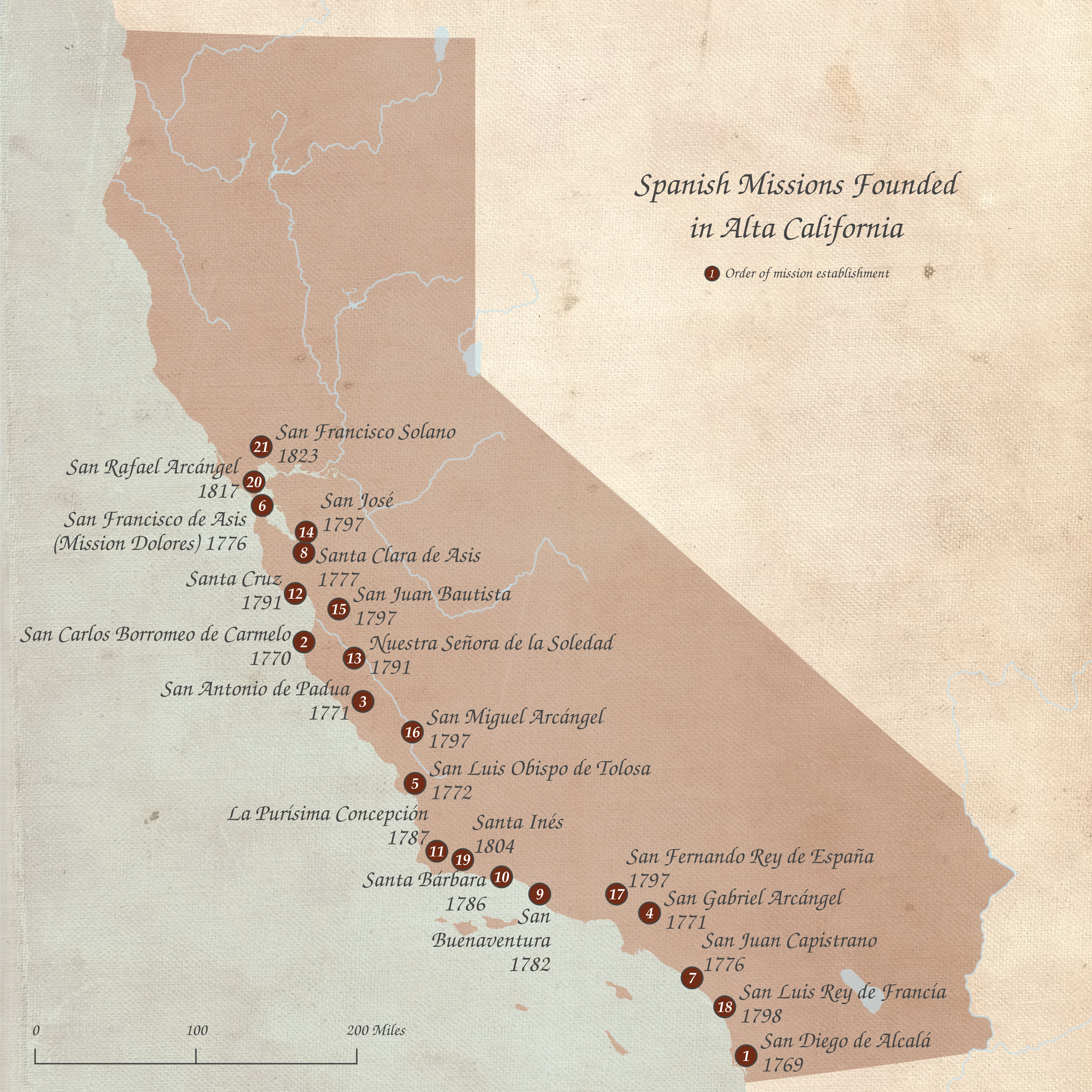
Alta California (, ), also known as Nueva California () among other names, was a province of New Spain formally established in 1804. Along with the Baja California peninsula, it had previously comprised the province of , but was made a separate province in 1804 (named ). Following the Mexican War of Independence, it became a territory of First Mexican Empire, Mexico in April 1822 and was renamed in 1824. The territory included all of the present-day U.S. states of California, Nevada, and Utah, and parts of Arizona, Wyoming, and Colorado. The territory was with Baja California Territory, Baja California (as a single ) in Mexico's 1836 ''Siete Leyes'' (Seven Laws) constitutional reform, granting it more autonomy. That change was undone in 1846, but rendered moot by the outcome of the Mexican–American War in 1848, when most of the areas formerly comprising Alta California Mexican Cession, were ceded to the U.S. in Treaty of Guadalupe Hidalgo, the treaty which ended the war. In ... [...More Info...] [...Related Items...] OR: [Wikipedia] [Google] [Baidu] |
California
California () is a U.S. state, state in the Western United States that lies on the West Coast of the United States, Pacific Coast. It borders Oregon to the north, Nevada and Arizona to the east, and shares Mexico–United States border, an international border with the Mexico, Mexican state of Baja California to the south. With almost 40million residents across an area of , it is the List of states and territories of the United States by population, largest state by population and List of U.S. states and territories by area, third-largest by area. Prior to European colonization of the Americas, European colonization, California was one of the most culturally and linguistically diverse areas in pre-Columbian North America. European exploration in the 16th and 17th centuries led to the colonization by the Spanish Empire. The area became a part of Mexico in 1821, following Mexican War of Independence, its successful war for independence, but Mexican Cession, was ceded to the U ... [...More Info...] [...Related Items...] OR: [Wikipedia] [Google] [Baidu] |
Surveyor
Surveying or land surveying is the technique, profession, art, and science of determining the terrestrial two-dimensional or three-dimensional positions of points and the distances and angles between them. These points are usually on the surface of the Earth, and they are often used to establish maps and boundaries for ownership, locations, such as the designated positions of structural components for construction or the surface location of subsurface features, or other purposes required by government or civil law, such as property sales. A professional in land surveying is called a land surveyor. Surveyors work with elements of geodesy, geometry, trigonometry, regression analysis, physics, engineering, metrology, programming languages, and the law. They use equipment, such as total stations, robotic total stations, theodolites, GNSS receivers, retroreflectors, 3D scanners, lidar sensors, radios, inclinometer, handheld tablets, optical and digital levels, subsurface loc ... [...More Info...] [...Related Items...] OR: [Wikipedia] [Google] [Baidu] |
Public Land Survey System
The Public Land Survey System (PLSS) is the surveying method developed and used in the United States to plat, or divide, real property for sale and settling. Also known as the Rectangular Survey System, it was created by the Land Ordinance of 1785 to survey land ceded to the United States by the Treaty of Paris (1783), Treaty of Paris in 1783, following the end of the American Revolution. Beginning with the Seven Ranges in present-day Ohio, the PLSS has been used as the primary survey method in the United States. Following the passage of the Northwest Ordinance in 1787, the Surveyor General of the Northwest Territory platted lands in the Northwest Territory. The Surveyor General was later merged with the United States General Land Office, which later became a part of the U.S. Bureau of Land Management (BLM). Today, the BLM controls the survey, sale, and settling of lands acquired by the United States. History Originally proposed by Thomas Jefferson to create a nation of "yeom ... [...More Info...] [...Related Items...] OR: [Wikipedia] [Google] [Baidu] |
Rancho De Los Palos Verdes
''Rancho de los Palos Verdes'' was a Mexican land grant in present-day Los Angeles County, California given in 1846 by Governor Pío Pico to José Loreto and Juan Capistrano Sepulveda. The name means "Ranch of the Green Trees". The grant encompassed the present-day cities of the Palos Verdes Peninsula, as well as portions of San Pedro, Torrance, Redondo Beach, Compton, Gardena, Lomita, Harbor City, Carson, Dominguez Hills, Wilmington, Los Angeles History The grant was originally a part of Manuel Dominguez's Rancho San Pedro Spanish land grant. Around 1810 Manuel Guttierez, executor of Dominguez's will and de facto owner of his rancho, granted permission to then 17-year-old Jose Dolores Sepulveda to herd livestock in the southwestern reaches of the Rancho San Pedro. This eventually became the basis for the Sepulveda family's contested claim to the Rancho de los Palos Verdes. Dolores had trouble getting his land title cleared, so he took a trip to Monterey to get the m ... [...More Info...] [...Related Items...] OR: [Wikipedia] [Google] [Baidu] |
Rancho San Pedro
Rancho San Pedro was one of the first California land grants and the first to win a patent from the United States. The Spanish Crown granted the of land to soldier Juan José Domínguez in 1784, with his descendants validating their legal claim with the Mexican government at in 1828, and later maintaining their legal claim through a United States patent validating in 1858. The original Spanish land grant included what today consists of the Pacific coast cities of Los Angeles harbor, San Pedro, the Palos Verdes peninsula, Torrance, Redondo Beach, Hermosa Beach, and Manhattan Beach, and east to the Los Angeles River, including the cities of Lomita, Gardena, Harbor City, Wilmington, Carson, Compton, and western portions of Long Beach and Paramount. History Juan José Domínguez (1736–1809), a Spanish soldier, arrived in San Diego, California, in 1769 with Fernando Rivera y Moncada and served with the Gaspar de Portolà expedition and, along with Junípero Serra, ... [...More Info...] [...Related Items...] OR: [Wikipedia] [Google] [Baidu] |
Rancho Los Alamitos
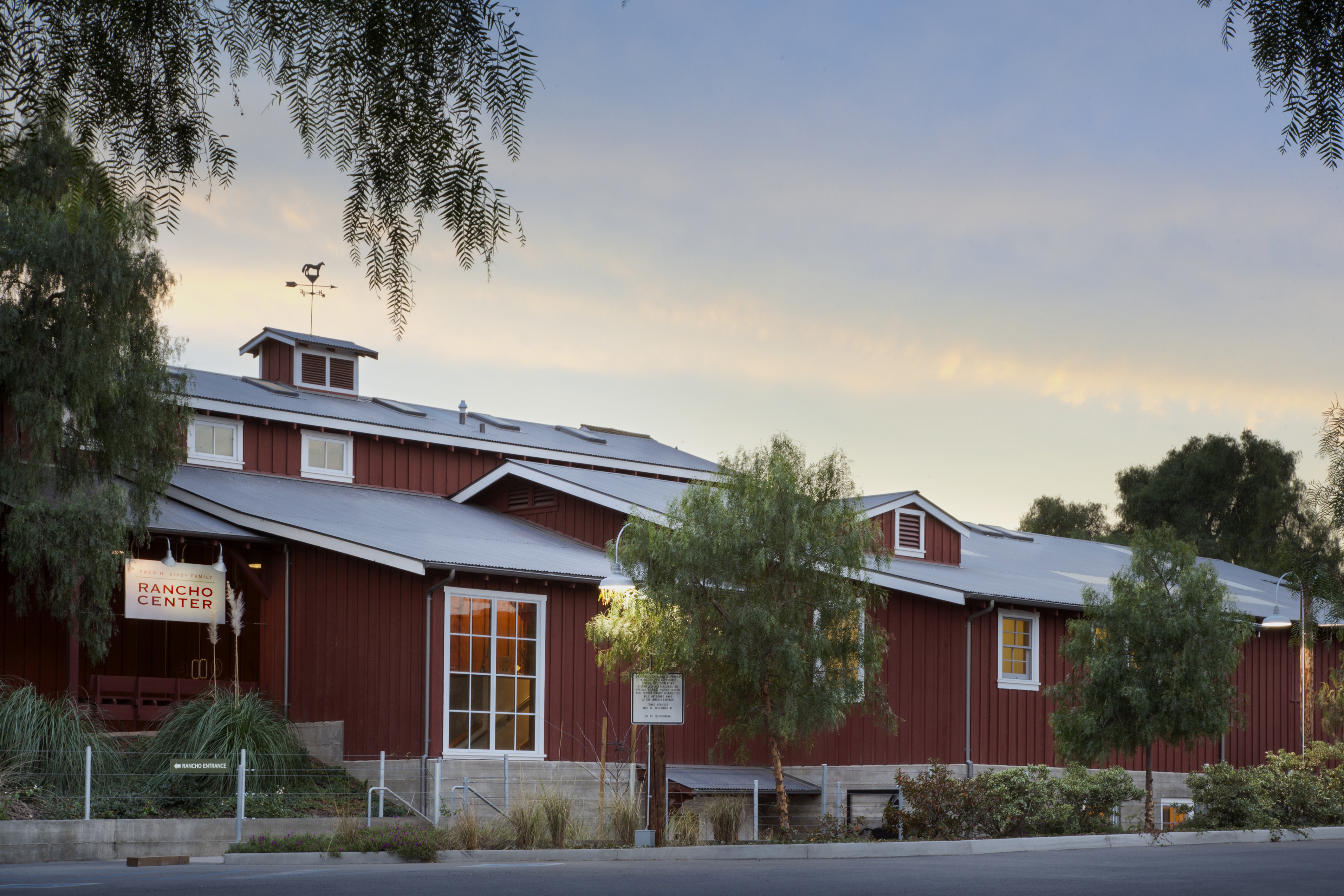
Rancho Los Alamitos takes its name from an 1834 Mexico, Mexican partition of the 1784 Rancho Los Nietos, a Ranchos of California, Spanish concession, covering an area in present-day California's southwestern Los Angeles County, California, Los Angeles County and northwestern Orange County, California, Orange County. Los Alamitos means the Little Populus sect. Aegiros, Cottonwoods or Populus, Poplars in Spanish language, Spanish, after the California native plants, native Populus fremontii, Fremont Cottonwood trees there. Rancho Los Alamitos originally included much of the area of present-day eastern Long Beach, California, Long Beach, all of Los Alamitos, California, Los Alamitos and Rossmoor, California, Rossmoor, and most of Seal Beach, California, Seal Beach, Cypress, California, Cypress, Stanton, California, Stanton and Garden Grove, California, Garden Grove. It is also sometimes referred to as Bixby Ranch, after its last private owners. The early 19th century adobe ranch ho ... [...More Info...] [...Related Items...] OR: [Wikipedia] [Google] [Baidu] |
Rancho Los Cerritos
Rancho Los Cerritos was a 1834 land grant in present-day southern Los Angeles County and Orange County, California The grant was the result of a partition of the Rancho Los Nietos grant. "Cerritos" means "little hills" in Spanish. The rancho lands include the present-day cities of Cerritos, Paramount, Bellflower and Long Beach. History At the request of Manuel Nieto heirs, governor José Figueroa in 1834, officially declared the Rancho Los Nietos grant under Mexican rule and ordered its partition into five smaller ranchos: Las Bolsas, Los Alamitos, Los Cerritos, Los Coyotes, and Santa Gertrudes. Manuela Nieto (daughter of Manuel Nieto) and her husband Guillermo Cota received Los Cerritos. Jonathan Temple married Rafaela Cota in 1830, and in 1843, he purchased Rancho Los Cerritos from the Cota family. With the cession of California to the United States following the Mexican–American War, the 1848 Treaty of Guadalupe Hidalgo provided that the land grants would b ... [...More Info...] [...Related Items...] OR: [Wikipedia] [Google] [Baidu] |
Rancho Santa Gertrudes
Rancho Santa Gertrudes was a 1834 Mexican land grant, in present-day Los Angeles County, California, resulting from a partition of Rancho Los Nietos. A former site of Nacaugna, the rancho lands included the present-day cities of Downey, Santa Fe Springs and the northern part of Norwalk. History At the request of Manuel Nieto heirs, governor José Figueroa in 1834, officially declared the Rancho Los Nietos grant under Mexican rule and ordered its partition into five smaller ranchos: Las Bolsas, Los Alamitos, Los Cerritos, Los Coyotes, and Santa Gertrudes. Josefa Cota (widow of Antonio Maria Nieto, son of Manuel Nieto) received the Rancho Santa Gertrudes grant. Lemuel Carpenter (1808–1859), who had married Maria de Los Angeles Dominguez, a niece of Josefa Cota, bought the rancho in 1843 from Josefa Cota, his aunt by marriage. With the cession of California to the United States following the Mexican–American War, the 1848 Treaty of Guadalupe Hidalgo provided that th ... [...More Info...] [...Related Items...] OR: [Wikipedia] [Google] [Baidu] |
Rancho Los Coyotes
Rancho Los Coyotes was a 1834 Mexican land grant resulting from the partition of the Rancho Los Nietos grant, in present-day southeastern Los Angeles County and northwestern Orange County, California. The rancho lands include the present-day cities of Cerritos, La Mirada, Artesia, Stanton, and Buena Park. History At the request of Manuel Nieto's heirs, Governor José Figueroa in 1834 officially declared the Rancho Los Nietos grant under Mexican rule and ordered its partition into five smaller ranchos: Las Bolsas, Los Alamitos, Los Cerritos, Los Coyotes, and Santa Gertrudes. Juan José Nieto (eldest son of Manuel Nieto) received Los Coyotes. In 1840, Juan José Nieto sold Rancho Los Coyotes to Juan Bautista Leandry, an Italian immigrant who settled in California in 1827 and was married to Maria Francisca Uribe, who renamed it "La Buena Esperanza," – The Good Hope – but it was still generally known as Los Coyotes. Leandry died in 1842, and his widow, Maria Francisc ... [...More Info...] [...Related Items...] OR: [Wikipedia] [Google] [Baidu] |
Rancho Las Bolsas
Rancho Las Bolsas was a 1834 Mexican land grant resulting from the partition of Rancho Los Nietos, located from the coast on inland within present day northwestern Orange County, California. The Spanish name '' "las bolsas" '' means "the pockets", and refers to pockets of land amongst the marsh wetlands of the Santa Ana River estuary. The rancho lands, adjacent to the southeast of Rancho La Bolsa Chica, include the present day cities of Huntington Beach, Garden Grove, Fountain Valley and Westminster. History At the request of the Manuel Nieto heirs, Governor José Figueroa in 1834, officially declared the Rancho Los Nietos grant under Mexican rule and ordered its partition into five smaller ranchos: Las Bolsas, Los Alamitos, Los Cerritos, Los Coyotes, and Santa Gertrudes. Maria Catarina Ruiz (widow of Jose Antonio Nieto, son of Manuel Nieto) received Las Bolsas. With the cession of California to the United States following the Mexican-American War, the 1848 ... [...More Info...] [...Related Items...] OR: [Wikipedia] [Google] [Baidu] |
History Of California
The history of California can be divided into the Indigenous peoples of the Americas, Native American period (about 10,000 years ago until 1542), the Exploration of North America, European exploration period (1542–1769), the Spanish colonial period (1769–1821), the Mexico, Mexican period (1821–1848), and United States statehood (September 9, 1850–present). California was one of the most culturally and linguistically diverse areas in pre-Columbian North America. After contact with :Spanish explorers of the Pacific, Spanish explorers, many of the Native American disease and epidemics, Native Americans died from foreign diseases. Finally, in the 19th century there was a genocide by United States government and private citizens, which is known as the California genocide. After the Portolá expedition of 1769–1770, Spanish missionaries began setting up 21 Spanish missions in California, California missions on or near the coast of Alta California, Alta (Upper) California, b ... [...More Info...] [...Related Items...] OR: [Wikipedia] [Google] [Baidu] |


