|
Dehong
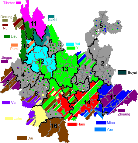
The Dehong Dai and Jingpo Autonomous Prefecture is an autonomous prefecture in western Yunnan province, China. It is bordered by Baoshan to the east and Myanmar's Kachin State to the west. Its titular ethnic minorities are the Dai and Jingpo, who make up 28 and 11 percent of the prefecture's population, respectively. Etymology Tai Nuea is the origin language of the word "Dehong", in Tai Le script (the script used to write the Tai Nüa language by the Tai Nua people) is written as "", transliterated to Latin as . Dehong means the lower reaches of the Nu River. The Chinese characters for Dehong are "". These two characters are a compound of , "moral" or "value"; and , "magnificent" or "great". History Early history Dianyue and Ailao were the ancient countries recorded in Chinese literature in the Dehong area, and Guozhanbi ( Kawsampi) was an ancient country established by the Dai people and recorded in Dai legends. Dianyue In the history book ''Records of the Grand Histo ... [...More Info...] [...Related Items...] OR: [Wikipedia] [Google] [Baidu] |
Mangshi
Mangshi ( zh, c=芒市, w=Mangshih; ; Jingpho language, Jingpho: ), former name Luxi ( zh, labels=no , c=潞西), is a county-level city and the seat of Dehong Dai and Jingpo Autonomous Prefecture in western Yunnan province, China. Mangshi has an area of , with an urban area of . Han Chinese, Dai people (Tai Nuea branch) and Jingpo people (Zaiwa branch) are the major ethnic groups. Luxi County was founded in 1949, and became a county-level city in 1996. Etymology Mangshi was originally called Luxi (). The name "Luxi" originated in 1934 when the central government of Republic of China established the direct ruled government Luxi Administrative Bureau (). The name means "west of the Lu River," referring to "Lujiang" (), another name for the Salween River, Nujiang (Salween) River. The name "Mangshi" evolved from the ancient tribal name Mangshi (), which was used to refer to the ancestors of the Palaung people, De'ang people. The earliest known use of "Mangshi" as a place name appe ... [...More Info...] [...Related Items...] OR: [Wikipedia] [Google] [Baidu] |
Tai Nuea Language
Tai Nuea or Tai Nüa (; ; , ), also called Dehong Tai (; , ) and Chinese Shan, is one of the languages spoken by the Dai people in China, especially in the Dehong Dai and Jingpo Autonomous Prefecture in the southwest of Yunnan Province. It is closely related to the other Tai languages and could be considered a dialect of Shan. It should not be confused with Tai Lü (Xishuangbanna Dai). Names Most Tai Nuea people call themselves Tai Le (, ), which means 'Upper Tai' or 'Northern Tai'. Note that this is different from Tai Lue, which is pronounced in Tai Nuea. Another autonym is (), where means 'bottom, under, the lower part (of)' and means 'the Hong River' (Luo 1998). Dehong is a transliteration of the term . The language is also known as Tai Mau, Tai Kong and Tai Na. Dialects Zhou (2001:13) classifies Tai Nuea into the Dehong () and Menggeng () dialects. Together, they add up to a total of 541,000 speakers. *Dehong dialect : 332,000 speakers ** Dehong Prefecture : M ... [...More Info...] [...Related Items...] OR: [Wikipedia] [Google] [Baidu] |
List Of Administrative Divisions Of Yunnan
Yunnan, a province of the People's Republic of China, is made up of the following administrative divisions. Administrative divisions All of these administrative divisions are explained in greater detail at political divisions of China. } , , , , , , 530126 , , SLY , - bgcolor="#E6E6FA" , Songming County , , , , , , 530127 , , SMI , - bgcolor="#E6E6FA" , Luquan County , , , , , , 530128 , , LUC , - bgcolor="#E6E6FA" , Xundian County , , , , , , 530129 , , XDN , - bgcolor="#DCDCDC" , Anning city , , , , , , 530181 , , ANG , - , - style = "background:#606060; height: 2pt" , colspan = "6" , , - , bgcolor="#FFFFFF" rowspan=9 , Qujing city (5303 / QJS) , Qilin District , , , , , , 530302 , , QLQ , - , Zhanyi District , , , , , , 530303 , , ZYB , - , Malong District , , , , , , 530304 , , , - bgcolor="#E6E6FA" , Luliang County , , , , , , 530322 , , LLX , - bgcolor="#E6E6FA" , Shizong County , , , , ... [...More Info...] [...Related Items...] OR: [Wikipedia] [Google] [Baidu] |
Yunnan
Yunnan; is an inland Provinces of China, province in Southwestern China. The province spans approximately and has a population of 47.2 million (as of 2020). The capital of the province is Kunming. The province borders the Chinese provinces of Guizhou, Sichuan, Autonomous regions of China, autonomous regions of Guangxi and Tibet Autonomous Region, Tibet, as well as Southeast Asian countries Myanmar (Burma), Vietnam, and Laos. Yunnan is China's fourth least developed province based on disposable income per capita in 2014. Yunnan is situated in a mountainous area, with high elevations in the Northwest and low elevations in the Southeast. Most of the population lives in the eastern part of the province. In the west, the altitude can vary from the mountain peaks to river valleys as much as . Yunnan is rich in natural resources and has the largest diversity of plant life in China. Of the approximately 30,000 species of Vascular plant, higher plants in China, Yunnan has perhaps 17, ... [...More Info...] [...Related Items...] OR: [Wikipedia] [Google] [Baidu] |
Yingjiang County
Yingjiang County ( zh, t=盈江縣, s=盈江县, p=Yíngjiāng Xiàn; ; Jingpho: ; ) is a county in Dehong Prefecture, Yunnan province, China, bordering Tengchong to the east, Lianghe County to the southeast, Longchuan County to the south and Burma's Kachin State to the west. Geography Yingjiang county has a border of with Kachin State, Myanmar in the west. The Danzha River ( zh, c=胆扎河, p=Dǎnzhá Hé) and Binglang River ( zh, c=, p=Bīngláng Jiāng) meet near Jiucheng ( zh, t=舊城, p=Jiùchéng) and become the Daying River (Dàyíngjiāng). The Daying then flows through Yingjiang County into Myanmar and into the Irrawaddy River, with the confluence near Bhamo. The Daying is known as the Taping (大平江; Dàpíng Jiāng) in Myanmar. Yingjiang county is mountainous with several alluvial plains. The county has various climate types, with ranges from the tropical, the subtropical, to the temperate zones. Intact forests can be seen in the mountains above . The elev ... [...More Info...] [...Related Items...] OR: [Wikipedia] [Google] [Baidu] |
Ruili
Ruili ( zh, s=瑞丽 , t=瑞麗 , p=Ruìlì; ; ; ; ), called Möng Mao in Tai, is a county-level city of Dehong Prefecture, in the west of Yunnan province, China. It is a major border crossing between China and Myanmar, with the town of Muse located across the border. Name The city is named after the Shweli River. 瑞 ''ruì'' means "auspicious", and 丽 ''lì'' means "beautiful". An older name of Ruili is Mengmao (), derived from the Tai Nuea language "Mong Mao" (), meaning "foggy place". Geography and climate Ruili is on the border with Myanmar. 64% of the population of Ruili are members of five highland and lowland ethnic minorities, including Dai, Jingpo, Deang, Lisu, and Achang. It is an important location for trade with Myanmar, in both legal and illegal goods and services. Prostitution and drug trade in the city are not uncommon. [...More Info...] [...Related Items...] OR: [Wikipedia] [Google] [Baidu] |
Longchuan County, Yunnan
Longchuan County ( zh, s=陇川县 , t=隴川縣 , p=Lǒngchuān Xiàn; ; Jingpho: ; ) is a county located in Dehong Prefecture, Yunnan province, southwestern China. Administration The county seat is in Zhangfeng Town (). Three other townships have been upgraded to town (镇, ''zhen'') status: Longba (陇把), Chengzi (城子), Jinghan (景罕) At present, Longchuan County has 4 towns, 4 townships and 1 ethnic township. ;4 towns ;4 townships ;1 ethnic township * Husa Achang Ethnic Township () Culture Many citizens of Dehong Prefecture belong to the Jingpo-nation ethnic group, an official minority in the People's Republic of China. They are one and the same as the people of Kachin State, the adjacent part of Myanmar Myanmar, officially the Republic of the Union of Myanmar; and also referred to as Burma (the official English name until 1989), is a country in northwest Southeast Asia. It is the largest country by area in Mainland Southeast Asia and has ... ... [...More Info...] [...Related Items...] OR: [Wikipedia] [Google] [Baidu] |
Dai People
The Dai people ( Burmese: ရှမ်းလူမျိုး; ; ; ; , ; , ; zh, c=, p=Dǎizú) are several Tai-speaking ethnic groups living in the Xishuangbanna Dai Autonomous Prefecture and the Dehong Dai and Jingpo Autonomous Prefecture of China's Yunnan Province. The Dai people form one of the 56 ethnic groups officially recognized by the People's Republic of China. By extension, the term can apply to groups in Laos, Vietnam, Thailand and Myanmar when Dai is used to mean specifically Tai Yai, Lue, Chinese Shan, Tai Dam, Tai Khao or even Tai in general. For other names, see the table below. Name ambiguity The Dai people are closely related to the Shan, Lao and Thai people who form a majority in Laos and Thailand, and a large minority in Myanmar. Originally, the Tai, or Dai, lived closely together in modern Yunnan Province until political chaos and wars in the north at the end of the Tang and Song dynasty and various nomadic peoples prompted some to move furth ... [...More Info...] [...Related Items...] OR: [Wikipedia] [Google] [Baidu] |
Achang People
The Achang ( zh, c=, p=Āchāngzú), also known as the Ngac'ang (their own name) is an ethnic group. They are one of Tibeto-Burman languages speaking people. They form one of the 56 ethnic groups officially recognized by the People's Republic of China. They also live in Myanmar, where they're known as Maingtha () in Shan State and Ngochang in Kachin State. The Achang number approximately 27,700, with 27,600 residing in Yunnan province, primarily in Lianghe County of Dehong Autonomous Prefecture. The Achang speak a Burmish language, related to Burmese, known as Achang. However, there is no indigenous writing system for the language, and Chinese characters are often used instead. Many Achang also speak Tai Lü language, mainly for commercial transactions with the Dai people. The Husa Achang (戶撒), living in Longchuan County (also in Dehong), speak a distinct dialect and consider themselves to be a separate group. In the 1950s, they filed an unsuccessful application to be ... [...More Info...] [...Related Items...] OR: [Wikipedia] [Google] [Baidu] |
Lianghe County
Lianghe County ( zh, s=梁河县 , p=Liánghé Xiàn; ; Jingpho: ; ) is located in Dehong Prefecture, Yunnan province, southwest China Southwestern China () is a region in the People's Republic of China. It consists of five provincial administrative regions, namely Chongqing, Sichuan, Guizhou, Yunnan, and Xizang. Geography Southwestern China is a rugged and mountainous region, .... Administrative divisions Lianghe County has 3 towns, 4 townships and 2 ethnic townships. ;3 towns * Zhedao () * Mangdong () * Mengyang () ;4 townships ;2 ethnic townships * Jiubao Achang Ethnic Township () * Nangsong Achang Ethnic Township () History Lianghe County was home to one of the Koshanpye Chinese Shan States. It was annexed into China in the early 20th century. Climate References External linksLianghe County Official Website County-level divisions of Dehong Prefecture {{Yunnan-geo-stub ... [...More Info...] [...Related Items...] OR: [Wikipedia] [Google] [Baidu] |
List Of Cities In China
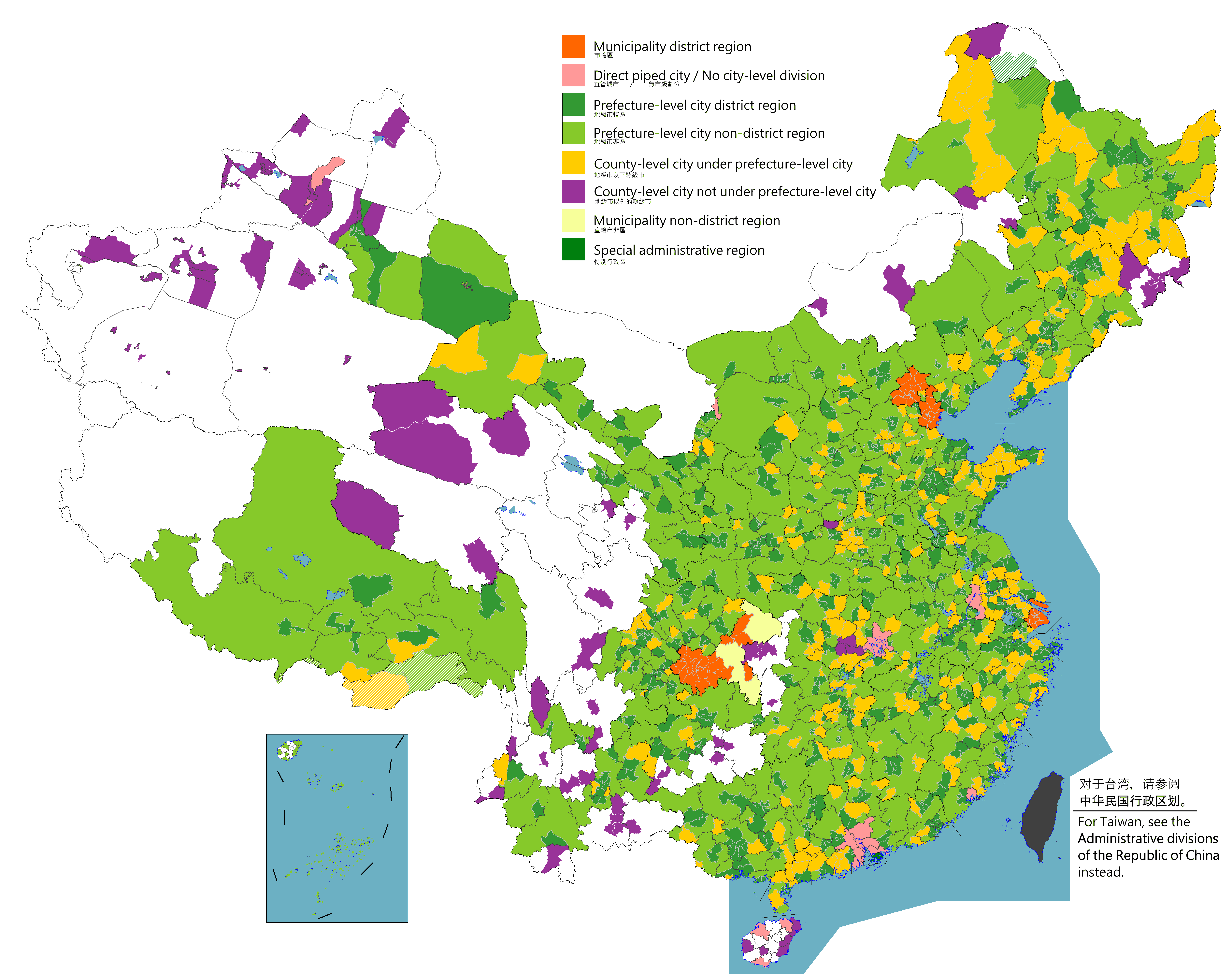
According to the administrative divisions of China, administrative divisions of the China, People's Republic of China, there are three levels of cities: provincial-level cities (consisting of Direct-administered municipalities of China, directly-administered municipalities and the Special administrative regions of China, special administrative regions of Hong Kong and Macau), Prefecture-level city, prefecture-level cities, and County-level city, county-level cities. As of January 2024, the PRC has a total of 707 cities: 4 municipalities, 2 SARs, 293 prefecture-level cities (including the 15 Sub-provincial division, sub-provincial cities) and 408 county-level cities (including the 38 Sub-prefectural city, sub-prefectural cities and 12 Xinjiang Production and Construction Corps, XXPC cities). This list does not include any cities in the Political status of Taiwan, disputed Taiwan Province and Fujian Province, Republic of China, portions of Fujian Province, which are claimed by ... [...More Info...] [...Related Items...] OR: [Wikipedia] [Google] [Baidu] |
Autonomous Prefecture
Autonomous prefectures ( zh, c=自治州, p=zìzhìzhōu) are one type of autonomous administrative divisions of China, autonomous administrative division in China, existing at the Prefecture-level divisions of China, prefectural level, with either list of ethnic groups in China and Taiwan, ethnic minorities forming over 50% of the population or being, most commonly, the historic home of significant minorities. The official name of an autonomous prefecture includes the most significant minority in that region, sometimes two, rarely three. For example, a prefecture with a large number of Kazakhs (''Kazak'' in official naming system) may be called a ''Kazak Autonomous Prefecture''. Like all other prefectural level divisions, autonomous prefectures are divided into County-level division, county level divisions. There is one exception: Ili Kazak Autonomous Prefecture contains two prefectures of its own. Under the Constitution of the People's Republic of China, autonomous prefectures ca ... [...More Info...] [...Related Items...] OR: [Wikipedia] [Google] [Baidu] |


