|
Cyclogenesis
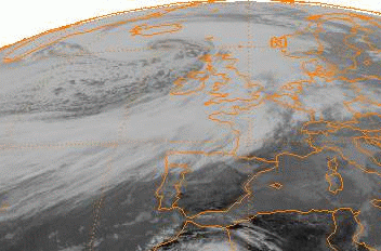
Cyclogenesis is the development or strengthening of cyclonic circulation in the atmosphere (a low-pressure area). Cyclogenesis is an umbrella term for at least three different processes, all of which result in the development of some sort of cyclone, and at any size from the microscale to the synoptic scale. * Tropical cyclones form due to latent heat driven by significant thunderstorm activity, developing a warm core. * Extratropical cyclone Extratropical cyclones, sometimes called mid-latitude cyclones or wave cyclones, are low-pressure areas which, along with the anticyclones of high-pressure areas, drive the weather over much of the Earth. Extratropical cyclones are capable o ...s form as waves along weather fronts before occluding later in their life cycle as cold core cyclones. * Mesocyclones form as warm core cyclones over land, and can lead to tornado formation. Waterspouts can also form from mesocyclones, but more often develop from environments of high ins ... [...More Info...] [...Related Items...] OR: [Wikipedia] [Google] [Baidu] |
Cyclone
In meteorology, a cyclone () is a large air mass that rotates around a strong center of low atmospheric pressure, counterclockwise in the Northern Hemisphere and clockwise in the Southern Hemisphere as viewed from above (opposite to an anticyclone). Cyclones are characterized by inward-spiraling winds that rotate about a zone of low-pressure area, low pressure. The largest low-pressure systems are polar vortex, polar vortices and extratropical cyclones of the largest scale (the synoptic scale). Warm-core cyclones such as tropical cyclones and subtropical cyclones also lie within the synoptic scale. Mesocyclones, tornadoes, and dust devils lie within smaller mesoscale meteorology, mesoscale. Upper level cyclones can exist without the presence of a surface low, and can pinch off from the base of the tropical upper tropospheric trough during the summer months in the Northern Hemisphere. Cyclones have also been seen on extraterrestrial planets, such as Mars, Jupiter, and Neptune. ... [...More Info...] [...Related Items...] OR: [Wikipedia] [Google] [Baidu] |
Explosive Cyclogenesis
Explosive cyclogenesis (also referred to as a weather bomb, meteorological bomb, explosive development, bomb cyclone, or bombogenesis) is the rapid deepening of an extratropical cyclonic low-pressure area. The change in pressure needed to classify something as explosive cyclogenesis is latitude dependent. For example, at 60° latitude, explosive cyclogenesis occurs if the central pressure decreases by or more in 24 hours. This is a predominantly maritime, winter event, but also occurs in continental settings, This process is the extratropical equivalent of the tropical rapid deepening. Although their cyclogenesis is entirely different from that of tropical cyclones, bomb cyclones can produce winds of , the same order as the first categories of the Saffir–Simpson scale, and yield heavy precipitation. Even though only a minority of the bomb cyclones become so strong, some weaker ones have also caused significant damage. History In the 1940s and 1950s, meteorologists at the Berg ... [...More Info...] [...Related Items...] OR: [Wikipedia] [Google] [Baidu] |
Anticyclogenesis
Anticyclogenesis is the development or strengthening of an anticyclonic circulation in the atmosphere. It is the opposite of anticyclolysis (the dissolution or weakening of an anticyclone) and has a cyclonic equivalent known as cyclogenesis. Anticyclones are alternatively referred to as high pressure systems. Process High-pressure systems form due to downward motion through the troposphere, the atmospheric layer where weather occurs. Preferred areas within a synoptic flow pattern in higher levels of the troposphere are beneath the western side of troughs. On weather maps, these areas show converging winds (isotachs), also known as confluence, or converging height lines near or above the level of non-divergence, which is near the 500 hPa pressure surface about midway up through the troposphere.Glossary of Meteorology (2009)Level of nondivergence.American Meteorological Society. Retrieved on 2009-02-17.Konstantin Matchev (2009)Middle-Latitude Cyclones - II. University of Florida. R ... [...More Info...] [...Related Items...] OR: [Wikipedia] [Google] [Baidu] |
Low-pressure Area
In meteorology, a low-pressure area, low area or low is a region where the atmospheric pressure is lower than that of surrounding locations. Low-pressure areas are commonly associated with inclement weather (such as cloudy, windy, with possible rain or storms), while high-pressure areas are associated with lighter winds and clear skies. Winds circle anti-clockwise around lows in the northern hemisphere, and clockwise in the southern hemisphere, due to opposing Coriolis force, Coriolis forces. Low-pressure systems form under areas of wind divergence that occur in the upper levels of the Atmosphere of Earth, atmosphere (aloft). The formation process of a low-pressure area is known as cyclogenesis. In Meteorology#Dynamic meteorology, meteorology, atmospheric divergence aloft occurs in two kinds of places: * The first is in the area on the east side of upper Trough (meteorology), troughs, which form half of a Rossby wave within the Westerlies (a trough (meteorology), trough with l ... [...More Info...] [...Related Items...] OR: [Wikipedia] [Google] [Baidu] |
Tropical Cyclone
A tropical cyclone is a rapidly rotating storm system characterized by a low-pressure center, a closed low-level atmospheric circulation, strong winds, and a spiral arrangement of thunderstorms that produce heavy rain and squalls. Depending on its location and strength, a tropical cyclone is referred to by different names, including hurricane (), typhoon (), tropical storm, cyclonic storm, tropical depression, or simply cyclone. A hurricane is a strong tropical cyclone that occurs in the Atlantic Ocean or northeastern Pacific Ocean, and a typhoon occurs in the northwestern Pacific Ocean. In the Indian Ocean, South Pacific, or (rarely) South Atlantic, comparable storms are referred to simply as "tropical cyclones", and such storms in the Indian Ocean can also be called "severe cyclonic storms". "Tropical" refers to the geographical origin of these systems, which form almost exclusively over tropical seas. "Cyclone" refers to their winds moving in a circle, whirling ... [...More Info...] [...Related Items...] OR: [Wikipedia] [Google] [Baidu] |
Extratropical Cyclone
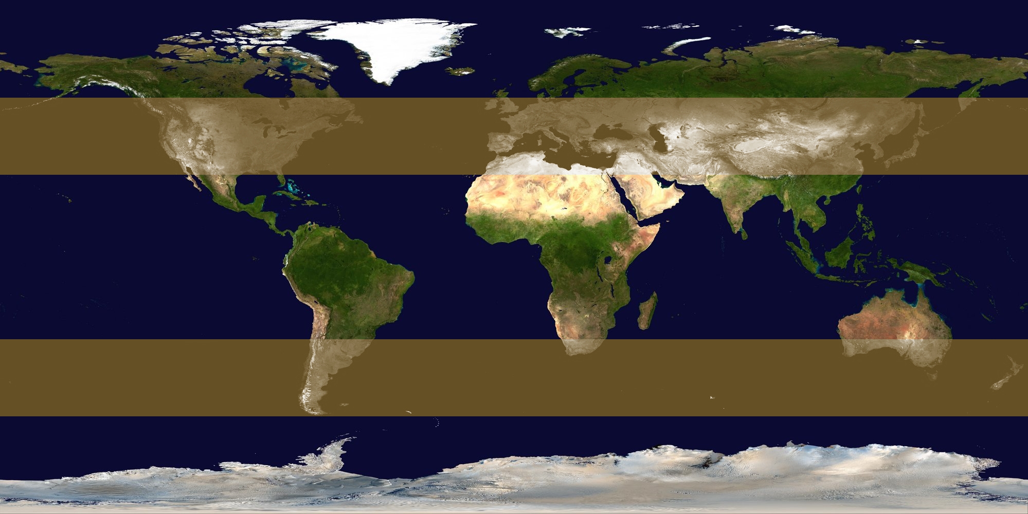
Extratropical cyclones, sometimes called mid-latitude cyclones or wave cyclones, are low-pressure areas which, along with the anticyclones of high-pressure areas, drive the weather over much of the Earth. Extratropical cyclones are capable of producing anything from cloudiness and mild showers to severe gales, thunderstorms, blizzards, and tornadoes. These types of cyclones are defined as large scale (synoptic) low pressure weather systems that occur in the middle latitudes of the Earth. In contrast with tropical cyclones, extratropical cyclones produce rapid changes in temperature and dew point along broad lines, called weather fronts, about the center of the cyclone. Terminology The term "cyclone" applies to numerous types of low pressure areas, one of which is the extratropical cyclone. The descriptor ''extratropical'' signifies that this type of cyclone generally occurs outside the tropics and in the middle latitudes of Earth between 30° and 60° latitude. Th ... [...More Info...] [...Related Items...] OR: [Wikipedia] [Google] [Baidu] |
Extratropical Cyclones
Extratropical cyclones, sometimes called mid-latitude cyclones or wave cyclones, are low-pressure areas which, along with the anticyclones of high-pressure areas, drive the weather over much of the Earth. Extratropical cyclones are capable of producing anything from cloudiness and mild showers to severe gales, thunderstorms, blizzards, and tornadoes. These types of cyclones are defined as large scale (synoptic) low pressure weather systems that occur in the middle latitudes of the Earth. In contrast with tropical cyclones, extratropical cyclones produce rapid changes in temperature and dew point along broad lines, called weather fronts, about the center of the cyclone. Terminology The term "cyclone" applies to numerous types of low pressure areas, one of which is the extratropical cyclone. The descriptor ''extratropical'' signifies that this type of cyclone generally occurs outside the tropics and in the middle latitudes of Earth between 30° and 60° latitude. They are termed ... [...More Info...] [...Related Items...] OR: [Wikipedia] [Google] [Baidu] |
Cold-core Low
A cold-core low, also known as an upper level low or cold-core cyclone, is a cyclone aloft which has an associated cold pool of air residing at high altitude within the Earth's troposphere, without a frontal structure. It is a low pressure system that strengthens with height in accordance with the thermal wind relationship. If a weak surface circulation forms in response to such a feature at subtropical latitudes of the eastern north Pacific or north Indian oceans, it is called a subtropical cyclone. Cloud cover and rainfall mainly occurs with these systems during the day. Severe weather, such as tornadoes, can occur near the center of cold-core lows. Cold lows can help spawn cyclones with significant weather impacts, such as polar lows, and Kármán vortices. Cold lows can lead directly to the development of tropical cyclones, owing to their associated cold pool of air aloft or by acting as additional outflow channels to aid in further development. Characteristics Col ... [...More Info...] [...Related Items...] OR: [Wikipedia] [Google] [Baidu] |
Nor'easter
A nor'easter (also northeaster; see below), or an East Coast low is a synoptic-scale extratropical cyclone in the western North Atlantic Ocean. The name derives from the direction of the winds that blow from the northeast. The original use of the term in North America is associated with storms that impact the upper north Atlantic coast of the United States and the Atlantic Provinces of Canada. Typically, such storms originate as a low-pressure area that forms within of the shore between North Carolina and Massachusetts. The precipitation pattern is similar to that of other extratropical storms. Nor'easters are usually accompanied by heavy rain or snow, and can cause severe coastal flooding, coastal erosion, hurricane-force winds, or blizzard conditions. Nor'easters are usually most intense during winter in New England and Atlantic Canada. They thrive on converging air masses—the cold polar air mass and the warmer air over the water—and are more severe in winter ... [...More Info...] [...Related Items...] OR: [Wikipedia] [Google] [Baidu] |
Madden–Julian Oscillation
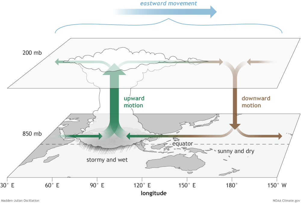
The Madden–Julian oscillation (MJO) is the largest element of the intraseasonal (30- to 90-day) variability in the tropical atmosphere. It was discovered in 1971 by Roland Madden and Paul Julian of the American National Center for Atmospheric Research (NCAR). It is a large-scale coupling between atmospheric circulation and tropical deep atmospheric convection. Unlike a standing pattern like the El Niño–Southern Oscillation (ENSO), the Madden–Julian oscillation is a traveling pattern that propagates eastward, at approximately , through the atmosphere above the warm parts of the Indian and Pacific oceans. This overall circulation pattern manifests itself most clearly as anomalous rainfall. The Madden–Julian oscillation is characterized by an eastward progression of large regions of both enhanced and suppressed tropical rainfall, observed mainly over the Indian and Pacific Ocean. The anomalous rainfall is usually first evident over the western Indian Ocean, and remains e ... [...More Info...] [...Related Items...] OR: [Wikipedia] [Google] [Baidu] |
Rapid Intensification
In meteorology, rapid intensification is a situation where a tropical cyclone intensifies dramatically in a short period of time. The United States National Hurricane Center defines rapid intensification as an increase in the maximum sustained winds of a tropical cyclone of at least in a 24-hour period. Necessary conditions External In order for rapid intensification to occur, several conditions must be in place. Water temperatures must be extremely warm (near or above ), and water of this temperature must be sufficiently deep such that waves do not churn deeper cooler waters up to the surface. Wind shear must be low; when wind shear is high, the convection and circulation in the cyclone will be disrupted. Dry air can also limit the strengthening of tropical cyclones. Internal Usually, an anticyclone in the upper layers of the troposphere above the storm must also be present for extremely low surface pressures to develop. This is because air must be converging towards the low p ... [...More Info...] [...Related Items...] OR: [Wikipedia] [Google] [Baidu] |


