|
Battle Of Diu
The Battle of Diu was a naval battle fought on 3 February 1509 in the Arabian Sea, in the port of Diu, India, between the Portuguese Empire and a joint fleet of the Sultan of Gujarat, the Mamlûk Burji Sultanate of Egypt and the Zamorin of Calicut.Rogers, Clifford J. ''Readings on the Military Transformation of Early Modern Europe'', San Francisco:Westview Press, 1995, pp. 299–333 aAngelfire.com/ref> The Portuguese victory was critical: the great Muslim alliance was soundly defeated, easing the Portuguese strategy of controlling the Indian Ocean to route trade down the Cape of Good Hope, circumventing the historical spice trade controlled by the Arabs and the Venetians through the Red Sea and Persian Gulf. After the battle, the Kingdom of Portugal rapidly captured several key ports in the Indian Ocean including Goa, Ceylon, Malacca, Bom Baim and Ormuz. The territorial losses crippled the Mamluk Sultanate and the Gujarat Sultanate. The battle catapulted the growth ... [...More Info...] [...Related Items...] OR: [Wikipedia] [Google] [Baidu] |
Lithograph
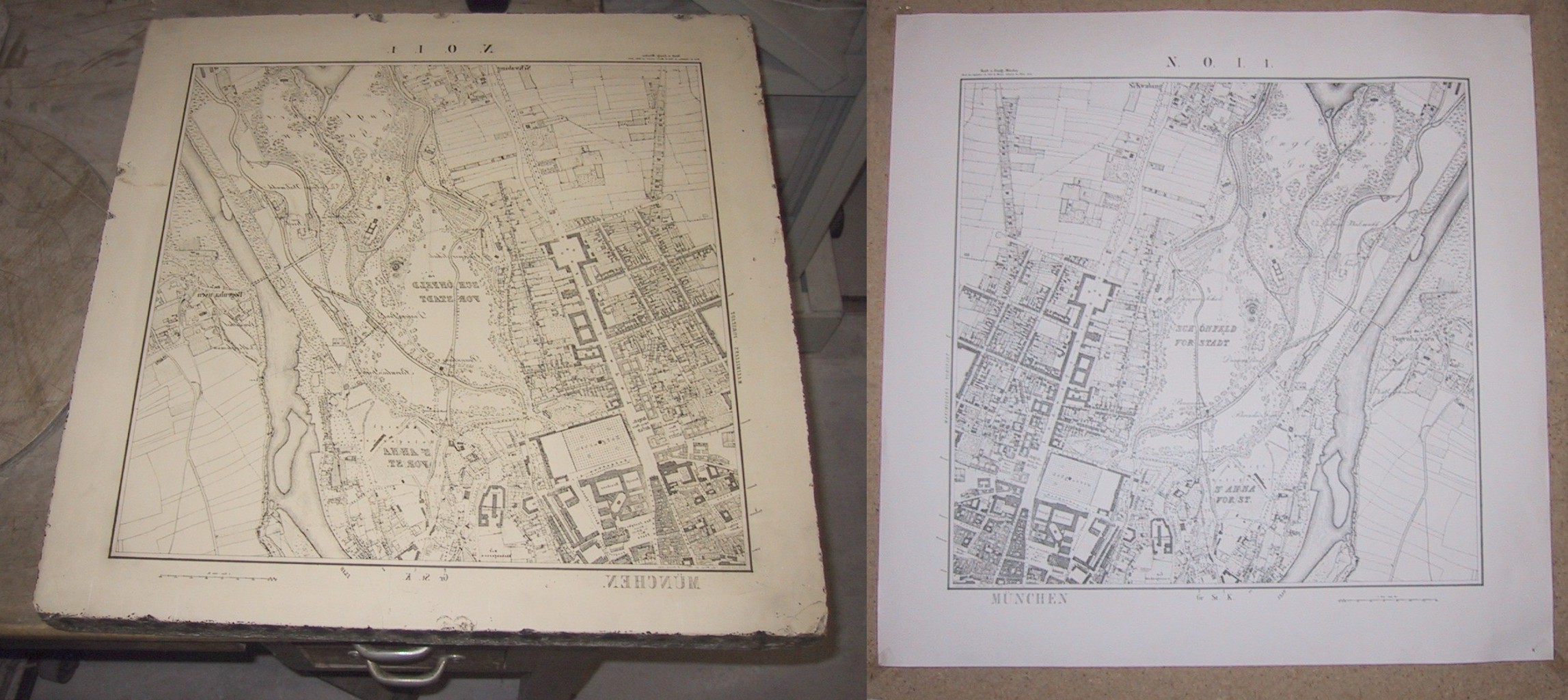
Lithography () is a planographic method of printing originally based on the miscibility, immiscibility of oil and water. The printing is from a stone (lithographic limestone) or a metal plate with a smooth surface. It was invented in 1796 by the German author and actor Alois Senefelder and was initially used mostly for sheet music, musical scores and maps.Meggs, Philip B. ''A History of Graphic Design''. (1998) John Wiley & Sons, Inc. p 146, .Carter, Rob, Ben Day, Philip Meggs. ''Typographic Design: Form and Communication'', Third Edition. (2002) John Wiley & Sons, Inc. p. 11. Lithography can be used to print text or images onto paper or other suitable material. A lithograph is something printed by lithography, but this term is only used for printmaking, fine art prints and some other, mostly older, types of printed matter, not for those made by modern commercial lithography. Traditionally, the image to be printed was drawn with a greasy substance, such as oil, fat, or wax on ... [...More Info...] [...Related Items...] OR: [Wikipedia] [Google] [Baidu] |
Galley
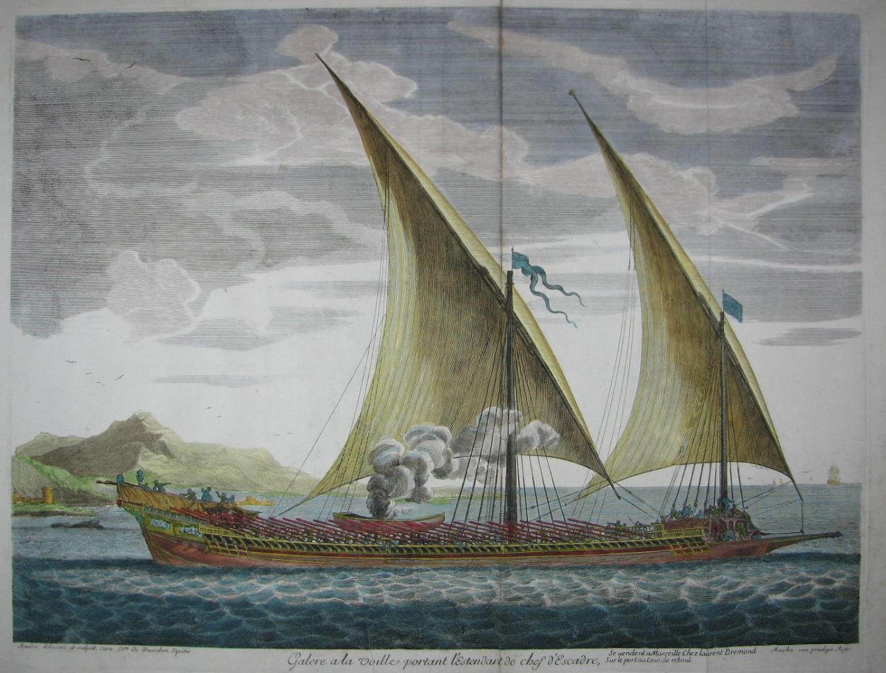
A galley is a type of ship optimised for propulsion by oars. Galleys were historically used for naval warfare, warfare, Maritime transport, trade, and piracy mostly in the seas surrounding Europe. It developed in the Mediterranean world during Classical antiquity, antiquity and continued to exist in various forms until the early 19th century. It typically had a long, slender hull, shallow draft (hull), draft, and often a low freeboard (nautical), freeboard. Most types of galleys also had sails that could be used in favourable winds, but they relied primarily on oars to move independently of winds and currents or in battle. The term "galley" originated from a Greek term for a small type of galley and came in use in English from about 1300. It has occasionally been used for unrelated vessels with similar military functions as galley but which were not Mediterranean in origin, such as medieval Scandinavian longships, 16th-century Ghali (ship), Acehnese ghalis and 18th-century North ... [...More Info...] [...Related Items...] OR: [Wikipedia] [Google] [Baidu] |
Cape Of Good Hope
The Cape of Good Hope ( ) is a rocky headland on the Atlantic Ocean, Atlantic coast of the Cape Peninsula in South Africa. A List of common misconceptions#Geography, common misconception is that the Cape of Good Hope is the southern tip of Africa, based on the misbelief that the Cape was the dividing point between the Atlantic Ocean, Atlantic and Indian Ocean, Indian oceans. In fact, the southernmost point of Africa is Cape Agulhas about to the east-southeast. The currents of the two oceans meet at the point where the warm-water Agulhas current meets the cold-water Benguela current and turns back on itself. That oceanic meeting point fluctuates between Cape Agulhas and Cape Point (about east of the Cape of Good Hope). When following the western side of the African coastline from the equator, however, the Cape of Good Hope marks the point where a ship begins to travel more eastward than southward. Thus, the first modern rounding of the cape in 1487 by Portuguese discoveries, ... [...More Info...] [...Related Items...] OR: [Wikipedia] [Google] [Baidu] |
Indian Ocean
The Indian Ocean is the third-largest of the world's five oceanic divisions, covering or approximately 20% of the water area of Earth#Surface, Earth's surface. It is bounded by Asia to the north, Africa to the west and Australia (continent), Australia to the east. To the south it is bounded by the Southern Ocean or Antarctica, depending on the definition in use. The Indian Ocean has large marginal or regional seas, including the Andaman Sea, the Arabian Sea, the Bay of Bengal, and the Laccadive Sea. Geologically, the Indian Ocean is the youngest of the oceans, and it has distinct features such as narrow continental shelf, continental shelves. Its average depth is 3,741 m. It is the warmest ocean, with a significant impact on global climate due to its interaction with the atmosphere. Its waters are affected by the Indian Ocean Walker circulation, resulting in unique oceanic currents and upwelling patterns. The Indian Ocean is ecologically diverse, with important ecosystems such ... [...More Info...] [...Related Items...] OR: [Wikipedia] [Google] [Baidu] |
Kozhikode
Kozhikode (), also known as Calicut, is a city along the Malabar Coast in the state of Kerala in India. Known as the City of Spices, Kozhikode is listed among the City of Literature, UNESCO's Cities of Literature. It is the nineteenth largest urban agglomeration in the country and the second largest one in Kerala. Calicut city is the second largest city proper in the state with a corporation limit population of 609,224 Calicut is classified as a Tier-2 city by the Government of India. It is the largest city on the Malabar Coast and was the capital of the British-era Malabar District, Malabar district. It was the capital of an independent kingdom ruled by the Samoothiris (Zamorins). The port at Kozhikode acted as the gateway to the medieval South Indian coast for the Chinese people, Chinese, the Persians, the Arabs, and finally the Europeans. According to data compiled by economics research firm Indicus Analytics in 2009 on residences, earnings and investments, Kozhikode was ... [...More Info...] [...Related Items...] OR: [Wikipedia] [Google] [Baidu] |
Saamoothiri
The Samoothiri (Anglicised as Zamorin; Malayalam: , , Arabic: ''Sāmuri'', Portuguese: ''Samorim'', Dutch: ''Samorijn'', Chinese: ''Shamitihsi''Ma Huan's Ying-yai Sheng-lan: 'The Overall Survey of the Ocean's Shores' 433 Translated and Edited by J. V. G. Mills. Cambridge University Press for the Hakluyt Society (1970).) was the title of the erstwhile ruler and monarch of the Calicut kingdom in the South Malabar region of India. Originating from the former feudal kingdom of Nediyiruppu Swaroopam, the Samoothiris and their vassal kings from Nilambur Kovilakam established Calicut as one of the most important trading ports on the southwest coast of India. At the peak of their reign, they ruled over a region extending from Kozhikode Kollam to the forested borders of Panthalayini Kollam (Koyilandy).Varier, M. R. Raghava. "Documents of Investiture Ceremonies" in K. K. N. Kurup, Edit., "India's Naval Traditions". Northern Book Centre, New Delhi, 1997K. V. Krishna Iyer, ''Zamorin ... [...More Info...] [...Related Items...] OR: [Wikipedia] [Google] [Baidu] |
Burji Dynasty
The Burji Mamluks () or Circassian Mamluks (), sometimes referred to as the Burji dynasty, were the rulers of the Mamluk Sultanate of Egypt from 1382 until 1517. As with the preceding Bahri Mamluks, the members of the Burji Mamluk ruling class were purchased as slaves (mamluks) and Manumission, manumitted, with the most powerful among them taking the role of sultan in Cairo. During this period, the ruling Mamluks were generally of Circassians, Circassian origin, drawn from the Christian population of the northern Caucasus. The name ''Burji'', meaning 'of the tower', refers to the traditional residence of these Mamluks in the barracks of the Citadel of Cairo. Although sultans typically designated their sons to succeed them after death, the latter rarely lasted more than a few years before being usurped by one of the powerful Mamluk commanders, usually from among the Mamluks purchased by previous sultans. Political power-plays often became important in designating a new sultan. Dur ... [...More Info...] [...Related Items...] OR: [Wikipedia] [Google] [Baidu] |
Mahmud Begada
Abu'l Fath Nasir-ud-Din Mahmud Shah I ( Gujarati: અબુલ ફત નાસીર ઉદ દિન મહમુદ શાહ), more famously known as Mahmud Begada, was a Sultan of the Gujarat Sultanate. Raised to the throne at a young age, he successfully captured Pavagadh and Junagadh forts in battles which gave him his name ''Begada''. He established Champaner as the capital. Names His full name was Abu'l Fath Nasir-ud-Din Mahmud Shah I. He was born Fat'h Khan or Fateh Khan. He titled himself, ''Sultân al-Barr, Sultân al-Bahr'', Sultan of the Land, Sultan of the Sea. Of the origin of Mahmúd's surname Begra or Begarha, two explanations are given in ''Bird’s History of Gujarát'' (p. 202) and ''Mirăt-i-Ahmedi'' (Persian Text, pp. 74): # From his mustachios being large and twisted like a bullock's horn, such a bullock being called Begado. # That the word comes from the Gujaráti ''be'', two, and ''gadh'', a fort, the people giving him this title in honour ... [...More Info...] [...Related Items...] OR: [Wikipedia] [Google] [Baidu] |
Portuguese Empire
The Portuguese Empire was a colonial empire that existed between 1415 and 1999. In conjunction with the Spanish Empire, it ushered in the European Age of Discovery. It achieved a global scale, controlling vast portions of the Americas, Africa and various islands in Asia and Oceania. It was one of the most powerful empires of the early modern period, while at its greatest extent in 1820, covering 5.5 million square km ( million square miles), making it among the List of largest empires, largest empires in history. Composed of colonialism, colonies, Factory (trading post)#Portuguese feitorias (c. 1445), factories, and later Territory#Overseas territory, overseas territories, it was the longest-lived colonial empire in history, from the conquest of Ceuta in North Africa in 1415 to the handover of Macau to China in 1999. The power and influence of the Kingdom of Portugal would eventually expand across the globe. In the wake of the Reconquista, Portuguese maritime exploration, Port ... [...More Info...] [...Related Items...] OR: [Wikipedia] [Google] [Baidu] |
Diu, Daman And Diu
Diu (), also known as Diu Town, is a medieval fortified town in Diu district in the union territory of Dadra and Nagar Haveli and Daman and Diu, India. Diu district is the tenth least populated district of India. The town of Diu lies at the eastern end of Diu Island and is known for its fortress and old Portuguese cathedral. It is a fishing town. The city is one of the hundred Indian cities competing in a national-level competition to get funds under Narendra Modi's flagship Smart Cities Mission. Diu will be competing for one of the last 10 spots against 20 cities from across India. In April 2018, it was reported that the Diu Smart City has already become India's first city to run on 100 percent renewable energy during the daytime. History The town and district were historically part of the Saurashtra region of Gujarat state and an important port on trade routes of the Arabian Sea of the Indian Ocean. Due to its strategic importance, there was a Battle of Diu in 150 ... [...More Info...] [...Related Items...] OR: [Wikipedia] [Google] [Baidu] |
Arabian Sea
The Arabian Sea () is a region of sea in the northern Indian Ocean, bounded on the west by the Arabian Peninsula, Gulf of Aden and Guardafui Channel, on the northwest by Gulf of Oman and Iran, on the north by Pakistan, on the east by India, and on the southeast by the Laccadive Sea and the Maldives, on the southwest by Somalia. Its total area is and its maximum depth is . The Gulf of Aden in the west connects the Arabian Sea to the Red Sea through the strait of Bab-el-Mandeb, and the Gulf of Oman is in the northwest, connecting it to the Persian Gulf. Geography The Arabian Sea's surface area is about .Arabian Sea Encyclopædia Britannica The maximum width of the sea is approximately , and its maximum depth is . The biggest river flowing into the sea is the Indus River. The Arabian Sea has two ... [...More Info...] [...Related Items...] OR: [Wikipedia] [Google] [Baidu] |
Naval Battle
Naval warfare is combat in and on the sea, the ocean, or any other battlespace involving a major body of water such as a large lake or wide river. The armed forces branch designated for naval warfare is a navy. Naval operations can be broadly divided into riverine/littoral applications (brown-water navy), open-ocean applications (blue-water navy), between riverine/littoral and open-ocean applications (green-water navy), although these distinctions are more about strategic scope than tactical or operational division. The strategic offensive purpose of naval warfare is projection of force by water, and its strategic defensive purpose is to challenge the similar projection of force by enemies. History Mankind has fought battles on the sea for more than 3,000 years. Even in the interior of large landmasses, transportation before the advent of extensive railways was largely dependent upon rivers, lakes, canals, and other navigable waterways. The latter were crucial in the developm ... [...More Info...] [...Related Items...] OR: [Wikipedia] [Google] [Baidu] |


