|
Az-Zakariyya
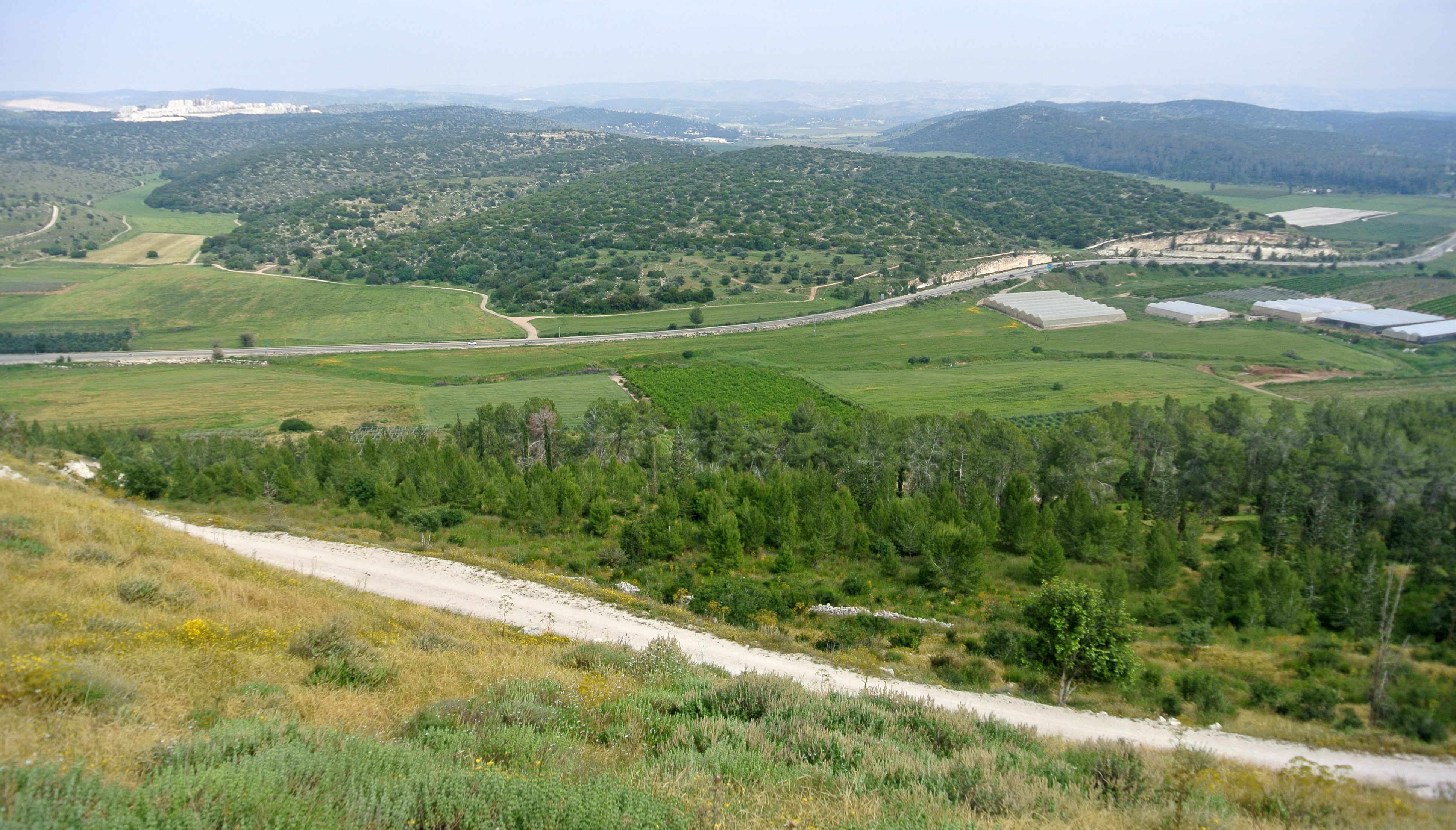
Zekharia () is a moshav in central Israel. It was formerly a Palestinian village, whose inhabitants were expelled in 1948-9. Located near Beit Shemesh, it falls under the jurisdiction of Mateh Yehuda Regional Council. In it had a population of . Settlement in the area dates back to the Iron Age. During the Roman era a town named Beit Zacharia was located on the hill, which according to legend was the burial place of the prophet Zechariah. By the Mamluk era, it had become a Muslim village, and was known by various names, including Zakariyya al-Battih, Kefr Zakaria, Az-Zakariyya or simply Zakariyya. Although the village had been allotted to the Arab state in the 1947 United Nations proposed partition plan, the area was occupied by Israeli forces during the 1948 Arab–Israeli War and the remaining Arab population was expelled in 1950, after which a new Jewish moshav, now Hebraized as Zekharia, was founded on the site. Geography Zekharia is located off the road between Beit Gu ... [...More Info...] [...Related Items...] OR: [Wikipedia] [Google] [Baidu] |
Azekah
Azekah (, ''ʿazēqā'') was an ancient town in the Shephela ("lowlands of Judea") guarding the upper reaches of the Valley of Elah, about 26 km (16 mi) northwest of Hebron. The current '' tell'' (ruin) by that name, also known as Tel Azeka (, ''ʿtel azēqā'') or Tell Zakariya, has been identified with the biblical Azekah, dating back to the Canaanite period. Today, the site lies on the purlieu of Britannia Park. According to Epiphanius of Salamis, the name meant "white" in Hebrew. The ''tell'' is pear shaped with the tip pointing northward. Due to its location in the Elah Valley it functioned as one of the main Judahite border cities, sitting on the boundary between the lower and higher Shfela.Gadot, ''et al.'' (2012), pp. 196–206 Although listed in Joshua 15:35 as being a city in the plain, it is actually partly in the hill country, partly in the plain. Biblical history In the Bible, it is said to be one of the places where the Amorite kings were defeated by J ... [...More Info...] [...Related Items...] OR: [Wikipedia] [Google] [Baidu] |
Mateh Yehuda Regional Council
Mateh Yehuda Regional Council (, ''Mo'atza Azorit Mateh Yehuda'', ) is a Regional council (Israel), regional council in the Jerusalem District of Israel. In 2024 it was home to 51,125 people. The name of the regional council stems from the fact that its territory was part of the land allotted to the Tribe of Judah, according to the Bible. Places and communities The regional council administers moshavim, kibbutzim, Israeli Arabs, Arab villages and other rural settlements in the Jerusalem corridor, north and south of the Highway 1 (Israel), Jerusalem-Tel Aviv highway, from Jerusalem in the southeast to Latrun in the northwest, and down to the area of Beit Shemesh (Valley of Elah, Ha'ela Valley) in the south. The settlements vary greatly in their character. There are religious, secular and mixed Jewish communities, two Arab communities, and the only mixed Arab-Jewish village in Israel - Neve Shalom. Many of the Jewish communities in the Mateh Yehuda district were established by Aliy ... [...More Info...] [...Related Items...] OR: [Wikipedia] [Google] [Baidu] |
Jerusalem
Jerusalem is a city in the Southern Levant, on a plateau in the Judaean Mountains between the Mediterranean Sea, Mediterranean and the Dead Sea. It is one of the List of oldest continuously inhabited cities, oldest cities in the world, and is considered Holy city, holy to the three major Abrahamic religions—Judaism, Christianity, and Islam. Both Israel and Palestine claim Jerusalem as their capital city; Israel maintains its primary governmental institutions there, while Palestine ultimately foresees it as its seat of power. Neither claim is widely Status of Jerusalem, recognized internationally. Throughout History of Jerusalem, its long history, Jerusalem has been destroyed at least twice, Siege of Jerusalem (other), besieged 23 times, captured and recaptured 44 times, and attacked 52 times. According to Eric H. Cline's tally in Jerusalem Besieged. The part of Jerusalem called the City of David (historic), City of David shows first signs of settlement in the 4th ... [...More Info...] [...Related Items...] OR: [Wikipedia] [Google] [Baidu] |
Districts Of Mandatory Palestine
The districts and sub-districts of Mandatory Palestine formed the first and second levels of administrative division and existed through the whole era of Mandatory Palestine, namely from 1920 to 1948. The number and territorial extent of the districts varied over time, as did their subdivision into sub-districts. In Arabic, a district was known as a ''minṭaqah'' (منطقة, plural ''manaṭiq'' مناطق), while in Hebrew it was known as a ''mahoz'' (מחוז, plural ''mehozot'' מחוזות). Each district had an administration headed by a district governor, a role renamed as district commissioner in 1925. Sub-districts were managed by an assistant district commissioner. They were aided by a district officer, who was typically either Arab or Jewish, based on the ethnic make-up of the sub-district. By the end of the mandate period, Palestine was divided into 6 districts and 16 subdistricts. Administrative divisions prior to 1922 During the Ottoman period, Palestine was ... [...More Info...] [...Related Items...] OR: [Wikipedia] [Google] [Baidu] |
Geopolitical Entity
The FAO geopolitical ontology is an ontology developed by the Food and Agriculture Organization of the United Nations (FAO) to describe, manage and exchange data related to geopolitical entities such as countries, territories, regions and other similar areas. Definitions and examples An ontology is a kind of dictionary that describes information in a certain domain using concepts and relationships. It is often implemented using OWL (Web Ontology Language), an XML-based standard language that can be interpreted by computers. * A ''Concept'' is defined as abstract knowledge. For example, in the geopolitical ontology a non-self-governing territory and a geographical group are concepts. Concepts are explicitly implemented in the ontology with individuals and classes: ** An ''individual'' is defined as an object perceived from the real world. In the geopolitical domain Ethiopia and the least developed countries group are individuals. ** A ''class'' is defined as a set of individual ... [...More Info...] [...Related Items...] OR: [Wikipedia] [Google] [Baidu] |
Palestine Grid
The Palestine grid was the geographic coordinate system used by the Survey Department of Palestine. The system was chosen by the Survey Department of the Government of Palestine in 1922. The projection used was the Cassini projection, Cassini-Soldner projection. The central Meridian (geography), meridian (the line of longitude along which there is no local distortion) was chosen as that passing through a marker on the hill of Mar Elias Monastery south of Jerusalem. The false origin (zero point) of the grid was placed 100 km to the south and west of the Ali el-Muntar hill that overlooks Gaza City, Gaza city. The unit length for the grid was the kilometre; the British units were not even considered. At the time the grid was established, there was no intention of mapping the lower reaches of the Negev Desert, but this did not remain true. Those southern regions having a negative Easting and northing, northing coordinate then became a source of confusion, which was solved by ad ... [...More Info...] [...Related Items...] OR: [Wikipedia] [Google] [Baidu] |
Mandatory Palestine
Mandatory Palestine was a British Empire, British geopolitical entity that existed between 1920 and 1948 in the Palestine (region), region of Palestine, and after 1922, under the terms of the League of Nations's Mandate for Palestine. After an Arab Revolt, Arab uprising against the Ottoman Empire during the First World War in 1916, British Empire, British Egyptian Expeditionary Force, forces drove Ottoman Empire, Ottoman forces out of the Levant. The United Kingdom had agreed in the McMahon–Hussein Correspondence that it would honour Arab independence in case of a revolt but, in the end, the United Kingdom and French Third Republic, France divided what had been Ottoman Syria under the Sykes–Picot Agreement—an act of betrayal in the eyes of the Arabs. Another issue was the Balfour Declaration of 1917, in which Britain promised its support for the establishment of a Homeland for the Jewish people, Jewish "national home" in Palestine. Mandatory Palestine was then establishe ... [...More Info...] [...Related Items...] OR: [Wikipedia] [Google] [Baidu] |
Sozomen
Salamanes Hermias Sozomenos (; ; c. 400 – c. 450 AD), also known as Sozomen, was a Roman lawyer and historian of the Christian Church. Family and home Sozoman was born around 400 in Bethelia, a small town near Gaza, into a wealthy Christian family of Palestine. He told the history of Southern Palestine derived from oral tradition. He appeared to be familiar with the region around Gaza, and mentioned having seen Bishop Zeno of Majuma, at the seaport of Gaza. Sozomen wrote that his grandfather lived at Bethelia, near Gaza, and became a Christian together with his household, probably under Constantius II. A neighbor named Alaphrion was miraculously healed by Saint Hilarion, who cast out a demon from Alaphrion, and, as eyewitnesses to the miracle, his family converted, along with Alaphrion's. The conversion marked a turning-point in the Christianization of southern Palestine, according to his account. The grandfather became within his own circle a highly esteemed interpret ... [...More Info...] [...Related Items...] OR: [Wikipedia] [Google] [Baidu] |
Astarte
Astarte (; , ) is the Greek language, Hellenized form of the Religions of the ancient Near East, Ancient Near Eastern goddess ʿAṯtart. ʿAṯtart was the Northwest Semitic languages, Northwest Semitic equivalent of the East Semitic languages, East Semitic goddess Ishtar. Astarte was worshipped from the Bronze Age through classical antiquity, and her name is particularly associated with her worship in the ancient Levant among the Canaanite religion, Canaanites and Phoenician religion, Phoenicians, though she was originally associated with Amorite cities like Ugarit and Emar, as well as Mari, Syria, Mari and Ebla. She was also celebrated in ancient Egyptian religion, Egypt, especially during the reign of the Nineteenth Dynasty of Egypt, Ramessides, following the importation of foreign cults there. Phoenicians introduced her cult in their colonies on the Iberian Peninsula. Name The Proto-Semitic language, Proto-Semitic form of this goddess's name was . While earlier scholars ... [...More Info...] [...Related Items...] OR: [Wikipedia] [Google] [Baidu] |
Tomb
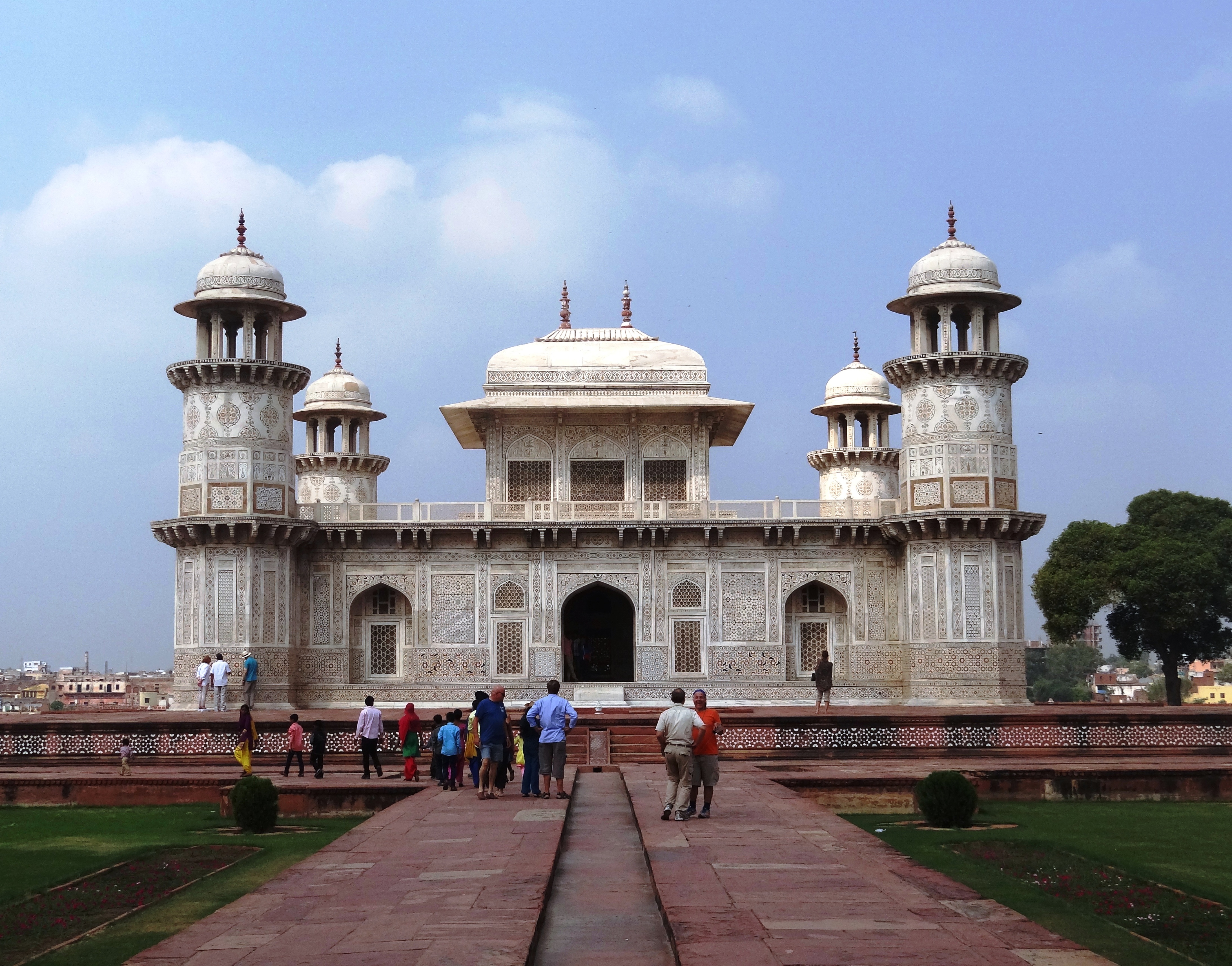
A tomb ( ''tumbos'') or sepulchre () is a repository for the remains of the dead. It is generally any structurally enclosed interment space or burial chamber, of varying sizes. Placing a corpse into a tomb can be called '' immurement'', although this word mainly means entombing people alive, and is a method of final disposition, as an alternative to cremation or burial. Overview The word is used in a broad sense to encompass a number of such types of places of interment or, occasionally, burial, including: * Architectural shrines – in Christianity, an architectural shrine above a saint's first place of burial, as opposed to a similar shrine on which stands a reliquary or feretory into which the saint's remains have been transferred * Burial vault – a stone or brick-lined underground space for multiple burials, originally vaulted, often privately owned for specific family groups; usually beneath a religious building such as a * Church * Cemetery * Churchyard ... [...More Info...] [...Related Items...] OR: [Wikipedia] [Google] [Baidu] |
Tell (archaeology)
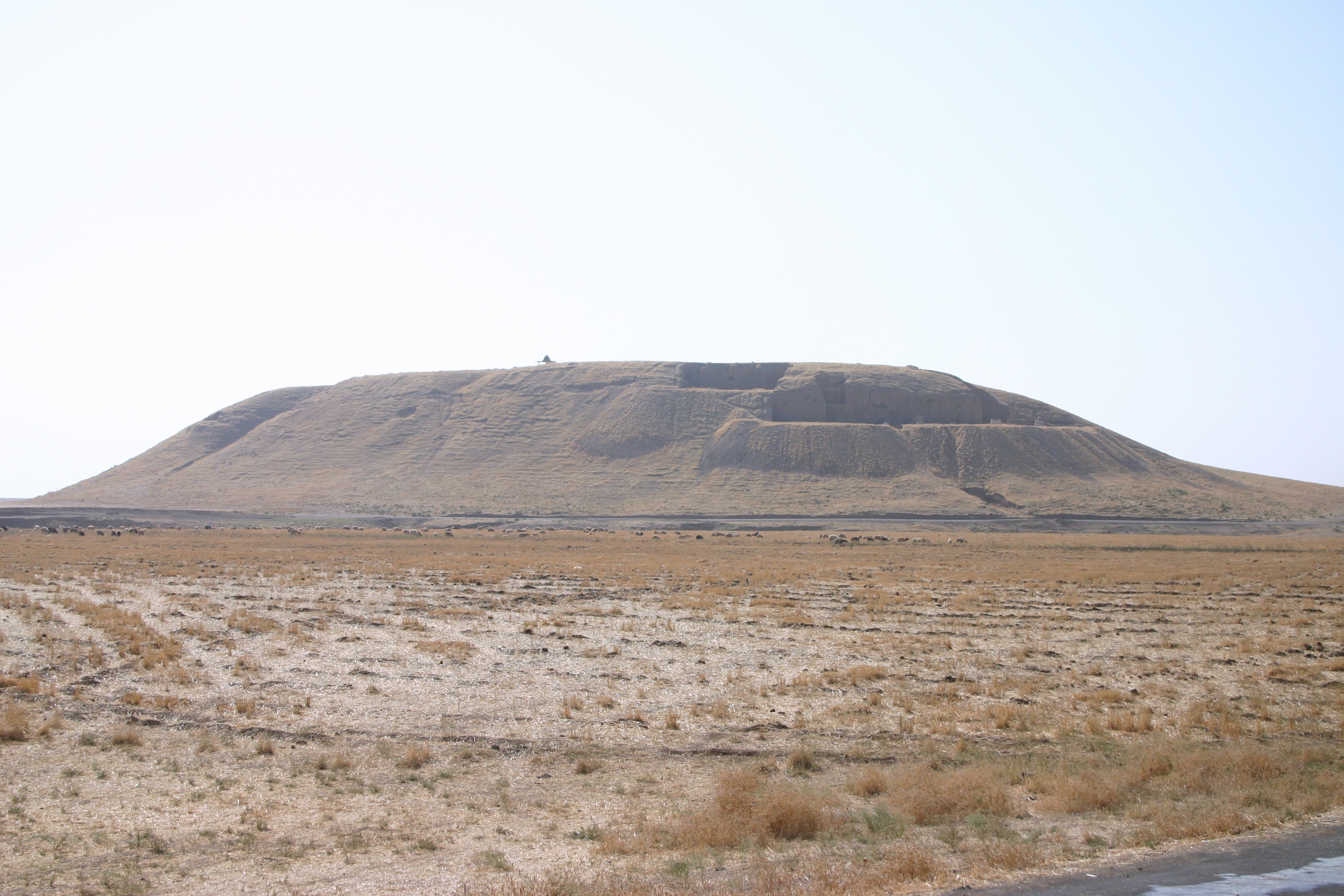
In archaeology, a tell (from , ', 'mound' or 'small hill') is an artificial topographical feature, a mound consisting of the accumulated and stratified debris of a succession of consecutive settlements at the same site, the refuse of generations of people who built and inhabited them and natural sediment. Tells are most commonly associated with the ancient Near East but are also found elsewhere, such as in Southern Europe, Southern and parts of Central Europe, from Greece and Bulgaria to Hungary and Spain,, see map. and in North Africa. Within the Near East they are concentrated in less arid regions, including Upper Mesopotamia, the Southern Levant, Anatolia and Iran, which had more continuous settlement. Eurasian tells date to the Neolithic, the Chalcolithic and the Bronze and Iron Ages. In the Southern Levant the time of the tells ended with the conquest by Alexander the Great, which ushered in the Hellenistic period with its own, different settlement-building patterns. Many t ... [...More Info...] [...Related Items...] OR: [Wikipedia] [Google] [Baidu] |
Madaba Map
The Madaba Map, also known as the Madaba Mosaic Map, is part of a floor mosaic in the early Byzantine church of Saint George in Madaba, Jordan. The mosaic map depicts an area from Lebanon in the north to the Nile Delta in the south, and from the Mediterranean Sea in the west to the Eastern Desert. It contains the oldest surviving original cartographic depiction of the Holy Land and especially Jerusalem. The map dates to the sixth century AD. History The Madaba Mosaic Map depicts Jerusalem with the New Church of the Theotokos, which was dedicated on 20 November 542. Buildings erected in Jerusalem after 570 are absent from the depiction, thus limiting the date range of its creation to the period between 542 and 570. The mosaic was made by unknown artists, probably for the Christian community of Madaba, which was the seat of a bishop at that time. In 614, Madaba was conquered by the Sasanian Empire. In the eighth century, the ruling Muslim Umayyad Caliphate had some figura ... [...More Info...] [...Related Items...] OR: [Wikipedia] [Google] [Baidu] |


