|
Alidade
An alidade () (archaic forms include alhidade, alhidad, alidad) or a turning board is a device that allows one to sight a distant object and use the line of sight to perform a task. This task can be, for example, to Triangulation (surveying), triangulate a scale map on site using a plane table drawing of intersecting lines in the direction of the object from two or more points or to measure the angle and horizontal distance to the object from some reference point's Polar coordinate system, polar measurement. Angles measured can be horizontal, vertical or in any chosen plane. The alidade sighting ruler was originally a part of many types of scientific and astronomical instrument. At one time, some alidades, particularly using Graduation (instrument), circular graduations as on astrolabes, were also called ''diopters''. With modern technology, the name is applied to complete instruments such as the 'plane table alidade'. Origins The word in Arabic (, , ), signifies the same de ... [...More Info...] [...Related Items...] OR: [Wikipedia] [Google] [Baidu] |
Plane Table
A plane table (plain table prior to 1830) is a device used in surveying, site mapping, exploration mapping, coastal navigation mapping, and related disciplines to provide a solid and level surface on which to make field drawings, charts and maps. The early use of the name ''plain table'' reflected its simplicity and plainness rather than its flatness. " Plane" refers to the table being both flat levelled ( horizontal). History The earliest mention of a plane table dates to 1551 in Abel Foullon's ''"Usage et description de l'holomètre"'', published in Paris.Turner, Anthony, ''Early Scientific Instruments, Europe 1400-1800'', Sotheby's Publishing, 1987, . page 81 However, since Foullon's description was of a complete, fully developed instrument, it must have been invented earlier. A brief description was also added to the 1591 edition of Digge's ''Pantometria''. The first mention of the device in English was by Cyprian Lucar in 1590.Turner, Gerard L'E., ''Scientific Instr ... [...More Info...] [...Related Items...] OR: [Wikipedia] [Google] [Baidu] |
Graduation (instrument)
A graduation is a marking used to indicate points on a visual scale, which can be present on a container, a measuring device, or the axes of a line plot, usually one of many along a line or curve, each in the form of short line segments perpendicular to the line or curve. Often, some of these line segments are longer and marked with a numeral, such as every fifth or tenth graduation. The scale itself can be linear (the graduations are spaced at a constant distance apart) or nonlinear. Linear graduation of a scale occurs mainly (but not exclusively) on straight measuring devices, such as a rule or measuring tape, using units such as inches or millimetres. Graduations can also be spaced at varying spatial intervals, such as when using a logarithmic, for instance on a measuring cup, can vary in scale due to the container's non- cylindrical shape. Graduations along a curve Circular graduations of a scale occur on a circular arc or limb of an instrument. In some cases, non-ci ... [...More Info...] [...Related Items...] OR: [Wikipedia] [Google] [Baidu] |
Telescope
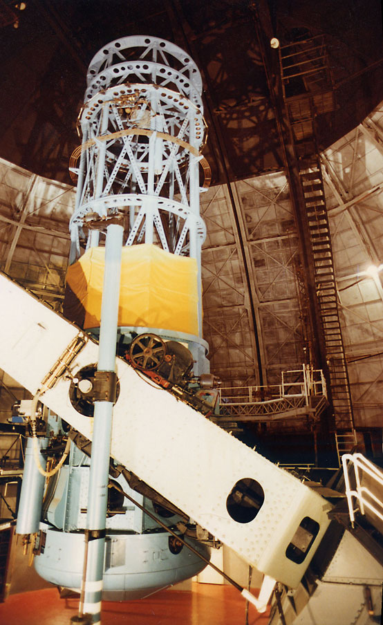
A telescope is a device used to observe distant objects by their emission, Absorption (electromagnetic radiation), absorption, or Reflection (physics), reflection of electromagnetic radiation. Originally, it was an optical instrument using lenses, curved mirrors, or a combination of both to observe distant objects – an optical telescope. Nowadays, the word "telescope" is defined as a wide range of instruments capable of detecting different regions of the electromagnetic spectrum, and in some cases other types of detectors. The first known practical telescopes were refracting telescopes with glass lenses and were invented in the Netherlands at the beginning of the 17th century. They were used for both terrestrial applications and astronomy. The reflecting telescope, which uses mirrors to collect and focus light, was invented within a few decades of the first refracting telescope. In the 20th century, many new types of telescopes were invented, including radio telescopes in t ... [...More Info...] [...Related Items...] OR: [Wikipedia] [Google] [Baidu] |
Sextant
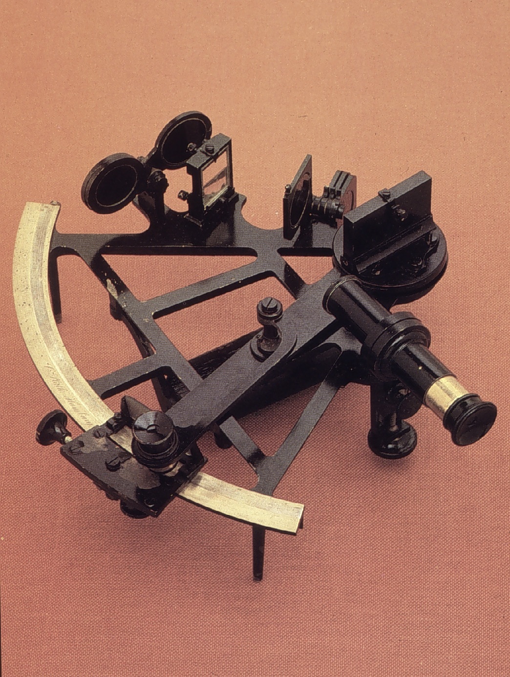
A sextant is a doubly reflecting navigation instrument that measures the angular distance between two visible objects. The primary use of a sextant is to measure the angle between an astronomical object and the horizon for the purposes of celestial navigation. The estimation of this angle, the altitude, is known as ''sighting'' or ''shooting'' the object, or ''taking a sight''. The angle, and the time when it was measured, can be used to calculate a position line on a nautical or aeronautical chart—for example, sighting the Sun at noon or Polaris at night (in the Northern Hemisphere) to estimate latitude (with sight reduction). Sighting the height of a landmark can give a measure of ''distance off'' and, held horizontally, a sextant can measure angles between objects for a position on a chart. A sextant can also be used to measure the lunar distance between the moon and another celestial object (such as a star or planet) in order to determine Greenwich Mean Time and hence ... [...More Info...] [...Related Items...] OR: [Wikipedia] [Google] [Baidu] |
Octant (instrument)
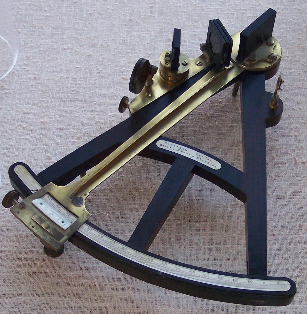
The octant, also called a reflecting quadrant (instrument), quadrant, is a reflecting instrument used in navigation. Etymology The name ''octant'' derives from the Latin ''octans'' meaning ''eighth part of a circle'', because the instrument's arc is Circular sector, one eighth of a circle. ''Reflecting quadrant'' derives from the instrument using mirrors to reflect the path of light to the observer and, in doing so, doubles the angle measured. This allows the instrument to use a one-eighth of a Turn (geometry), turn to measure a quarter-Turn (geometry), turn or Circular sector, quadrant. Origin of the octant Newton's reflecting quadrant Isaac Newton's reflecting quadrant was invented around 1699. A detailed description of the instrument was given to Edmond Halley, but the description was not published until after Halley's death in 1742. It is not known why Halley did not publish the information during his life, as this prevented Newton from getting the credit for the inven ... [...More Info...] [...Related Items...] OR: [Wikipedia] [Google] [Baidu] |
Fire Lookout Tower
A fire lookout tower, fire tower, or lookout tower is a tower that provides housing and protection for a person known as a " fire lookout", whose duty it is to search for wildfires in the wilderness. It is a small building, usually on the summit of a mountain or other high vantage point to maximize viewing distance and range, known as ''view shed''. From this vantage point the fire lookout can see smoke that may develop, determine the location by using a device known as an Osborne Fire Finder, and call for wildfire suppression crews. Lookouts also report weather changes and plot the location of lightning strikes during storms. The location of the strike is monitored for a period of days afterwards, in case of ignition. A typical fire lookout tower consists of a small room, known as a ''cab,'' atop a large steel or wooden tower. Historically, the tops of tall trees have also been used to mount permanent platforms. Sometimes natural rock may be used to create a lower platform. In ... [...More Info...] [...Related Items...] OR: [Wikipedia] [Google] [Baidu] |
Wildfire
A wildfire, forest fire, or a bushfire is an unplanned and uncontrolled fire in an area of Combustibility and flammability, combustible vegetation. Depending on the type of vegetation present, a wildfire may be more specifically identified as a bushfire (Bushfires in Australia, in Australia), desert fire, grass fire, hill fire, Peat#Peat fires, peat fire, prairie fire, vegetation fire, or veld fire. Some natural forest ecosystems Fire ecology, depend on wildfire. Modern forest management often engages in prescribed burns to mitigate fire risk and promote natural forest cycles. However, controlled burns can turn into wildfires by mistake. Wildfires can be classified by cause of ignition, physical properties, combustible material present, and the effect of weather on the fire. Wildfire severity results from a combination of factors such as available fuels, physical setting, and weather. Climatic cycles with wet periods that create substantial fuels, followed by drought and heat, of ... [...More Info...] [...Related Items...] OR: [Wikipedia] [Google] [Baidu] |
Scale (map)
The scale of a map is the ratio of a distance on the map to the corresponding distance on the ground. This simple concept is complicated by the curvature of the Earth's surface, which forces scale to vary across a map. Because of this variation, the concept of scale becomes meaningful in two distinct ways. The first way is the ratio of the size of the generating globe to the size of the Earth. The generating globe is a conceptual model to which the Earth is shrunk and from which the map is Map projection, projected. The ratio of the Earth's size to the generating globe's size is called the nominal scale (also called principal scale or representative fraction). Many maps state the nominal scale and may even display a bar scale (sometimes merely called a "scale") to represent it. The second distinct concept of scale applies to the variation in scale across a map. It is the ratio of the mapped point's scale to the nominal scale. In this case 'scale' means the scale factor (also ca ... [...More Info...] [...Related Items...] OR: [Wikipedia] [Google] [Baidu] |
Topographic Map
In modern mapping, a topographic map or topographic sheet is a type of map characterized by large- scale detail and quantitative representation of relief features, usually using contour lines (connecting points of equal elevation), but historically using a variety of methods. Traditional definitions require a topographic map to show both natural and artificial features. A topographic survey is typically based upon a systematic observation and published as a map series, made up of two or more map sheets that combine to form the whole map. A topographic map series uses a common specification that includes the range of cartographic symbols employed, as well as a standard geodetic framework that defines the map projection, coordinate system, ellipsoid and geodetic datum. Official topographic maps also adopt a national grid referencing system. Natural Resources Canada provides this description of topographic maps: Other authors define topographic maps by contrasting them with ... [...More Info...] [...Related Items...] OR: [Wikipedia] [Google] [Baidu] |
Telescopic Alidade, USS Green Bay
A telescope is an instrument designed for the observation of remote objects. Telescope(s) also may refer to: Music * The Telescopes, a British psychedelic band ** The Telescopes (album) * ''Telescope'' (album), by Circle, 2007 * ''The Telescope'' (album), by Her Space Holiday, 2006 * ''Telescopes'' (EP), by Waking Ashland, 2006 * "Telescope" (song), by Hayden Panettiere, 2012 * "Telescope", a song by Cheryl Cole from '' A Million Lights'', 2012 * "Telescopes", a song by Reks from ''Grey Hairs'', 2008 Other media * ''Telescope'' (TV series), a 1963–1973 Canadian documentary program * "The Telescope" (''BoJack Horseman''), a 2014 television episode * ''The Telescope'' (magazine), an American monthly for amateur astronomers 1931–1941 * ''The Telescope'' (Magritte), a 1963 painting by René Magritte * Telescope, a type of dolly zoom film/video shot * ''The Telescope'', a 1957 play by R. C. Sherriff Other uses * Telescope (horse) (foaled 2010), an Irish Thoroughbred raceh ... [...More Info...] [...Related Items...] OR: [Wikipedia] [Google] [Baidu] |


