|
Yaque Del Sur
The Yaque del Sur River (Spanish, ''Río Yaque del Sur'') is a river in the southwestern Dominican Republic. It is approximately 183 km in length. Etymology ''Yaque'' or ''Yaqui'' was a Taíno word given to two rivers in the Dominican Republic. One of those rivers is called the Yaque del Norte ("Northern Yaque"), and goes to the north of Hispaniola, emptying in the Atlantic Ocean; and the second, the Yaque del Sur ("Southern Yaque") goes to the south, emptying in the Caribbean Sea The Caribbean Sea is a sea of the Atlantic Ocean, North Atlantic Ocean in the tropics of the Western Hemisphere, located south of the Gulf of Mexico and southwest of the Sargasso Sea. It is bounded by the Greater Antilles to the north from Cuba .... Uses The river is not navigable, except by small craft. It is important and used extensively for irrigating rice, plantain, sugarcane, beans, bananas, and peanuts. References Rivers of the Dominican Republic {{DominicanRepublic-river-s ... [...More Info...] [...Related Items...] OR: [Wikipedia] [Google] [Baidu] |
San Juan Province (Dominican Republic)
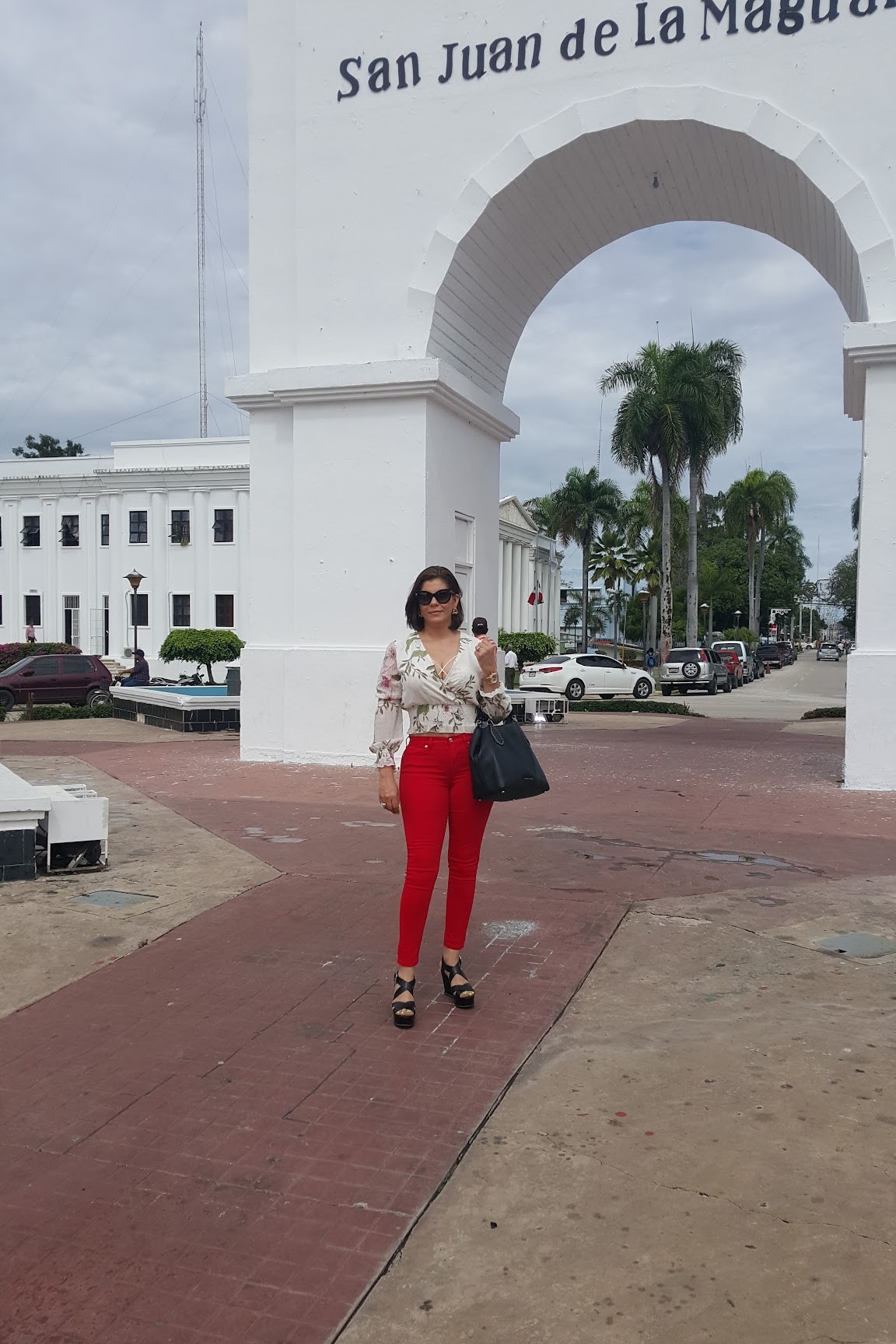
San Juan () is a province of the Dominican Republic. Before 1961 it was known as ''Benefactor''. San Juan is the Republic's largest province, bearing a size of 3,569 square kilometers (1,378 miles), and it is landlocked. Geography It comprises a total area of 3,569.39 km2, being the largest province in the Dominican Republic, and according to the 2002 census it had a population of 241,105 inhabitants. It is crossed by numerous rivers, among which the San Juan River, the Yaque del Sur River, the Sabaneta River, the Macasías and the Mijo stand out. It has three hydroelectric dams, Sabaneta, Sabana Yegua and Palomino, the latter inaugurated in 2013. Within the provincial territory there are three parks or protected areas, including the Juan Ulises García Bonelly Park, and the José Armando Bermúdez and José del Carmen Ramírez National Parks. In the area of Las Matas de Farfán there is a sulphurous spring, La Zurza, which is highly visited by regional tourism. The San ... [...More Info...] [...Related Items...] OR: [Wikipedia] [Google] [Baidu] |
Azua Province
Azua () is a province which is collectively one of the thirty-two provinces of the Dominican Republic. It is divided into 10 municipalities (the same as Santiago) and its capital city is Azua de Compostela. It is bordered by the provinces of La Vega to the north-east, San José de Ocoa and Peravia to the east, Barahona and Baoruco to the west and San Juan to the north-west. To the south, Azua has a significant coastline of the Caribbean Sea. Azua is known for its diverse geography and climate, with the southern part of the province having an arid climate that is not the typical tropical-like that is found in other parts of the Caribbean. Geography The southern part of the province is located in the Llanura or Llano de Azua (also known as the "Plena de Azua"), a coastal plain surrounded by mountains that act as barriers to the water-laden winds so that the lower parts of the province are very arid. Azua had the Sierra de Ocoa, which is the southern end of the Cordillera Centra ... [...More Info...] [...Related Items...] OR: [Wikipedia] [Google] [Baidu] |
Baoruco Province
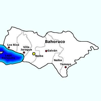
Baoruco, alternatively spelt Bahoruco (), is a Provinces of the Dominican Republic, province of the Dominican Republic located in the southwest of the country, part of the Enriquillo Region, along with the provinces of Barahona, Independencia and Pedernales. Before 1952 it included what is now Independencia Province. Important features are the Sierra de Neiba mountain range and Lake Enriquillo. Municipalities and municipal districts The province is divided into the following Municipalities of the Dominican Republic, municipalities (''municipios'') and municipal districts (''distrito municipal'' - D.M.) within them: *Galván, Dominican Republic, Galván *Los Ríos, Dominican Republic, Los Ríos **Las Clavellinas city (D.M.) *Neiba **El Palmar, Dominican Republic, El Palmar (D.M.) *Tamayo (Dominican Republic), Tamayo **Cabeza de Toro (D.M.) **Montserrat, Baoruco, Montserrat (D.M.) **Santana, Baoruco, Santana (D.M.) **Uvilla, Baoruco, Uvilla (D.M.) *Villa Jaragua The following is ... [...More Info...] [...Related Items...] OR: [Wikipedia] [Google] [Baidu] |
Barahona Province
Barahona () is a province of the Dominican Republic. Located in the country's southwestern region, it is dividing into 11 municipalities and its capital bears the city of the same name. Barahona borders the provinces of Pedernales to the southwest, Baoruco and Independencia to the north, and Azua to the east along with coastline to the south with the Caribbean Sea. The province has an approximately three hours drive from Santo Domingo the capital of the Dominican Republic. In 2019, volunteers from Amigos de las Americas visited to facilitate projects within the various municipalities of Barahona. Municipalities and municipal districts The province as of June 20, 2006 is divided into the following municipalities (''municipios'') and municipal districts (''distrito municipal'' - D.M.) within them: * Cabral * El Peñón *Enriquillo **Arroyo Dulce (D.M.) * Fundación ** Pescadería (D.M.) * Jaquimeyes **Palo Alto (D.M.) * La Ciénaga **Bahoruco (D.M.) * Las Salinas * Paraís ... [...More Info...] [...Related Items...] OR: [Wikipedia] [Google] [Baidu] |
Spanish Language
Spanish () or Castilian () is a Romance languages, Romance language of the Indo-European languages, Indo-European language family that evolved from the Vulgar Latin spoken on the Iberian Peninsula of Europe. Today, it is a world language, global language with 483 million native speakers, mainly in the Americas and Spain, and about 558 million speakers total, including second-language speakers. Spanish is the official language of List of countries where Spanish is an official language, 20 countries, as well as one of the Official languages of the United Nations, six official languages of the United Nations. Spanish is the world's list of languages by number of native speakers, second-most spoken native language after Mandarin Chinese; the world's list of languages by total number of speakers, fourth-most spoken language overall after English language, English, Mandarin Chinese, and Hindustani language, Hindustani (Hindi-Urdu); and the world's most widely spoken Romance language ... [...More Info...] [...Related Items...] OR: [Wikipedia] [Google] [Baidu] |
River
A river is a natural stream of fresh water that flows on land or inside Subterranean river, caves towards another body of water at a lower elevation, such as an ocean, lake, or another river. A river may run dry before reaching the end of its course if it runs out of water, or only flow during certain seasons. Rivers are regulated by the water cycle, the processes by which water moves around the Earth. Water first enters rivers through precipitation, whether from rainfall, the Runoff (hydrology), runoff of water down a slope, the melting of glaciers or snow, or seepage from aquifers beneath the surface of the Earth. Rivers flow in channeled watercourses and merge in confluences to form drainage basins, or catchments, areas where surface water eventually flows to a common outlet. Rivers have a great effect on the landscape around them. They may regularly overflow their Bank (geography), banks and flood the surrounding area, spreading nutrients to the surrounding area. Sedime ... [...More Info...] [...Related Items...] OR: [Wikipedia] [Google] [Baidu] |
Dominican Republic
The Dominican Republic is a country located on the island of Hispaniola in the Greater Antilles of the Caribbean Sea in the Atlantic Ocean, North Atlantic Ocean. It shares a Maritime boundary, maritime border with Puerto Rico to the east and a Dominican Republic–Haiti border, land border with Haiti to the west, occupying the Geography of the Dominican Republic, eastern five-eighths of Hispaniola which, along with Saint Martin (island), Saint Martin, is one of only two islands in the Caribbean shared by two sovereign states. In the Antilles, the country is the List of Caribbean islands by area, second-largest nation by area after Cuba at and List of Caribbean countries by population, second-largest by population after Haiti with approximately 11.4 million people in 2024, of whom 3.6 million reside in the Greater Santo Domingo, metropolitan area of Santo Domingo, the capital city. The native Taíno people had inhabited Hispaniola prior to European colonization of the America ... [...More Info...] [...Related Items...] OR: [Wikipedia] [Google] [Baidu] |
Taíno
The Taíno are the Indigenous peoples of the Caribbean, Indigenous peoples of the Greater Antilles and surrounding islands. At the time of European contact in the late 15th century, they were the principal inhabitants of most of what is now The Bahamas, Cuba, the Dominican Republic, Haiti, Jamaica, Puerto Rico, and the northern Lesser Antilles. The Lucayan people, Lucayan branch of the Taíno were the first New World peoples encountered by Christopher Columbus, in the Lucayan Archipelago, Bahama Archipelago on October 12, 1492. The Taíno historically spoke an Arawakan languages, Arawakan language. Granberry and Vescelius (2004) recognized two varieties of the Taino language: "Classical Taino", spoken in Puerto Rico and most of Hispaniola, and "Ciboney Taino", spoken in the Bahamas, most of Cuba, western Hispaniola, and Jamaica. They lived in agricultural societies ruled by caciques with fixed settlements and a Matrilineality, matrilineal system of kinship and inheritance. Taíno ... [...More Info...] [...Related Items...] OR: [Wikipedia] [Google] [Baidu] |
Hispaniola
Hispaniola (, also ) is an island between Geography of Cuba, Cuba and Geography of Puerto Rico, Puerto Rico in the Greater Antilles of the Caribbean. Hispaniola is the most populous island in the West Indies, and the second-largest by List of Caribbean islands by area, land area, after Geography of Cuba, Cuba. The island is Dominican Republic–Haiti border, divided into two separate Sovereign state, sovereign countries: the Spanish-speaking Geography of the Dominican Republic, Dominican Republic () to the east and the French language, French and Haitian Creole–speaking Geography of Haiti, Haiti () to the west. The only other divided island in the Caribbean is Saint Martin (island), Saint Martin, which is shared between France () and the Kingdom of the Netherlands, Netherlands (). At the time of the European arrival of Christopher Columbus, Hispaniola was home to the Ciguayo language, Ciguayo, Macorix language, Macorix, and Taíno Indigenous peoples of the Caribbean, native pe ... [...More Info...] [...Related Items...] OR: [Wikipedia] [Google] [Baidu] |
Atlantic Ocean
The Atlantic Ocean is the second largest of the world's five borders of the oceans, oceanic divisions, with an area of about . It covers approximately 17% of Earth#Surface, Earth's surface and about 24% of its water surface area. During the Age of Discovery, it was known for separating the New World of the Americas (North America and South America) from the Old World of Afro-Eurasia (Africa, Asia, and Europe). Through its separation of Afro-Eurasia from the Americas, the Atlantic Ocean has played a central role in the development of human society, globalization, and the histories of many nations. While the Norse colonization of North America, Norse were the first known humans to cross the Atlantic, it was the expedition of Christopher Columbus in 1492 that proved to be the most consequential. Columbus's expedition ushered in an Age of Discovery, age of exploration and colonization of the Americas by European powers, most notably Portuguese Empire, Portugal, Spanish Empire, Sp ... [...More Info...] [...Related Items...] OR: [Wikipedia] [Google] [Baidu] |
Caribbean Sea
The Caribbean Sea is a sea of the Atlantic Ocean, North Atlantic Ocean in the tropics of the Western Hemisphere, located south of the Gulf of Mexico and southwest of the Sargasso Sea. It is bounded by the Greater Antilles to the north from Cuba to Puerto Rico, the Lesser Antilles to the east from the Virgin Islands to Trinidad and Tobago, South America to the south from the Venezuela, Venezuelan coastline to the Colombia, Colombian coastline, and Central America and the Yucatán Peninsula to the west from Panama to Mexico. The Geopolitics, geopolitical region around the Caribbean Sea, including the numerous islands of the West Indies and adjacent coastal areas in the mainland of the Americas, is known as the Caribbean. The Caribbean Sea is one of the largest seas on Earth and has an area of about . The sea's deepest point is the Cayman Trough, between the Cayman Islands and Jamaica, at below sea level. The Caribbean coastline has many gulfs and bays: the Gulf of Gonâve, the Gul ... [...More Info...] [...Related Items...] OR: [Wikipedia] [Google] [Baidu] |
Irrigation
Irrigation (also referred to as watering of plants) is the practice of applying controlled amounts of water to land to help grow crops, landscape plants, and lawns. Irrigation has been a key aspect of agriculture for over 5,000 years and has been developed by many cultures around the world. Irrigation helps to grow crops, maintain landscapes, and revegetation, revegetate disturbed soils in dry areas and during times of below-average rainfall. In addition to these uses, irrigation is also employed to protect crops from frost, suppress weed growth in grain fields, and prevent soil consolidation. It is also used to cool livestock, reduce dust, dispose of sewage, and support mining operations. Drainage, which involves the removal of surface and sub-surface water from a given location, is often studied in conjunction with irrigation. There are several methods of irrigation that differ in how water is supplied to plants. Surface irrigation, also known as gravity irrigation, is the olde ... [...More Info...] [...Related Items...] OR: [Wikipedia] [Google] [Baidu] |


