|
Xanthaptychia Aurantiaca
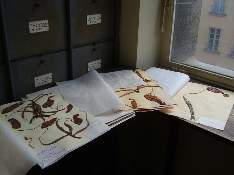
''Xanthaptychia aurantiaca'', the Arctic orangebush lichen, is a species of terricolous (ground-dwelling), fruticose lichen in the family Teloschistaceae. This small orange lichen is endemic to the Canadian Arctic and is known from a few scattered collections across this region. It was classified as an endangered species by the IUCN in 2020. Taxonomy The lichen was first formally described in 1823 by the Scottish botanist Robert Brown, as ''Borrera aurantiaca''. In his original diagnosis of the species, he noted its ascending, orange, slightly compressed, bare, and somewhat dichotomous thallus with a pale base, and very short and obtuse terminal . Brown suggested that the species was related to ''Borrera flavicans'' (now known as ''Teloschistes flavicans''), and that both are distinguished from others by their somewhat cylindrical, shrubby thallus. He further noted that in this species, the apothecia (fruiting bodies) are unknown, and therefore the appropriate genus placement ... [...More Info...] [...Related Items...] OR: [Wikipedia] [Google] [Baidu] |
Teloschistes
''Teloschistes'' is a genus of lichens in the family Teloschistaceae. It was circumscribed by Norwegian botanist Johannes Musaeus Norman in 1852. The name of the genus means "split ends". Species *''Teloschistes chrysophthalmus'' *''Teloschistes fasciculatus'' *''Teloschistes flavicans'' *''Teloschistes inflatus'' *''Teloschistes sieberianus'' *''Teloschistes spinosus'' *''Teloschistes velifer'' *''Teloschistes xanthoroides ''Teloschistes'' is a genus of lichens in the family Teloschistaceae. It was circumscribed by Norwegian botanist Johannes Musaeus Norman in 1852. The name of the genus means "split ends". Species *''Teloschistes chrysophthalmus'' *'' Teloschist ...'' References Teloschistales Teloschistales genera Lichen genera Taxa described in 1853 {{Teloschistales-stub ... [...More Info...] [...Related Items...] OR: [Wikipedia] [Google] [Baidu] |
Tundra
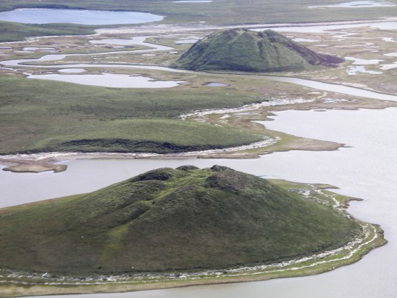
In physical geography, tundra () is a type of biome where tree growth is hindered by frigid temperatures and short growing seasons. The term ''tundra'' comes through Russian (') from the Kildin Sámi word (') meaning "uplands", "treeless mountain tract". There are three regions and associated types of tundra: Arctic tundra, alpine tundra, and Antarctic tundra. Tundra vegetation is composed of dwarf shrubs, sedges, grasses, mosses, and lichens. Scattered trees grow in some tundra regions. The ecotone (or ecological boundary region) between the tundra and the forest is known as the tree line or timberline. The tundra soil is rich in nitrogen and phosphorus. The soil also contains large amounts of biomass and decomposed biomass that has been stored as methane and carbon dioxide in the permafrost, making the tundra soil a carbon sink. As global warming heats the ecosystem and causes soil thawing, the permafrost carbon cycle accelerates and releases much of these soil-conta ... [...More Info...] [...Related Items...] OR: [Wikipedia] [Google] [Baidu] |
Herbarium
A herbarium (plural: herbaria) is a collection of preserved plant specimens and associated data used for scientific study. The specimens may be whole plants or plant parts; these will usually be in dried form mounted on a sheet of paper (called '' exsiccatum'', plur. ''exsiccata'') but, depending upon the material, may also be stored in boxes or kept in alcohol or other preservative. The specimens in a herbarium are often used as reference material in describing plant taxa; some specimens may be types, some may be specimens distributed in series called exsiccatae. The same term is often used in mycology to describe an equivalent collection of preserved fungi, otherwise known as a fungarium. A xylarium is a herbarium specialising in specimens of wood. The term hortorium (as in the Liberty Hyde Bailey Hortorium) has occasionally been applied to a herbarium specialising in preserving material of horticultural origin. History The making of herbaria is an ancient phenome ... [...More Info...] [...Related Items...] OR: [Wikipedia] [Google] [Baidu] |
Cape Parry
Cape Parry is a headland in Canada's Northwest Territories. Located at the northern tip of the Parry Peninsula, it projects into Amundsen Gulf. The nearest settlement is Paulatuk, to the south, and Fiji Island is located to the west. Cape Parry was formerly accessible through Cape Parry Airport that was located at the Distant Early Warning Line. The airport was listed as abandoned after the closure of the DEW line site. It is named for the Arctic explorer William Edward Parry. History Between the 1950s to the 1980s, a Distant Early Warning Line site (PIN-Main, ) was located south of Police Point, the cape's western point. During the period of 1969 to 1982, eighteen sounding rocket launches were made at Cape Parry. Geography Cape Parry is a three-pointed outcrop of coastal cliffs. The limestone formation rises above sea level. The deeply incised coastal beaches are composed of sand and gravel, and form bays and inlets. On either side of the narrow isthmus that joins Cape Pa ... [...More Info...] [...Related Items...] OR: [Wikipedia] [Google] [Baidu] |
Victoria Island
Victoria Island ( ikt, Kitlineq, italic=yes) is a large island in the Arctic Archipelago that straddles the boundary between Nunavut and the Northwest Territories of Canada. It is the eighth-largest island in the world, and at in area, it is Canada's second-largest island. It is nearly double the size of Newfoundland (), and is slightly larger than the island of Great Britain () but smaller than Honshu (). The western third of the island lies in the Inuvik Region of the Northwest Territories; the remainder is part of Nunavut's Kitikmeot Region. The island is named after Queen Victoria, the Canadian sovereign from 1867 to 1901 (though she first became Queen in 1837). The features bearing the name "Prince Albert" are named after her consort, Albert. History In 1826 John Richardson saw the southwest coast and called it " Wollaston Land". In 1839 Peter Warren Dease and Thomas Simpson followed its southeast coast and called it "Victoria Land". A map published by John Barrow ... [...More Info...] [...Related Items...] OR: [Wikipedia] [Google] [Baidu] |
Melville Island (Northwest Territories And Nunavut)
Melville IslandCoordinates are located on the NWT side. (french: Île Melville; Inuktitut: ''ᐃᓗᓪᓕᖅ, Ilulliq'') is an uninhabited island of the Arctic Archipelago with an area of . It is the 33rd largest island in the world and Canada's eighth largest island. Mountains on Melville Island, some of the largest in the western Canadian Arctic, reach heights of . There are two subnational pene-exclaves that lie west of the 110th meridian and form part of the Northwest Territories. These can only be reached by land from Nunavut or boat from the Northwest Territories. Melville Island is shared by the Northwest Territories, which is responsible for the western half of the island, and Nunavut, which is responsible for the eastern half. The border runs along the 110th meridian west. Geography The island has little or no vegetation. Where continuous vegetation occurs, it usually consists of hummocks of mosses, lichens, grasses, and sedges. The only woody spe ... [...More Info...] [...Related Items...] OR: [Wikipedia] [Google] [Baidu] |
Banks Island
Banks Island is one of the larger members of the Arctic Archipelago. Situated in the Inuvik Region, and part of the Inuvialuit Settlement Region, of the Northwest Territories, it is separated from Victoria Island to its east by the Prince of Wales Strait and from the mainland by Amundsen Gulf to its south. The Beaufort Sea lies to its west, and to its northeast M'Clure Strait separates the island from Prince Patrick Island and Melville Island. It is home to at least fourteen mammal species including the Peary caribou, barren-ground caribou, and polar bears. At one time over 68,000 muskoxen lived on the island, the majority of the world's population. However, the bacterium '' Erysipelothrix rhusiopathiae'' has led to a sharp decline in their numbers. The island is the summer home to hundreds of thousands of migratory birds who nest at Banks Island Migratory Bird Sanctuary No. 1 and Banks Island Migratory Bird Sanctuary No. 2. As of the 2016 census it had a human popu ... [...More Info...] [...Related Items...] OR: [Wikipedia] [Google] [Baidu] |
Northwest Territories
The Northwest Territories (abbreviated ''NT'' or ''NWT''; french: Territoires du Nord-Ouest, formerly ''North-Western Territory'' and ''North-West Territories'' and namely shortened as ''Northwest Territory'') is a federal territory of Canada. At a land area of approximately and a 2016 census population of 41,790, it is the second-largest and the most populous of the three territories in Northern Canada. Its estimated population as of 2022 is 45,605. Yellowknife is the capital, most populous community, and only city in the territory; its population was 19,569 as of the 2016 census. It became the territorial capital in 1967, following recommendations by the Carrothers Commission. The Northwest Territories, a portion of the old North-Western Territory, entered the Canadian Confederation on July 15, 1870. Since then, the territory has been divided four times to create new provinces and territories or enlarge existing ones. Its current borders date from April 1, 1999, when t ... [...More Info...] [...Related Items...] OR: [Wikipedia] [Google] [Baidu] |
Inuvialuit Settlement Region
The Inuvialuit Settlement Region, abbreviated as ISR ( ikt, Inuvialuit Nunangit Sannaiqtuaq – INS; french: Région désignée des Inuvialuit – RDI), located in Canada's western Arctic, was designated in 1984 in the Inuvialuit Final Agreement by the Government of Canada for the Inuvialuit people. It spans of land, mostly above the tree line, and includes several subregions: the Beaufort Sea, the Mackenzie River delta, the northern portion of Yukon ("Yukon North Slope"), and the northwest portion of the Northwest Territories. The ISR includes both Crown Lands and Inuvialuit Private Lands. The ISR is one of the four Inuit regions of Canada, collectively known as Inuit Nunangat, represented by the Inuit Tapiriit Kanatami (ITK). The other regions include Nunatsiavut in Labrador, Nunavik in northern Quebec, and the territory of Nunavut. The ISR is the homeland of the Inuvialuit. The Inuvialuit Regional Corporation, established in 1986 as the receiver of the lands and financial ... [...More Info...] [...Related Items...] OR: [Wikipedia] [Google] [Baidu] |
Common Name
In biology, a common name of a taxon or organism (also known as a vernacular name, English name, colloquial name, country name, popular name, or farmer's name) is a name that is based on the normal language of everyday life; and is often contrasted with the scientific name for the same organism, which is Latinized. A common name is sometimes frequently used, but that is not always the case. In chemistry, IUPAC defines a common name as one that, although it unambiguously defines a chemical, does not follow the current systematic naming convention, such as acetone, systematically 2-propanone, while a vernacular name describes one used in a lab, trade or industry that does not unambiguously describe a single chemical, such as copper sulfate, which may refer to either copper(I) sulfate or copper(II) sulfate. Sometimes common names are created by authorities on one particular subject, in an attempt to make it possible for members of the general public (including such interested p ... [...More Info...] [...Related Items...] OR: [Wikipedia] [Google] [Baidu] |
Xanthaptychia
''Xanthaptychia'' is a genus of lichen-forming fungi in the family Teloschistaceae. The genus, circumscribed in 2017, has three corticolous (bark-dwelling) species. Taxonomy ''Xanthaptychia'' is in the ''Seirophora'' clade of the subfamily Caloplacoideae within the family Teloschistaceae. It was circumscribed in 2017 by lichenologists Sergey Kondratyuk and Sonja Ravera. The genus forms a distinct, robust monophyletic branch, setting it apart from related genera. Four species were included in the genus. The etymology of ''Xanthaptychia'' is influenced by its resemblance to ''Anaptychia'' of the Physciaceae (in the lack of a lower cortical layer) and to lichens of the Teloschistaceae, evident in its foliose thallus. ''Xanthaptychia'' differs from the related ''Seirophora'' in its tissue in the thallus and the cortex of the of the apothecia, and its primary distribution in high-altitude mountainous regions of northern Eurasia or North America. Description ''Xanthaptychia'' ... [...More Info...] [...Related Items...] OR: [Wikipedia] [Google] [Baidu] |


