|
Worcester (1785 EIC Ship)
''Worcester'' was launched in 1785 as an East Indiaman for the British East India Company (EIC). She made eight voyages to India and China for the EIC and participated as a transport in two naval expeditions before she was sold in 1809 for breaking up. Career EIC voyage #1 (1786–1788): Captain John Hall sailed from the Downs on 20 February 1786, bound for Madras and China. ''Worcester'' reached Madras on 16 July and Malacca on 14 October. She arrived at Whampoa on 17 June 1787. Homeward bound, she crossed the Second Bar on 23 December, reached St Helena on 27 March 1788, and arrived back at the Downs on 26 June. EIC voyage #2 (1790–1791): Captain Hall sailed from Portsmouth on 22 May 1790, bound for Bombay. ''Worcester'' reached Johanna on 25 August and arrived at Bombay on 20 September. She then sailed up and down India's west coast. She was at Tellicherry on 11 November and Cochin on 16 November, before returning to Tellicherry on 5 December. She was at Cannanore on ... [...More Info...] [...Related Items...] OR: [Wikipedia] [Google] [Baidu] |
Flag Of The British East India Company (1707)
The flag of the East India Company was used to represent the East India Company, which was chartered in England in 1600. The flag was altered as the nation changed from England to Great Britain to the United Kingdom. It was initially a red and white striped ensign with the flag of England in the canton. The flag displayed in the canton was later replaced by the flag of Great Britain and then the flag of the United Kingdom, as the nation developed. Early years Upon receiving a Royal Charter to trade in the Indian Ocean from Queen Elizabeth I in 1600, the English East India Company adopted a flag of red and white stripes (varying from nine to thirteen stripes in total), with the flag of England in the canton. The flag caused problems for the East India Company at first when trading in the Far East, because of its use of the Saint George's Cross. In Japan in 1616, the Company's ships were turned away because the cross on the flag was viewed as a symbol of Christianity, which ... [...More Info...] [...Related Items...] OR: [Wikipedia] [Google] [Baidu] |
French Revolutionary Wars
The French Revolutionary Wars () were a series of sweeping military conflicts resulting from the French Revolution that lasted from 1792 until 1802. They pitted French First Republic, France against Kingdom of Great Britain, Great Britain, Habsburg monarchy, Austria, Kingdom of Prussia, Prussia, Russian Empire, Russia, and several other countries. The wars are divided into two periods: the War of the First Coalition (1792–1797) and the War of the Second Coalition (1798–1802). Initially confined to Europe, the fighting gradually assumed a global dimension. After a decade of constant warfare and aggressive diplomacy, France had conquered territories in the Italian peninsula, the Low Countries, and the Rhineland with its very large and powerful military which had been totally mobilized for war against most of Europe with mass conscription of the vast French population. French success in these conflicts ensured military occupation and the spread of revolutionary principles over mu ... [...More Info...] [...Related Items...] OR: [Wikipedia] [Google] [Baidu] |
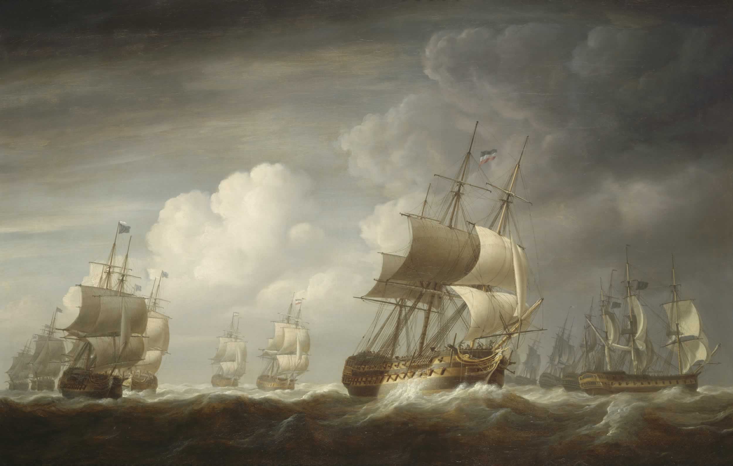
A Fleet Of East Indiamen At Sea
A, or a, is the first letter and the first vowel letter of the Latin alphabet, used in the modern English alphabet, and others worldwide. Its name in English is '' a'' (pronounced ), plural ''aes''. It is similar in shape to the Ancient Greek letter alpha, from which it derives. The uppercase version consists of the two slanting sides of a triangle, crossed in the middle by a horizontal bar. The lowercase version is often written in one of two forms: the double-storey and single-storey . The latter is commonly used in handwriting and fonts based on it, especially fonts intended to be read by children, and is also found in italic type. In English, '' a'' is the indefinite article, with the alternative form ''an''. Name In English, the name of the letter is the ''long A'' sound, pronounced . Its name in most other languages matches the letter's pronunciation in open syllables. History The earliest known ancestor of A is ''aleph''—the first letter of the Phoenician ... [...More Info...] [...Related Items...] OR: [Wikipedia] [Google] [Baidu] |
Kollam
Kollam (;), is an ancient seaport and the List of cities and towns in Kerala, fourth largest city in the Indian state of Kerala. Located on the southern tip of the Malabar Coast of the Arabian Sea, the city is on the banks of Ashtamudi Lake and is 71 kilometers (44 mi) northwest of the Thiruvananthapuram. Kollam is one of List of ancient Indian cities, India's oldest continuously inhabited cities, with evidence of habitation stretching back to the megalithic; the city has also been a maritime entrepôt millennia, the earliest attestation of which dates back to the Phoenicians and Romans. It is the southern gateway to the Kerala backwaters, Backwaters of Kerala, and is known for its cashew processing, coir manufacturing, and tourism industries. Kollam has had a strong commercial reputation since ancient times. The Arabs, Phoenicians, Chinese, Ethiopians, Syrians, Jews, Chaldeans and Romans have all engaged in trade at the port of Kollam for millennia. As a result of Chinese t ... [...More Info...] [...Related Items...] OR: [Wikipedia] [Google] [Baidu] |
Khejuri II
Khejuri II is a Community Development Block that forms an administrative division in Contai subdivision of Purba Medinipur district in the Indian state of West Bengal. History Khijri Khijri (or Khejuri) today is a small village about 125 kilometres south of Calcutta on the right bank of the Hooghly River. Sixteenth century maps project an emerging island in the area. Seventeenth-century maps show two islands – Khejuri and Hijli. The entire area was submerged under water. Long embankments have been built to keep the saline water away and the land recovered with great effort. In the days of the Nawabs of Bengal, this area had many salt pans. In the early days of the East India Company, the port and the town flourished at Khejuri. In the first half of the 19th century it was known to the British as Kedgeree. The British established their control over the area in 1765 and by 1780 had established a port and factory there. A light-house was built in 1810 at Dariapur, a village ab ... [...More Info...] [...Related Items...] OR: [Wikipedia] [Google] [Baidu] |
Sagar Island
Sagar Island is an island in the Ganges delta, lying on the Continental Shelf, continental shelf of Bay of Bengal about 100 km (54 nautical miles) south of Kolkata. This island forms the Sagar (community development block), Sagar CD Block in Kakdwip subdivision of South 24 Parganas district in the Indian States and territories of India, State of West Bengal. Although Sagar Island is a part of Sundarbans, it does not have any tiger habitation or mangrove forests or small river tributaries as is characteristic of the overall Sundarban delta. This island is a place of Hindu pilgrimage. Every year on the day of Makar Sankranti (14 January), hundreds of thousands of Hindus gather to take a holy dip at the confluence of river Ganges and Bay of Bengal and offer prayers (''Puja (Hinduism), puja'') in the Kapil Muni Temple. Kolkata Port Trust has a pilot station and a light house. Geography Location Sagar Island is located at . It has an average elevation of . Climate History ... [...More Info...] [...Related Items...] OR: [Wikipedia] [Google] [Baidu] |
Diamond Harbour
Diamond Harbour is a town and municipality located in the South 24 Parganas district of the Indian state of West Bengal. Situated on the eastern banks of the Hooghly River, it serves as the administrative headquarters of the Diamond Harbour subdivision and forms part of the larger Kolkata Metropolitan Area. Historically known for its strategic position near the river’s estuary, the town has evolved from a small port settlement into a local urban centre with educational institutions, administrative offices, and a growing population. The town is known for its scenic riverside views, modest elevation, and proximity to Kolkata, making it a notable point for regional transit and tourism. Governed by the Diamond Harbour Municipality, the town covers an area of 10.36 square kilometres and had a population of 41,802 according to the 2011 Census. It is also an important constituency in both the state assembly and the national parliament. History Diamond Harbour was originally k ... [...More Info...] [...Related Items...] OR: [Wikipedia] [Google] [Baidu] |
Simon's Bay
Simon's Town (), sometimes spelled Simonstown, is a town in the Western Cape, South Africa and is home to Naval Base Simon's Town, the South African Navy's largest base. It is located on the shores of Simon's Bay in False Bay, on the eastern side of the Cape Peninsula. For more than two centuries, it has been a naval base and harbour (first for the British Royal Navy and now the South African Navy). The town is named after Simon van der Stel, an early governor of the Cape Colony. Topography The land rises steeply from near the water's edge and the town is boxed in along the shoreline by the heights above. The small harbour itself is protected from swells by a breakwater that was built with thousands of huge blocks of sandstone quarried out of the face of the mountain above. Simon's Town is now in effect a suburb of the City of Cape Town Metropolitan Municipality. The Simon's Town railway station is the terminus of the Southern Line, a railway line that runs south of the centr ... [...More Info...] [...Related Items...] OR: [Wikipedia] [Google] [Baidu] |
Lloyd's List
''Lloyd's List'' is one of the world's oldest continuously running journals, having provided weekly shipping news in London as early as 1734. It was published daily until 2013 (when the final print issue, number 60,850, was published), and is now published digitally. Also known simply as ''The List'', it was begun by Edward Lloyd, the proprietor of Lloyd's Coffee House, as a source of information for merchants' agents and insurance underwriters who met regularly in his establishment on Lombard Street to negotiate insurance coverage for trading vessels. It continues to provide this information in addition to marine insurance, offshore energy, logistics, market data, research, global trade and law information, and shipping news. History The earliest form of ''Lloyd's List'' was estimated by some to have begun by 1692. One historian, Michael Palmer, wrote that: "No later than January 1692, Lloyd began publishing a weekly newsletter, ‘Ships Arrived at and Departed from sever ... [...More Info...] [...Related Items...] OR: [Wikipedia] [Google] [Baidu] |
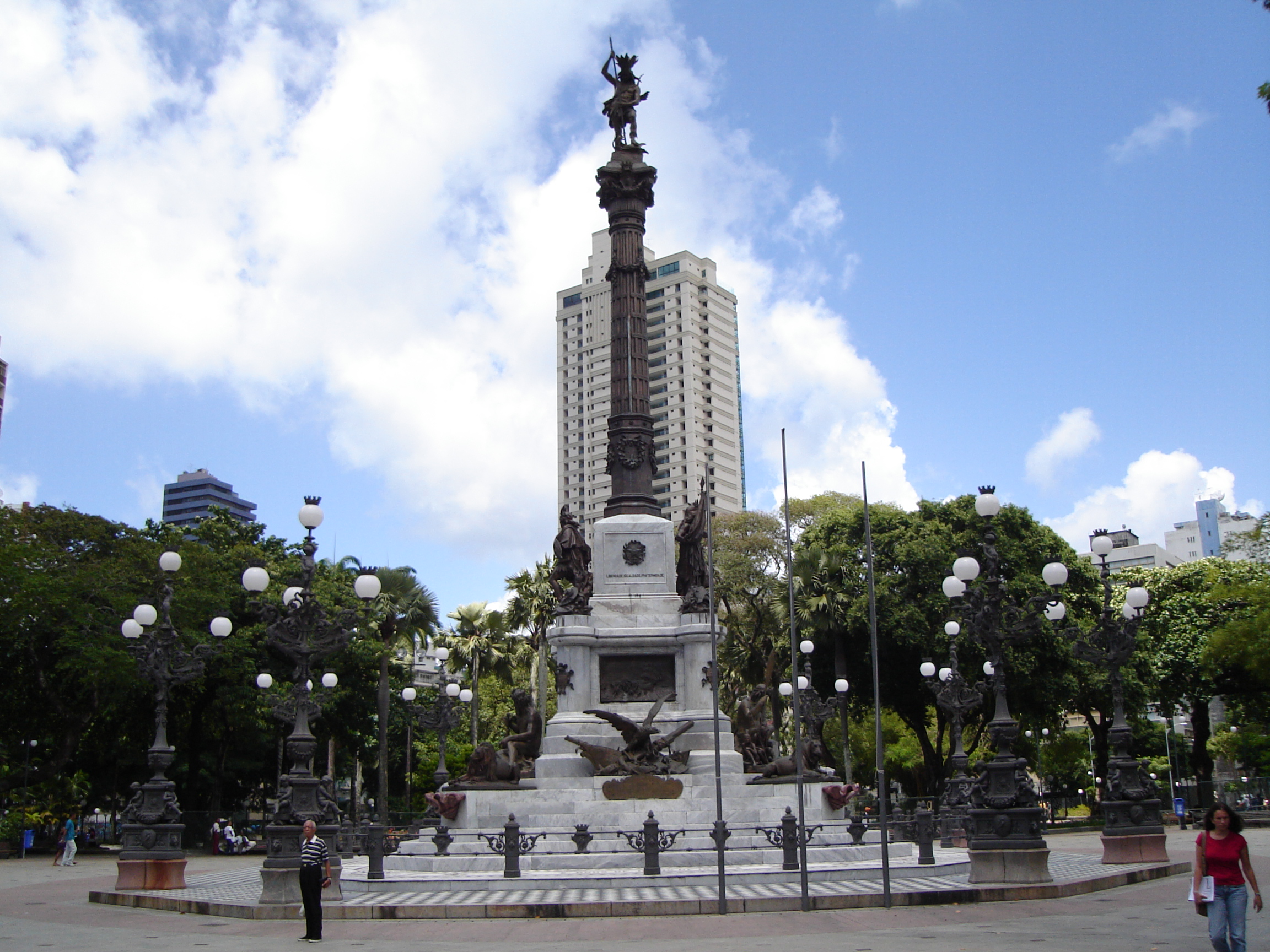
Salvador, Bahia
Salvador () is a Municipalities of Brazil, Brazilian municipality and capital city of the Federative units of Brazil, state of Bahia. Situated in the Zona da Mata in the Northeast Region, Brazil, Northeast Region of Brazil, Salvador is recognized throughout the country and internationally for its #Cuisine, cuisine, #Music, music, and #Pelourinho, architecture. The African influence in many cultural aspects of the city makes it a center of Afro-Brazilian culture. As the Capitals of Brazil, first capital of Colonial Brazil, the city is List of oldest continuously inhabited cities, one of the oldest in the Americas. Its foundation in 1549 by Tomé de Sousa took place on account of the implementation of the List of governors-general of Brazil, General Government of Brazil by the Portuguese Empire. Centralization as a capital, along with Portuguese colonization, were important factors in shaping the profile of the municipality, as were certain geographic characteristics. The construct ... [...More Info...] [...Related Items...] OR: [Wikipedia] [Google] [Baidu] |
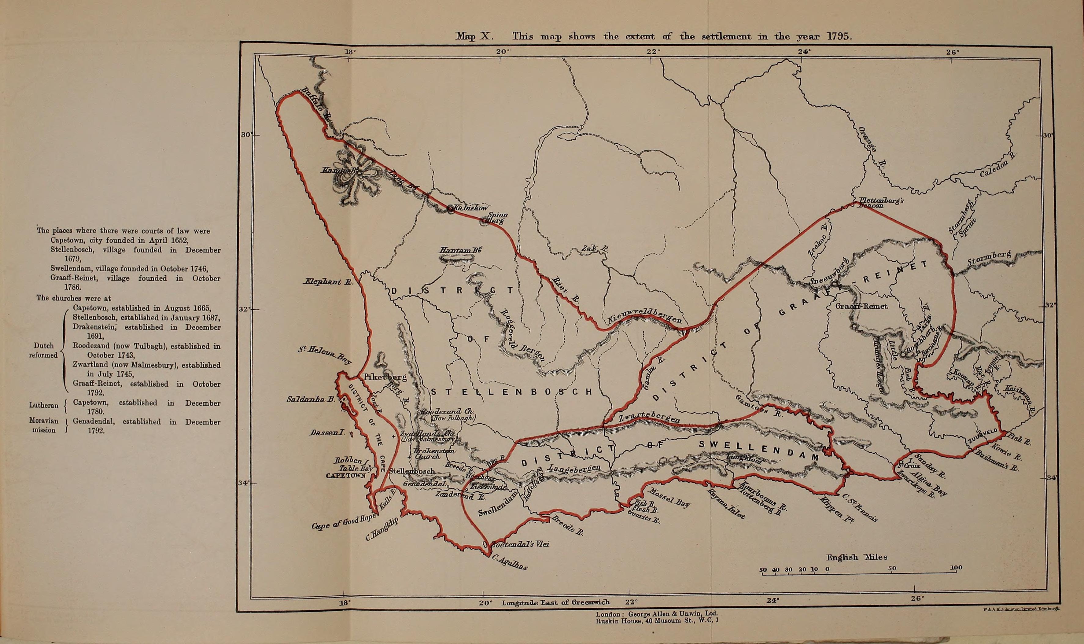
Invasion Of The Cape Colony
The invasion of the Cape Colony, also known as the Battle of Muizenberg (), was a British military expedition launched in 1795 against the Dutch Cape Colony at the Cape of Good Hope. The Dutch colony at the Cape, established and controlled by the United East India Company in the seventeenth century, was at the time the only viable South African port for ships making the journey from Europe to the European colonies in the East Indies. It therefore held vital strategic importance, although it was otherwise economically insignificant. In the winter of 1794, during the French Revolutionary Wars, French troops entered the Dutch Republic, which was reformed into the Batavian Republic. In response, Great Britain launched operations against the Dutch Empire to use its facilities against the French Navy. The British expedition was led by Vice-Admiral Sir George Elphinstone and sailed in April 1795, arriving off Simon's Town at the Cape in June. Attempts were made to negotiate a settlem ... [...More Info...] [...Related Items...] OR: [Wikipedia] [Google] [Baidu] |
Alured Clarke
Sir Alured Clarke (24 November 1744 – 16 September 1832) was a British Army officer. He took charge of all British troops in Georgia (U.S. state), Georgia in May 1780 and was then deployed to Philadelphia to supervise the evacuation of British Prisoner of war, prisoners of war at the closing stages of the American Revolutionary War. He went on to be List of Governors of Jamaica, Governor of Jamaica and then List of lieutenant governors of Quebec, lieutenant-governor of Lower Canada in which role he had responsibility for implementing the Constitutional Act 1791. He was then sent to India where he became Commander-in-Chief of the Madras Army, then briefly Governor-General of India and finally Commander-in-Chief, India, Commander-in-Chief of India during the Fourth Anglo-Mysore War. Military career Born the son of Charles Clarke (judge), Charles Clarke (c.1702–1750) and Jane Clarke (née Mullins), Alured Clarke was educated at Eton College and was commissioned as an ens ... [...More Info...] [...Related Items...] OR: [Wikipedia] [Google] [Baidu] |


