|
U.S. Route 40 In Delaware
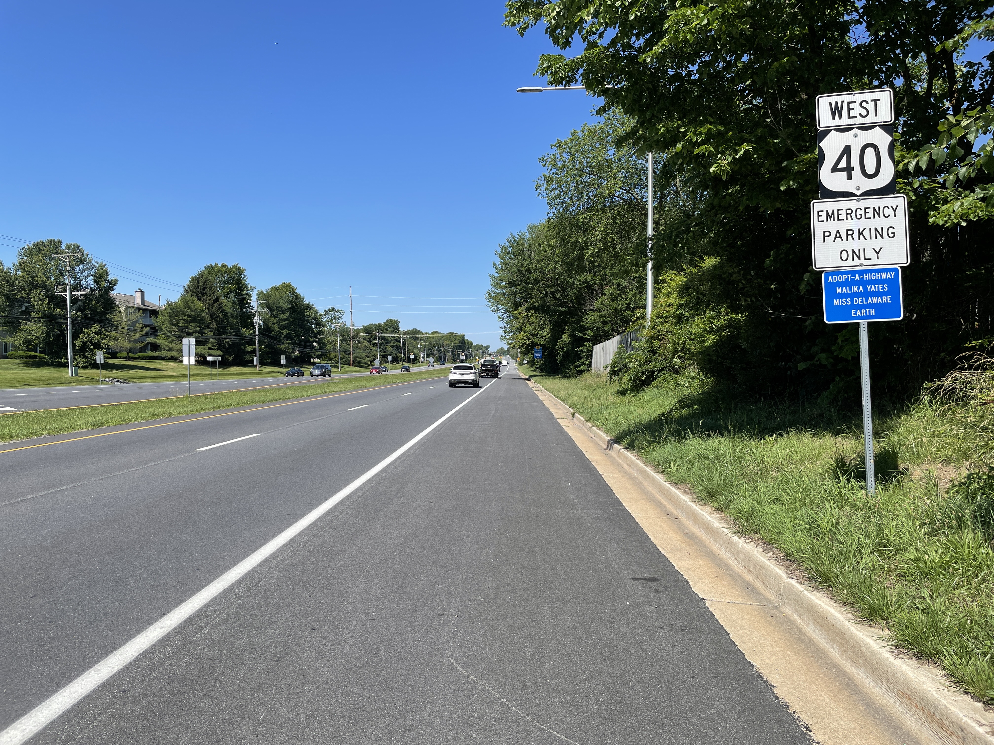
U.S. Route 40 (US 40) is a US highway running from Silver Summit, Utah, east to Atlantic City, New Jersey. In the US state of Delaware, it serves as a major east–west highway in northern New Castle County, Delaware, New Castle County, just south of Wilmington, Delaware, Wilmington. It runs from the Maryland state line west of Glasgow, Delaware, Glasgow east to the Delaware Memorial Bridge over the Delaware River to New Jersey, at which point it is concurrency (road), concurrent with Interstate 295 (Delaware–Pennsylvania), Interstate 295 (I-295). Along the way, US 40 passes through suburban areas in Glasgow and Bear, Delaware, Bear before running concurrent with U.S. Route 13 in Delaware, US 13 and I-295 around New Castle, Delaware, New Castle. US 40 is a multilane divided highway the entire length across Delaware, with the section concurrent with I-295 a freeway. US 40 was originally built as a state highway during the 1920s, comprisi ... [...More Info...] [...Related Items...] OR: [Wikipedia] [Google] [Baidu] |
Delaware Department Of Transportation
The Delaware Department of Transportation (DelDOT) is an agency of the U.S. state of Delaware. The Secretary of Transportation is Shanté Hastings. The agency was established in 1917 and has its headquarters in Dover, Delaware, Dover. The department's responsibilities include maintaining 89 percent of the state's public roadways (the Delaware State Route System) totaling 13,507 lane miles, snow removal, overseeing the "Adopt-A-Highway" program, overseeing E-ZPass Delaware, the Division of Motor Vehicles (DMV), and the Delaware Transit Corporation (known as DART First State). DelDOT maintains a 24/7 Traffic Management Center in Smyrna, Delaware, Smyrna at the State Emergency Operations Center. At that location, they monitor traffic conditions, operate traffic lights, and broadcast on 1380 AM via WTMC radio. Since 1969, the agency has also maintained a transportation library on Bay Road in Dover. On February 18, 2011, Sec. Carolann Wicks, who had been Secretary of Transportatio ... [...More Info...] [...Related Items...] OR: [Wikipedia] [Google] [Baidu] |
Delaware River
The Delaware River is a major river in the Mid-Atlantic region of the United States and is the longest free-flowing (undammed) river in the Eastern United States. From the meeting of its branches in Hancock, New York, the river flows for along the borders of New York, Pennsylvania, New Jersey, and Delaware, before emptying into Delaware Bay. The river has been recognized by the National Wildlife Federation as one of the country's Great Waters and has been called the "Lifeblood of the Northeast" by American Rivers. Its watershed drains an area of and provides drinking water for 17 million people, including half of New York City via the Delaware Aqueduct. The Delaware River has two branches that rise in the Catskill Mountains of New York: the West Branch at Mount Jefferson in Jefferson, Schoharie County, and the East Branch at Grand Gorge, Delaware County. The branches merge to form the main Delaware River at Hancock, New York. Flowing south, the river re ... [...More Info...] [...Related Items...] OR: [Wikipedia] [Google] [Baidu] |
Belltown Run (Muddy Run Tributary)
Belltown Run is a tributary to Muddy Run in northern New Castle County, Delaware in the United States. Course Belltown Run rises on the Long Creek divide New Castle County, Delaware and flows northeast to meet Muddy Run at Heather Woods. Watershed Belltown Run drains of area, receives about 45.2 in/year of precipitation, has a topographic wetness index of 622.53 and is about 18.0% forested. See also *List of Delaware rivers List of rivers in Delaware (U.S. state), grouped by type and sorted by name. Major rivers and creeks (28) * Appoquinimink River * Blackbird Creek * Brandywine Creek * Broad Creek * Broadkill River * Choptank River *Christina River *Delaware Rive ... Maps References {{authority control Rivers of Delaware Rivers of New Castle County, Delaware Tributaries of the Christina River ... [...More Info...] [...Related Items...] OR: [Wikipedia] [Google] [Baidu] |
Delaware Route 896
Delaware Route 896 (DE 896) is a state highway located in New Castle County, Delaware, New Castle County, Delaware. The route runs from U.S. Route 13 in Delaware, U.S. Route 13 (US 13) in Boyds Corner, Delaware, Boyds Corner north to the Maryland border northwest of Newark, Delaware, Newark, where the road becomes unsigned Maryland Route 896 (MD 896) briefly before heading into Pennsylvania as Pennsylvania Route 896 (PA 896). The route heads west from US 13 before turning north along with Delaware Route 71, DE 71 in Mount Pleasant, Delaware, Mount Pleasant, crossing the Chesapeake & Delaware Canal on the Summit Bridge. After the bridge, DE 71 splits off to the east and the road continues to Glasgow, Delaware, Glasgow, where it comes to an intersection with U.S. Route 40 in Delaware, US 40. DE 896 continues north and interchange with Interstate 95 in Delaware, Interstate 95 (I-95) before reaching Newark, where i ... [...More Info...] [...Related Items...] OR: [Wikipedia] [Google] [Baidu] |
Baltimore
Baltimore is the most populous city in the U.S. state of Maryland. With a population of 585,708 at the 2020 census and estimated at 568,271 in 2024, it is the 30th-most populous U.S. city. The Baltimore metropolitan area is the 20th-largest metropolitan area in the country at 2.84 million residents. The city is also part of the Washington–Baltimore combined statistical area, which had a population of 9.97 million in 2020. Baltimore was designated as an independent city by the Constitution of Maryland in 1851. Though not located under the jurisdiction of any county in the state, it forms part of the central Maryland region together with the surrounding county that shares its name. The land that is present-day Baltimore was used as hunting ground by Paleo-Indians. In the early 1600s, the Susquehannock began to hunt there. People from the Province of Maryland established the Port of Baltimore in 1706 to support the tobacco trade with Europe and established the Town ... [...More Info...] [...Related Items...] OR: [Wikipedia] [Google] [Baidu] |
US 40 WB Past DE 72
US or Us most often refers to: * ''Us'' (pronoun), the objective case of the English first-person plural pronoun ''we'' * US, an abbreviation for the United States US, U.S., Us, us, or u.s. may also refer to: Arts and entertainment Albums * ''Us'' (Brother Ali album) or the title song, 2009 * ''Us'' (Empress Of album), 2018 * ''Us'' (Mull Historical Society album), 2003 * ''Us'' (Peter Gabriel album), 1992 * ''Us'' (EP), by Moon Jong-up, 2021 * ''Us'', by Maceo Parker, 1974 * ''Us'', mini-album by Peakboy, 2019 Songs * "Us" (James Bay song), 2018 * "Us" (Jennifer Lopez song), 2018 * "Us" (Regina Spektor song), 2004 * "Us" (Gracie Abrams song), 2024 * "Us", by Azealia Banks from '' Fantasea'', 2012 * "Us", by Celine Dion from ''Let's Talk About Love'', 1997 * "Us", by Gucci Mane from '' Delusions of Grandeur'', 2019 * "Us", by Spoon from '' Hot Thoughts'', 2017 Other media * US Festival, two 1980s California music festivals organized by Steve Wozniak * ''Us'' (1991 ... [...More Info...] [...Related Items...] OR: [Wikipedia] [Google] [Baidu] |
Delaware Route 273
Delaware Route 273 (DE 273) is a state highway in New Castle County, Delaware. The route runs from Maryland Route 273 (MD 273) at the Maryland border near Newark east to DE 9 and DE 141 in New Castle. The route heads through suburban areas between Newark and New Castle as a multilane road, passing through Ogletown and Christiana. DE 273 intersects DE 896 in downtown Newark; DE 2/ DE 72 on the eastern edge of Newark; DE 4 in Ogletown; Interstate 95 (I-95), DE 7, and DE 1 in Christiana; DE 37 in Pleasantville; and DE 58 and U.S. Route 13 (US 13)/ US 40 in Hares Corner. What is now DE 273 was originally built as a state highway in the 1920s and 1930s, with the portion east of Hares Corner becoming a part of US 40, which had crossed the Delaware River on a ferry between New Castle and Pennsville, New Jersey. DE 273 was designated by 1936 to run from the Ma ... [...More Info...] [...Related Items...] OR: [Wikipedia] [Google] [Baidu] |
Pennsville, New Jersey
Pennsville Township is a township in Salem County, in the U.S. state of New Jersey. The township is named for William Penn. It is the westernmost town in New Jersey. As of the 2020 United States census, the township's population was 12,684, a decrease of 725 (−5.4%) from the 2010 census count of 13,409, which in turn reflected an increase of 215 (+1.6%) from the 13,194 counted in the 2000 census. The township had the 24th-highest property tax rate in New Jersey, with an equalized rate of 4.285% in 2020, compared to 3.476% in the county as a whole and a statewide average of 2.279%. The township, and all of Salem County, is part of South Jersey and of the Philadelphia- Wilmington- Camden, PA-NJ- DE- MD combined statistical area, also known as the Delaware Valley or Philadelphia metropolitan area. History Early History At the time of the European settlements in America in the 1600s, the Lenni Lenape Tribe called Unilachtigo occupied the area, calling it "Hoppemense." ... [...More Info...] [...Related Items...] OR: [Wikipedia] [Google] [Baidu] |
Penns Grove, New Jersey
Penns Grove is a borough in Salem County, in the U.S. state of New Jersey. As of the 2020 United States census, the borough's population was 4,837, a decrease of 310 (−6.0%) from the 2010 census count of 5,147, which in turn reflected an increase of 261 (+5.3%) from the 4,886 counted in the 2000 census. Penns Grove had the fourth-highest property tax rate in New Jersey, with an equalized rate of 5.556% in 2020, compared to 3.476% in Salem County and a statewide average of 2.279%. History The area was long primarily agricultural. Penns Grove was incorporated as a borough by an act of the New Jersey Legislature on March 8, 1894, from portions of Upper Penns Neck Township (now Carneys Point Township), based on the results of a referendum held two days earlier.Snyder, John P''The Story of New Jersey's Civil Boundaries: 1606-1968'' Bureau of Geology and Topography; Trenton, New Jersey; 1969. p. 216. Accessed May 30, 2024. It began to industrialize around this time. The borou ... [...More Info...] [...Related Items...] OR: [Wikipedia] [Google] [Baidu] |
Freeway
A controlled-access highway is a type of highway that has been designed for high-speed vehicular traffic, with all traffic flow—ingress and egress—regulated. Common English terms are freeway, motorway, and expressway. Other similar terms include ''wikt:throughway, throughway'' or ''thruway'' and ''parkway''. Some of these may be limited-access highways, although this term can also refer to a class of highways with somewhat less isolation from other traffic. In countries following the Vienna Convention on Road Signs and Signals, Vienna convention, the motorway qualification implies that walking and parking are forbidden. A fully controlled-access highway provides an unhindered flow of traffic, with no traffic signals, Intersection (road), intersections or frontage, property access. They are free of any at-grade intersection, at-grade crossings with other roads, railways, or pedestrian paths, which are instead carried by overpasses and underpasses. Entrances and exits to t ... [...More Info...] [...Related Items...] OR: [Wikipedia] [Google] [Baidu] |


