|
Turuntie
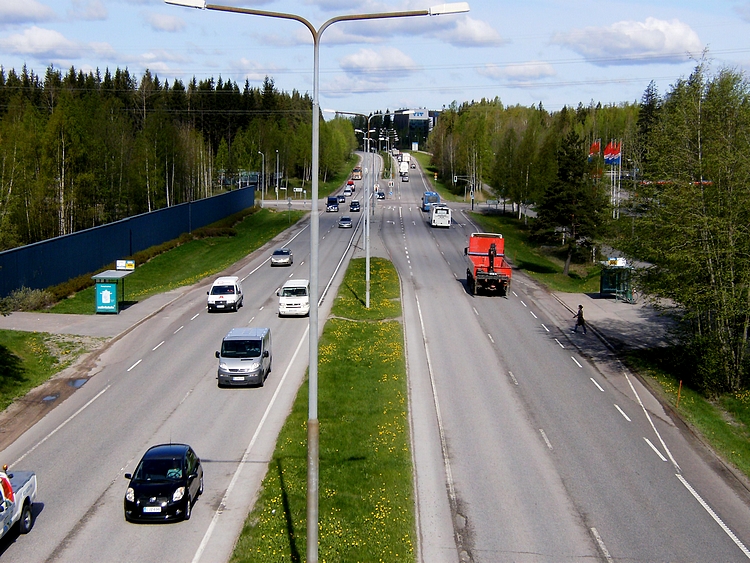
Finnish regional road 110 (, ), or Turku Road (, ), is the leading regional road from Helsinki to Turku. The road is a parallel to the former Highway 1 and the current Highway 1 ( E18). Regional road 110 actually starts at the Haaga roundabout. In it, it differs from regional road 120, or Vihdintie, which again starts at the northern end of Mannerheimintie. The road runs from Helsinki through Veikkola to Saukkola and Nummenkylä in Lohja and from there through Salo's Kitula Kitula (; literally translated the "place of linger") is a village in Suomusjärvi, Salo, Finland, Salo, in Southwest Finland, along Finnish regional road 110, regional road 110 (Old Turku Road). It is the administrative center of the former munic ..., Muurla and the center of Salo to Kupittaa in Turku. The alignment of the road partly follows the old king's road. References External links Roads in Finland Transport in Helsinki Transport in Espoo Transport in Turku {{Europe-road-stub ... [...More Info...] [...Related Items...] OR: [Wikipedia] [Google] [Baidu] |
Mannerheimintie
Mannerheimintie () (previously known as ''Henrikinkatu'', ''Läntinen ja Itäinen Henrikinkatu'', ''Läntinen ja Itäinen Heikinkatu'', ''Turuntie'', ''Läntinen viertotie'', ''Heikinkatu''), colloquially known as Mansku, named after the Finnish military leader and statesman Carl Gustaf Emil Mannerheim, is the main street and boulevard of Helsinki, Finland. It also forms part of the European route E12 and a continuation of the Finnish national road 3. The street was originally named Heikinkatu (), after Robert Henrik Rehbinder on the first part up to the current Kiasma Art museum and Turuntie after that, but was renamed after the Winter War. The change of name was also a reference to Mannerheim's victory parade along the road during the Finnish Civil War (1918), after German forces, allied with Mannerheim's Finnish forces, had retaken the city. The street is 5.5 kilometres long and begins at Erottaja in the city centre, near the Swedish Theatre and continues in a northe ... [...More Info...] [...Related Items...] OR: [Wikipedia] [Google] [Baidu] |
Salo, Finland
Salo () is a town in Finland, located in the southwestern interior of the country. The population of Salo is approximately , while the Salo sub-region, sub-region has a population of approximately . It is the most populous Municipalities of Finland, municipality in Finland, and the 24th most populous List of urban areas in Finland by population, urban area in the country. Salo is located in the Southwest Finland. Salo covers an area of of which is water. The population density is . The municipality is unilingually Finnish language, Finnish. The name ''Salo'' means woodland, backwoods, but also a wooded island in Finnish. It is believed that Salo originally referred to an island located south of the current town over a thousand years ago, which is now a hill due to post-glacial rebound, and not even close to the sea today. Salo is a small city located between the capital Helsinki ( away) and the provincial capital Turku ( away). The city's proximity to these larger cities h ... [...More Info...] [...Related Items...] OR: [Wikipedia] [Google] [Baidu] |
Finnish National Road 1
The Finnish national road 1 ( or ; ) is the main route between the major cities of Helsinki and Turku in southern Finland. It runs from Munkkiniemi in Helsinki to the VI District of Turku, and is part of the European route E18. The road is a motorway for its whole length. The first portion of the motorway was constructed in the 1960s between central Helsinki and Kehä III, and extended to Lohjanharju in the 1970s. In the other end of the road, the motorway stretches from eastern Turku to Lahnajärvi near Suomusjärvi. In 2005, a portion of motorway between Lohjanharju and Lohja was opened. The last part of the motorway (Lahnajärvi–Lohjanharju) was opened on January 28, 2009. This part of motorway contains five tunnels totalling . The longest tunnel (, double-bore) is also the second longest road tunnel in Finland. Route The road passes through the following localities: *Helsinki *Espoo *Kirkkonummi (Veikkola) *Vihti *Lohja * Salo *Paimio *Kaarina *Turku See also * ... [...More Info...] [...Related Items...] OR: [Wikipedia] [Google] [Baidu] |
Finnish Regional Road 120
Finnish regional road 120 (, ), or Vihti Road (, ), is a regional road from Haaga in Helsinki to Maikkala in Vihti. The road is part of the former Pori Highway. Regional road 120 was originally intended as the main road connection from Helsinki to Pori via the Vihti church village, but when it was completed, the road was already prone to accidents due to its complexity, hilliness and narrowness. However, the Helsinki-side section of the road up to Ring III has later been widened to four lanes, but the beginning of Vihdintie in Etelä-Haaga from Mannerheimintie to Haaga roundabout is street-like. The regional road also passes Highway 25 at the village of Otalampi. Significant commercial centers along Vihdintie include the Ristikko Shopping Centre in the Konala district. [...More Info...] [...Related Items...] OR: [Wikipedia] [Google] [Baidu] |
Helsinki
Helsinki () is the Capital city, capital and most populous List of cities and towns in Finland, city in Finland. It is on the shore of the Gulf of Finland and is the seat of southern Finland's Uusimaa region. About people live in the municipality, with million in the Helsinki capital region, capital region and million in the Helsinki metropolitan area, metropolitan area. As the most populous List of urban areas in Finland by population, urban area in Finland, it is the country's most significant centre for politics, education, finance, culture, and research. Helsinki is north of Tallinn, Estonia, east of Stockholm, Sweden, and west of Saint Petersburg, Russia. Helsinki has significant History of Helsinki, historical connections with these three cities. Together with the cities of Espoo, Vantaa and Kauniainen—and surrounding commuter towns, including the neighbouring municipality of Sipoo to the east—Helsinki forms a Helsinki metropolitan area, metropolitan are ... [...More Info...] [...Related Items...] OR: [Wikipedia] [Google] [Baidu] |
Transport In Helsinki
Helsinki () is the capital and most populous city in Finland. It is on the shore of the Gulf of Finland and is the seat of southern Finland's Uusimaa region. About people live in the municipality, with million in the capital region and million in the metropolitan area. As the most populous urban area in Finland, it is the country's most significant centre for politics, education, finance, culture, and research. Helsinki is north of Tallinn, Estonia, east of Stockholm, Sweden, and west of Saint Petersburg, Russia. Helsinki has significant historical connections with these three cities. Together with the cities of Espoo, Vantaa and Kauniainen—and surrounding commuter towns, including the neighbouring municipality of Sipoo to the east—Helsinki forms a metropolitan area. This area is often considered Finland's only metropolis and is the world's northernmost metropolitan area with over one million inhabitants. Additionally, it is the northernmost capital of an E ... [...More Info...] [...Related Items...] OR: [Wikipedia] [Google] [Baidu] |
Roads In Finland
Roads in Finland comprise of highways, paved and gravel roads which are divided in four to five classes according to their local importance. The total length of public roads, private and forest roads and streets in Finland is about . Classification of public roads The classification and numbering system of state-maintained roads of Finland is as follows: *Motorways in Finland, Main roads Class I (; ): 1–39 (between major cities) *Highways in Finland, Main roads Class II (; ): 40–99 (between regional centers) *Regional roads (; ): 100–999 (between large municipalities or alternate routes) *Connecting roads (; ): 1000–9999 (connecting to a larger road) *Local roads (; ): 11000–19999 (between villages cf. farm-to-market road) Streets are maintained by the local municipality. Winter maintenance of roads and streets is managed by a local authority. Regional roads and connecting roads cf. county highways and roads. Main roads cf. Interstates or U.S. routes. All ... [...More Info...] [...Related Items...] OR: [Wikipedia] [Google] [Baidu] |
King's Road (Finland)
King's Road (Finnish: ''Kuninkaantie'', Swedish: ''Kungsvägen'') is an old mailing route in Northern Europe dating back to the 14th century, starting from Bergen in Norway on the Atlantic coast, passing through the capitals of Norway and Sweden (Oslo and Stockholm) crossing the sea through the Åland archipelago to Turku in SW Finland and ending up in Vyborg in Russia. The modern tourist route "King's Road" is extended to St. Petersburg Saint Petersburg, formerly known as Petrograd and later Leningrad, is the second-largest city in Russia after Moscow. It is situated on the River Neva, at the head of the Gulf of Finland on the Baltic Sea. The city had a population of 5,601, .... See also * King's Road (other) for other King's Roads External links * Roads in Finland Old roads of Norway Roads in Russia Roads in Sweden {{Norway-transport-stub ... [...More Info...] [...Related Items...] OR: [Wikipedia] [Google] [Baidu] |
Kupittaa
Kupittaa () is a district in Turku, Finland. It is located on the eastern side of the city's centre, around the Kupittaa Park, the first landscaped park in a Finnish city. The district serves as a centre for recreation and business. Turku has recently planned a residential area for 750 residents on the premises of a former HKScan sausage factory. Name The name ''Kupittaa'' may be associated with an old border and may be related to the word , a name for a boundary mark. Another theory is that it comes from the Slavic language, Slavic word for a merchant, . History According to a version of the legend, the first paganism, pagan Finns were baptism, baptised into Christianity by the Bishop Henry at a spring in Kupittaa Park on Midsummer Day in the year 1155. In the 18th century, the spring was used as a thermal bath, spa facility. Buildings Most of the Turku Science Park business centre is located in Kupittaa. The centre is currently expanding around Kupittaa railway station, next ... [...More Info...] [...Related Items...] OR: [Wikipedia] [Google] [Baidu] |


