|
Tower Of Brenta
The Tower of Brenta (3,014 metres) is a peak in the Brenta Dolomites, forming the highest summit of the ''Catena degli Sfulmini'' sector within the SOIUSA classification.Being a sector related to SOIUSA subgroups, it is not often used. In particular, the Central Brenta Subgroup cod. II/C-28.IV-A.1.e is divided into the Cima Brenta Massif cod. 1.e/a and precisely Sfulmini Chain cod. 1.e/b. It ranks among the principal peaks of the Brenta Group and is one of the 86 Dolomites summits exceeding 3,000 metres. The mountain overlooks the ''Conca degli Armi'', the Armi Glacier, and the nearby ''.'' Description The Tower of Brenta is a large tower in between the ''Bocchetta Alta degli Sfulmini'' and the ''Bocca degli Armi''. Its northern face features a high, rocky wall incised with deep chimneys, while the southwest and southeast faces are more compact and vertical. The high-quality dolomite rock and accessibility from nearby refuges (Alimonta, , and ) make it a popular destination ... [...More Info...] [...Related Items...] OR: [Wikipedia] [Google] [Baidu] |
Trentino
Trentino (), officially the Autonomous Province of Trento (; ; ), is an Autonomous province#Italy, autonomous province of Italy in the Northern Italy, country's far north. Trentino and South Tyrol constitute the Regions of Italy, region of Trentino-Alto Adige/Südtirol, an autonomous region under the constitution. The province is composed of 166 ''comuni'' (: ''comune''). Its capital is the city of Trento (Trent). The province covers an area of more than , with a total population of 541,098 in 2019. Trentino is renowned for its Mountain, mountains, such as the Dolomites, which are part of the Alps. Etymology The province is generally known as "Trentino". The name derives from Trento, the capital city of the province. Originally, the term was used by the local population only to refer to the city and its immediate surroundings. Under former Austrian Empire, Austrian rule, which began in the 19th century (previously, Trentino was governed by the local bishop), the common German ... [...More Info...] [...Related Items...] OR: [Wikipedia] [Google] [Baidu] |
Molveno
Molveno is a ''comune'' (municipality) in Trentino in the northern Italian region of Trentino-Alto Adige/Südtirol, located about northwest of Trento. It is famous for its positioning on Lake Molveno as a holiday destination, its nearby ski resorts (Andalo-Paganella) and its connection to the National Park Adamello Brenta. Geography Molveno is located at the northern end of a long lake ('' Lago di Molveno''), at the foot of the Brenta Group and the Paganella mountain. The Lake of Molveno, formed by a landslide about 4000 years ago, is the second largest in Trentino-Alto Adige, . It has a maximum depth of . It's famous for its diverse fish species, including trout, arctic char and perch. Molveno borders the following municipalities: Andalo, Cavedago, Ragoli, San Lorenzo in Banale, Spormaggiore, Terlago, Tuenno and Vezzano. History The area of Molveno is known to have been settled since the Neolithic age. Due to its strategic position at the entrance of the Brenta-Paganel ... [...More Info...] [...Related Items...] OR: [Wikipedia] [Google] [Baidu] |
Tre Ville
Tre Ville is a ''comune'' (municipality) in the Province of Trentino in the Italian region Trentino-Alto Adige/Südtirol. It was established on 1 January 2016 by the merger of the municipalities of Montagne, Preore and Ragoli Ragoli (''Ràgoi'' in local dialect) was a ''comune'' (municipality) in Trentino in the northern Italian region Trentino-Alto Adige/Südtirol, located about west of Trento. As of 31 December 2004, it had a population of 781 and an area of .All d .... References Cities and towns in Trentino-Alto Adige/Südtirol {{TrentinoAltoAdige-geo-stub ... [...More Info...] [...Related Items...] OR: [Wikipedia] [Google] [Baidu] |
Alps
The Alps () are some of the highest and most extensive mountain ranges in Europe, stretching approximately across eight Alpine countries (from west to east): Monaco, France, Switzerland, Italy, Liechtenstein, Germany, Austria and Slovenia. The Alpine arch extends from Nice on the western Mediterranean Sea, Mediterranean to Trieste on the Adriatic Sea, Adriatic and Vienna at the beginning of the Pannonian Basin. The mountains were formed over tens of millions of years as the African and Eurasian tectonic plates collided. Extreme shortening caused by the event resulted in marine sedimentary rocks rising by thrust fault, thrusting and Fold (geology), folding into high mountain peaks such as Mont Blanc and the Matterhorn. Mont Blanc spans the French–Italian border, and at is the highest mountain in the Alps. The Alpine region area contains 82 peaks higher than List of Alpine four-thousanders, . The altitude and size of the range affect the climate in Europe; in the mountain ... [...More Info...] [...Related Items...] OR: [Wikipedia] [Google] [Baidu] |
SOIUSA
Alps by SOIUSA. SOIUSA (an acronym for - English: ''International Standardized Mountain Subdivision of the Alps-ISMSA'') is a classification system of the Alps from the geographic and toponomastic point of view. It was designed by Sergio Marazzi, Italian researcher and author of the Orographic Atlas of the Alps ''SOIUSA''. His book was presented with the patronage of the Italian Alpine Club on 23 Jan 2006, but has yet to receive any formal acceptance. History The SOIUSA is an interpretation by Marazzi of the terrain of the Alps aiming to replace the traditional way the Alps were partitioned in Italy, the , which was adopted in 1926 by the Italian National Geographic Committee () after the IX Italian Geographic Congress (). SOIUSA takes into account the European geographic literature normalizing and standardizing the different national classification systems in use. It was publicly presented in a lecture organized by the Italian Alpine Club's Milan conference on 6 April 2006, f ... [...More Info...] [...Related Items...] OR: [Wikipedia] [Google] [Baidu] |
Dolomites
The Dolomites ( ), also known as the Dolomite Mountains, Dolomite Alps or Dolomitic Alps, are a mountain range in northeastern Italy. They form part of the Southern Limestone Alps and extend from the River Adige in the west to the Piave Valley ( Pieve di Cadore) in the east. The northern and southern borders are defined by the Puster Valley and the Sugana Valley (). The Dolomites are in the regions of Veneto, Trentino-Alto Adige/Südtirol and Friuli-Venezia Giulia, covering an area shared between the provinces of Belluno, Vicenza, Verona, Trentino, South Tyrol, Udine and Pordenone. Other mountain groups of similar geological structure are spread along the River Piave to the east—; and far away over the Adige River to the west—'' Dolomiti di Brenta'' (Western Dolomites). A smaller group is called (Little Dolomites), between the provinces of Trentino, Verona and Vicenza. The Dolomiti Bellunesi National Park and many other regional parks are in the Dolomites. On 26 J ... [...More Info...] [...Related Items...] OR: [Wikipedia] [Google] [Baidu] |
Dolomite (rock)
Dolomite (also known as dolomite rock, dolostone or dolomitic rock) is a sedimentary rock, sedimentary carbonate rock that contains a high percentage of the mineral Dolomite (mineral), dolomite, CaMg(CO3)2. It occurs widely, often in association with limestone and evaporites, though it is less abundant than limestone and rare in Cenozoic rock beds (beds less than about 66 million years in age). One of the first geologists to distinguish dolomite from limestone was Déodat Gratet de Dolomieu, a French mineralogist and geologist after whom it is named. He recognized and described the distinct characteristics of dolomite in the late 18th century, differentiating it from limestone. Most dolomite was formed as a magnesium replacement of limestone or of Lime (mineral), lime mud before lithification. The geological process of conversion of calcite to dolomite is known as dolomitization and any intermediate product is known as dolomitic limestone. The "dolomite problem" refers to the v ... [...More Info...] [...Related Items...] OR: [Wikipedia] [Google] [Baidu] |
Campanile Basso
Campanile Basso is a mountain in the Brenta group (''It.: Dolomiti di Brenta''), a subgroup of the Rhaetian Alps in the Italian Region of Trentino-Alto Adige, with a height of (). It is of a slender, almost fully vertical shape on all sides, rising 300 metres straight up. The mountain is named for its similarity in shape to a belltower (It.: campanile) and it being low (It.: basso) compared to the neighboring Campanile Alto and Brenta Alta. The German alpinist Karl Schulz introduced in 1884 the name ''Guglia di Brenta'' ("Guglia = "spire"), a name widely used until World War I and especially enduring in German literature, but considered inappropriate by locals and Italian climbers.Castiglioni, page 242 Geologically, Campanile Basso is entirely formed of Triassic sedimentary rock, dense and compact dolomite. Due to its inaccessible appearance it was long left untouched during the alpine exploration of the Eastern Alps. Around the turn of the century a competitive race for the f ... [...More Info...] [...Related Items...] OR: [Wikipedia] [Google] [Baidu] |
Grade (climbing)
Many climbing routes have grades for the technical difficulty, and in some cases for the risks, of the route. The first ascent, first ascensionist can suggest a grade but it will be amended for the ''consensus view'' of subsequent ascents. While many countries with a tradition of climbing developed their own grading systems, a small number of grading systems have become internationally dominant for each type of climbing, and which has led to the standardization of grading worldwide. Over the years, grades have List of grade milestones in rock climbing, consistently risen in all forms of climbing, helped by improvements in climbing technique and climbing equipment, equipment. In free climbing (i.e. climbing rock routes with no aid), the most popular grading systems are the French numerical or sport system (e.g. f7c+), the American YDS system (e.g. 5.13a), and latterly the UIAA scale (e.g. IX+). These systems grade technical difficulty being the main focus of the lower-risk a ... [...More Info...] [...Related Items...] OR: [Wikipedia] [Google] [Baidu] |
Via Ferrata
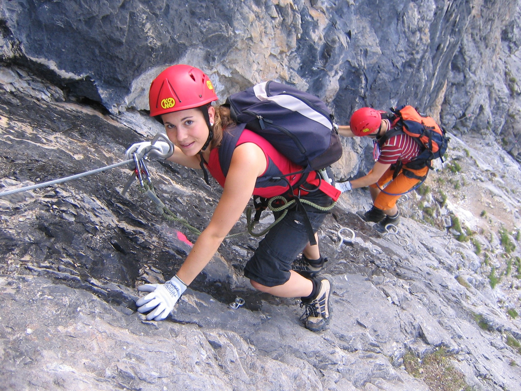
A via ferrata (Italian language, Italian for "iron path", plural ''vie ferrate'' or in English ''via ferratas'') is a protected climbing route found in the Alps and certain other Alpine locations. The protection includes steel fixtures such as cables and railings to arrest the effect of any fall, which the climber can either hold onto or Glossary of climbing terms#clip in, clip into using climbing protection. Some via ferratas can also include steel fixtures that provide aid climbing, aid in overcoming the obstacles encountered, including steel ladders and steel steps. Description A via ferrata is a climbing route in the mountains that employs steel cables, rungs, or ladders, fixed to the rock to which the climbers affix #Via ferrata set, a harness with two leashes, which allows the climbers to secure themselves to the metal fixture and limit any fall. The cable and other fixtures, such as iron rungs (stemples), pegs, carved steps, and ladders and bridges, provide both footing ... [...More Info...] [...Related Items...] OR: [Wikipedia] [Google] [Baidu] |
Mountains Of Trentino
A mountain is an elevated portion of the Earth's crust, generally with steep sides that show significant exposed bedrock. Although definitions vary, a mountain may differ from a plateau in having a limited summit area, and is usually higher than a hill, typically rising at least above the surrounding land. A few mountains are isolated summits, but most occur in mountain ranges. Mountains are formed through tectonic forces, erosion, or volcanism, which act on time scales of up to tens of millions of years. Once mountain building ceases, mountains are slowly leveled through the action of weathering, through slumping and other forms of mass wasting, as well as through erosion by rivers and glaciers. High elevations on mountains produce colder climates than at sea level at similar latitude. These colder climates strongly affect the ecosystems of mountains: different elevations have different plants and animals. Because of the less hospitable terrain and climate, mountains ... [...More Info...] [...Related Items...] OR: [Wikipedia] [Google] [Baidu] |


