|
Tourism In Ethiopia
Tourism in Ethiopia accounted for 5.5% of the country's gross domestic product (GDP) in 2006, having barely increased 2% over the previous year. The government is proving its commitment and willingness to develop tourism through a number of initiatives. Tourism is a featured component of Ethiopia's Poverty Reduction Strategy Paper (PRSP), which aims to combat poverty and encourage economic development. Overview Tourist destinations include List of National Parks of Ethiopia, Ethiopia's collection of national parks (including Semien Mountains National Park), and historic sites, such as the cities of Axum, Lalibela and Gondar, Harar Jugol walled city, Negash Mosque, in Negash and Sof Omar Caves. Developed in the 1960s, tourism declined greatly during the later 1970s and the 1980s under the Derg. Recovery began in the 1990s, but growth has been constrained by the lack of suitable hotels and other infrastructure, despite a boom in construction of small and medium-sized hotels and ... [...More Info...] [...Related Items...] OR: [Wikipedia] [Google] [Baidu] |
Public Domain
The public domain (PD) consists of all the creative work to which no Exclusive exclusive intellectual property rights apply. Those rights may have expired, been forfeited, expressly Waiver, waived, or may be inapplicable. Because no one holds the exclusive rights, anyone can legally use or reference those works without permission. As examples, the works of William Shakespeare, Ludwig van Beethoven, Miguel de Cervantes, Zoroaster, Lao Zi, Confucius, Aristotle, L. Frank Baum, Leonardo da Vinci and Georges Méliès are in the public domain either by virtue of their having been created before copyright existed, or by their copyright term having expired. Some works are not covered by a country's copyright laws, and are therefore in the public domain; for example, in the United States, items excluded from copyright include the formulae of Classical mechanics, Newtonian physics and cooking recipes. Other works are actively dedicated by their authors to the public domain (see waiver) ... [...More Info...] [...Related Items...] OR: [Wikipedia] [Google] [Baidu] |
Gedeo Cultural Landscape
The Gedeo Cultural Landscape is a region of the Gedeo Zone, part of the South Ethiopia Regional State in south-central Ethiopia. It stretches across the eastern flank of the Main Ethiopian Rift, ranging from above sea level. The region is home to roughly 2,550,000 Gedeo people. Dotted with sacred forests and megalithic monuments, the region has been the homeland of the Gedeo people for thousands of years. Traditional agroforestry is practiced in the region by the Gedeo people. Because of these traditional practices, its long history of occupation, and the cultural importance of the region, the Gedeo Cultural Landscape was inscribed on the UNESCO World Heritage List in 2023. History The Gedeo region has been occupied for millennia; evidence of occupation dates back to the Neolithic period. Thousands of stone monuments (stelae) across roughly 100 sites have been recorded across the landscape. The largest of the stelae measure about 8 meters high and 1 meter in diameter, and they ... [...More Info...] [...Related Items...] OR: [Wikipedia] [Google] [Baidu] |
Simien Mountains National Park
Simien Mountains National Park is the largest national park in Ethiopia. Located in the North Gondar Zone of the Amhara Region, its territory covers the highest parts of the Simien Mountains and includes Ras Dashan, the highest point in Ethiopia. It is home to a number of endangered species, including the Ethiopian wolf and the walia ibex, a wild goat found nowhere else in the world. The gelada baboon and the caracal, a cat, also occur within the Simien Mountains. More than 50 species of birds inhabit the park, including the bearded vulture, or lammergeier, with its wingspan. The park is crossed by an unpaved road which runs from Debarq, where the administrative headquarters of the park is located, east through a number of villages to the Buahit Pass, where the road turns south to end at Mekane Berhan, beyond the park boundary. History The park was established in 1969, having been set up by Clive Nicol, who wrote about his experiences in ''From the Roof of Africa'' (1 ... [...More Info...] [...Related Items...] OR: [Wikipedia] [Google] [Baidu] |
Tiya
Tiya is a town in central Ethiopia. It is situated in the Gurage Zone of the Southern Nations, Nationalities, and Peoples Region south of Addis Ababa. It is also the location of the Tiya archaeological site, famous for its unique stelae. Demographics Based on figures from the Central Statistical Agency in 2005, Tiya has an estimated total population of 3,363 of whom 1,615 are men and 1,748 are women. Table B.4 The 1994 national census reported this town had a total population of 1,856 of whom 894 were males and 962 were females. Tiya is one of three towns in Soddo . See ...
|
Omo River
The Omo River (; also called Omo-Bottego) in southern Ethiopia is the largest Ethiopian river outside the Nile Basin. Its course is entirely contained within the boundaries of Ethiopia, and it empties into Lake Turkana on the border with Kenya. The river is the principal stream of an endorheic drainage basin, the Turkana Basin. The river basin is famous for its large number of early hominid fossils and archeological findings such as early stone tools, leading to its inclusion on the UNESCO World Heritage List in 1980. Geography The Omo River forms through the confluence of the Gibe River, by far the largest total tributary of the Omo River, and the Wabe River, the largest left-bank tributary of the Omo. Given their sizes, lengths and courses one might consider both the Omo and the Gibe rivers to be one and the same river but with different names. Consequently, the whole river basin is sometimes called the ''Omo-Gibe River Basin''. This river basin includes part of the western ... [...More Info...] [...Related Items...] OR: [Wikipedia] [Google] [Baidu] |
Awash River
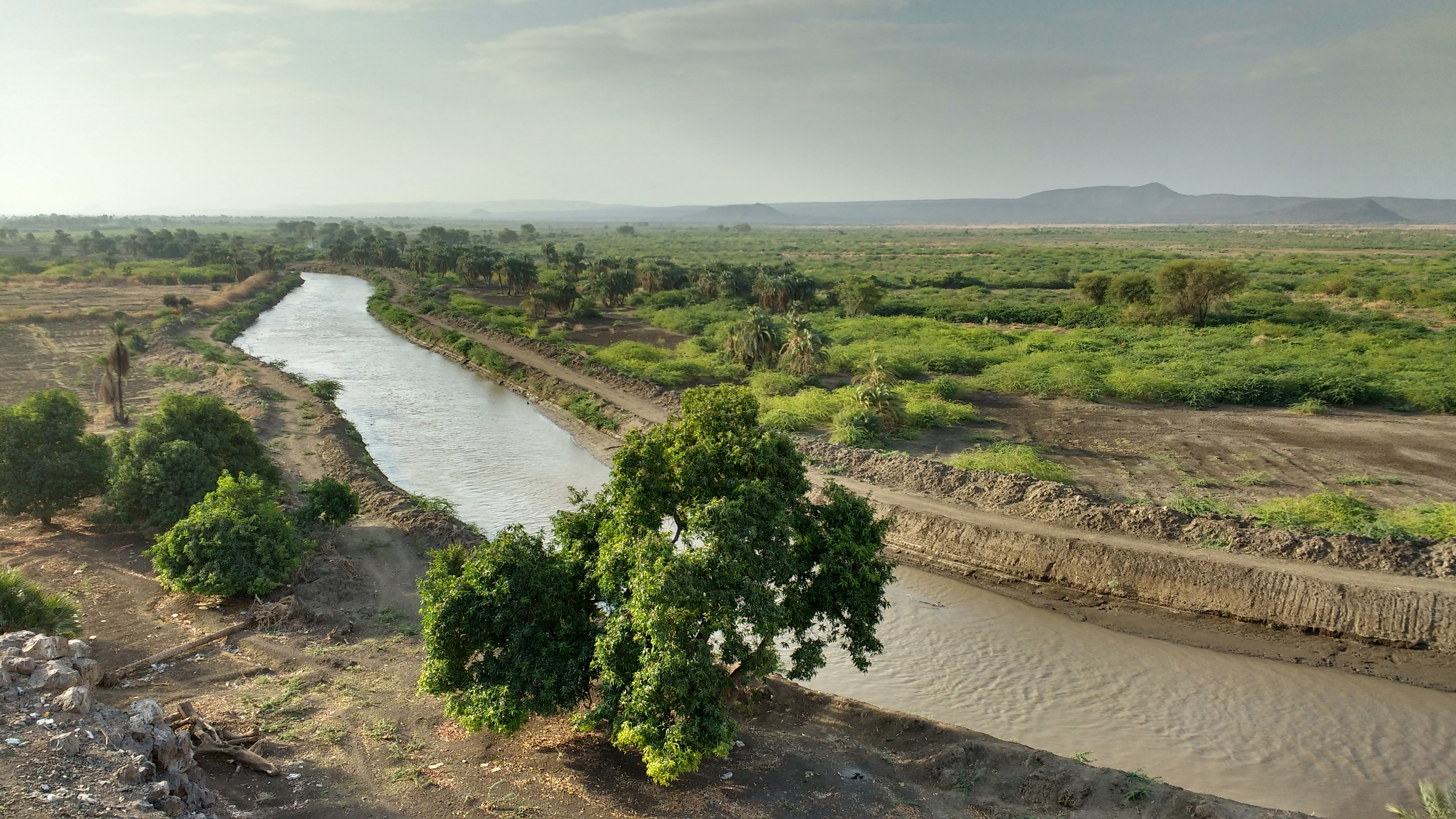
} The Awash River (sometimes spelled Awaash; Oromo language, Oromo: ''Awaash OR Hawaas'', Amharic: ዐዋሽ, Afar language, Afar: ''Hawaash We'ayot'', Somali language, Somali: ''Webiga Dir'', Italian language, Italian: ''Auasc'') is a major river of Ethiopia. Its course is entirely contained within the boundaries of Ethiopia and empties into a chain of interconnected lakes that begin with Lake Gargori and end with Lake Abbe (or Abhe Bad) on the border with Djibouti, about from the head of the Gulf of Tadjoura. The Awash River is the principal stream of an endorheic drainage basin covering parts of the Amhara Region, Amhara, Oromia and Somali Regions, as well as the southern half of the Afar Region. The Awash River basin, spanning 23 administrative zones, covers 10% of Ethiopia's area. The basin usually has two rainy seasons, a shorter one around March (''Belg''), and a longer one between June and September (''Kiremt''), which partly fall into one longer rainy season. Climate chan ... [...More Info...] [...Related Items...] OR: [Wikipedia] [Google] [Baidu] |
Konso
Karat is a town in south-western Ethiopia and the capital of the Konso Zone in the new South Ethiopia Regional State. Situated 20 km north of the Sagan River at an elevation of , it is also called Pakawle by some of the neighboring inhabitants. The town and the surrounding villages were inscribed on the UNESCO World Heritage List in 2011 as a cultural landscape for its unique cultural traditions and importance for the Konso people. History Oral traditions of the Konso people suggest that they migrated to the region roughly 400 years ago, which is supported by the number of generations (21) noted since the first ritual chief. In 1897, Menelik II took over the city.Shako OttoTraditional Konso culture and the missionary impact ''Persee.fr'', 2005 Father Azaïs presented the Waga (wa'kka) statues in 1931. In 1956, Murdock associated the archeological megaliths of the town to a Cushitic peoples, cushitic signature. In Kluckhohn's ''Markets of Africa'' published in 1962, the auth ... [...More Info...] [...Related Items...] OR: [Wikipedia] [Google] [Baidu] |
Harar
Harar (; Harari language, Harari: ሀረር / ; ; ; ), known historically by the indigenous as Harar-Gey or simply Gey (Harari: ጌይ, ݘٛىيْ, ''Gēy'', ), is a List of cities with defensive walls, walled city in eastern Ethiopia. It is also known in Arabic as the City of Wali, Saints (). Harar is the capital city of the Harari Region. The ancient city is located on a hilltop in the eastern part of the country and is about from the Ethiopian capital Addis Ababa at an elevation of . For centuries, Harar has been a major commercial center, linked by the trade routes with the rest of Ethiopia, the entire Horn of Africa, the Arabian Peninsula, Asia, and through its ports, the outside world. Harar Jugol, the old walled city, was listed as a World Heritage Site in 2006 by UNESCO in recognition of its cultural heritage. Because of Harar's long history of involvement during times of trade in the Arabian Peninsula, the Government of Ethiopia has made it a criminal offence to demol ... [...More Info...] [...Related Items...] OR: [Wikipedia] [Google] [Baidu] |
Fasil Ghebbi
The Fasil Ghebbi () is a fortress located in Gondar, Amhara Region, Ethiopia. It was founded in the 17th century by Emperor Fasilides and was the home of Ethiopian emperors. Its unique architecture shows diverse influences including Portuguese, Hindu, and Arab characteristics. Because of its historical importance and architecture, the fortress was inscribed as a UNESCO World Heritage Site in 1979. ''Ghebbi'' is an Amharic word for a compound or enclosure. The complex of buildings includes Fasilides' castle, Iyasu I's palace, Dawit III's Hall, Empress Mentewab's castle, a chancellery and library from Yohannes I, a banqueting hall from the emperor Bakaffa, stables, and three churches: Asasame Qeddus Mikael, Elfign Giyorgis and Gemjabet Mariyam. History The origins of the Fasil Ghebbi is preceded by old tradition of Ethiopian emperors traveling around their possessions, living off the produce of the peasants and dwelling in tents. Reflecting this connection, this preci ... [...More Info...] [...Related Items...] OR: [Wikipedia] [Google] [Baidu] |
Backpacking (wilderness)
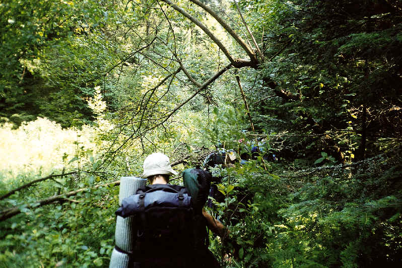
Backpacking is the outdoor recreation of carrying gear on one's back while hiking for more than a day. It is often an extended journey and may involve camping outdoors. In North America, tenting is common, where simple shelters and mountain huts, widely found in Europe, are rare. In New Zealand, hiking is called Tramping in New Zealand, tramping, and tents are used alongside a nationwide network of huts. Hill walking is equivalent in Britain (but this can also refer to a day walk), though backpackers make use of a variety of accommodation, in addition to camping. Backpackers use simple huts in South Africa. Trekking and bushwalking are other words used to describe such multi-day trips. The terms walking tour or Long distance path , long distance hike are also used. Backpacking backpacking (travel), as a method of travel is a different activity, which mainly uses public transport during a journey that can last months. It is, however, similar to bikepacking, bicycle touring, Canoe ... [...More Info...] [...Related Items...] OR: [Wikipedia] [Google] [Baidu] |
Adventure Travel
Adventure travel is a type of tourism, involving exploration or travel with a certain degree of risk (real or perceived), and which may require special skills and physical exertion. In the United States, adventure tourism has seen growth in late 20th and early 21st century as tourists seek out-of-the-ordinary or "roads less traveled" vacations, but lack of a clear operational definition has hampered measurement of market size and growth. According to the U.S.-based Adventure Travel Trade Association, adventure travel may be any tourist activity that includes physical activity, a cultural exchange, and connection with outdoor activities and nature. Adventure tourists may have the motivation to achieve mental states characterized as rush or flow, resulting from stepping outside their comfort zone. This may be from experiencing culture shock or by performing acts requiring significant effort and involve some degree of risk, real or perceived, or physical danger. This may i ... [...More Info...] [...Related Items...] OR: [Wikipedia] [Google] [Baidu] |


