|
Tin City AFS
Tin City Long Range Radar Site is a United States Air Force radar station. It is located west-northwest of Nome, Alaska. It is the former Tin City Air Force Station (AAC ID: F-04, LRR ID: A-11). The radar surveillance station was closed on 1 November 1983, and was re-designated as a Long Range Radar (LRR) site as part of the Alaska Radar System. Today, it remains active as part of the Alaska NORAD Region under the command of the 611th Air and Space Operations Center, Elmendorf AFB, Alaska. History Tin City AFS was a continental defence radar station constructed to provide the United States Air Force early warning of an attack by the Soviet Union on Alaska. It was one of the ten original radar surveillance sites constructed during the early 1950s to establish a permanent air defense system in Alaska. The station was located at the westernmost tip of the Seward Peninsula, also the most westerly point of land on the North American continent. Two small islands, the Little ... [...More Info...] [...Related Items...] OR: [Wikipedia] [Google] [Baidu] |
Alaskan Air Command
The Alaskan Air Command (AAC) is an inactive United States Air Force Major Command originally established in 1942 under the United States Army Air Forces. Its mission was to organize and administer the air defense system of Alaska, exercise direct control of all active measures, and coordinate all passive means of air defense. In addition, the command also supported Strategic Air Command elements operating through and around Alaska. It was redesignated Eleventh Air Force on 9 August 1990 and, concurrently, status changed from a major command of the United States Air Force to a subordinate organization of Pacific Air Forces. History Establishment Established on 18 December 1945 the end of World War II, assuming jurisdiction of former Eleventh Air Force, assets in the Alaska Territory. Headquartered at Davis Army Airfield on Adak, the initial mission of AAC was the consolidation of wartime Army Air Forces in Alaska and training of those forces remaining after demobilization. It ... [...More Info...] [...Related Items...] OR: [Wikipedia] [Google] [Baidu] |
Siberia
Siberia ( ; , ) is an extensive geographical region comprising all of North Asia, from the Ural Mountains in the west to the Pacific Ocean in the east. It has formed a part of the sovereign territory of Russia and its predecessor states since the lengthy conquest of Siberia, which began with the fall of the Khanate of Sibir in 1582 and concluded with the annexation of Chukotka in 1778. Siberia is vast and sparsely populated, covering an area of over , but home to roughly a quarter of Russia's population. Novosibirsk, Krasnoyarsk, and Omsk are the largest cities in the area. Because Siberia is a geographic and historic concept and not a political entity, there is no single precise definition of its territorial borders. Traditionally, Siberia spans the entire expanse of land from the Ural Mountains to the Pacific Ocean, with the Ural River usually forming the southernmost portion of its western boundary, and includes most of the drainage basin of the Arctic Ocean. I ... [...More Info...] [...Related Items...] OR: [Wikipedia] [Google] [Baidu] |
710th Aircraft Control And Warning Squadron - Emblem
71 may refer to: * 71 (number) * one of the years 71 BC, AD 71, 1971, 2071 * ''71'' (film), 2014 British film set in Belfast in 1971 * '' 71: Into the Fire'', 2010 South Korean film * Various highways; see List of highways numbered 71 * The atomic number of lutetium, a lanthanide * The number of the French department Saône-et-Loire * Nickname for the city of Wrocław Wrocław is a city in southwestern Poland, and the capital of the Lower Silesian Voivodeship. It is the largest city and historical capital of the region of Silesia. It lies on the banks of the Oder River in the Silesian Lowlands of Central Eu ... * 71 Niobe, a main-belt asteroid See also * {{Number disambiguation ... [...More Info...] [...Related Items...] OR: [Wikipedia] [Google] [Baidu] |
Tin City LRRS Airport
Tin City LRRS Airport is a military airport located one nautical mile (1.85 km) east of the historic location of Tin City, Alaska, Tin City, in the Nome Census Area, Alaska, Nome Census Area of the U.S. state of Alaska. It is owned by the U.S. Air Force. Overview Tin City Airport is a United States Air Force military airstrip. Its mission is to provide contractor access to the Tin City Long Range Radar Station for equipment servicing and other requirements. The airstrip was constructed in 1951 during the construction of the Tin City Air Force Station. During the station's operational use as a manned radar station, it provided transportation for station personnel and for supplies and equipment to be airlifted to the station. With the fully manned radar station's closure in 1983, the airstrip now provides access to the unattended site for maintenance personnel and other requirements. It is minimally staffed by support personnel 24/7, and is not open to the public. During ... [...More Info...] [...Related Items...] OR: [Wikipedia] [Google] [Baidu] |
Pacific Air Forces
The Pacific Air Forces (PACAF) is a List of Major Commands of the United States Air Force, Major Command (MAJCOM) of the United States Air Force and is also the air component command of the United States Indo-Pacific Command (USINDOPACOM). PACAF is headquartered at the Hickam AFB portion of Joint Base Pearl Harbor–Hickam, Hawaii, and is one of two USAF MAJCOMs assigned outside the Continental United States, the other being the United States Air Forces in Europe – Air Forces Africa. Over the past sixty-five plus years, PACAF has been engaged in combat during the Korean and Vietnam Wars and Operations Desert Storm, Southern Watch, Northern Watch, Enduring Freedom and Iraqi Freedom. The mission of Pacific Air Forces is to provide ready air and space power to promote U.S. interests in the Asia-Pacific region during peacetime, through crisis, and in war. PACAF organizes, trains, and equips the 45,000 Total Force personnel of the USAF, Regular Air Force, the Air Force Reserve and ... [...More Info...] [...Related Items...] OR: [Wikipedia] [Google] [Baidu] |
SEEK IGLOO
SEEK Limited is an Australian employment website for job listings, headquartered in Melbourne, Victoria. Seek also operates in China, Hong Kong, Indonesia, Malaysia, New Zealand, Philippines, Singapore and Thailand. History Seek was founded in November 1997 by Andrew Bassat, Paul Bassat and Matt Rockman along with first employees Robert Sloan and Adam Ryan as an online version of print employment classifieds, and it launched its website in March 1998. On 18 April 2005, Seek was floated on the Australian Securities Exchange with a market capitalisation of $587 million. In May 2022, it moved its head office to a newly-constructed building in Cremorne, Victoria. In June 2024, SEEK sold its holdings in the Latin American job-boards OCC (Mexico) and Catho (Brazil). References Further reading * * * "SEEK doubles down on Brazil, increases stake in Asia business" ''Sydney Morning Herald ''The Sydney Morning Herald'' (''SMH'') is a daily tabloid newspaper published in Sy ... [...More Info...] [...Related Items...] OR: [Wikipedia] [Google] [Baidu] |
AN/FPS-117
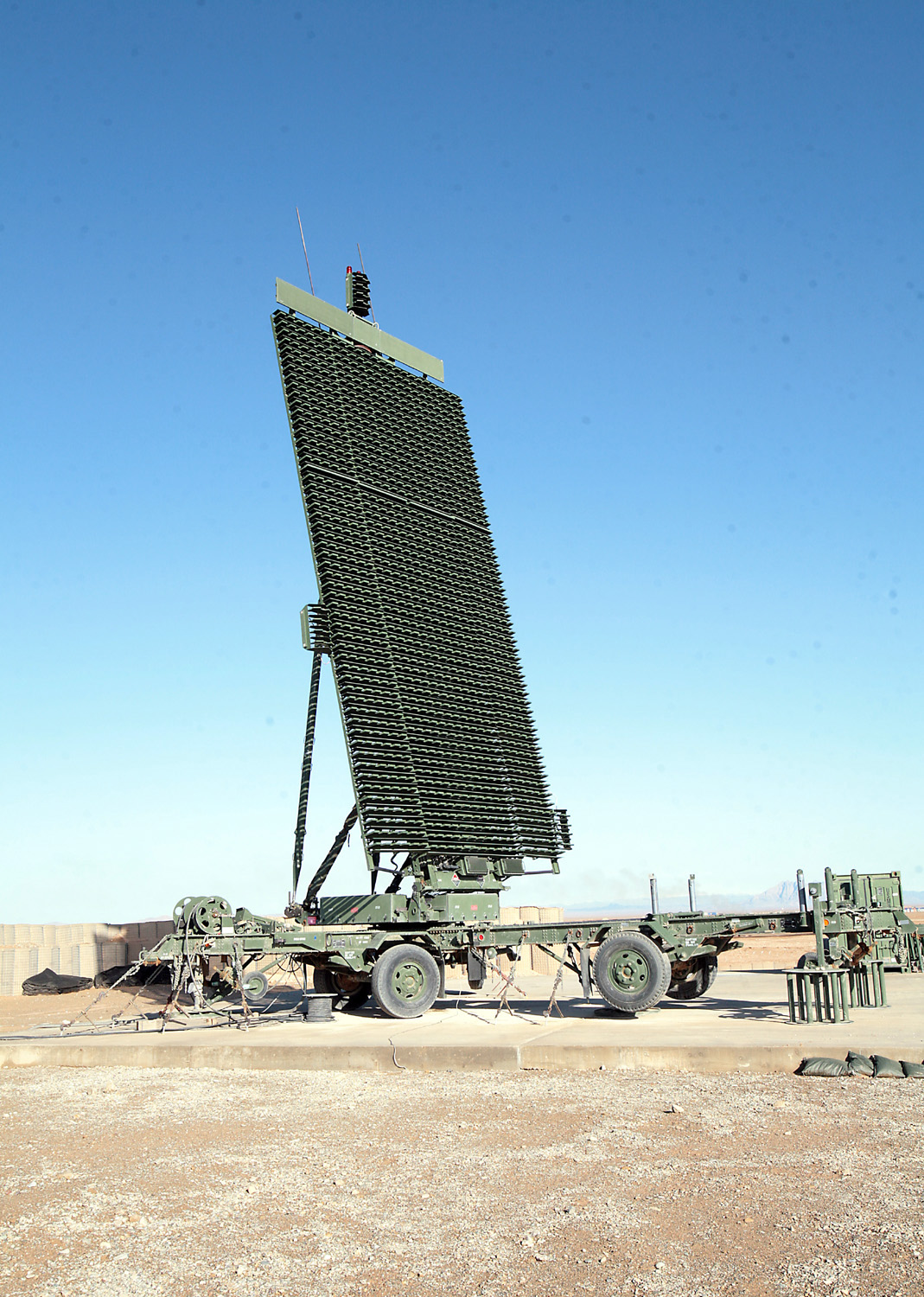
The AN/FPS-117 is an L-band active electronically scanned array (AESA) 3-dimensional air search radar first produced by GE Aerospace in 1980 and now part of Lockheed Martin. The system offers instrumented detection at ranges on the order of and has a wide variety of interference and clutter rejection systems. The system was originally developed as part of the "Seek Igloo/Seek Frost" effort to replace the older radar systems of the DEW line with designs that could be operated remotely and require much less maintenance as part of DEW's replacement, the American-Canadian North Warning System (NWS). Implementation of the NWS resulted in a reduction in operations and maintenance spending by up to 50% compared to previous systems. GE made a number of modifications to the basic design to better tailor it to different roles. To fill a need for the US Marine Corps, GE developed the transportable AN/TPS-59, and later combined design elements to produce the smaller AN/TPS-77 which is even ... [...More Info...] [...Related Items...] OR: [Wikipedia] [Google] [Baidu] |
Air Force Communications Service
An atmosphere () is a layer of gases that envelop an astronomical object, held in place by the gravity of the object. A planet retains an atmosphere when the gravity is great and the temperature of the atmosphere is low. A stellar atmosphere is the outer region of a star, which includes the layers above the opaque photosphere; stars of low temperature might have outer atmospheres containing compound molecules. The atmosphere of Earth is composed of nitrogen (78%), oxygen (21%), argon (0.9%), carbon dioxide (0.04%) and trace gases. Most organisms use oxygen for respiration; lightning and bacteria perform nitrogen fixation which produces ammonia that is used to make nucleotides and amino acids; plants, algae, and cyanobacteria use carbon dioxide for photosynthesis. The layered composition of the atmosphere minimises the harmful effects of sunlight, ultraviolet radiation, solar wind, and cosmic rays and thus protects the organisms from genetic damage. The current composition of t ... [...More Info...] [...Related Items...] OR: [Wikipedia] [Google] [Baidu] |
White Alice Communications System
The White Alice Communications System (WACS, "White Alice" colloquially) was a United States Air Force telecommunication network with 80 radio stations constructed in Alaska during the Cold War. It used tropospheric scatter for over-the-horizon links and microwave relay for shorter line-of-sight links. Sites were characterized by large parabolic, tropospheric scatter antennas as well as smaller microwave dishes for point-to-point links. The system connected remote Air Force sites in Alaska, such as Aircraft Control and Warning (AC&W), Distant Early Warning Line (DEW Line) and Ballistic Missile Early Warning System (BMEWS), to command and control facilities and in some cases it was used for civilian phone calls. The network was originally operated by the USAF, but was turned over to RCA for operations after 1969. The opening of satellite communication links in the 1970s made the system obsolete, and in 1979 it was replaced by an RCA satellite link that connected all of the stations ... [...More Info...] [...Related Items...] OR: [Wikipedia] [Google] [Baidu] |
AN/FPS-20
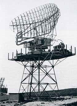
The AN/FPS-20 was a widely used L band early warning and ground-controlled interception radar system employed by the United States Air Force Air Defense Command, the NORAD Pinetree Line in Canada, the USAF CONAD in the continental United States, and a variety of other users. The design started life as the Bendix AN/FPS-3 in 1950, was upgraded to the FPS-20, then spawned over a dozen different variants as additional upgrades were applied. The FPS-20 formed the backbone of the US air defense network through the early Cold War with over 200 units deployed. Most FPS-20 sites were replaced by modern equipment in the late 1960s, although a number were turned over to the FAA, modified for air traffic control use, and became ARSR-60s. The first AN/FPS-3 arrived in December 1950, slated for installation at Eniwetok Atoll to control aircraft involved in the atomic bomb tests of early 1951. Over the next few years, 48 FPS-3s were installed to replace older systems in the Lashup Radar Network ... [...More Info...] [...Related Items...] OR: [Wikipedia] [Google] [Baidu] |
AN/FPS-3
The AN/FPS-20 was a widely used L band early warning and ground-controlled interception radar system employed by the United States Air Force Air Defense Command, the NORAD Pinetree Line in Canada, the USAF CONAD in the continental United States, and a variety of other users. The design started life as the Bendix AN/FPS-3 in 1950, was upgraded to the FPS-20, then spawned over a dozen different variants as additional upgrades were applied. The FPS-20 formed the backbone of the US air defense network through the early Cold War with over 200 units deployed. Most FPS-20 sites were replaced by modern equipment in the late 1960s, although a number were turned over to the FAA, modified for air traffic control use, and became ARSR-60s. The first AN/FPS-3 arrived in December 1950, slated for installation at Eniwetok Atoll to control aircraft involved in the atomic bomb tests of early 1951. Over the next few years, 48 FPS-3s were installed to replace older systems in the Lashup Radar ... [...More Info...] [...Related Items...] OR: [Wikipedia] [Google] [Baidu] |
Murphy Dome AFS
Murphy Dome Air Force Station (AAC ID: F-02, LRR ID: A-02) is a closed United States Air Force General Surveillance Radar station west-northwest of Fairbanks, Alaska. The control center station was closed on 1 November 1983, and was re-designated as a Long Range Radar (LRR) site as part of the Alaska Radar System. Today, it remains active as part of the Alaska NORAD Region under the jurisdiction of the Pacific Air Forces Regional Support Center, Joint Base Elmendorf–Richardson, Alaska. A popular aurora viewing area is located nearby. History Murphy Dome AFS was a continental defense radar station constructed to provide the United States Air Force early warning of an attack by the Soviet Union on Alaska. It was one of the ten original aircraft control and warning sites constructed during the early 1950s to establish a permanent air defense system in Alaska. Murphy Dome was initially operated by a detachment of the 532nd Aircraft Control and Warning Group, Ladd AFB (now Fo ... [...More Info...] [...Related Items...] OR: [Wikipedia] [Google] [Baidu] |


