|
Times Of Joy And Sorrow
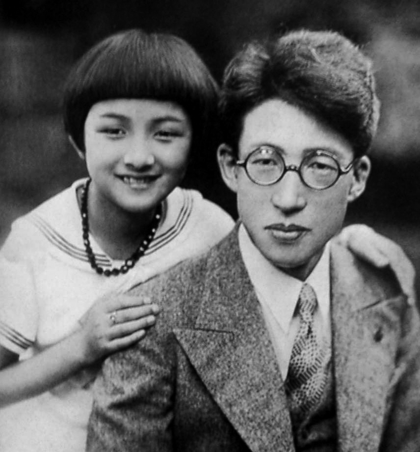
, also titled ''The Lighthouse'' in the UK, is a 1957 Japanese drama film written and directed by Keisuke Kinoshita. Plot In 1932, a young lighthouse keeper returns from his father's funeral with a new bride, who quickly learns the importance of the marital bond to members of her husband's profession, which is often characterized by the hardships of physical isolation and sudden reassignment. Over the next 25 years they transfer to ten different lighthouses throughout Japan, raising two children and befriending multiple colleagues and their families. They endure wartime attacks on the strategically relevant lighthouses as well as a tragedy involving one of their children, ultimately celebrating the other's marriage and settling together into middle age. Cast * Hideko Takamine as Kiyoko Arisawa * Keiji Sada as Shiro Arisawa * Takahiro Tamura as Mr. Nozu * Katsuo Nakamura as Kotaro * YŇćko Katsuragi as Fuji Tatsuko * KŇćji Mitsui as Mr. Kanemaki * Kuniko Igawa as Itoko Suzuki * ... [...More Info...] [...Related Items...] OR: [Wikipedia] [Google] [Baidu] |
Hideko Takamine
was a Japanese actress who began as a child actress and maintained her fame in a career that spanned 50 years. She is particularly known for her collaborations with directors Mikio Naruse and Keisuke Kinoshita, with ''Twenty-Four Eyes'' (1954) and ''Floating Clouds'' (1955) being among her most noted films. Biography Takamine was born in Hakodate, HokkaidŇć, in 1924. At the age of four, following the death of her mother, she was placed in the care of her aunt in Tokyo. Her first role was in the Shochiku studio's 1929 film ''Mother'' (''Haha''), which brought her tremendous popularity as a child actor. Many of the films of her early career were imitations of Shirley Temple films. After moving to the Toho studio in 1937, her dramatic roles in KajirŇć Yamamoto's ''Tsuzurikata kyŇćshitsu'' (1938) and ''Horse (1941 film), Horse'' (1941) brought her added fame as a girl star. She toured as a singer to entertain Japanese troops and, after the World War II, war, sang for American occup ... [...More Info...] [...Related Items...] OR: [Wikipedia] [Google] [Baidu] |
Izu ŇĆshima
is an inhabited volcanic island in the Izu archipelago in the Philippine Sea, off the coast of Honshu, Japan, east of the Izu Peninsula and southwest of BŇćsŇć Peninsula. As with the other islands in the Izu Island group, Izu ŇĆshima forms part of the Fuji-Hakone-Izu National Park. Izu ŇĆshima, at is the largest and closest of Tokyo's outlying islands, which also include the Ogasawara Islands. Geography The island is a stratovolcano with a basaltic composite cone, dating from the late Pleistocene period, between 10,000 and 15,000 years ago. It rises from an ocean floor with a depth of between . The island has a roughly circular coastline of approximately in length. The highest elevation, , is an active volcano with a height of . The mountain has been recorded to have erupted numerous times through history and is mentioned as far back as Nara period written records. Major eruptions occurred in 1965 and 1986, each forcing a temporary evacuation of the inhabitants. The la ... [...More Info...] [...Related Items...] OR: [Wikipedia] [Google] [Baidu] |
Ise-Shima
The region of Japan, also called the , refers to the areas of eastern Mie Prefecture in or around Ise-Shima National Park, which include the cities Ise, Toba, Shima, and parts of the town of Minami-Ise. The area thrives on tourism, with many resort hotels and beaches in the area. Ise-Shima is also famed for fresh seafood, particular oysters. The peninsula extends out into the Pacific Ocean, and unlike the factory-dotted coast of Ise Bay, the main industry is seafood and marine products, particularly pearl cultivation. Locations Tourism in the Ise-Shima region is fueled primarily by these locations: *Ise Grand Shrine *Meoto Iwa * Mikimoto Pearl Island * Toba Aquarium * Shima Spain Village Access Direct service is available to Ise-Shima from both Osaka and Nagoya is the largest city in the ChŇębu region of Japan. It is the list of cities in Japan, fourth-most populous city in Japan, with a population of 2.3million in 2020, and the principal city of the ChŇękyŇć metrop ... [...More Info...] [...Related Items...] OR: [Wikipedia] [Google] [Baidu] |
Anorisaki Lighthouse
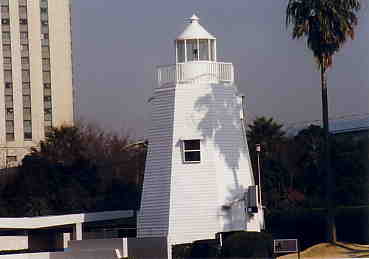
is a lighthouse on the top of Shima Peninsula in the city of Shima, Mie Prefecture, Japan. History The Anorisaki Lighthouse was designed and constructed by British engineer Richard Henry Brunton. Work began in late 1871. It was first lit on April 1, 1873. It is the first lighthouse in Japan to use a rotating Fresnel lens. The octagonal structure was built of Zelkova serrata wood and had a total height of 10.6 metres. During his career in Japan, Brunton constructed 25 lighthouses from far northern HokkaidŇć to southern KyŇęshŇę, each with a different design. Although Anorisaki Lighthouse was the 20th of the 25 built by Brunton, it was the oldest with a wooden construction. Since its construction in the late 19th century, Anorisaki Lighthouse was relocated twice. The lighthouse was first relocated in 1911 due coastal erosion, being moved five miles further inland, and then again in 1948, when the original structure was replaced with a more modern design and relocated to t ... [...More Info...] [...Related Items...] OR: [Wikipedia] [Google] [Baidu] |
Shizuoka Prefecture
is a Prefectures of Japan, prefecture of Japan located in the ChŇębu region of Honshu. Shizuoka Prefecture has a population of 3,555,818 and has a geographic area of . Shizuoka Prefecture borders Kanagawa Prefecture to the east, Yamanashi Prefecture to the northeast, Nagano Prefecture to the north, and Aichi Prefecture to the west. Shizuoka (city), Shizuoka is the capital and Hamamatsu is the largest city in Shizuoka Prefecture, with other major cities including Fuji, Shizuoka, Fuji, Numazu, and Iwata, Shizuoka, Iwata. Shizuoka Prefecture is located on Japan's Pacific Ocean coast and features Suruga Bay formed by the Izu Peninsula, and Lake Hamana which is considered to be one of Japan's largest lakes. Mount Fuji, the tallest volcano in Japan and cultural icon of the country, is partially located in Shizuoka Prefecture on the border with Yamanashi Prefecture. Shizuoka Prefecture has a significant Motor vehicle, motoring heritage as the founding location of Honda, Suzuki Motor C ... [...More Info...] [...Related Items...] OR: [Wikipedia] [Google] [Baidu] |
Omaezaki
is a city located in Shizuoka Prefecture, Japan. Omaezaki is located at the tip of Omaezaki Peninsula on Japan's Pacific coast. , the city had an estimated population of 32,422 in 12,095 households and a population density of 490 persons per km2. The total area of the city was . Geography Omaezaki City lies approximately south of Shizuoka City at the tip of a peninsula of the same name, stretching east into the Pacific Ocean. The majority of the city consists of gentle hills and valleys with some steep cliffs on the peninsula's east coast. Like much of Japan, Shizuoka Prefecture is an earthquake zone, and small tremors frequently occur in the area. Omaezaki is also in an area at risk from tsunami. Surrounding municipalities *Shizuoka Prefecture ** Kakegawa ** Kikugawa ** Makinohara Climate Omaezaki has a humid subtropical climate (Köppen climate classification ''Cfa''). Due to its location, Omaezaki experiences strong coastal winds between October and April. The Japanes ... [...More Info...] [...Related Items...] OR: [Wikipedia] [Google] [Baidu] |
Omaesaki Lighthouse
is a lighthouse located on a hill at the outermost extremity of :fr:Cap Omae, Cape Omae south of :ja:Śĺ°ŚČćŚīéśłĮ, Omaezaki Port, Shizuoka Prefecture, Japan. A lighthouse was built at Cape Omae as early as 1635, when the Tokugawa Shogunate recognized the frequency of marine accidents on the rocks off the coast of TŇćtŇćmi Province. History Omaesaki Lighthouse was one of the 26 lighthouses to be built in Meiji period Japan by o-yatoi gaikokujin, British engineer Richard Henry Brunton. Although not one of the eight lighthouses stipulated specifically by the provisions of the Anglo-Japanese Treaty of Amity and Commerce of 1858, construction was given priority by the Meiji government after a Japanese navy vessel grounded on the rocks off Cape Omae on April 8, 1871. Construction began on May 26, 1872 and the lighthouse was completed on May 1, 1874 at a cost of 25,000 yen. The lighthouse is noteworthy as the first to use a Fresnel lens in Japan. The light was upgraded to a more ... [...More Info...] [...Related Items...] OR: [Wikipedia] [Google] [Baidu] |
Niigata Prefecture
is a Prefectures of Japan, prefecture in the ChŇębu region of Honshu of Japan. Niigata Prefecture has a population of 2,131,009 (1 July 2023) and is the List of Japanese prefectures by area, fifth-largest prefecture of Japan by geographic area at . Niigata Prefecture borders Toyama Prefecture and Nagano Prefecture to the southwest, Gunma Prefecture to the south, Fukushima Prefecture to the east, and Yamagata Prefecture to the northeast. Niigata, Niigata, Niigata is the capital and largest city of Niigata Prefecture, with other major cities including Nagaoka, Niigata, Nagaoka, JŇćetsu, Niigata, JŇćetsu, and SanjŇć, Niigata, SanjŇć. Niigata Prefecture contains the Niigata Major Metropolitan Area centered on Niigata with a population of 1,395,612, the largest metropolitan area on the Sea of Japan coast and the twelfth-largest in Japan. Niigata Prefecture is part of the historic Hokuriku region and features Sado Island, the sixth largest island of Japan in area following the List o ... [...More Info...] [...Related Items...] OR: [Wikipedia] [Google] [Baidu] |
Sado Island
is an island located in the eastern part of the Sea of Japan, under the jurisdiction of Sado City, Niigata Prefecture, Japan, with a coastline of . In October 2017, Sado Island had a population of 55,212 people. Sado Island covers an area of , and is the second largest island after Okinawa Island outside of the four main islands of Japan, excluding the disputed Southern Kurils. The shortest distance between Sado Island and Honshu is . The highest peak on Sado Island is Mount Kinpoku, with an elevation of . Geography The shape of Sado Island resembles the kanji character for ‚Äėwork‚Äô (Ś∑•) in Japanese or the letter ‚ÄėS‚Äô. The topography of the island can be roughly divided into three parts, the ŇĆsado range in the north, the Kosado range in the south, and the Kakakura plain with flat terrain in between. The ŇĆsado range area is higher in altitude, and the highest peak of Sado Island, Mount Kinpoku ( above sea level), is also located in this area. The coastline on the n ... [...More Info...] [...Related Items...] OR: [Wikipedia] [Google] [Baidu] |
Nagasaki Prefecture
is a Prefectures of Japan, prefecture of Japan, mainly located on the island of KyŇęshŇę, although it also includes a number of islands off KyŇęshŇę's northwest coast - including Tsushima and Iki. Nagasaki Prefecture has a population of 1,246,481 (1 February 2025) and has a geographic area of 4,130 Square kilometre, km2 (1,594 sq mi). Nagasaki Prefecture borders Saga Prefecture to the northeast. Nagasaki is the capital and largest city of Nagasaki Prefecture, with other major cities including Sasebo, Isahaya, Nagasaki, Isahaya, and ŇĆmura, Nagasaki, ŇĆmura. Nagasaki Prefecture is located in western KyŇęshŇę with a territory consisting of many mainland peninsulas centered around ŇĆmura Bay, as well as islands and archipelagos including Tsushima Island, Tsushima and Iki Island, Iki in the Korea Strait and the GotŇć Islands in the East China Sea. Nagasaki Prefecture is known for its century-long Nanban trade, trading history with the Europeans and as the sole place of direct trade ... [...More Info...] [...Related Items...] OR: [Wikipedia] [Google] [Baidu] |
GotŇć Islands
The are Japanese islands in the Sea of Japan. They are part of Nagasaki Prefecture. Geography There are 140 islands, including five main ones: , , , , and . The northernmost island is Ukujima. The group of islands runs approximately from Osezaki Lighthouse, Fukue Island to Tsuwazaki Lighthouse, NakadŇćri Island. Its center is near Naru Island at about . To the north is Tsushima Island in the Tsushima Strait and to the east is KyŇęshŇę and the rest of Nagasaki Prefecture. It is about from the port of Nagasaki. The Tsushima Current (a branch of the Kuroshio) passes around the islands. The southern of the two principal islands, Fukue, measures approximately north-to-south by east-to-west; the northern, NakadŇćri Island, measures approximately north-to-south by east-to-west at its widest point. Most of NakadŇćri Island, however, is quite narrow, measuring less than wide for much of its length. Some dome-shaped hills command the old castle town of Fukue. The isla ... [...More Info...] [...Related Items...] OR: [Wikipedia] [Google] [Baidu] |
ŇĆita Prefecture
is a prefecture of Japan located on the island of KyŇęshŇę. ŇĆita Prefecture has a population of 1,081,646 (1 February 2025) and has a geographic area of 6,340 km2 (2,448 sq mi). ŇĆita Prefecture borders Fukuoka Prefecture to the northwest, Kumamoto Prefecture to the southwest, and Miyazaki Prefecture to the south. ŇĆita is the capital and largest city of ŇĆita Prefecture, with other major cities including Beppu, Nakatsu, and Saiki. ŇĆita Prefecture is located in the northeast of KyŇęshŇę on the Bungo Channel, connecting the Pacific Ocean and Seto Inland Sea, across from Ehime Prefecture on the island of Shikoku. ŇĆita Prefecture is famous for its hot springs and is a popular tourist destination in Japan for its ''onsen'' and '' ryokan'', particularly in and around the city of Beppu. It has more ''onsen'' than any other Japanese prefecture. History Around the 6th century, Kyushu consisted of four regions: Tsukushi Province, Hi Province, Kumaso Province and Toyo P ... [...More Info...] [...Related Items...] OR: [Wikipedia] [Google] [Baidu] |


