|
Tao'er River
The Taoer () is a river in Northeast China. It is a right tributary of the Nen River. The source of the river is in the Greater Khingan, Inner Mongolia. It flows through Jilin ) , image_skyline = Changbaishan Tianchi from western rim.jpg , image_alt = , image_caption = View of Heaven Lake , image_map = Jilin in China (+all claims hatched).svg , mapsize = 275px , map_al ... where it joins the Nen River near Da'an. References {{coord missing, China Rivers of Inner Mongolia Rivers of Jilin ... [...More Info...] [...Related Items...] OR: [Wikipedia] [Google] [Baidu] |
Nen River
The Nen River or Nenjiang ( zh, c=, p=Nèn Jiāng, w=Nen-chiang), or Nonni () is a river in Northeast China. The Nen River flows through the northern part of Heilongjiang Province and the northeastern section of Inner Mongolia, some parts of the river forming the border between the two regions. At in length, the Nen River is the longest tributary of the Songhua River. The Nen River flows in the general southern direction in a wide valley between the Greater Khingan and the Lesser Khingan mountain ranges in the west and east, respectively, and meets the Second Songhua River near Da'an to form the Songhua River. The river is prone to flooding, as occurred most recently in 1998 and 2005. Tributaries Major tributaries of the Nen River include: * Gan River (甘河) (Right) * Nemor River (讷谟尔河) (Left) * Nuomin River (诺敏河) (Right) * Wuyuer (乌裕尔河)/Nuyur River (Left) * Yalu River (雅鲁河) (Right) * Chuoer River (Right) * Taoer/Chaor River (洮儿河) ( ... [...More Info...] [...Related Items...] OR: [Wikipedia] [Google] [Baidu] |
Northeast China
Northeast China () is a geographical region of China, consisting officially of three provinces Liaoning, Jilin and Heilongjiang. The heartland of the region is the Northeast China Plain, the largest plain in China with an area of over . The region is separated from the Russian Far East to the north and east by the Amur, Argun and Ussuri Rivers; from North Korea to the south by the Yalu and Tumen Rivers; and from the neighboring North China to the west by the Greater Khingan Range and Yan Mountains. It is also bounded by the Bohai Bay and Yellow Sea to the southwest, about away from East China's Jiaodong Peninsula across the Bohai Strait, due to be connected via a proposed undersea tunnel. The four prefectures of Inner Mongolia (which is part of North China) east of the Greater Khingan, i.e. Chifeng, Tongliao, Hinggan and Hulunbuir, are sometimes also considered broader parts of Northeast China, and together with the aforementioned three provinces formed what was h ... [...More Info...] [...Related Items...] OR: [Wikipedia] [Google] [Baidu] |
Tributary
A tributary, or an ''affluent'', is a stream or river that flows into a larger stream (''main stem'' or ''"parent"''), river, or a lake. A tributary does not flow directly into a sea or ocean. Tributaries, and the main stem river into which they flow, drain the surrounding drainage basin of its surface water and groundwater, leading the water out into an ocean, another river, or into an endorheic basin. The Irtysh is a chief tributary of the Ob (river), Ob river and is also the longest tributary river in the world with a length of . The Madeira River is the largest tributary river by volume in the world with an average discharge of . A confluence, where two or more bodies of water meet, usually refers to the joining of tributaries. The opposite to a tributary is a distributary, a river or stream that branches off from and flows away from the main stream. [...More Info...] [...Related Items...] OR: [Wikipedia] [Google] [Baidu] |
Greater Khingan
The Greater Khingan Range or Da Hinggan Range ( zh, s=大兴安岭, t=大興安嶺, p=Dà Xīng'ān Lǐng; IPA: ) is a volcanic mountain range in the Inner Mongolia region of Northeast China. It was originally called the Xianbei Mountains, which later became the name of the northern branch of the Donghu, the Xianbei. Geography The range extends from north to south. It is the watershed between the Nen and Songhua river systems to the east, and the Amur and its tributaries to the northwest. Population Its slopes are a relatively rich grazing area. The Khitan people lived on the eastern slopes before establishing the Liao Dynasty in the tenth century. Oroqen, a Tungusic people, live along the Greater and Lesser Khingan range in northeastern China and belong to the oldest autochthonous populations of the region. On the western slopes lived the nomadic people, who raised sheep and camels and used the Mongolian plateau for their pastoralist economy. In fiction The Greater K ... [...More Info...] [...Related Items...] OR: [Wikipedia] [Google] [Baidu] |
Inner Mongolia
Inner Mongolia, officially the Inner Mongolia Autonomous Region, is an Autonomous regions of China, autonomous region of China. Its border includes two-thirds of the length of China's China–Mongolia border, border with the country of Mongolia. Inner Mongolia also accounts for a small section of China's China–Russia border, border with Russia (Zabaykalsky Krai). Its capital is Hohhot; other major cities include Baotou, Chifeng, Tongliao, and Ordos City, Ordos. The autonomous region was established in 1947, incorporating the areas of the former Republic of China (1912–1949), Republic of China provinces of Suiyuan, Chahar Province, Chahar, Rehe Province, Rehe, Liaobei, and Xing'an Province, Xing'an, along with the northern parts of Gansu and Ningxia. Its area makes it the List of Chinese administrative divisions by area, third largest Chinese administrative subdivision, constituting approximately and 12% of China's total land area. Due to its long span from east to west, Inn ... [...More Info...] [...Related Items...] OR: [Wikipedia] [Google] [Baidu] |
Jilin
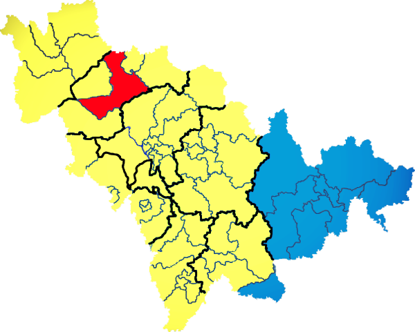
) , image_skyline = Changbaishan Tianchi from western rim.jpg , image_alt = , image_caption = View of Heaven Lake , image_map = Jilin in China (+all claims hatched).svg , mapsize = 275px , map_alt = Map showing the location of Jilin Province , map_caption = Map showing the location of Jilin Province , coordinates = , subdivision_type = Country , subdivision_name = China , named_for = from ''girin ula'', a Manchu language, Manchu phrase meaning "along the river" , seat_type = Capital , seat = , seat1_type = , seat1 = , parts_type = Divisions , parts_style = para , p1 = 9 Prefectures of China, prefectures , p2 = 60 Counties of China, counties , p3 = 1006 Townships of China, townships , government_type = Provinces of China, Province , governing_body = Jilin Provinci ... [...More Info...] [...Related Items...] OR: [Wikipedia] [Google] [Baidu] |
Da'an, Jilin
Da'an () is a city of northwestern Jilin province in Northeast China, on the southern bank of the Songhua River and the border with Heilongjiang province. It is under the administration of Baicheng City, to the west, and lies northwest of Songyuan. Da'an City is 423,700, including 423,000 permanent residents. Administrative divisions There are five subdistricts, 10 towns A town is a type of a human settlement, generally larger than a village but smaller than a city. The criteria for distinguishing a town vary globally, often depending on factors such as population size, economic character, administrative stat ..., 16 townships, and one ethnic township. Subdistricts: * Anbei Subdistrict (), Jinhua Subdistrict (), Linjiang Subdistrict (), Huiyang Subdistrict (), Changhong Subdistrict () Towns: * Yueliangpao (), Anchang (), Fengshou (), Xinping'an (), Liangjiazi (), Sheli (), Dagangzi (), Chagan (), Longzhao () Townships: * Sikeshu Township (), Lianhe To ... [...More Info...] [...Related Items...] OR: [Wikipedia] [Google] [Baidu] |
Rivers Of Inner Mongolia
A river is a natural stream of fresh water that flows on land or inside caves towards another body of water at a lower elevation, such as an ocean, lake, or another river. A river may run dry before reaching the end of its course if it runs out of water, or only flow during certain seasons. Rivers are regulated by the water cycle, the processes by which water moves around the Earth. Water first enters rivers through precipitation, whether from rainfall, the runoff of water down a slope, the melting of glaciers or snow, or seepage from aquifers beneath the surface of the Earth. Rivers flow in channeled watercourses and merge in confluences to form drainage basins, or catchments, areas where surface water eventually flows to a common outlet. Rivers have a great effect on the landscape around them. They may regularly overflow their banks and flood the surrounding area, spreading nutrients to the surrounding area. Sediment or alluvium carried by rivers shapes the landscape aro ... [...More Info...] [...Related Items...] OR: [Wikipedia] [Google] [Baidu] |


