|
Tamara Coast To Coast Way
The Tamara Coast to Coast Way is a walking route in England from Cremyll on the south coast of Cornwall to Morwenstow on its north coast. The route largely follows the River Tamar, which rises less than from the north coast, and is mostly in Cornwall with some sections in Devon. ''Tamara'' was the ancient goddess of the River Tamar. By connecting with the South West Coast Path, the Tamara Way completes a circular walking route around the boundaries of Cornwall, known as ''Kylgh Kernow'' he Circuit of Cornwall The route was officially opened in July 2023. It is waymarked with a logo showing a white bee on a green arrow on a blue roundel, with the name of the trail. It is marked and named on Ordnance Survey The Ordnance Survey (OS) is the national mapping agency for Great Britain. The agency's name indicates its original military purpose (see Artillery, ordnance and surveying), which was to map Scotland in the wake of the Jacobite rising of ... mapping. Refe ... [...More Info...] [...Related Items...] OR: [Wikipedia] [Google] [Baidu] |
Logo Of Tamara Coast To Coast Way
A logo (abbreviation of logotype; ) is a graphic mark, emblem, or symbol used to aid and promote public identification and recognition. It may be of an abstract or figurative design or include the text of the name that it represents, as in a wordmark. In the days of hot metal typesetting, a logotype was one word cast as a single piece of type (e.g. "The" in ATF Garamond), as opposed to a ligature, which is two or more letters joined, but not forming a word. By extension, the term was also used for a uniquely set and arranged typeface or colophon. At the level of mass communication and in common usage, a company's logo is today often synonymous with its trademark or brand.Wheeler, Alina. ''Designing Brand Identity'' © 2006 John Wiley & Sons, Inc. (page 4) Etymology Douglas Harper's ''Online Etymology Dictionary'' states that the first surviving written record of the term 'logo' dates back to 1937, and that the term was "probably a shortening of logogram". History Numerous ... [...More Info...] [...Related Items...] OR: [Wikipedia] [Google] [Baidu] |
Cremyll
Cremyll (pronounced ) is a small coastal village in the civil parish of Maker-with-Rame, in south-east Cornwall, England, United Kingdom. Cremyll is on the Rame Peninsula facing Plymouth Sound. The village is about 9 miles by road or 0.5 miles by boat from Plymouth. History There has been a ferry at Cremyll since the 11th century and it was a link in the main southern route into Cornwall until the 1830s. In medieval times the ferry was part of the manor of Stone-House, held by the Valletorts. There was a larger community called West Stonehouse (compare with East Stonehouse) until it was burnt by the French in 1350. The Cornish side of Plymouth Sound was not always Cornish. It was incorporated into Anglo-Saxon territory in 705 CE in order to secure both banks of the estuary against Viking raids. An area of the Rame Peninsula, (up to Kingsand) remained as part of Devon until 1844, when it was made part of Cornwall. The village is on the most easterly extension of the Rame P ... [...More Info...] [...Related Items...] OR: [Wikipedia] [Google] [Baidu] |
Cornwall
Cornwall (; or ) is a Ceremonial counties of England, ceremonial county in South West England. It is also one of the Celtic nations and the homeland of the Cornish people. The county is bordered by the Atlantic Ocean to the north and west, Devon to the east, and the English Channel to the south. The largest urban area is the Redruth and Camborne conurbation. The county is predominantly rural, with an area of and population of 568,210. After the Redruth-Camborne conurbation, the largest settlements are Falmouth, Cornwall, Falmouth, Penzance, Newquay, St Austell, and Truro. For Local government in England, local government purposes most of Cornwall is a Unitary authorities of England, unitary authority area, with the Isles of Scilly governed by a Council of the Isles of Scilly, unique local authority. The Cornish nationalism, Cornish nationalist movement disputes the constitutional status of Cornwall and seeks greater autonomy within the United Kingdom. Cornwall is the weste ... [...More Info...] [...Related Items...] OR: [Wikipedia] [Google] [Baidu] |
Morwenstow
Morwenstow () is a civil parish in north Cornwall, England, United Kingdom. The parish abuts the west coast, about six miles (10 km) north of Bude and within the Cornwall Area of Outstanding Natural Beauty (AONB). Morwenstow is the most northerly parish in Cornwall. As well as the churchtown (a hamlet called Crosstown), other settlements in the parish include Shop, Woodford, Gooseham, Eastcott, Woolley and West Youlstone. The population at the 2011 census was 791. Morwenstow parish is bounded to the north and east by parishes in Devon, to the south by Kilkhampton parish and to the west by the Atlantic. The River Tamar has its source at a spring on Woolley Moor, at , which is in the parish near the border with Devon. Morwenstow is the one-time home of the eccentric vicar and poet Robert Stephen Hawker (1803–1875), the writer of Cornwall's anthem '' Trelawny''. Hawker is also credited with reviving the custom of Harvest Festivals. Parish church T ... [...More Info...] [...Related Items...] OR: [Wikipedia] [Google] [Baidu] |
River Tamar
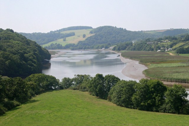
The Tamar (; ) is a river in south west England that forms most of the border between Devon (to the east) and Cornwall (to the west). A large part of the valley of the Tamar is protected as the Tamar Valley National Landscape (an Area of Outstanding Natural Beauty), and some is included in the Cornwall and West Devon Mining Landscape (a World Heritage Site) due to its historic mining activities. The Tamar's source is less than from the north Cornish coast, but it flows southward across the South West Peninsula, peninsula to the south coast. The total length of the river is . At its mouth, the Tamar flows into the Hamoaze before entering Plymouth Sound, a bay in the English Channel. Tributaries of the river include the rivers River Inny, Cornwall, Inny, River Ottery, Ottery, River Kensey, Kensey and River Lynher, Lynher (or ''St Germans River'') on the Cornish side and the River Deer, Deer and River Tavy, Tavy on the Devon side. The name Tamar (or Tamare) was mentioned by Ptole ... [...More Info...] [...Related Items...] OR: [Wikipedia] [Google] [Baidu] |
Devon
Devon ( ; historically also known as Devonshire , ) is a ceremonial county in South West England. It is bordered by the Bristol Channel to the north, Somerset and Dorset to the east, the English Channel to the south, and Cornwall to the west. The city of Plymouth is the largest settlement, and the city of Exeter is the county town. The county has an area of and a population of 1,194,166. The largest settlements after Plymouth (264,695) are the city of Exeter (130,709) and the Seaside resort, seaside resorts of Torquay and Paignton, which have a combined population of 115,410. They all are located along the south coast, which is the most populous part of the county; Barnstaple (31,275) and Tiverton, Devon, Tiverton (22,291) are the largest towns in the north and centre respectively. For local government purposes Devon comprises a non-metropolitan county, with eight districts, and the Unitary authorities of England, unitary authority areas of Plymouth City Council, Plymouth an ... [...More Info...] [...Related Items...] OR: [Wikipedia] [Google] [Baidu] |
South West Coast Path
The South West Coast Path is England's longest waymarked Long-distance footpaths in the UK, long-distance footpath and a National Trail. It stretches for , running from Minehead in Somerset, along the coasts of Devon and Cornwall, to Poole Harbour in Dorset. Because it rises and falls with every river mouth, it is also one of the more challenging trails. The total height climbed has been calculated to be 114,931 ft (35,031 m), almost four times the height of Mount Everest. It has been voted 'Britain's Best Walking route' twice in a row by readers of The Ramblers' ''Walk'' magazine, and regularly features in lists of the world's best walks. The final section of the path was designated as a National Trail in 1978. Many of the landscapes which the South West Coast Path crosses have special status, either as a national parks of England and Wales, national park or one of the heritage coasts. The path passes through two World Heritage Sites: the Dorset and East Devon Coast, ... [...More Info...] [...Related Items...] OR: [Wikipedia] [Google] [Baidu] |
Ordnance Survey
The Ordnance Survey (OS) is the national mapping agency for Great Britain. The agency's name indicates its original military purpose (see Artillery, ordnance and surveying), which was to map Scotland in the wake of the Jacobite rising of 1745. There was also a more general and nationwide need in light of the potential threat of invasion during the Napoleonic Wars. Since 1 April 2015, the Ordnance Survey has operated as Ordnance Survey Ltd, a state-owned enterprise, government-owned company, 100% in public ownership. The Ordnance Survey Board remains accountable to the Secretary of State for Science, Innovation and Technology. It was also a member of the Public Data Group. Paper maps represent only 5% of the company's annual revenue. It produces digital map data, online route planning and sharing services and mobile apps, plus many other location-based products for business, government and consumers. Ordnance Survey mapping is usually classified as either "Scale (map), lar ... [...More Info...] [...Related Items...] OR: [Wikipedia] [Google] [Baidu] |
Footpaths In Cornwall
A footpath (also pedestrian way, walking trail, nature trail) is a type of thoroughfare that is intended for use only by pedestrians and not other forms of traffic such as motorized vehicles, bicycles and horses. They can be found in a wide variety of places, from the centre of cities, to farmland, to mountain ridges. Urban footpaths are usually paved, may have steps, and can be called alleys, lanes, steps, etc. National parks, nature preserves, conservation areas and other protected wilderness areas may have footpaths (trails) that are restricted to pedestrians. The term 'footpath' includes pedestrian paths that are next to the road in Irish English, Indian English, Australian English, and New Zealand English (known as 'pavement' in the British English and South African English, or sidewalk in North American English). A footpath can also take the form of a footbridge, linking two places across a river. Origins and history Public footpaths are rights of way originally cre ... [...More Info...] [...Related Items...] OR: [Wikipedia] [Google] [Baidu] |


