|
Sussex In The High Middle Ages
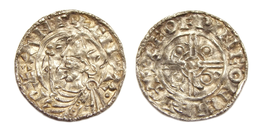
Sussex in the High Middle Ages includes the history of Sussex from the Norman Conquest in 1066 until the death of King John, considered by some to be the last of the Angevin kings of England, in 1216. It was during the Norman period that Sussex achieved its greatest importance in comparison with other English counties. Throughout the High Middle Ages, Sussex was on the main route between England and Normandy, and the lands of the Anglo-Norman nobility in what is now western France. The growth in Sussex's population, the importance of its ports and the increased colonisation of the Weald were all part of changes as significant to Sussex as those brought by the neolithic period, by the Romans and the Saxons. Sussex also experienced the most radical and thorough reorganisation of land in England, as the Normans divided the county into five (later six) tracts of lands called rapes. Although Sussex may have been divided into rapes earlier in its history, under the Normans they were c ... [...More Info...] [...Related Items...] OR: [Wikipedia] [Google] [Baidu] |
Sussex
Sussex (), from the Old English (), is a Historic counties of England, historic county in South East England that was formerly an independent medieval Anglo-Saxons, Anglo-Saxon Kingdom of Sussex, kingdom. It is bounded to the west by Hampshire, north by Surrey, northeast by Kent, south by the English Channel, and divided for many purposes into the Ceremonial counties of England, ceremonial counties of West Sussex and East Sussex. Brighton and Hove, though part of East Sussex, was made a unitary authority in 1997, and as such, is administered independently of the rest of East Sussex. Brighton and Hove was granted city status in the United Kingdom, city status in 2000. Until then, Chichester was Sussex's only city. The Brighton and Hove built-up area is the 15th largest conurbation in the UK and Brighton and Hove is the most populous city or town in Sussex. Crawley, Worthing and Eastbourne are major towns, each with a population over 100,000. Sussex has three main geographic su ... [...More Info...] [...Related Items...] OR: [Wikipedia] [Google] [Baidu] |
Senlac Hill
Senlac Hill (or Senlac Ridge) is the generally accepted location in which Harold Godwinson deployed his army for the Battle of Hastings on 14 October 1066. It is located near what is now the town of Battle, East Sussex. The name ''Senlac'' was popularised by the Victorian historian E. A. Freeman, based solely on a description of the battle by the Anglo-Norman chronicler Orderic Vitalis. Freeman went on to suggest that the Normans nicknamed the area ''Blood lake'' as a pun on the English ''Sand lake''. It is probable that Orderic would have known the English name for ''Senlac'', as he spent his early life in England since he had been born to an English mother. His education, towards the end of his time in England, was from an English monk. However, Freeman's hypothesis has been criticised by other historians since it relies purely on the evidence from Orderic Vitalis. Orderic was born nine years after the Battle of Hastings, and earlier chroniclers did not use the name ''Se ... [...More Info...] [...Related Items...] OR: [Wikipedia] [Google] [Baidu] |
Edburton Castle Ring
Edburton Castle Ring (or ''Castle Rings'') is an archaeological site in West Sussex, England, on the peak of Edburton Hill on the South Downs, near the villages of Edburton and Fulking. It is a Scheduled Monument. Description It is a motte-and-bailey castle A motte-and-bailey castle is a European fortification with a wooden or stone keep situated on a raised area of ground called a motte, accompanied by a walled courtyard, or bailey, surrounded by a protective ditch and palisade. Relatively easy to ..., thought to have been built soon after the arrival of the Normans in 1066. British ... [...More Info...] [...Related Items...] OR: [Wikipedia] [Google] [Baidu] |
Wallingford, Oxfordshire
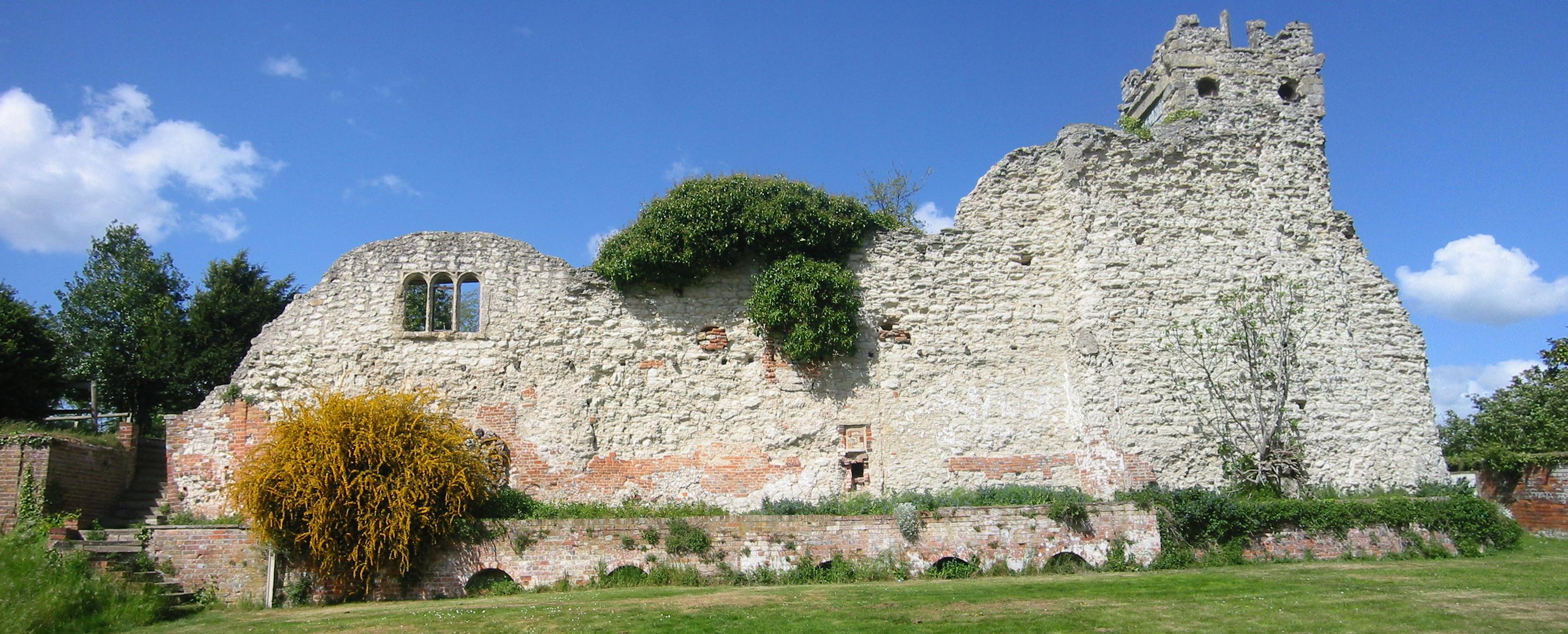
Wallingford () is a historic market town and civil parish located between Oxford and Reading on the River Thames in England. Although belonging to the historic county of Berkshire, it is within the ceremonial county of Oxfordshire for administrative purposes (since 1974) as a result of the 1972 Local Government Act. Wallingford is north of Reading, south of Oxford and north west of Henley-on-Thames. The town's population was 11,600 in the 2011 census. The town has played an important role in English history starting with the surrender of Stigand to William the Conqueror in 1066, which led to his taking the throne and the creation of Wallingford Castle. The castle and the town enjoyed royal status and flourished for much of the Middle Ages. The Treaty of Wallingford, which ended a civil war known as The Anarchy between King Stephen and Empress Matilda, was signed there. The town then entered a period of decline after the arrival of the Black Death and falling out of f ... [...More Info...] [...Related Items...] OR: [Wikipedia] [Google] [Baidu] |
Winchester
Winchester is a City status in the United Kingdom, cathedral city in Hampshire, England. The city lies at the heart of the wider City of Winchester, a local government Districts of England, district, at the western end of the South Downs National Park, on the River Itchen, Hampshire, River Itchen. It is south-west of London and from Southampton, its nearest city. At the 2011 census, Winchester had a population of 45,184. The wider City of Winchester district, which includes towns such as New Alresford, Alresford and Bishop's Waltham, has a population of 116,595. Winchester is the county town of Hampshire and contains the head offices of Hampshire County Council. Winchester developed from the Roman Britain, Roman town of Venta Belgarum, which in turn developed from an Iron Age oppidum. Winchester was one of the most important cities in England until the Norman conquest of England, Norman conquest in the eleventh century. It has since become one of the most expensive and afflue ... [...More Info...] [...Related Items...] OR: [Wikipedia] [Google] [Baidu] |
Selsey
Selsey is a seaside town and civil parish, about eight miles (12 km) south of Chichester in West Sussex, England. Selsey lies at the southernmost point of the Manhood Peninsula, almost cut off from mainland Sussex by the sea. It is bounded to the west by Bracklesham Bay, to the north by Broad Rife (''rife''Parish. A Dictionary of the Sussex Dialect. pp. 96–97 being the local word for stream or creek), to the east by Pagham Harbour and terminates in the south at Selsey Bill. There are significant rock formations beneath the sea off both of its coasts, named the Owers rocks and Mixon rocks. Coastal erosion has been an ever-present problem for Selsey.SCOPAC''Sedimentary Study from East Head to Pagham.'' Section 1.1. – The Standing Conference on Problems Associated with the Coastline (SCOPAC) was established in 1986 and consists of local authorities, the Environment agency and others. ''Archaeological evidence demonstrates that the coastline was some 2 to 3 km s ... [...More Info...] [...Related Items...] OR: [Wikipedia] [Google] [Baidu] |
Chichester Harbour
Chichester Harbour is a large natural harbour in West Sussex and Hampshire. It is situated to the south-west of the city of Chichester and to the north of the Solent. The harbour and surrounding land has been designated as an Area of Outstanding Natural Beauty (AONB) and a biological and geological Site of Special Scientific Interest (SSSI). The area is also part of the Solent Maritime Special Area of Conservation, Chichester and Langstone Harbours Ramsar site, Special Protection Area and Nature Conservation Review site, Grade I. Part of it is a Geological Conservation Review site and two areas are Local Nature Reserves. Chichester Harbour is a area that is managed by Chichester Harbour Conservancy, an independent public body that was established by an Act of Parliament in 1971. Description Chichester Harbour is one of four natural harbours in that area of the coastline, the others being Portsmouth Harbour, Langstone Harbour and Pagham Harbour. It is one of the few rema ... [...More Info...] [...Related Items...] OR: [Wikipedia] [Google] [Baidu] |
Chichester
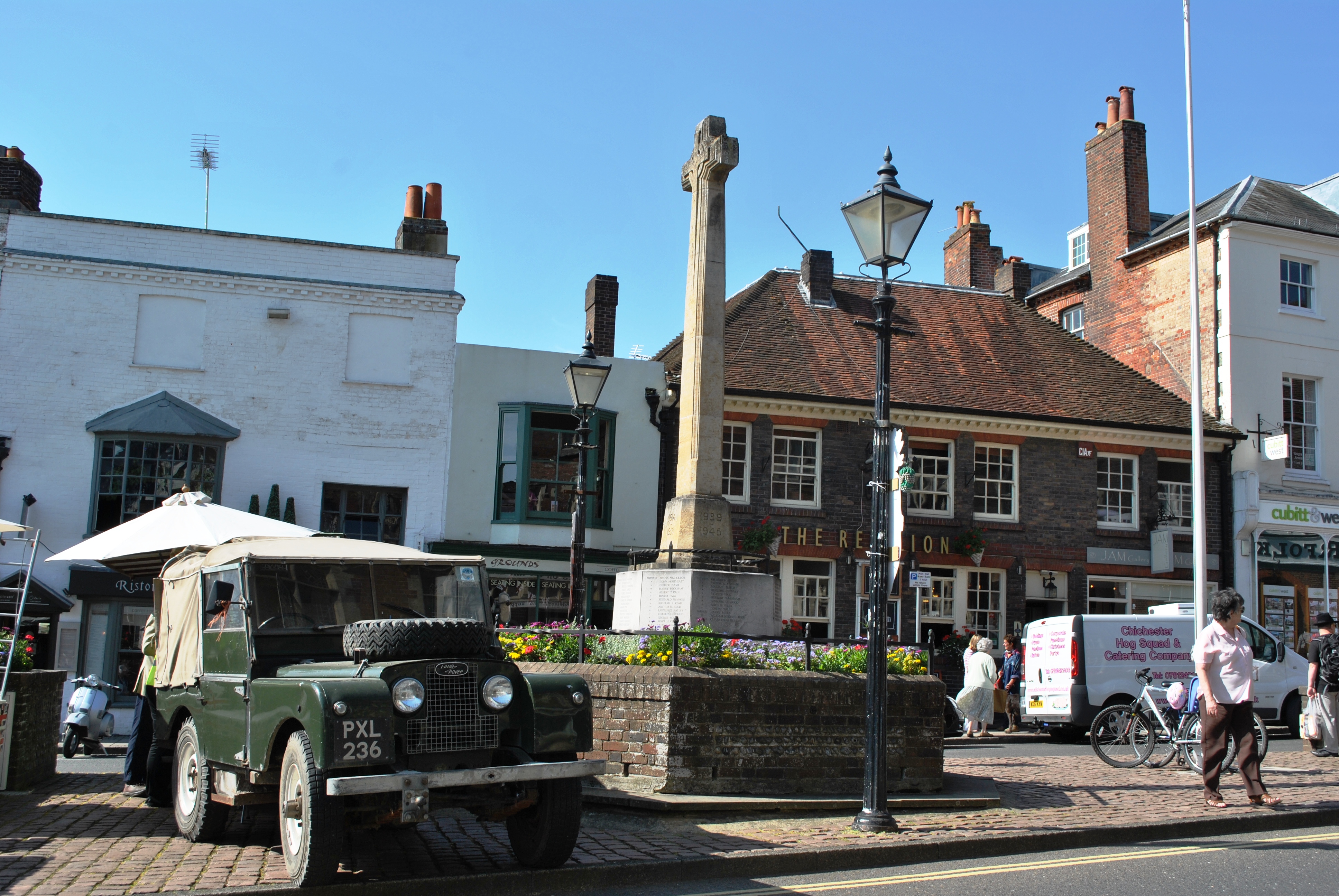
Chichester () is a cathedral city and civil parish in West Sussex, England.OS Explorer map 120: Chichester, South Harting and Selsey Scale: 1:25 000. Publisher:Ordnance Survey – Southampton B2 edition. Publishing Date:2009. It is the only city in West Sussex and is its county town. It was a Roman and Anglo-Saxon settlement and a major market town from those times through Norman and medieval times to the present day. It is the seat of the Church of England Diocese of Chichester, with a 12th-century cathedral. The city has two main watercourses: the Chichester Canal and the River Lavant. The Lavant, a winterbourne, runs to the south of the city walls; it is hidden mostly in culverts when close to the city centre. History Roman period There is no recorded evidence that the city that became Chichester was a settlement of any size before the coming of the Romans. The area around Chichester is believed to have played a significant part during the Roman invasion of A ... [...More Info...] [...Related Items...] OR: [Wikipedia] [Google] [Baidu] |
Arundel
Arundel ( ) is a market town and civil parish in the Arun District of the South Downs, West Sussex, England. The much-conserved town has a medieval castle and Roman Catholic cathedral. Arundel has a museum and comes second behind much larger Chichester in its number of listed buildings in West Sussex. The River Arun runs through the eastern side of the town. Arundel was one of the boroughs reformed by the Municipal Reform Act 1835. From 1836 to 1889 the town had its own Borough police force with a strength of three. In 1974 it became part of the Arun district, and is now a civil parish with a town council. Name The name comes from the Old English ''Harhunedell'', meaning "valley of horehound", and was first recorded in the Domesday Book. Folk etymology, however, connects the name with the Old French word ''arondelle'', meaning "swallow", and swallows appear on the town's arms. Governance An electoral ward of the same name exists. This ward stretches north to H ... [...More Info...] [...Related Items...] OR: [Wikipedia] [Google] [Baidu] |
Steyning
Steyning ( ) is a town and civil parish in the Horsham district of West Sussex, England. It is located at the north end of the River Adur gap in the South Downs, four miles (6.4 km) north of the coastal town of Shoreham-by-Sea. The smaller villages of Bramber and Upper Beeding constitute, with Steyning, a built-up area at this crossing-point of the river. Demography The parish has a land area of . In the 2001 census 5,812 people lived in 2,530 households, of whom 2,747 were economically active. History Saxon Steyning has existed since Anglo-Saxon times. Legend has it that St Cuthman built a church, at one time dedicated to him, later to St Andrew, and now jointly to St Andrew and St Cuthman, where he stopped after carrying his mother in a wheelbarrow. Several of the signs that can be seen on entering Steyning bear an image of his feat. King Alfred the Great's father, Æthelwulf of Wessex, was originally buried in that church, before being transferred to Winches ... [...More Info...] [...Related Items...] OR: [Wikipedia] [Google] [Baidu] |
Hurstpierpoint
Hurstpierpoint is a village in West Sussex, England, southwest of Burgess Hill, and west of Hassocks railway station. It sits in the civil parish of Hurstpierpoint and Sayers Common which has an area of 2029.88 ha and a population of 7,112. The village was once chiefly one long street running east and west and most of the buildings in it are of the 18th century or later. In the late 20th Century and early 21st Century saw Hurstpierpoint expanding greatly with new homes built north, east and west of the village. Hurstpierpoint hosts the Hurst Festival which takes place every summer and has an active Scouts and Guides Groups. Geography The village is built on a sandstone ridge, above sea level, running east and west across the parish, on the road from Lewes to Albourne. This is crossed in the centre of the village by Cuckfield Road which goes north to Cuckfield. Hurstpierpoint is located close to the A23. History The Hurstpierpoint manor held all the land i ... [...More Info...] [...Related Items...] OR: [Wikipedia] [Google] [Baidu] |
Keymer
Keymer is a village in Hassocks civil parish, in the Mid Sussex District of West Sussex, England. It lies on the B2116 road south of Burgess Hill. Keymer was an ancient parish that like its near neighbour Clayton was merged into the modern day parish of Hassocks. Both Keymer and Clayton's records go back as far as the Domesday Book. Keymer is situated just to the east of Hassocks and is only a matter of a few hundred yards from the boundary with East Sussex. It has a fine parish church, St Cosmas and St Damian Church. The oldest part of Keymer can be found in the area of this church and the Greyhound public house. Several buildings in this area are listed as being of special architectural or historic interest and the oldest dates from the 15th century. To the north-east of Keymer can be found Oldland Mill dating from the 18th century. It is one of the few remaining post mill The post mill is the earliest type of European windmill. Its defining feature is that the whole ... [...More Info...] [...Related Items...] OR: [Wikipedia] [Google] [Baidu] |


