|
Sub-Paleogene Surface
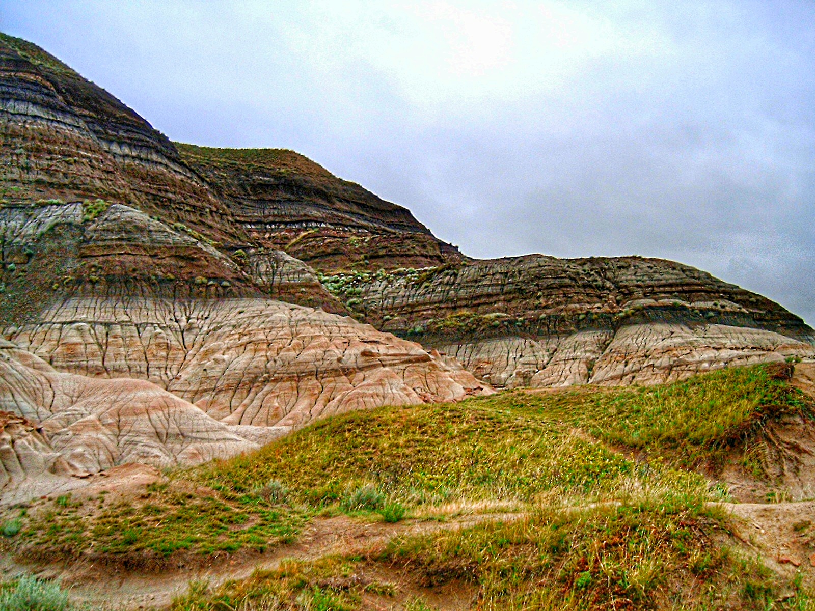
The Sub-Paleogene surface is an ancient erosion surface that exists in southern England. In parts the Sub-Paleogene surface appear as tilted plain and parts as an unconformity beneath sediments of Paleogene age. The surface was formed by the erosion of chalklands in England following a regression in the Maastrichtian age. The time during which the surface formed has been estimated by comparing the age of the last Maastrichtian chalk to deposit and the age of the earliest Paleogene sediment to cover the surface. This yields a bracket between 71–73 million years ago (Mya) and 59.3 Mya. The cause of the regression and hence of the erosion above sea level has been debated. It has been linked to eustatic sea level change, the Alpine orogeny and —more recently— to the Iceland plume. The surface was formerly known as Sub-Eocene surface until it was discovered that some sediments overlying the surface were in fact Paleogene. See also *Cretaceous–Paleogene boundary *Sub-Mesozoic ... [...More Info...] [...Related Items...] OR: [Wikipedia] [Google] [Baidu] |
Erosion Surface
In geology and geomorphology, an erosion surface is a surface of rock or regolith that was formed by erosion and not by construction (e.g. lava flows, sediment deposition) nor fault displacement. Erosional surfaces within the stratigraphic record are known as unconformities, but not all unconformities are buried erosion surfaces. Erosion surfaces vary in scale and can be formed on a mountain range or a rock. Particularly large and flat erosion surfaces receive the names of peneplain, paleoplain, planation surface or pediplain. An example of erosion surface is road surface erosion which is caused by natural and anthropogenic factors. Erosion surface can be measured through direct, contact measurement methods and indirect, non-contact measurement methods. Road surface erosion Just like mountains and rocks, erosion can also occur on unsealed roads due to natural and anthropogenic factors. Road surface erosion could be caused by snowfall, rainfall and wind. The material an ... [...More Info...] [...Related Items...] OR: [Wikipedia] [Google] [Baidu] |
Paleogene
The Paleogene ( ; also spelled Palaeogene or Palæogene; informally Lower Tertiary or Early Tertiary) is a geologic period and system that spans 43 million years from the end of the Cretaceous Period million years ago (Mya) to the beginning of the Neogene Period Mya. It is the beginning of the Cenozoic Era of the present Phanerozoic Eon. The earlier term Tertiary Period was used to define the span of time now covered by the Paleogene Period and subsequent Neogene Period; despite no longer being recognised as a formal stratigraphic term, 'Tertiary' is still widely found in earth science literature and remains in informal use. Paleogene is often abbreviated "Pg" (but the United States Geological Survey uses the abbreviation PE for the Paleogene on the Survey's geologic maps). During the Paleogene, mammals diversified from relatively small, simple forms into a large group of diverse animals in the wake of the Cretaceous–Paleogene extinction event that ended the preceding C ... [...More Info...] [...Related Items...] OR: [Wikipedia] [Google] [Baidu] |
Marine Regression
A marine regression is a geological process occurring when areas of submerged seafloor are exposed above the sea level. The opposite event, marine transgression, occurs when flooding from the sea covers previously-exposed land. Evidence of marine regressions and transgressions occurs throughout the fossil record, and the fluctuations are thought to have caused or contributed to several mass extinctions, such as the Permian-Triassic extinction event (250 million years ago) and Cretaceous–Paleogene extinction event (66 Ma). During the Permian-Triassic extinction, the largest extinction event in the Earth's history, the global sea level fell 250 m (820 ft). A major regression could itself cause marine organisms in shallow seas to go extinct, but mass extinctions tend to involve both terrestrial and aquatic species, and it is harder to see how a marine regression could cause widespread extinctions of land animals. Regressions are, therefore, seen as correlates or symptoms of maj ... [...More Info...] [...Related Items...] OR: [Wikipedia] [Google] [Baidu] |
Maastrichtian
The Maastrichtian () is, in the ICS geologic timescale, the latest age (uppermost stage) of the Late Cretaceous Epoch or Upper Cretaceous Series, the Cretaceous Period or System, and of the Mesozoic Era or Erathem. It spanned the interval from . The Maastrichtian was preceded by the Campanian and succeeded by the Danian (part of the Paleogene and Paleocene). The Cretaceous–Paleogene extinction event (formerly known as the Cretaceous–Tertiary extinction event) occurred at the end of this age. In this mass extinction, many commonly recognized groups such as non-avian dinosaurs, plesiosaurs and mosasaurs, as well as many other lesser-known groups, died out. The cause of the extinction is most commonly linked to an asteroid about wide colliding with Earth, ending the Cretaceous. Stratigraphic definitions Definition The Maastrichtian was introduced into scientific literature by Belgian geologist André Hubert Dumont in 1849, after studying rock strata of the ... [...More Info...] [...Related Items...] OR: [Wikipedia] [Google] [Baidu] |
Eustacy
Mean sea level (MSL, often shortened to sea level) is an average surface level of one or more among Earth's coastal bodies of water from which heights such as elevation may be measured. The global MSL is a type of vertical datuma standardised geodetic datumthat is used, for example, as a chart datum in cartography and marine navigation, or, in aviation, as the standard sea level at which atmospheric pressure is measured to calibrate altitude and, consequently, aircraft flight levels. A common and relatively straightforward mean sea-level standard is instead the midpoint between a mean low and mean high tide at a particular location. Sea levels can be affected by many factors and are known to have varied greatly over geological time scales. Current sea level rise is mainly caused by human-induced climate change. When temperatures rise, mountain glaciers and the polar ice caps melt, increasing the amount of water in water bodies. Because most of human settlement a ... [...More Info...] [...Related Items...] OR: [Wikipedia] [Google] [Baidu] |
Iceland Plume
The Iceland hotspot is a hotspot which is partly responsible for the high volcanic activity which has formed the Iceland Plateau and the island of Iceland. Iceland is one of the most active volcanic regions in the world, with eruptions occurring on average roughly every three years (in the 20th century there were 39 volcanic eruptions on and around Iceland). About a third of the basaltic lavas erupted in recorded history have been produced by Icelandic eruptions. Notable eruptions have included that of Eldgjá, a fissure of Katla, in 934 (the world's largest basaltic eruption ever witnessed), Laki in 1783 (the world's second largest), and several eruptions beneath ice caps, which have generated devastating glacial bursts, most recently in 2010 after the eruption of Eyjafjallajökull. Iceland's location astride the Mid-Atlantic Ridge, where the Eurasian and North American Plates are moving apart, is partly responsible for this intense volcanic activity, but an additional c ... [...More Info...] [...Related Items...] OR: [Wikipedia] [Google] [Baidu] |
Cretaceous–Paleogene Boundary
The Cretaceous–Paleogene (K–Pg) boundary, formerly known as the Cretaceous–Tertiary (K–T) boundary, is a geological signature, usually a thin band of rock containing much more iridium than other bands. The K–Pg boundary marks the end of the Cretaceous Period, the last period of the Mesozoic Era, and marks the beginning of the Paleogene Period, the first period of the Cenozoic Era. Its age is usually estimated at around 66 million years, with radiometric dating yielding a more precise age of 66.043 ± 0.011 Ma. The K–Pg boundary is associated with the Cretaceous–Paleogene extinction event, a mass extinction which destroyed a majority of the world's Mesozoic species, including all dinosaurs except for birds. Strong evidence exists that the extinction coincided with a large meteorite impact at the Chicxulub crater and the generally accepted scientific theory is that this impact triggered the extinction event. The word "Cretaceous" is derived from the Latin "creta" ... [...More Info...] [...Related Items...] OR: [Wikipedia] [Google] [Baidu] |
Sub-Mesozoic Hilly Peneplains
200px, An undulating hilly landscape in Falkenberg Municipality, 200px">An undulating hilly landscape in Varberg Municipality, Halland. The Sub-Mesozoic hilly peneplains or Sub-Mesozoic hilly relief is a landscape in Scandinavia made up of undulating hills and joint valleys and occasional kaolinized bedrock in valley bottoms. The landscape formed in the Mesozoic Era and was eventually drowned by the sea during the Campanian marine transgression, transgression and covered by a thick cover of Cretaceous sedimentary rocks. Later erosion of the cover rocks partly re-exposed this landscape. During the Quaternary epoch the re-exposed Mesozoic hilly relief escaped major glacier erosion being only surficially scoured in parts. The Sub-Mesozoic hilly relief formed starting from a peneplain formed in the Permian and Triassic. Remnants of this peneplain can be traced as a tilted summit accordance in the Swedish West Coast. This would indicated that Paleozoic strata that covered much of F ... [...More Info...] [...Related Items...] OR: [Wikipedia] [Google] [Baidu] |
Utsira High
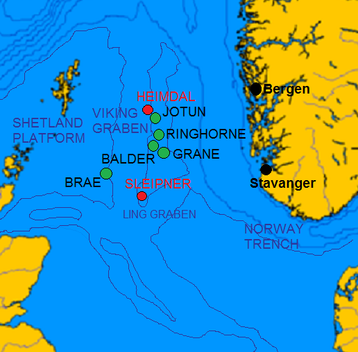
Utsira High no, Utsirahøgda is a basement high and horst in the southwest of the Norwegian continental shelf. It lies east of the Viking Graben and west of the Stord and Egersund basins 190 km west of Stavanger. It was on the Balder oil field at the flank of the Utsira High that oil was first discovered in Norway in 1967. The basement is of Utsira High is composed of granite that formed in Ordovician times. Parts of these granites contain saprolite and saprock that formed from weathering above sea level during the Early Mesozoic. before they became buried in Late Jurassic and Early Cretaceous-aged sandstone. These weathered rocks may be unconventional petroleum reservoirs. The strandflat at Bømlo island is considered a sedimentary rock Sedimentary rocks are types of rock that are formed by the accumulation or deposition of mineral or organic particles at Earth's surface, followed by cementation. Sedimentation is the collective name for processes that cause ... [...More Info...] [...Related Items...] OR: [Wikipedia] [Google] [Baidu] |
Cretaceous England
The Cretaceous ( ) is a geological period that lasted from about 145 to 66 million years ago (Mya). It is the third and final period of the Mesozoic Era, as well as the longest. At around 79 million years, it is the longest geological period of the entire Phanerozoic. The name is derived from the Latin ''creta'', "chalk", which is abundant in the latter half of the period. It is usually abbreviated K, for its German translation ''Kreide''. The Cretaceous was a period with a relatively warm climate, resulting in high eustatic sea levels that created numerous shallow inland seas. These oceans and seas were populated with now- extinct marine reptiles, ammonites, and rudists, while dinosaurs continued to dominate on land. The world was ice free, and forests extended to the poles. During this time, new groups of mammals and birds appeared. During the Early Cretaceous, flowering plants appeared and began to rapidly diversify, becoming the dominant group of plants across the Earth by t ... [...More Info...] [...Related Items...] OR: [Wikipedia] [Google] [Baidu] |
Unconformities
An unconformity is a buried erosional or non-depositional surface separating two rock masses or strata of different ages, indicating that sediment deposition was not continuous. In general, the older layer was exposed to erosion for an interval of time before deposition of the younger layer, but the term is used to describe any break in the sedimentary geologic record. The significance of angular unconformity (see below) was shown by James Hutton, who found examples of Hutton's Unconformity at Jedburgh in 1787 and at Siccar Point in 1788. The rocks above an unconformity are younger than the rocks beneath (unless the sequence has been overturned). An unconformity represents time during which no sediments were preserved in a region or were subsequently eroded before the next deposition. The local record for that time interval is missing and geologists must use other clues to discover that part of the geologic history of that area. The interval of geologic time not represented is ... [...More Info...] [...Related Items...] OR: [Wikipedia] [Google] [Baidu] |


