|
Stroudwater Barge
A Stroudwater barge was a type of barge developed for use on the Stroudwater Navigation, a canal in Gloucestershire. Origins As for most specialised British canal barge designs, their size was chosen to be the largest that could fit through the locks and bridges of the area in which they worked. The locks of the Stroudwater Navigation are . This gave typical dimensions for the barges of length and a beam of . They could carry between 70 and 75 tons. As usual for barges they were carvel built, with bluff bows and rounded bilges. The stem post is high with a towing bitt behind, and with a canoe stern. Both stem and stern had a small decked area. The bow carried a large iron windlass and the stern provided a small living cabin beneath the deck. There was no sailing mast or propulsion, as they were bank-hauled by horses. These barges were used on the Stroudwater canal and onto the Gloucester and Sharpness Canal, via Saul Junction, and thence to either Gloucester or for tr ... [...More Info...] [...Related Items...] OR: [Wikipedia] [Google] [Baidu] |
The Hull Of The Tirley (geograph 2904265)
''The'' () is a grammatical article in English, denoting persons or things that are already or about to be mentioned, under discussion, implied or otherwise presumed familiar to listeners, readers, or speakers. It is the definite article in English. ''The'' is the most frequently used word in the English language; studies and analyses of texts have found it to account for seven percent of all printed English-language words. It is derived from gendered articles in Old English which combined in Middle English and now has a single form used with nouns of any gender. The word can be used with both singular and plural nouns, and with a noun that starts with any letter. This is different from many other languages, which have different forms of the definite article for different genders or numbers. Pronunciation In most dialects, "the" is pronounced as (with the voiced dental fricative followed by a schwa) when followed by a consonant sound, and as (homophone of the archai ... [...More Info...] [...Related Items...] OR: [Wikipedia] [Google] [Baidu] |
Windlass
The windlass is an apparatus for moving heavy weights. Typically, a windlass consists of a horizontal cylinder (barrel), which is rotated by the turn of a crank or belt. A winch is affixed to one or both ends, and a cable or rope is wound around the winch, pulling a weight attached to the opposite end. The Greek scientist Archimedes was the inventor of the windlass. The oldest depiction of a windlass for raising water can be found in the Book of Agriculture published in 1313 by the Chinese official Wang Zhen of the Yuan Dynasty ( 1290–1333). Uses * Vitruvius, a military engineer writing about 28 BC, defined a machine as "a combination of timber fastened together, chiefly efficacious in moving great weights." About a century later, Hero of Alexandria summarized the practice of his day by naming the "five simple machines" for "moving a given weight by a given force" as the lever, windlass, screw for power, wedge, and tackle block (pulley). Until nearly the end of the n ... [...More Info...] [...Related Items...] OR: [Wikipedia] [Google] [Baidu] |
Severn Trow
A trow was a type of cargo boat found in the past on the rivers Severn and Wye in Great Britain and used to transport goods. Features The mast could be taken down so that the trow could go under bridges, such as the bridge at Worcester and the many bridges up and downstream. The mast was stepped in a three sided frame open at the rear but closed with an iron pin or rope lashing. From the top of the mast a forestay ran down to the bow winch. To lower the mast the pin was removed and the winch slackened off to let the mast fall towards the stern. The reverse operation pulled the mast up. Despite their flat-bottomed hull form which made volume available for their load and permitted drying out on muddy banks in the tidal area where they operated, Trows were seaworthy. For example, with an added keel the Droitwich Trow ''Hastings'' is recorded as taking 90 tons of salt from Droitwich to France across the English Channel. The flat-bottomed trows sailed on the sea by hauling a log ... [...More Info...] [...Related Items...] OR: [Wikipedia] [Google] [Baidu] |
Arlingham
Arlingham is a village and civil parish in the Stroud District of Gloucestershire, England. The 2001 Census recorded a parish population of 410, increasing to 459 at the 2011 census (226 males, 233 females with 176 Households). The parish contains the hamlets of Milton End, Overton and Priding. The next parish to the east is Fretherne with Saul. Geography Arlingham lies at the western end of the horseshoe loop of the River Severn, known as the "Horseshoe Bend", looking across the water to Newnham on Severn and the Forest of Dean. Access to Arlingham is across Fretherne bridge over the Gloucester and Sharpness Canal, or Sandfield Bridge at Saul Junction. Having the canal on one side and the River Severn on three sides of the parish and a single lane connecting it to the villages to the East, it has developed a distinct identity. Its rural character is still maintained, having some ten working farms with dairy and beef herds and arable land. Although close to the river, unlike are ... [...More Info...] [...Related Items...] OR: [Wikipedia] [Google] [Baidu] |
Aust
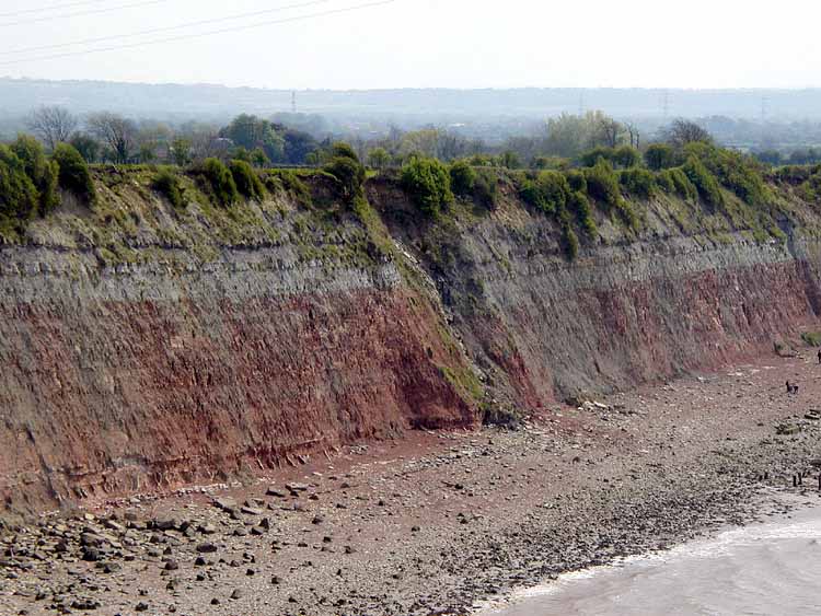
Aust is a small village in South Gloucestershire, England, about north of Bristol and about south west of Gloucester. It is located on the eastern side of the Severn estuary, close to the eastern end of the Severn Bridge which carries the M48 motorway. The village has a chapel, a church and a public house. There is a large area of farmland on the river bank, which is sometimes flooded due to the high tidal range of the Severn. Aust Cliff, above the Severn, is located about from the village. The civil parish of Aust includes the villages of Elberton and Littleton-upon-Severn. History Overview Aust, on the River Severn, was at one end of an ancient Roman road that let to Cirencester. Its name, Aust, may be one of the very few English place-names to be derived from the Latin ''Augusta''. The name of Aust is recorded in 793 or 794 as ''Austan'' (''terram aet Austan v manentes'') when it was returned to the Church of Worcester after having been taken by King Offa's earl, By ... [...More Info...] [...Related Items...] OR: [Wikipedia] [Google] [Baidu] |
Severn Railway Bridge
The Severn Railway Bridge (historically called the Severn Bridge) was a bridge carrying the railway across the River Severn between Sharpness and Lydney in Gloucestershire, England. It was built in the 1870s by the Severn Bridge Railway Company, primarily to carry coal from the Forest of Dean to the docks at Sharpness; it was the furthest-downstream bridge over the Severn until the opening of the Severn road bridge in 1966. When the company got into financial difficulties in 1893, it was taken over jointly by the Great Western Railway and the Midland Railway companies. The bridge continued to be used for freight and passenger services until 1960, and saw temporary extra traffic on the occasions that the Severn Tunnel was closed for engineering work. The bridge was constructed by Hamilston's Windsor Ironworks Company Limited of Garston, Liverpool. It was approached from the north via a masonry viaduct and had twenty-two spans. The pier columns were formed of circular secti ... [...More Info...] [...Related Items...] OR: [Wikipedia] [Google] [Baidu] |
River Severn
, name_etymology = , image = SevernFromCastleCB.JPG , image_size = 288 , image_caption = The river seen from Shrewsbury Castle , map = RiverSevernMap.jpg , map_size = 288 , map_caption = Tributaries (light blue) and major settlements on and near the Severn (bold blue) , pushpin_map = , pushpin_map_size = 288 , pushpin_map_caption= , subdivision_type1 = Country , subdivision_name1 = England and Wales , subdivision_type2 = , subdivision_name2 = , subdivision_type3 = Region , subdivision_name3 = Mid Wales, West Midlands, South West , subdivision_type4 = Counties , subdivision_name4 = Powys, Shropshire, Worcestershire, Gloucestershire , subdivision_type5 = Cities , subdivision_name5 = Shrewsbury, Worcester, Gloucester, Bristol , length = , width_min = , width_avg = , width_max = , depth_min = , depth_avg ... [...More Info...] [...Related Items...] OR: [Wikipedia] [Google] [Baidu] |
Purton Hulks
The Purton Hulks or Purton Ships' Graveyard is a number of abandoned boats and ships, deliberately beached beside the River Severn near Purton, Berkeley, Purton in Gloucestershire, England, to reinforce the river banks. Most were beached in the 1950s and are now in a state of considerable decay. The site forms the largest ship graveyard in mainland Britain. A riverbank collapse in 1909 led to concerns that the barrier between the river and the Gloucester and Sharpness Canal would be breached. Old vessels were run aground and soon filled with water and silt to create a tidal erosion barrier. The vessels included steel barges, Severn trows and concrete ships. The boats came from throughout the British Isles and were built in the second half of the 19th century and the first half of the 20th. Since 2000, archaeological investigations have been undertaken to find out more about the vessels and their states of decay. Explanatory labels have been provided. One barge has been schedul ... [...More Info...] [...Related Items...] OR: [Wikipedia] [Google] [Baidu] |
Sharpness Docks
Sharpness ( ) is an English port in Gloucestershire, one of the most inland in Britain, and eighth largest in the South West. It is on the River Severn at , at a point where the tidal range, though less than at Avonmouth downstream ( typical spring tide), is still large ( typical spring). There is a small community of approximately 100 residents directly adjacent to the port, in addition to the subvillage of Newtown approximately 0.5 miles to the south-east. Four miles to the south lies the small town of Berkeley. Docks Sharpness docks began as a basin giving access to the Gloucester and Sharpness Canal. There were no port facilities at Sharpness itself and all traffic proceeded up the canal to Gloucester. The original Old Dock opened, with the canal, in 1827. The dock was separated from the Severn by a lock gate. The level of the basin varied for the hour or two for which the gate was open and so it was isolated from the canal by a lock with two gates. This lock was impr ... [...More Info...] [...Related Items...] OR: [Wikipedia] [Google] [Baidu] |
Saul Junction
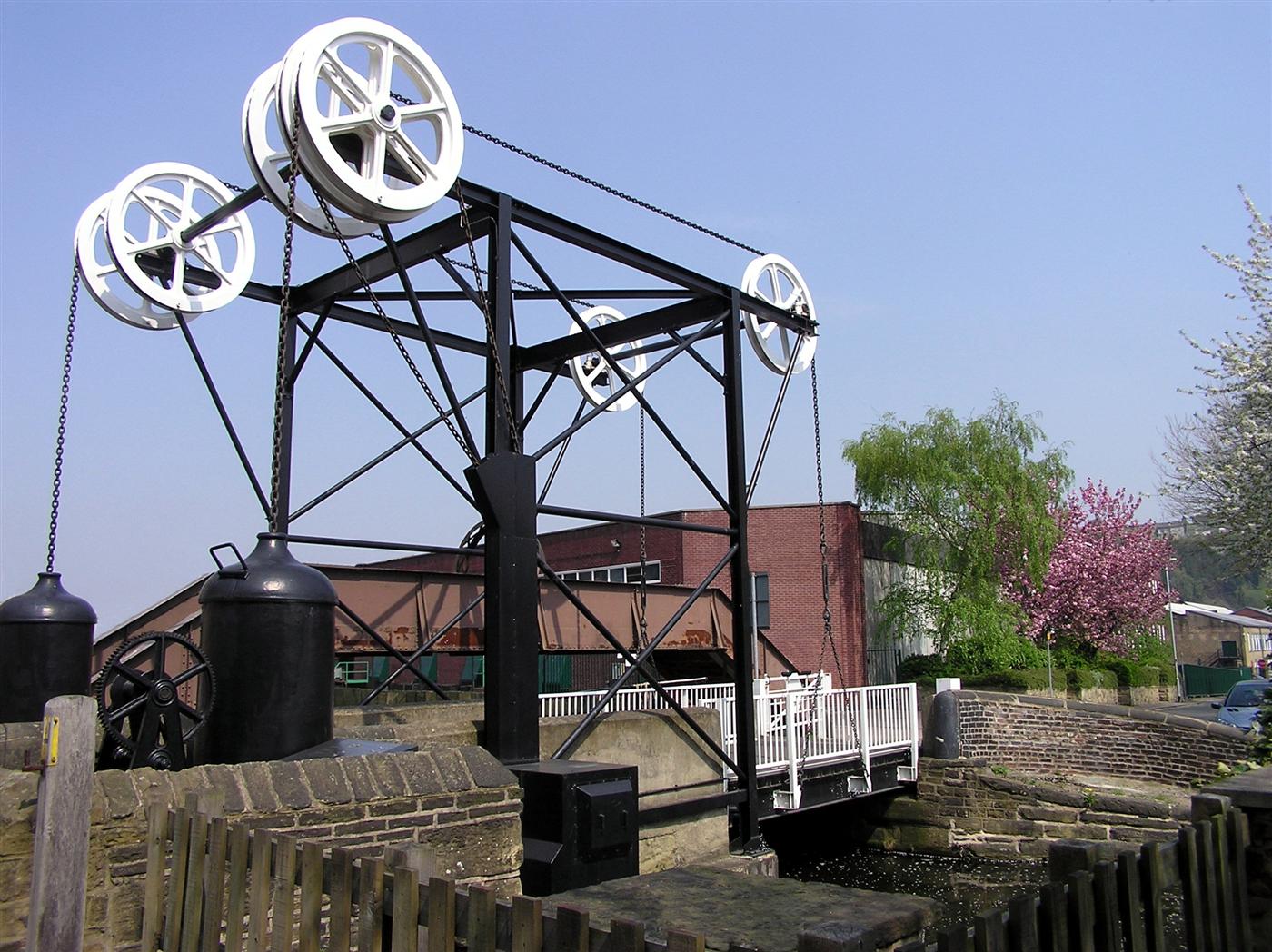
Saul is a village and former civil parish, now in the parish of Fretherne with Saul, in the Stroud (district), Stroud district, in the county of Gloucestershire, England. In 1881 the parish had a population of 597. On 24 March 1884 the parish was abolished to form Fretherne with Saul; part also went to Moreton Valance and Standish, Gloucestershire, Standish. Saul Junction The village lends its name to the nearby junction of the Stroudwater Navigation and the Gloucester and Sharpness Canal, a unique example of a crossing between two separately-owned canals. This is a popular and busy area, with three Swing bridge, swing bridges, an active boatyard including dry dock, a visitor centre operated by the Cotswold Canals Trust and a Canal & River Trust office, historically significant Listed building, listed structures, a Wycliffe College Boat Club, rowing club, car parks and a café, a marina including chandlery, boat hire and charitable excursions, extensive towpath moorings, a va ... [...More Info...] [...Related Items...] OR: [Wikipedia] [Google] [Baidu] |
Gloucester And Sharpness Canal
The Gloucester and Sharpness Canal (also known as the Gloucester and Berkeley Canal) is a ship canal in the west of England, between Gloucester and Sharpness; for much of its length it runs close to the tidal River Severn, but cuts off a significant loop in the river, at a once-dangerous bend near Arlingham. It was once the broadest and deepest canal in the world. The canal is long. Canal planning and construction Conceived in the canal mania period of the late 18th century, the Gloucester and Berkeley Ship Canal scheme (as it was originally named) was started by architect and civil engineer Robert Mylne. In 1793 an Act of Parliament was obtained authorising the raising of a total of £200,000.Hadfield (1969), p.342 The project rapidly encountered financial difficulties – to such an extent that Mylne left the project in 1798. By mid-1799 costs had reached £112,000 but only of the canal had been completed.Hadfield (1969), p.344 Robert Mylne's role was taken over by ... [...More Info...] [...Related Items...] OR: [Wikipedia] [Google] [Baidu] |
Transom Stern
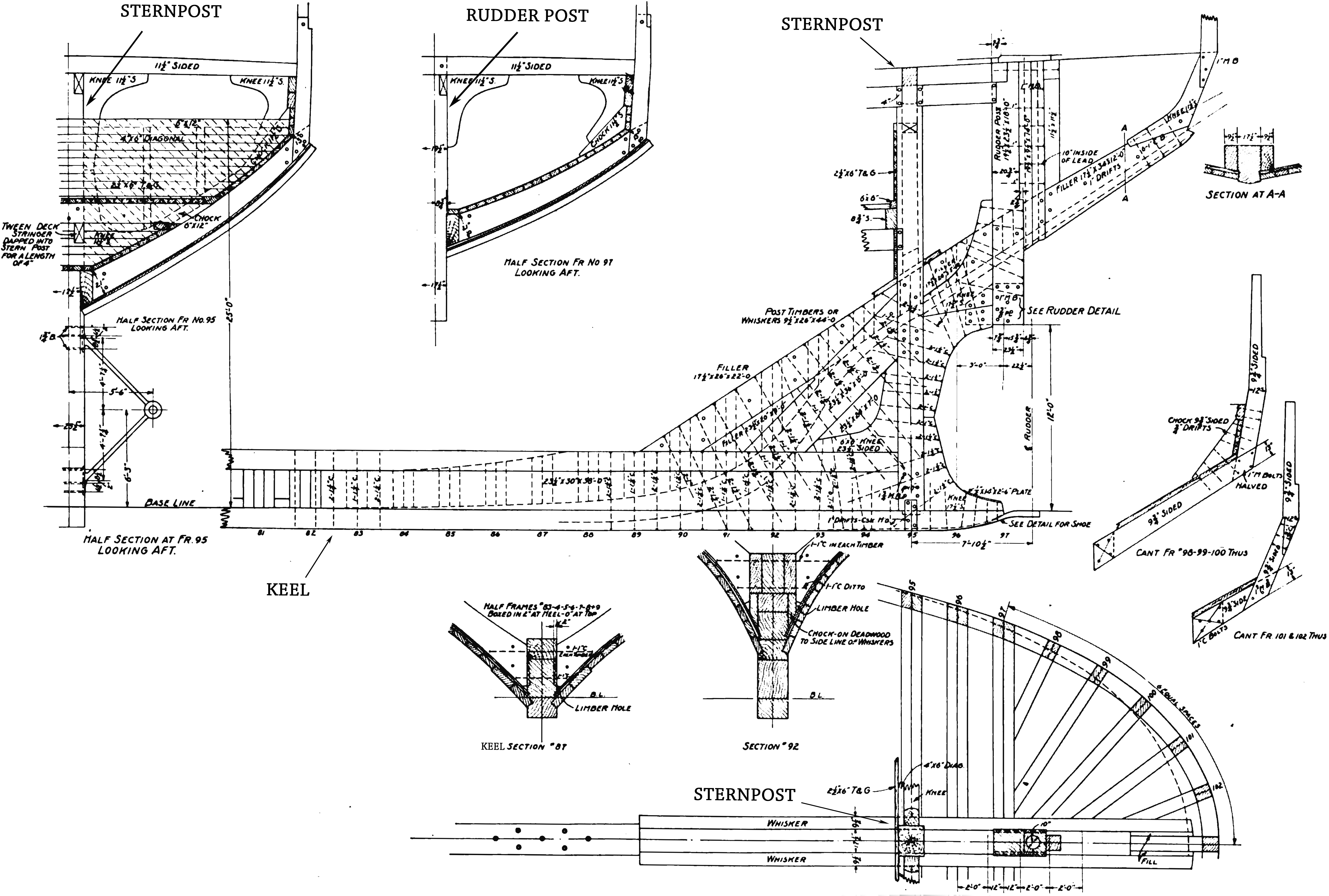
The stern is the back or aft-most part of a ship or boat, technically defined as the area built up over the sternpost, extending upwards from the counter rail to the taffrail. The stern lies opposite the bow, the foremost part of a ship. Originally, the term only referred to the aft port section of the ship, but eventually came to refer to the entire back of a vessel. The stern end of a ship is indicated with a white navigation light at night. Sterns on European and American wooden sailing ships began with two principal forms: the ''square'' or ''transom'' stern and the ''elliptical'', ''fantail'', or ''merchant'' stern, and were developed in that order. The hull sections of a sailing ship located before the stern were composed of a series of U-shaped rib-like frames set in a sloped or "cant" arrangement, with the last frame before the stern being called the ''fashion timber(s)'' or ''fashion piece(s)'', so called for "fashioning" the after part of the ship. This frame is d ... [...More Info...] [...Related Items...] OR: [Wikipedia] [Google] [Baidu] |
.png)


