|
Southern Rātā
''Metrosideros umbellata'', the southern rātā, is a tree endemic to New Zealand. It grows up to or more tall with a trunk up to or more in diameter. It produces masses of red flowers in summer. Unlike its relative, northern rātā, this species rarely grows as an epiphyte. Description The flowers of southern rātā are scarlet, with stamens about long. White or yellow flowers are also known. Flowering usually occurs between December and February, but this depends on local conditions. Leaves are from to long, and are sharply pointed. The wood is hard, dense, and very strong. The bark is rough and flaky and provides an ideal stratum for the roots of epiphytic plants such as ''Astelia'' species and ''Freycinetia banksii'' (kiekie). Southern rātā is a major source of honey on the West Coast of the South Island. The kākā, tūī, and bellbirds visit southern rātā to take advantage of the abundant nectar. Distribution It prefers cooler regions with high rainfall and ... [...More Info...] [...Related Items...] OR: [Wikipedia] [Google] [Baidu] |
Cultivar
A cultivar is a kind of Horticulture, cultivated plant that people have selected for desired phenotypic trait, traits and which retains those traits when Plant propagation, propagated. Methods used to propagate cultivars include division, root and stem cuttings, offsets, grafting, micropropagation, tissue culture, or carefully controlled seed production. Most cultivars arise from deliberate human genetic engineering, manipulation, but some originate from wild plants that have distinctive characteristics. Cultivar names are chosen according to rules of the International Code of Nomenclature for Cultivated Plants (ICNCP), and not all cultivated plants qualify as cultivars. Horticulturists generally believe the word ''cultivar''''Cultivar'' () has two meanings, as explained in ''#Formal definition, Formal definition'': it is a classification category and a taxonomic unit within the category. When referring to a taxon, the word does not apply to an individual plant but to all plants t ... [...More Info...] [...Related Items...] OR: [Wikipedia] [Google] [Baidu] |
Nelson, New Zealand
Nelson () is a List of cities in New Zealand, city and Districts of New Zealand, unitary authority on the eastern shores of Tasman Bay at the top of the South Island of New Zealand. It is the oldest city in the South Island and the second-oldest settled city in the country; it was established in 1841 and became a city by British royal charter in 1858. Nelson City is bordered to the west and south-west by the Tasman District and to the north-east, east and south-east by the Marlborough District. The Nelson urban area has a population of , making it New Zealand's 15th most populous urban area. Nelson is well known for its thriving local arts and crafts scene; each year, the city hosts events popular with locals and tourists alike, such as the Nelson Arts Festival. Naming Nelson was named in honour of Admiral Horatio Nelson, 1st Viscount Nelson, Horatio Nelson, who defeated both the First French Empire, French and Spanish fleets at the Battle of Trafalgar in 1805. Many roads ... [...More Info...] [...Related Items...] OR: [Wikipedia] [Google] [Baidu] |
Great Barrier Island
Great Barrier Island () lies in the outer Hauraki Gulf, New Zealand, north-east of central Auckland. With an area of it is the sixth-largest List of islands of New Zealand, island of New Zealand. Its highest point, Mount Hobson, Great Barrier Island, Mount Hobson, is above sea level.Great Barrier Island Aotea page on the DOC website (from the New Zealand Department of Conservation, Department of Conservation. Accessed 2008-06-04.) The local government in New Zealand, local authority is the Auckland Council. The island was initially exploited for its minerals and kauri trees and saw only limited agriculture. In 2013, it was inhabited by 939 people, from Statistics New Zealand. mostly living from ... [...More Info...] [...Related Items...] OR: [Wikipedia] [Google] [Baidu] |
Christchurch
Christchurch (; ) is the largest city in the South Island and the List of cities in New Zealand, second-largest city by urban area population in New Zealand. Christchurch has an urban population of , and a metropolitan population of over half a million. It is located in the Canterbury Region, near the centre of the east coast of the South Island, east of the Canterbury Plains. It is located near the southern end of Pegasus Bay, and is bounded to the east by the Pacific Ocean and to the south by the ancient volcanic complex of the Banks Peninsula. The Avon River / Ōtākaro, Avon River (Ōtākaro) winds through the centre of the city, with Hagley Park, Christchurch, a large urban park along its banks. With the exception of the Port Hills, it is a relatively flat city, on an average around above sea level. Christchurch has a reputation for being an English New Zealanders, English city, with its architectural identity and nickname the 'Garden City' due to similarities with garde ... [...More Info...] [...Related Items...] OR: [Wikipedia] [Google] [Baidu] |
Avon River (Canterbury)
River Avon may refer to: Australia * Avon River (Mid-Coast Council), New South Wales * Avon River (Wollongong), New South Wales * Avon River (Gippsland, Victoria) * Avon River (Grampians, Victoria) * Avon River (Western Australia) Canada * Avon River (Nova Scotia) * Avon River (Ontario) New Zealand * Avon River / Ōtākaro, in the Canterbury Region, where it runs through Christchurch. * Avon River (Marlborough) United Kingdom England * River Avon, Bristol, running from Acton Turville to Avonmouth (also known as the Bristol Avon). * River Avon, Devon, running from Ryder's Hill to Bigbury (also known as River Aune). * River Avon, Warwickshire The River Avon ( or ) in central England flows generally southwestwards and is a major left-bank and easternmost tributary of the River Severn. It is also known as the Warwickshire Avon or Shakespeare's Avon, to distinguish it from River Avo ..., running from Naseby to Tewkesbury (also known as Shakespeare's Avon). * River ... [...More Info...] [...Related Items...] OR: [Wikipedia] [Google] [Baidu] |
Lake Wānaka
Lake Wānaka is New Zealand's List of lakes in New Zealand#Largest lakes, fourth-largest lake and the seat of the town of Wānaka in the Otago region. The lake is 278 meters above sea level, covers , and is more than deep. "Wānaka" is the South Island dialect pronunciation of , which means "the lore of the tohunga or priest" or a place of learning. Geography Geography Lake Wānaka lies at the heart of the Otago Lakes in the lower South Island of New Zealand. The township of Wānaka, which sits in a glacier-carved basin on the shores of the lake, is the gateway to Mount Aspiring National Park, Mt Aspiring National Park. Lake Hāwea is a 15-minute drive away, en route to the frontier town of Makarora, the last stop before the West Coast Glacier region. To the south is the historic Cardrona Valley, a popular scenic alpine route to neighbouring Queenstown, New Zealand, Queenstown. Geology Lake Wānaka lies in a u-shaped valley formed by glacier, glacial erosion during the las ... [...More Info...] [...Related Items...] OR: [Wikipedia] [Google] [Baidu] |
Kaka Point
Kaka Point is a small town at the northern edge of The Catlins, an area of the southern South Island of New Zealand. It is located south of Balclutha and 8 km north of the headland of Nugget Point. It has a seasonally fluctuating population, and there are numerous cribs (holiday homes) at the settlement. The settlement's best−known resident was Māori poet Hone Tuwhare, who lived in Kaka Point for many years until he died in 2008. Kaka Point is named for the kākā bird, whose signature call is "ka-aa." There is a restaurant, a motel, bed and breakfasts establishments, and a camping grounds in Kaka Point. Demographics Kaka Point is described by Statistics New Zealand as a rural settlement. It covers , and had an estimated population of as of with a population density of people per km2. It is part of the much larger Catlins statistical area. Kaka Point had a population of 231 at the 2018 New Zealand census, an increase of 9 people (4.1%) since the 2013 census, and an ... [...More Info...] [...Related Items...] OR: [Wikipedia] [Google] [Baidu] |
Nugget Point
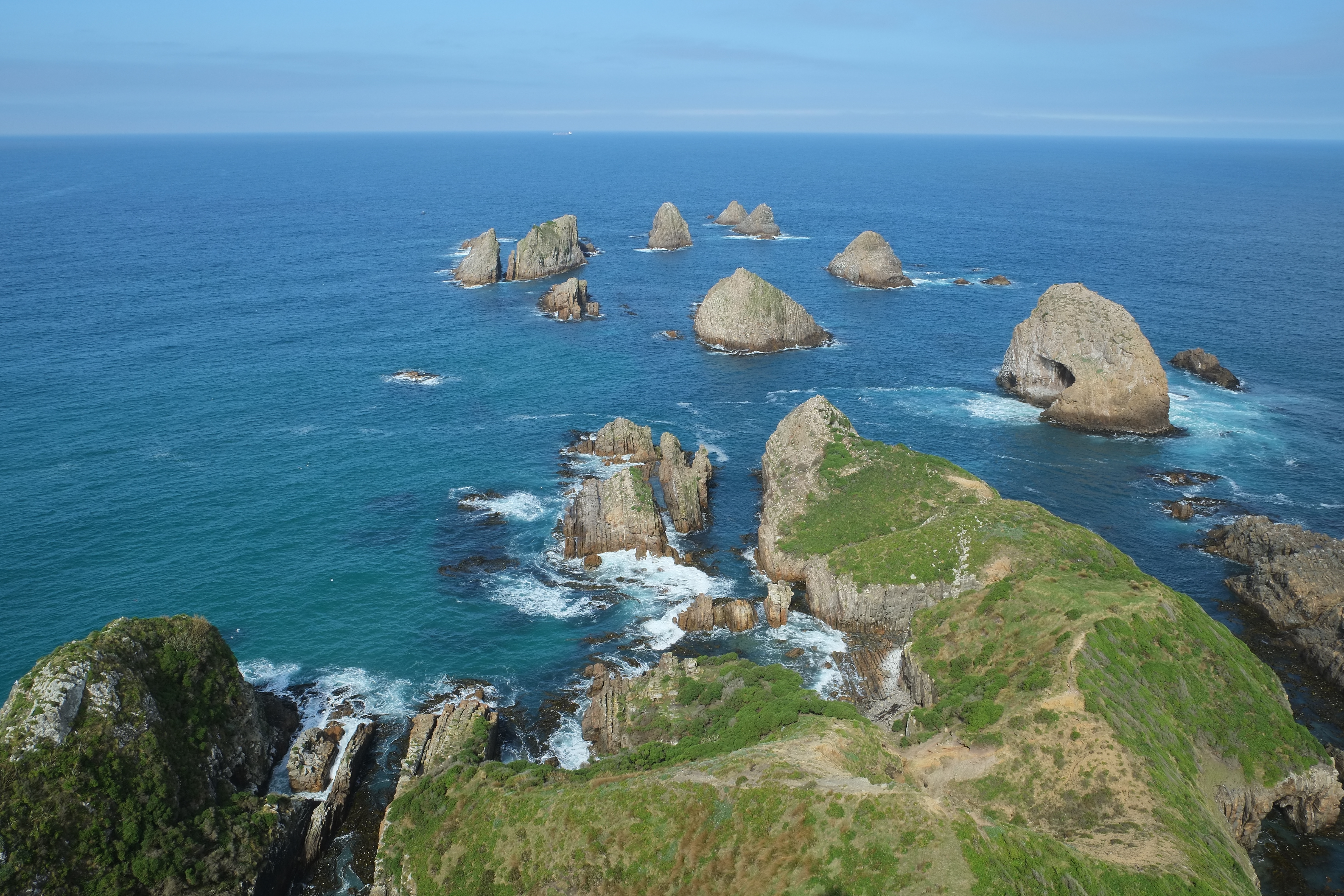
Nugget Point () is a coastal landform on the Otago coast in New Zealand. Located at the northern end of the Catlins coast, along the road from Kaka Point, this steep headland has a lighthouse at its tip, surrounded by rocky islets (The Nuggets). The point is home to many seabirds, including penguins, gannets and royal spoonbills, and a large breeding colony of fur seals. Roaring Bay, on the south coast of the tip of Nugget Point, is home to a small colony of yellow-eyed penguins. Nugget Point Lighthouse Nugget Point had been considered a significant danger in particular to small vessels trading along the coast to the Clutha River. The lighthouse was built in 1869 and started operating on 4 July 1870.Information panel at Nugget Point lighthouse The tower was constructed from locally quarried stone and stands above the water. Originally powered by an oil burner, it was converted to a 1000 W lamp in 1949 with electricity provided by a diesel generator until the 1960s, w ... [...More Info...] [...Related Items...] OR: [Wikipedia] [Google] [Baidu] |
Otira
Otira is a small township fifteen kilometres north of Arthur's Pass in the central South Island of New Zealand. It is on the northern approach to the pass, a saddle between the Ōtira and Bealey Rivers high in the Southern Alps. A possible meaning of is ''"o"'' (place of) and ''"tira"'' (the travellers). Another possible meaning is ''"Oti"'' (finished) and ''"ra"'' (Sun), because Otira Gorge is usually in deep shadow. History Otira was originally a stop on the Cobb and Co stagecoach from Canterbury to the West Coast. The Midland Line was extended from Stillwater to Jacksons in 1894 and then Otira in 1899, when the pass was navigated by coach from Otira until the railway tunnel opened in 1923. During the construction of the tunnel, Otira housed about 600 workers and their families. The Otira Railway Station was opened on 13 November 1900 (ex-Goat Creek on 15 October 1900), and closed in February 1992. In the 1950s, the town had a population of about 350, but this had ... [...More Info...] [...Related Items...] OR: [Wikipedia] [Google] [Baidu] |
Stockton, New Zealand
Stockton is a former settlement in the northwestern South Island of New Zealand in the West Coast region. It is located in the Papahaua Ranges about 30 kilometres linear distance north east from Westport. Stockton is best known for the Stockton Mine operated by Solid Energy Solid Energy was the largest coal mining company in New Zealand and is a state owned enterprise of the New Zealand Government. The company was formed from the former government department State Coal Mines. It was then established as a state ow .... This mine had the first electric railway in New Zealand, from 1908 to 1953, when it was replaced by an aerial cableway. References External linksSolid Energy- Stockton mine page {{Buller District Buller District Mining communities in New Zealand Ghost towns in the West Coast Region ... [...More Info...] [...Related Items...] OR: [Wikipedia] [Google] [Baidu] |
Denniston Plateau
Denniston Plateau (technically the Denniston-Stockton Plateau) is an 18 km long, 600–800 m high Coal field, coalfield plateau in the Papahaua Range on the West Coast, New Zealand, West Coast of the South Island of New Zealand. A combination of impermeable rock, high rainfall, and shallow acidic soil has created a unique ecosystem of stunted trees and heath-like vegetation which is home to numerous Endemism, endemic and Undescribed taxon, undescribed species of plants and invertebrates. The plateau contains rich seams of high-quality coal, which led to the creation and abandonment of the mining towns of Denniston, New Zealand, Denniston and Millerton, New Zealand, Millerton, and the current Stockton Mine. Plans to create a new Open-pit mining, open-cast mine on the southern part of the plateau have become an environmental controversy. Physiography The Denniston-Stockton Plateau stretches approximately , from Mt Rochfort near Westport in the south to Granity in the north. I ... [...More Info...] [...Related Items...] OR: [Wikipedia] [Google] [Baidu] |


