|
Shropshire Hills Area Of Outstanding Natural Beauty
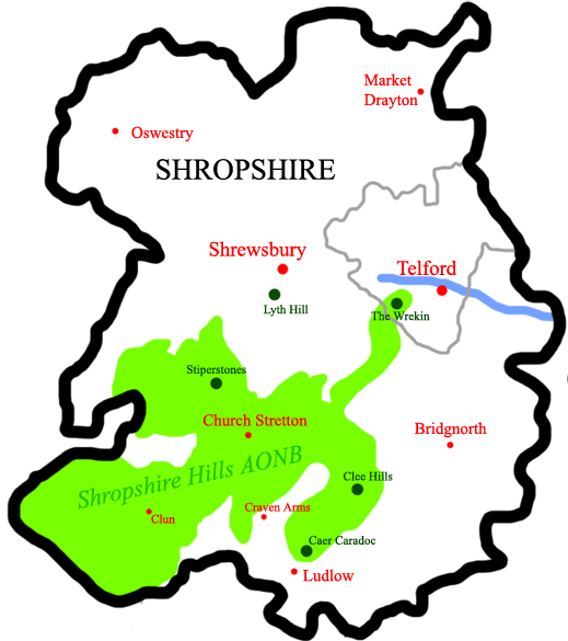
The Shropshire Hills National Landscape is a designated Area of Outstanding Natural Beauty (AONB) in Shropshire, England. It is located in the south of the county, extending to its border with Wales. Designated in 1958, the area encompasses of land primarily in south-west Shropshire, taking its name from the upland region of the Shropshire Hills. The A49 road and Welsh Marches Railway Line bisect the area north–south, passing through or near Shrewsbury, Church Stretton, Craven Arms and Ludlow. Hills The Shropshire Hills, located in the Welsh Marches, are relatively high: the highest point in the county, Brown Clee Hill, near Ludlow, has an altitude of . This gives Shropshire the 13th highest hill per county in England. Titterstone Clee Hill, part of the Clee Hills, is nearly as high as Brown Clee, at , making it the third highest hill in the county. The Stiperstones are the second highest, at , and are notable for their tors of quartzite; particularly notable are D ... [...More Info...] [...Related Items...] OR: [Wikipedia] [Google] [Baidu] |
Long Mynd
The Long Mynd is a heath and moorland plateau that forms part of the Shropshire Hills in Shropshire, England. The high ground, which is common land and designated as an Area of Outstanding Natural Beauty, lies between the Stiperstones range to the west and the Stretton Hills and Wenlock Edge to the east. Much of it is owned by the National Trust, and is managed by the Longmynd Commoners. The Long Mynd is approximately long by wide, and is broadly characterised by steep valleys on its eastern flanks, and a long slope to the western side rising in a steep escarpment. In its vicinity are the principal settlements of Church Stretton, Little Stretton and All Stretton, Pulverbatch, Smethcott, Woolstaston, Asterton, Myndtown, Wentnor and Ratlinghope. The highest point on the Long Mynd is Pole Bank (); this and the adjacent hill of Caer Caradoc () are classed as Marilyns. Etymology The name ''Long Mynd'' means "long mountain", the second element being Brittonic in ori ... [...More Info...] [...Related Items...] OR: [Wikipedia] [Google] [Baidu] |
Clee Hills
The Clee Hills are a range of hills in Shropshire, England near Ludlow, consisting of Brown Clee Hill , the highest peak in Shropshire, and Titterstone Clee Hill . They are both in the Shropshire Hills Area of Outstanding Natural Beauty. Geography The hills stretch over and run north–south, and for about this distance the lowest point along the hills is just under . Titterstone Clee Hill is around five miles south of Brown Clee Hill. The B4364 road from Ludlow to Bridgnorth runs between the two hills, offering good views of both. The hills have been said to form a "gateway" from the built up areas of the West Midlands to the hills and rural landscape of Wales and are at the heart of the Welsh Marches. Much quarrying has taken place on the hills over the years, and there are large air traffic control domes and radar towers on the summits of both hills which can be seen for many miles around. Views Views from the west of the hills spread as far as Snowdonia and Cadair Idris, ... [...More Info...] [...Related Items...] OR: [Wikipedia] [Google] [Baidu] |
Ercall Hill
The Ercall is a small hill in Shropshire, England, between The Wrekin and Wellington. It is an internationally important geological site, part of The Wrekin and The Ercall Site of Special Scientific Interest (SSSI). The hill is managed by Shropshire Wildlife Trust and includes 540 million year old ripple beds and ancient pre-Cambrian lava flows in exposed quarries. Quartzite from the neighbouring Wrekin is also visible. The Ercall bears the marks of extensive quarrying, although the quarries are now disused, safe and open to the public. When the M54 motorway was constructed in 1974, the road was built through the northern end of the hill. Flora and fauna The woods of the forest are important for various butterfly species. In the summer, the Ercall Woods which line the hill are a favourite habitat for the speckled wood and during spring when the forest is laden with bluebells, the dingy skipper can arrive in great numbers. The exposed quarries are popular with other butterfl ... [...More Info...] [...Related Items...] OR: [Wikipedia] [Google] [Baidu] |
M54 Motorway
The M54 is a east-west motorway in the counties of Shropshire and Staffordshire, England. It is also referred to as the Telford motorway, after the road's primary westbound destination, the town of Telford. It cost £65 million to construct, and is two-lane dual carriageway for the majority of its length, with sections of three-lane. The M54 Spur route, spur connects the M6 motorway near Essington, Staffordshire with the A5 road (Great Britain), A5 trunk road at Wellington, Shropshire. The motorway forms part of the strategic route to North Wales, roughly following the path of the Roman Watling Street and the A5 road (Great Britain), A5 north-westwards, towards the port of Holyhead. It is the only motorway in Shropshire, and forms a vital part of the county's road network. In 2007, the motorway handled an annual average daily traffic of between 50,300 (J2–3) and 41,800 (J4–5) vehicles. History Planning The idea of the M54 was originally presented due to the high volum ... [...More Info...] [...Related Items...] OR: [Wikipedia] [Google] [Baidu] |
A5 Road (Great Britain)
The A5, the London-Holyhead trunk road, is a major road in England and Wales. It runs for about from London to the Irish Sea at the ferry port of Holyhead. In many parts the route follows that of the Roman Iter II route which later took the Anglo-Saxon name Watling Street. History Roman road The section of the A5 between London and Shrewsbury is roughly contiguous with one of the principal Roman roads in Britain: that between ''Londinium'' (modern-day London) and ''Deva'' (modern-day Chester), which diverges from the present-day A5 corridor at Wroxeter ('' Viroconium Cornoviorum'') near Shrewsbury. Telford's Holyhead Road The Act of Union 1800, which unified Great Britain and Ireland, gave rise to a need to improve communication links between London and Dublin. A parliamentary committee led to an act of Parliament, the ( 55 Geo. 3. c. 152) that authorised the purchase of existing turnpike road interests and, where necessary, the construction of new road, to com ... [...More Info...] [...Related Items...] OR: [Wikipedia] [Google] [Baidu] |
Wellington, Shropshire
Wellington is a market town and a civil parish in the borough of Telford and Wrekin, Shropshire, England. It is situated northwest of Telford and east of Shrewsbury, near the western terminus of the M54 motorway. The summit of The Wrekin lies 3 miles to the southwest. Wellington’s population was 25,554 in the 2011 census. History A church has stood for almost 1,000years and a priest is mentioned in the Domesday Book. The original churchyard still remains. A new church, dedicated to All Saints, designed by George Steuart, was built in 1789. Wellington's first market charter was granted to Giles of Erdington, lord of the manor, in 1244 and a market still exists today. The market had an open-sided market hall by 1680, and possibly much earlier, but it was dismantled in about 1805. In 1841 a market company was formed to purchase the market rights from Lord Forester in 1856. In 1848 the company built a town hall with the butter market below, creating a permanent covered sp ... [...More Info...] [...Related Items...] OR: [Wikipedia] [Google] [Baidu] |
Salient (geography)
A salient, panhandle, or bootheel is an elongated protrusion of a geopolitical entity, such as a subnational entity or a sovereign state. While similar to a peninsula in shape, a salient is most often not surrounded by water on three sides. Instead, it has a land border on at least two sides and extends from the larger geographical body of the administrative unit. In American English, the term panhandle is often used to describe a relatively long and narrow salient, such as the westernmost extensions of Florida Panhandle, Florida and Oklahoma Panhandle, Oklahoma, or the northernmost portion of Idaho Panhandle, Idaho. Another term is bootheel, used for the Missouri Bootheel and New Mexico Bootheel areas. Origin The term ''salient'' is derived from salient (military), military salients. The term "panhandle" derives from the analogous part of a cooking pan, and its use is generally confined to North America. The salient shape can be the result of arbitrarily drawn international ... [...More Info...] [...Related Items...] OR: [Wikipedia] [Google] [Baidu] |
The Wrekin
The Wrekin ( ) is a hill in east Shropshire, England. It is located some west of Telford, on the border between the unitary authorities of Shropshire Council, Shropshire and Telford and Wrekin. Rising above the Shropshire Plain to a height of above sea level, it is a prominent and well-known landmark, signalling the entrance to Shropshire for travellers westbound on the M54 motorway. The Wrekin is contained within the northern Salient (geography), salient of the Shropshire Hills AONB. The hill is popular with walkers and tourists and offers good views of Shropshire. It can be seen well into Staffordshire and the Black Country, and even as far as the Beetham Tower, Manchester, Beetham Tower in Manchester, Winter Hill (North West England), Winter Hill in Lancashire and Cleeve Hill, Gloucestershire, Cleeve Hill in Gloucestershire. Name The earliest mention of ''the Wrekin'' occurs in a charter of 855, as entered in a late 11th-century Worcester, England, Worcester cartulary, spe ... [...More Info...] [...Related Items...] OR: [Wikipedia] [Google] [Baidu] |
All Stretton
All Stretton is a village and a now separate Civil parishes in England, civil parish in Shropshire, England. Much of it is covered by a Conservation Area (United Kingdom), Conservation Area. Geography All Stretton lies about a mile to the north of the market town of Church Stretton, on the old Shrewsbury Road (the B5477) – Shrewsbury is 12 miles to the north. Similarly, the small village of Little Stretton, Shropshire, Little Stretton lies to the south of Church Stretton on the same road. The village lies between 580 and 600 feet above sea level at the northern end of the Stretton Gap. The beginning of the Cound Brook, a minor river that runs 25 miles across the southern Shropshire-River Severn, Severn plains, is found in the village, where the stream from the Batch valley joins the Ashbrook. To the west of All Stretton is the Long Mynd, and to the east is Caer Caradoc. The village does not lie in the parish of All Stretton, which is to its north, but in the civil parish of ... [...More Info...] [...Related Items...] OR: [Wikipedia] [Google] [Baidu] |
Caer Caradoc
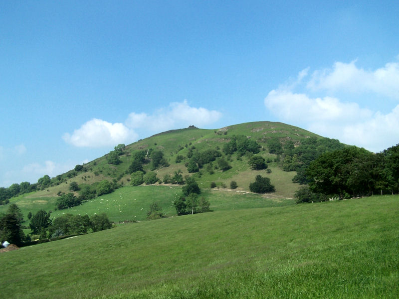
Caer Caradoc (, the fort of Caradog) is a hill in the English county of Shropshire. It overlooks the town of Church Stretton and the village of All Stretton and offers panoramic views to the north towards the Wrekin, east to Wenlock Edge, and west over the nearby Long Mynd. It is not to be confused with another hillfort of the same name 1 km west of Chapel Lawn near Bucknell. Caer Caradoc rises sharply out of a narrow valley known as the Stretton Gap. It is the highest point on a high, narrow, northeast–southwest "whaleback ridge", sometimes called a hogsback ridge. The Wrekin is a very similarly shaped hill and on the same alignment, some to the north-east. Caer Caradoc can be fairly easily climbed from Church Stretton but the ascent/descent is steep; a more gentle climb is from the village of Cardington, which lies two miles (3 km) east. Much of the hill is composed from volcanic rocks, like the Wrekin and other hills, formed of narrow ridges of resista ... [...More Info...] [...Related Items...] OR: [Wikipedia] [Google] [Baidu] |
Honeypot (geography)
A honeypot site is a location attractive to tourists who, due to their numbers, place pressure on the environment and local people. Honeypots are often used by cities or countries to manage their tourism industry. The use of honeypots can protect fragile land away from major cities while satisfying tourists. One such example is the construction of local parks to prevent tourists from damaging more valuable ecosystems further from their main destination. Honeypots have the added benefit of concentrating many income-generating visitors in one place, therefore developing that area, and in turn making it more appealing to tourists. However, honeypots can suffer from problems of overcrowding, including litter, vandalism, and strain on facilities and transport networks. Honeypots attract tourists because of parking spaces, shopping centres, parks and public toilets. The tourist shops are normally placed all over the shopping centre, which creates pressure on the whole centre to keep t ... [...More Info...] [...Related Items...] OR: [Wikipedia] [Google] [Baidu] |
Carding Mill Valley
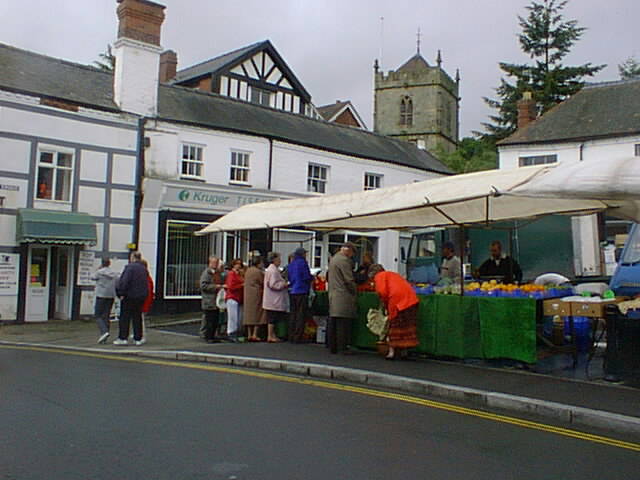
Church Stretton is a market town and civil parish in Shropshire, England, south of Shrewsbury and north of Ludlow. The population in 2011 was 4,671.National Statistics Church Stretton 2011 population area and density The town was nicknamed Little Switzerland (landscape), Little Switzerland in the late Victorian era, Victorian and Edwardian era, Edwardian period for its landscape, and became a health resort. The local geology includes some of the oldest rocks in England and a notable Fault (geology), fault is named after the town. Church Stretton is in the Shropshire Hills AONB, Shropshire Hills Area of Outs ... [...More Info...] [...Related Items...] OR: [Wikipedia] [Google] [Baidu] |


